-
Posts
76,428 -
Joined
-
Last visited
Content Type
Profiles
Blogs
Forums
American Weather
Media Demo
Store
Gallery
Posts posted by weatherwiz
-
-
-
2 hours ago, RUNNAWAYICEBERG said:
Racing across 84 scarfing down a fish fillet happy meal while jamming to a Swift album as he looks for an open area to park frantically unfolding his 1989 tripod camera to catch a glimpse of a deteriorating summer storm…in a Bruins jersey.
All that is pretty accurate minus the tripod camera. My camcorder broke in August 2020 severe storms and I haven't gotten a new one.
-
 3
3
-
-
2 minutes ago, Torch Tiger said:
we're gonna party like it's 1989
Taylor Swift re-made her 1989 album (which is phenomenal BTW) so maybe the atmosphere too will re-make 1989
-
 1
1
-
 3
3
-
 1
1
-
-
14 minutes ago, Cyclone-68 said:
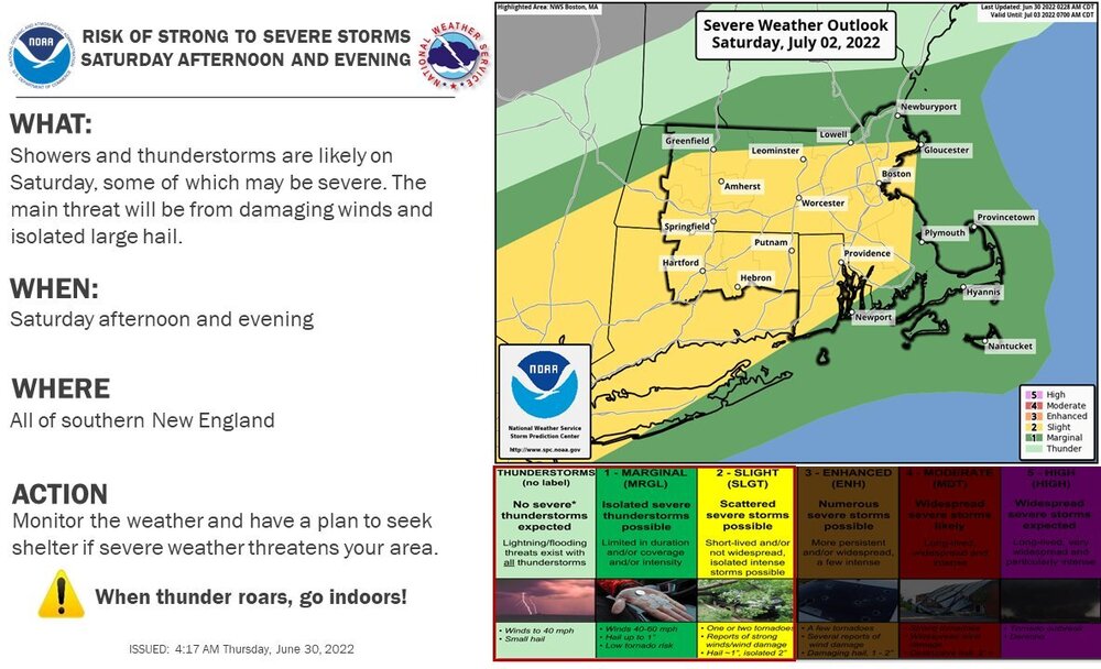
I’m slightly surprised that Wiz hasn’t started a thread for the severe threat late Saturday?
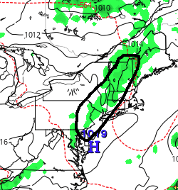
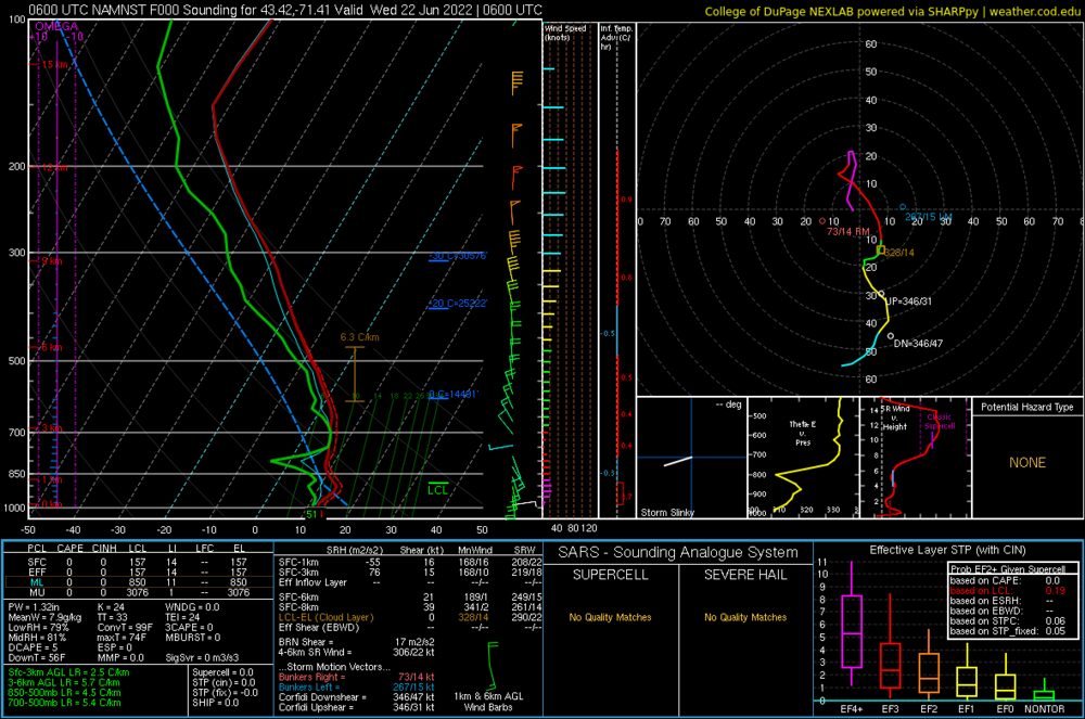
It's one of those fake threats. Not sure there is much severe potential with it outside of maybe a few localized severe storms. Lapse rates [mid-level] are a joke which is going to hold back instability potential and the best dynamics and shortwave forcing is along and north of the international border. Everything will essentially be water-logged downdrafts with torrential rain and maybe some 30-40 mph gusts. Also looks like timing may be crap b/c pre-frontal moves through too early.
The summer of crap continues to carry the torch.
-
 1
1
-
 1
1
-
 1
1
-
-
6 minutes ago, RUNNAWAYICEBERG said:
Hopefully he does but it’s not a healthy way to live. Especially considering his idea of a good meal is McDeez cheeseburgers and washes it down with beer. Only a matter of time before he collapses live on amwx as he chases a row of dark clouds.
I don't do the cheeseburgers anymore. They blow. The fish Filet is the best.
-
 7
7
-
-
13 minutes ago, CoastalWx said:
Also, I don’t have the data in front of me, but it does seem like the last 10 years have been quieter than normal in SNE. I know we have had some isolated big events, but just seems quiet overall. I don’t count an EF-0 from a renegade downpour.
It seems that we're getting an increased number of cool season setups and it also seems like we're getting lower-end setups to actually produce. This gets into the EF-0 stuff but given the warmer waters we're seeing increased llvl CAPE values with higher shears in place. I think dual-pol has also helped sizably in identifying quick spinups but as "garbage" as those seem they are still important to identify.
But I really do miss the 90's. I know sometimes our perception is far different than reality but it seemed we used to get several solid squall lines every summer. I always used to get pissed though b/c these things would get to Hartford, completely fall apart, and then sometimes rebuild east. But those years not only had solid squall lines...but we would also get some decent nocturnal events too (especially August). August 9, 2000 was wild.
-
Let's do it...need this to happen. BADLY

-
 2
2
-
 5
5
-
-
-
56 minutes ago, RUNNAWAYICEBERG said:
Solitaire?
26
-
Sitting outside playing cards and it’s super toasty. Very hot
-
 1
1
-
-
Maybe we can at least get some cold pool hailers
-
 1
1
-
 1
1
-
-
Grass is grass and will do what it wants
-
 1
1
-
-
1 minute ago, Great Snow 1717 said:
I haven't carried a balance in decades...no need to...
I think once you have a credit history built up it isn't as detrimental to carry some credit card debt. I was able to get myself out of $6K in credit card debt last year...took a while but once I got it way down my credit score shot up like crazy...got it close to 800 at one point. But I'm back in $5K lol...mostly b/c there was a huge debacle with insurance when I got 5 teeth extracted in May so I had to pay the $3,000 out-of-pocket. But hopefully I'll get some of that covered and I can put the reimbursement towards the debt.
-
 1
1
-
-
3 minutes ago, Great Snow 1717 said:
My credit score would violently disagree about it being bad to have credit card balances...
It highly depends on how much of your limit you're using/ If you have a $5,000 limit but carrying a $3,000 balance...that's going to hurt you vs. carrying like a $300 balance.
-
7 minutes ago, FXWX said:
Absolutely correct Wiz... One of the most useless discussions in New England weather forum is the drought, endless Stein chatter. Lack of exciting severe wx or hurricane threats or truly hot periods pushes folks to spend endless time on New England faux drought crap.
Yeah drought talk gets way over-played in our region. I don't get the fetish. Even TV outlets within the region will show the maps and talk about it. I mean I guess it is a time filler with nothing going on but we are not in a drought.
-
 1
1
-
 1
1
-
-
And just because people have to water their lawns and gardens a few extra times a week doesn't mean drought either
-
 4
4
-
-
Drought and New England should never be used in the same sentence. These "drought monitor" charts are brutal. There is a difference between drought and dry soils.
-
 4
4
-
 2
2
-
-
14 minutes ago, CoastalWx said:
That rain looks like big drop all
bark no bite stuff. Maybe a very narrow area gets a decent drink?
It's coming down on the moderate side here in Springfield. This is miserable...absolutely miserable. It's so cold that my computer won't even display the temperature. It just says, "Rain to Stop"...when, Christmas???? This is terrible...I'm actually about to make a cup of hot cocoa
-
 1
1
-
-
2 minutes ago, Typhoon Tip said:
Hey 'Wiz ...
this is what I was mentioning to you yesterday, about subtle reasons to be engaged- heh ...I mean it's all we got after acceptance of what we are around this region of the planet.
But this is a cut out of the 06z Euro, and this smattering region of QPF is convectively sequenced ... notable from 12z as non -existent, then blossoms nearing 18z.
Not a big deal and wouldn't be mentioned but .. those are crispy towers and zap threats to golfers nonetheless... I like those kind of sky scape artistries of summer air masses. Nice towers for serious bun times
Of course...it may also be overdone .. heh. As we know, the Euro tends to mix and extend BL too much - not sure if that's an augmenter to convection but since both are UVM related ..
Re heat this weekend: I'm noticing the 2-m products suggest sucking the DP out of the air, as it the air mass spills E of the western OV/E Great Lakes... Some of that is d-slope, but I wonder about these erstwhile deficits lending to that. It's kind of like a inverse dry-line somewhere along the spine the Apps. But 63 to 65 type air mass seems to end up in the high 50s across SNE ..both Sat/Sun afternoon, when both global models have 90 to 95 west and north of the marine zones. Maybe a dry heat pulse.
I'm starting to wonder if this 2023 warm season is going to go down this way ... Like, for ever 10 days of translucent blue and/or temp challenged scung overcast like today, we finally get 2 days of summer.
Certainly seems plausible we could see some isolated activity given the presence of some weak instability and modestly cold mid-level temperatures, but I agree...sometimes these can yield some very nice crispy towers which are fun to look at. In fact, I really dig those. Maybe a better likelihood along terrain-induced influences for any development?
-
58 minutes ago, dendrite said:
maybe we can generate weak mid-level vortices and watch birds get caught and whirlwind across the sky
-
6 minutes ago, Typhoon Tip said:
short version, concept agreement ... very little agreement on details.
longer version, probably because this closing ordeal is really A, not that strong, and B, ...most of it's mechanics are elevated. It's an odd behavior - really, it's like what we might see in February, with a closing 500 mb surface that retrogrades. During the the cold season, we delight in that behavior for obvious reasons. But unlike the cold season...we don't have intense lower tropospheric, lateral baroclinic gradients ...and strong frontal identification for structuring UVM/jet responses closer to the sfc --> cyclogenetic results.
So the models are printing QPF and axis for focus sort of like spraying as a result lacking those foci. It's 'sort of' a red flag that the whole operation could be over done, or...even underdone, if some region stalls a rain band.
Agreed...this could be overdone or underdone. I think there arguments that can be made for both cases. While we don't have those intense lower baroclinic gradients like we do during the cool season, we do have higher instability so the question becomes, how much does that compensate? But in the essence, PWATs are very high along a narrow corridor and you do have a strengthening southerly component to the llvl flow which should aid in convergence along the boundary. This may be a situation where western areas cash in again when it's eastern areas which need it most

-
Major differences between some of the models. With these differences, however, it should be noted there is strong agreement that there will be a narrow north-to-south axis of showers and areas of heavier rains it's just a question of where the diffuse warm front and stronger llvl forcing setup. West of 91 obviously stands the best chance for some heavier rains but that could also be as far west as the HV. Really challenging forecast here b/c the warm front (as diffuse as it is) is quite sloped.
-
This is just utterly depressing. I feel like Frosty the Snowman with someone slowly removing my top hat and laughing as I slowly melt away into a puddle of nothing-ness.
-
 1
1
-
 2
2
-
-
1 minute ago, OceanStWx said:
Not sure if you can access this (https://hwp-viz.gsd.esrl.noaa.gov/wave1d/?col=2&hgt=1&location=KPWM&selectedgroup=Default&obs=true&fontsize=1&darkmode=auto&graph=fa-chart-bar&probfield=Tmax&proboperator=>%3D&probvalue=40&colorfriendly=false&whiskers=false&boxes=true&median=false&det=true&tz=local) but it plots obs on the forecast as time goes on.
I can access!
Woah this is awesome thanks!


June pattern and forecast discussion
in New England
Posted
I was watching the radar before bed and it elicited a dream in which a line of storms EXPLODED moving across SNE. There were dozens of tornado warnings along it. The entire dream is a bit fuzzy but I recall a friend asking to pick me up...I think a bunch of people were going to the beach or something (even know it was at night) and I said sure. I went to go in the shower but checked the radar and didn't realize how close the line was. I look out the window and lightning was going crazy so I couldn't take a shower.