wxman_ind
-
Posts
155 -
Joined
-
Last visited
About wxman_ind

-
New record high for Indy today. We're in the lower 70s. The old record of 68 was relatively low in comparison to adjacent days though.
-
from the ECMWF website, which can explain it better than I: "Extreme values of EFI (close to +1 or -1) and positive values of SOT signify that a very unusual event is expected." SOT is shift of tails.
-
Winter 2023/24 Medium/Long Range Discussion
wxman_ind replied to Chicago Storm's topic in Lakes/Ohio Valley
One of the GEFS members agrees with this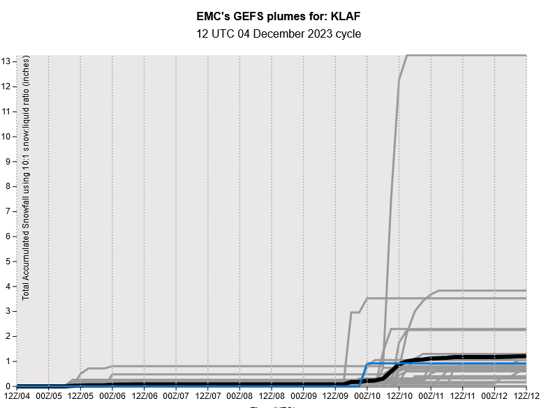
-
The outlook for December for Indiana calls for above normal temperatures. If that holds, Indy could set its record for the warmest year ever. We are currently running ahead of 2012!
-
Impacts are taken into consideration as well as the amounts, so a warning could theoretically be issued for 5-6"
-
Yes, this is the reasoning behind it. Criteria is for an event, not a 12 or 24 hour period.
-
Visibility at Indy was down to 1.25 miles in the 5 min observations. I've never seen in my life wildfire smoke like this in Indiana.
-
Indy made it to 95 degrees. I believe it's the warmest temp since 2018.
-
Lovely rain and 32 degrees here
-
5" IMBY so far. Nearly 3 times the seasonal snowfall from before the storm.
-
0.3" inches at Indy today.
-
Issued only the 2nd Winter Wx Advisory for this season in central IN today. Still looks like it's trending north I see.
-
0.3" inches at Indy. First measurable snowfall of met winter, and nearly doubles snow season total.
-
Winter 2021-22 Short/Medium Range Discussion
wxman_ind replied to Chicago Storm's topic in Lakes/Ohio Valley
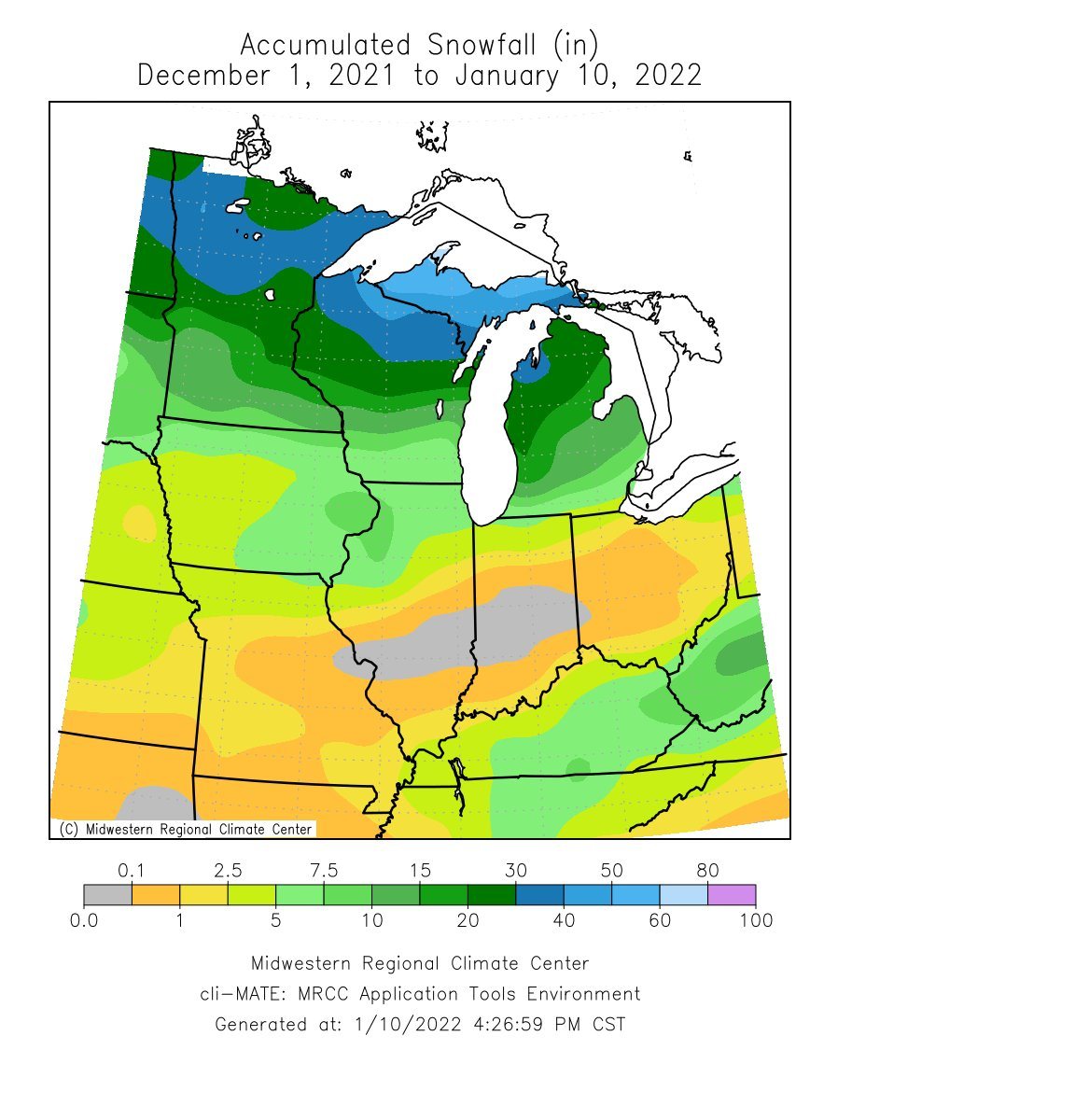
Will central Indiana fill in this snow hole? (This is for Met Winter, Indy has had 0.5" since November)
-
There is a process to go through before EF-4 or 5 ratings are given, and it takes time.