OSUmetstud
-
Posts
16,521 -
Joined
-
Last visited
Content Type
Profiles
Blogs
Forums
American Weather
Media Demo
Store
Gallery
Everything posted by OSUmetstud
-
Winter 2020 New England Banter and General Obs
OSUmetstud replied to CapturedNature's topic in New England
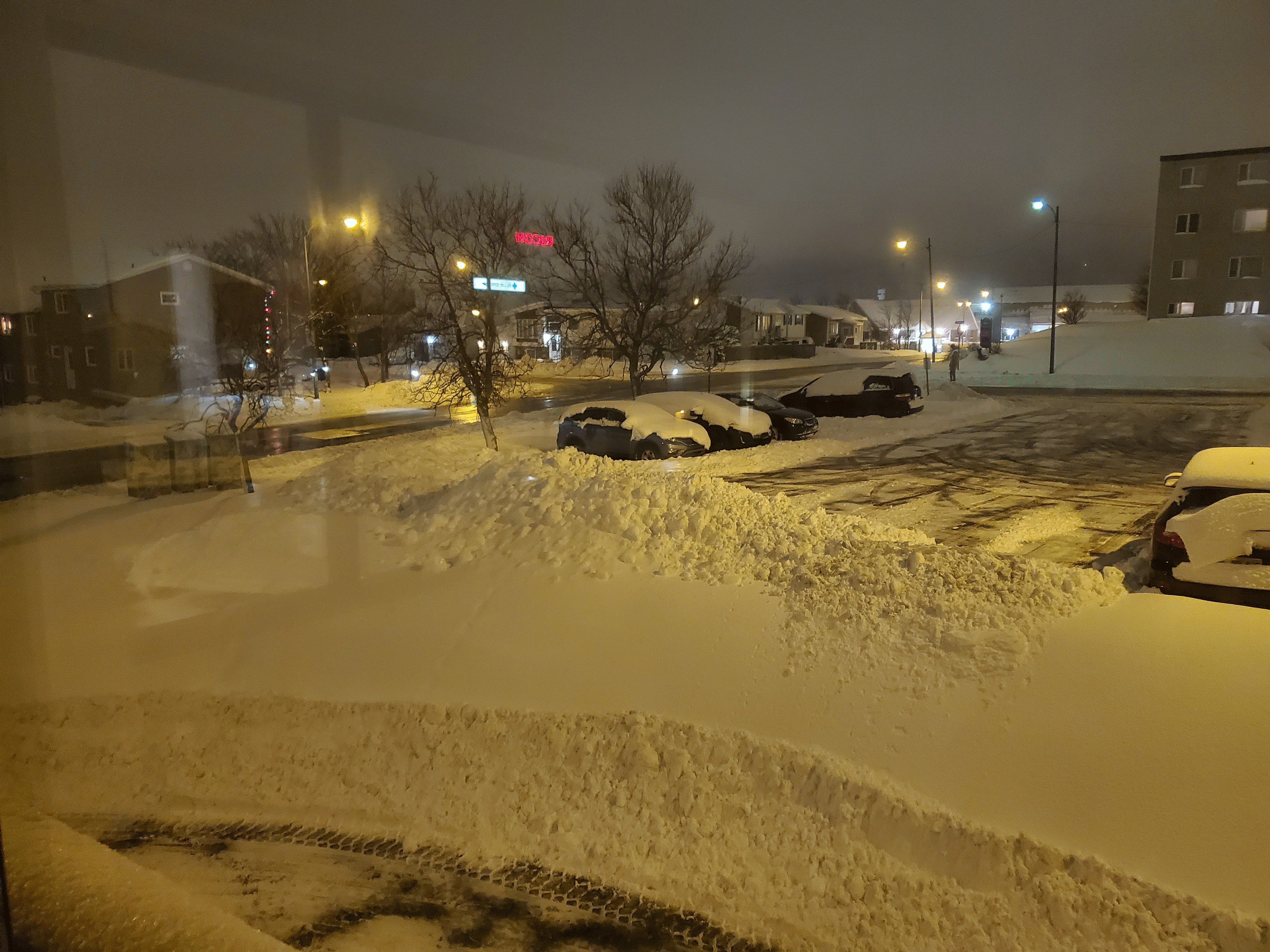
I saved it as .gif instead of jpg and it worked okay. Drew the short straw this year, apparently. I'm working 5 night shifts in a row, this being number 3, a view from the office... One of our business development guys in Mississauga is paying for our dinner so I got some skip the dishes chinese so it's not all bad.
-
Winter 2020 New England Banter and General Obs
OSUmetstud replied to CapturedNature's topic in New England
Round 1 was 7" or so. Round 2 looks decent on the radar, but it's only supposed to be like another 2-3" but we'll see. The low trended weaker over the past 24-36 hours or so. -
Winter 2020 New England Banter and General Obs
OSUmetstud replied to CapturedNature's topic in New England
I was going to post a pic from my phone but im getting a -200 error. Does anyone know why that is? The picture is under the size limit. -
I think the most meaningful thing for this would actually be to grade yourself vs. climatology. This applies to everyone of course, not just you. The whole point of this exercise should be to get skill over climatology in the long hall.
-
You breathlessly posted about the canadian in the three separate threads in the middle of the night last night.
-
Who is we?
-
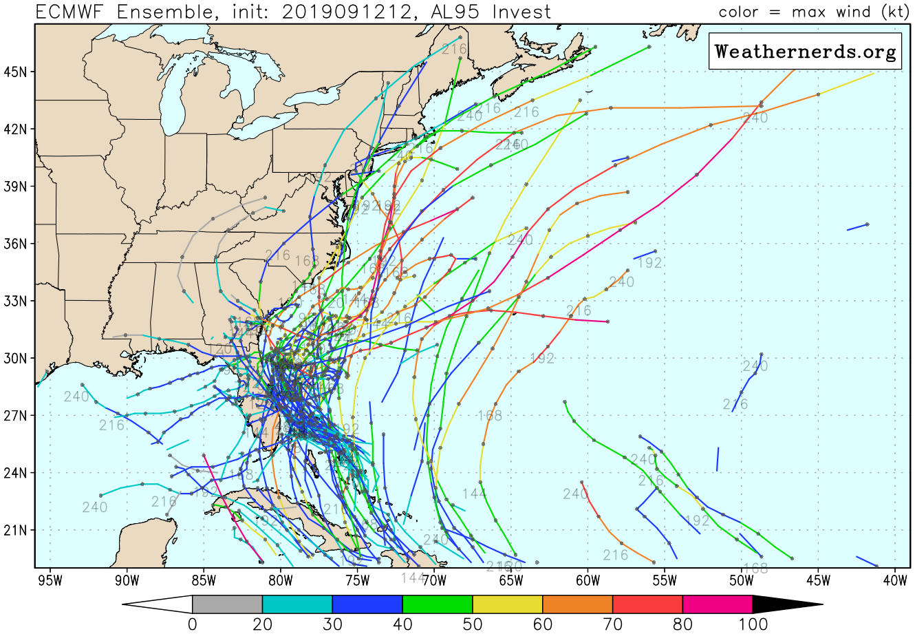
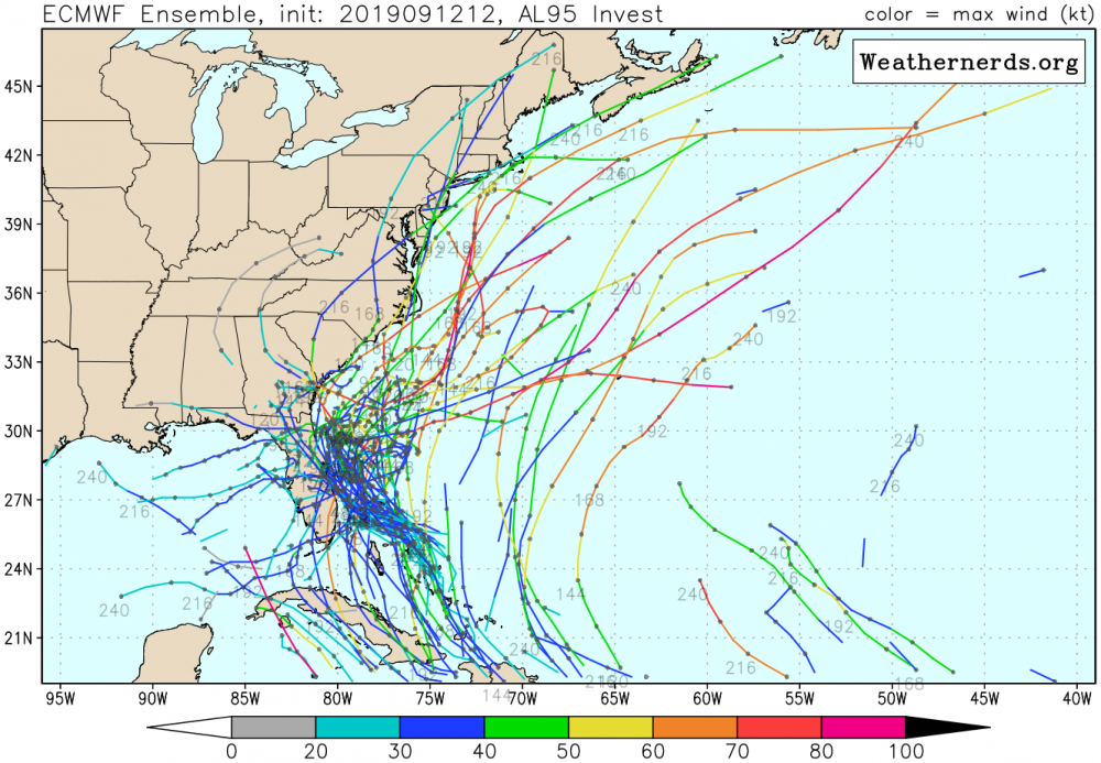
00z Ukmet has the a strong storm out about 100 NM west of Bermuda at t+144.
-
Congrats bermuda
-
Meh. Some of these tracks appear to be from a different disturbance, too.
-
Yeah, development is more likely than not
-
Yeah, I'd say the chances are "elevated" re: climatology, but still very unlikely overall.
-
Boring. Most likely scenario.
-
6 days from Carol's development to landfall, more like 3-4 days for Bob. People will get warning either way. Track, intensity, and genesis forecasting are all way better than they were decades ago.
-
UKMET is out at 33.5, -72.2 about 250 NM off the coast of NC at the end of its run (144) and has a strong, large hurricane. Looks to me it would make a slow escape northeast from there.
-
We probably get an average of like 2 additional days of weather predictability now compared to when Gloria happened.
-
NHC had a low bias in the 2-day and 5-day genesis probabilities last year. 70 percent forecast probabilities verified in development between 85 and 90 percent of the time and 80 percent 5-day probabilities verified in development 90 percent of the time.
-
Definitely possible if it stays on the weak side and develops a bit later. Strong models UKMET/ECMWF) develop early from what i can see .
-
Yeah, there's a decent signal for a MJO wave later this month into early October. Could get interesting with increased activity and midwest/east trough pattern with the north atlantic ridge.
-
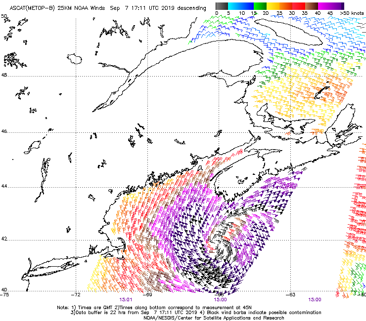
Thats a Les Suetes wind location. Not a proper gradient wind from the hurricane-force low but i guess it counts lol.
-
Osbourne Head, near the entrance to Halifax Harbour is sustained at 62 mph, gusting to 88 mph.
-
Cool. We had obs with Hurricane Chris on one of the rigs offshore NS that support hurricane force winds after the NHC had downgraded. I sent them an email about it, but they never responded nor added it to the tropical cyclone report. I assume it was part of ET transition through since it seemed to come on the backside as it pulled away from them.
-
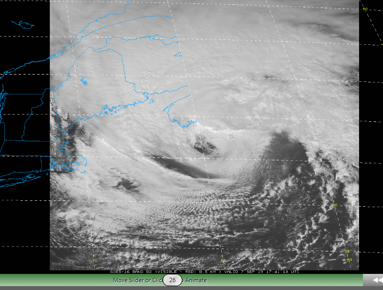
At least that area of winds that they reference is well offshore mainly s of the center. This the ASCAT image the prompted the upgrade. And like the NHC said, it appears that the area of high winds is associated with transition. It has the look of sting jet feature of satellite with an area of subsidence induce cloudless skies.
-
https://weather.gc.ca/city/pages/ns-37_metric_e.html Gusts to 116 km/h / 72 mph here, Very exposed station.
-
Yep, exactly.
-
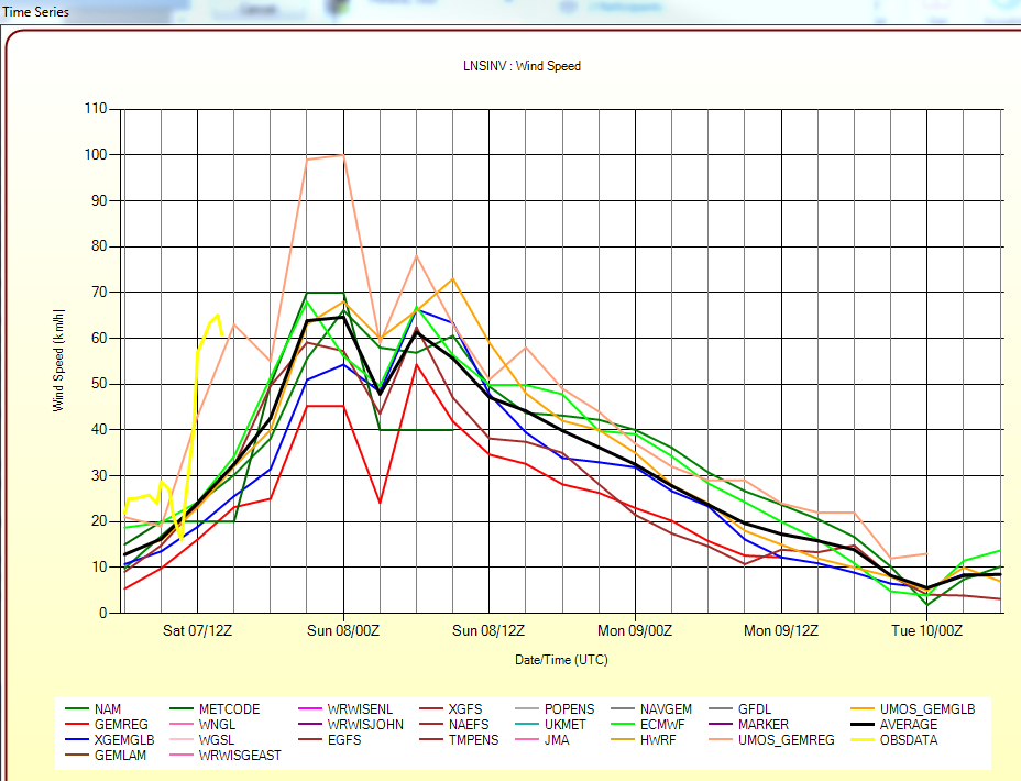
There is a Les Suetes in Inverness currently in ESE winds. But this isn't particularly remarkable for them, compared to winter setups.