

Tatamy
-
Posts
2,044 -
Joined
-
Last visited
Content Type
Profiles
Blogs
Forums
American Weather
Media Demo
Store
Gallery
Posts posted by Tatamy
-
-
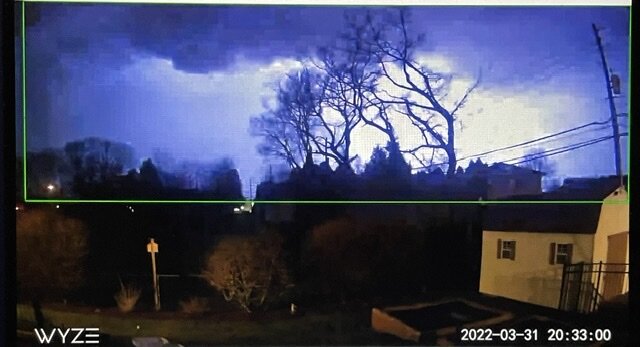
Lightning with the approaching squall line.
-
 6
6
-
-
Back to tonight’s threat the squall line is a few minutes away now and there is plenty of lightning associated with it. I have a severe thunderstorm warning in effect at my location as it trucks on to the east.
-
16 minutes ago, bluewave said:
A warning probably wouldn’t have made much of a difference. Many people just ignore them anyway. We have seen how many people drive their cars into flash floods with or without specific warnings. Cars and trucks were maintaining their speed without slowing down when they encountered the squall.
https://www.inquirer.com/weather/snow-squall-pennsylvania-81-philadelphia-weather-20220329.html
The squall, part of what Martin called an eight-hour siege, blew up a bit sooner than forecasters expected and in advance of the “main event” squalls in the afternoon. The weather service didn’t issue a warning for it. It likely wouldn’t have made much difference: A squall might be so short-lived that it’s over by the time a warning is issued. And the ones on Monday were “small … in and out in a couple of minutes,” he said. “You can’t get a lot of lead time with something like that.”
Radar hole?
It is uncertain whether it was a factor in terms of advance notice, but AccuWeather’s Walker said the accident site is not well-observed by radar. It is on the outer edge of radar ranges, since it is about equidistant from the weather service devices operated by the offices in Mount Holly, State College, and Binghamton, N.Y. Monday’s squalls had low cloud tops, and they might have eluded the radar peripheries.
The human factor
John Blickley, an official with the Schuylkill County emergency management agency, said he was amazed at how many of the vehicles appeared to be maintaining their speeds despite the blizzardlike conditions.
“I think there are some people who are naturally oblivious,” said Pennsylvania State Police Trooper David Beohm.
The argument made by the Met from State College strikes me as being lame. Six people dead and millions of dollars of property damage. But the snow squall was short lived so no warning was necessary - really? Many tornadoes are short lived however warnings are issued once rotation is detected in the atmosphere. How many of those warnings verify? I don’t disagree with the issuance of tornado warnings under these circumstances BTW. In any case there is definitely a problem with how this threat was addressed (or not) by all parties involved.
-
 1
1
-
-
3 hours ago, bluewave said:
Only a few days between a snow squall warning and severe thunderstorm warning and possible tornado in PA.
There was no snow squall warning in effect for Schuylkill Cty at the time of the terrible multiple vehicle crash on I81 on Monday morning. Due to the distance between the radar stations situated in this region weather radars cannot see below 9000 feet in that location. The squall was low topped so it was underneath the radar beam. A similar scenario played out in February in that area of PA. I was out in the Scranton region on that day (I drove south on I81 and then onto I476 to the south of there. Elevations range up 2000 ft in that vicinity. The roads had been brined or were dry. Temperatures ranged from 21 to 25 depending on altitude. Penndot had signage posted on the electronic equipment about the potential snow squall hazard. I encountered snow flurries and showers on my drive. This squall that caused the accident was apparently in a narrow streamer that reached SE down to the Philadelphia area. This has been a recurring problem in east central PA and I hope they decide to increase radar coverage in that area.
-
5
-
-
3 hours ago, donsutherland1 said:
Morning thoughts…
It will be partly cloudy and breezy. A snow shower or even squall is possible in parts of the region during the afternoon or evening as an Arctic front moves through. High temperatures will likely reach the middle and upper 40s in much of the region. Likely high temperatures around the region include:
New York City (Central Park): 47°
Newark: 48°
Philadelphia: 48°
It will turn much colder tonight and temperatures will rise no higher than the lower or middle 30s tomorrow.
Normals:
New York City: 30-Year: 53.7°; 15-Year: 54.3°
Newark: 30-Year: 54.6°; 15-Year: 55.5°
Philadelphia: 30-Year: 56.8°; 15-Year: 57.5°
There is a snow squall about 30 miles west of Allentown currently. Visibility of about 1/2 mile associated with this feature as it moves east. There is also a nasty snow squall along I84 to the east of Scranton. If you are up in NW NJ or Orange Cty keep an eye out for this one. Visibility of less than 1/4 mile associated with it.
-
3
-
-
Mt. Holly issues a Severe Thunderstorm Warning for parts of eastern and NE PA for the incoming squall line. If you are in western or NW NJ or adjacent NY keep an eye on this one.
-
36 minutes ago, Ericjcrash said:
Yeah, it looks impressive on radar but was really just a bunch of really nice gusts. Awesome ground blizzard conditions.
Strongly agree.
-
Just now, LibertyBell said:
I'd say about 50% of that will hold together for us, let's wait and see.
This feature is weakening as it moves east. There are a few brief bursts of moderate snow however much of it is just flurries. It is accompanied by strong winds.
-
1
-
-
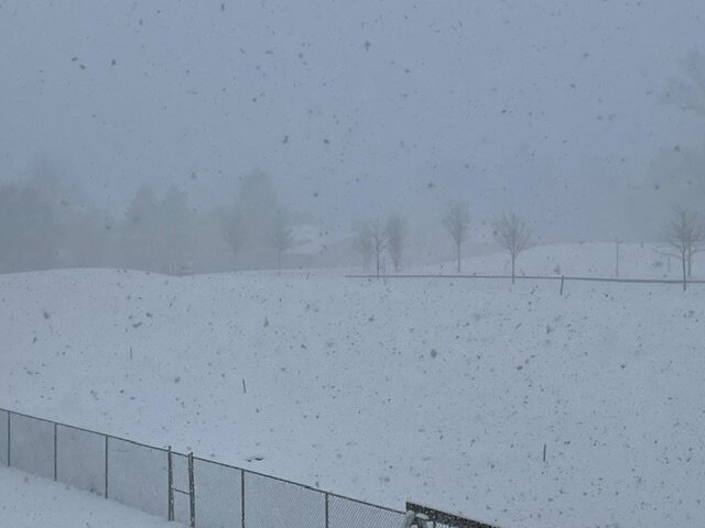
Light snow with 1 mile visibility. Temperature at 25. Strong winds are whipping up ground blizzard conditions here.
-
3
-
-
There are some very potent snow squalls in the Harrisburg area right now. There are some very low visibility’s associated with these. On radar at least this activity is slowly translating to the east. If anyone reading this is going to be traveling west into PA and west of Allentown I 78 is closed due to accidents at Hamburg.
-
6 minutes ago, bluewave said:
The snow behind the Arctic front into PA is lighter than the heavier slug of precipitation that accompanied the rapidly deepening low. The mesos did a good of showing this. Maybe we can get some heavier snow squalls tonight when the deep upper low rolls through.
There are actually some good bursts of snow in the Harrisburg area right now. The latest run of the HRRR is not too bullish on that area of snow translating to the east with much potency.
-
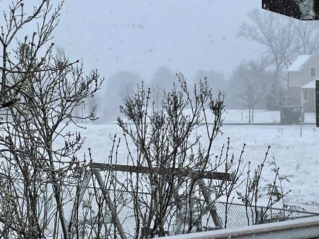
3 1/2” OTG. Moderate snow continues. 27*
-
1
-
1
-
-
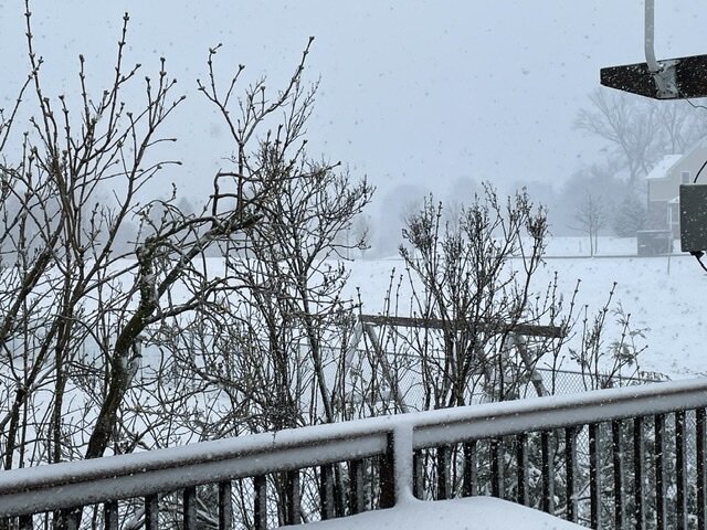
Heavy snow with 1/8 mile visibility 29*
-
2
-
-
-
1 minute ago, BxSnowWx37 said:
The flip is coming in fast..radar looks pretty gd too..its pinging outside currently by my house already.
")
It really has been booking off to the east as of late. Conversely the back edge of the snow is moving to the NE across VA at about 60 mph. This storm is a fast mover.
-
 1
1
-
-
2 minutes ago, MJO812 said:
Bigger question
Is snowman19 getting snow
")
No weenies today- what happened??
-
1
-
 2
2
-
-
Just now, HVSnowLover said:
Euro did well overall though leading the way with the offshore track instead of inland runner most other models were showing. It was too likely cold in the short range.
Strongly agree that the Euro lead the way with the more easterly track during the week.
-
2
-
-
I am seeing that here now with heavy snow 30*
-
2
-
-
5 minutes ago, Northof78 said:
Change line coming in hot, snow/sleet now east of 287 along 78 in Somerset Cnty
There’s rain and snow mixed where 78 and 287 meet however you need to go west of there to find accumulating snow.
-
1
-
-
3 minutes ago, MANDA said:
8:00 a.m. - 37 degrees with light to moderate rain.
8:20 a.m. - 33 degrees with sleet and rain mixed.
8:30 a.m. - 32 degrees light to moderate snow
9:00 a.m. - 29 degrees with light to moderate snow.
Accumulating on everything but pavement and concrete but just starting to stick on those surfaces now. Winds gusty!
Big difference in conditions from where you are at elevation as compared to those on I80 to your south.
-
-
6 minutes ago, dmillz25 said:
The changeover seems faster than expected no?
Actually for the time being it does not appear that the changeover line is proceeding any further east (as seen on traffic cams). It still runs from about Jugtown Mtn along I78 to the area where 206 connects with I80.
-
1
-
-
-
Snow in NJ as Far East as Rte 206 along I80 and Pattenburg (exit12) along I78.
-
2
-
March 2022
in New York City Metro
Posted
We have experienced a very impressive squall line out here tonight. This feature would match up very well with one we could experience in the warm season. We have had continuous lightning and thunder for over an hour now. Rain total is up to 1.07”. My Tempest has recorded 754 lightning strikes in the past three hours within 30 miles. This is really impressive stuff for March!