

BlizzardNole
-
Posts
2,304 -
Joined
-
Last visited
Content Type
Profiles
Blogs
Forums
American Weather
Media Demo
Store
Gallery
Posts posted by BlizzardNole
-
-
49 minutes ago, jewell2188 said:
What’s up for tomorrow ??
For the region? Lots of showers and thunderstorms
For my area: same as today, 0.0
-
 2
2
-
-
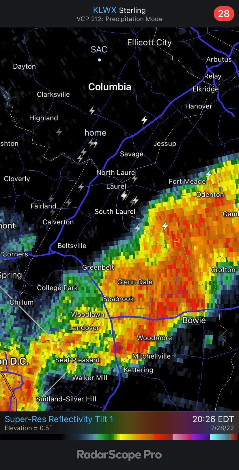
This was the full line after it formed and moved off. Good thing I watered the garden this morning LOL

-
1
-
-
New and creative way for my area to fail. Two cells popped 1-2 miles east and a few miles SE. Then they congealed into a solid line moving away to the NE.

-
90/73 and no wind. It's a hot one! People in Deep Creek area are getting their money's worth

-
I looked at the July rainfall map from LWX (under Current Conditions/Rainfall) and there are swaths around Bowie and in St Mary's Co. in the 10-15 inch range. That is crazy. My area was in the 2-3 inch which is a little dry but no drought. New Bedford, CT and much of Cape Cod had 0.25 to 0.50 for the month

-
Neat map but deceiving. It has Montgomery County at just above normal (105%) but places like Bethesda had several times as much rain as my spot. All three major airports were above, but I think I had around 2 inches total or about 50%
-
Wasn't expecting pop-up showers today. I'm missing one just to the south but the breeze and clouds from it are nice
-
LWX thinking that areas that have been left out recently could have a chance Sunday night -- let's hope!
"...Although areas to the north across ern WV, and north central MD could see heavier rainfall totals, these areas have been very dry recently and I`m not anticipating any flooding issues across those areas at this time."
-
 2
2
-
-
46 minutes ago, yoda said:
Looks like you are about to get hit
Yes, finally! A pretty good shower (no lightning). About a half inch which is best rain in weeks.
-
2
-
-
Whoo SE VA has been getting pounded on lately. I've been in VA Beach for weeks like that. One year (I think 2018) they opened the base for people to pass through as local roads had a foot of water just sitting on them. Lots of board games that week

-
3 hours ago, high risk said:
One other odd aspect of the storm yesterday: there was no lightning as the line moved through southern Howard, but it started cranking out bolts on the back side of the storm as it moved into PG. There were numerous lightning strikes in Howard, eastern Montgomery, and western PG well after the rain had ended, including one that was way, way too close here and knocked out our power for 5 hours.

Wow at far back from the rain some of those bolts are! Those are the kind of strikes that kill
-
2
-
-
Unreal how good that line to the SE looks now; some places about to get their second shot of the day. I'll be running the irrigation tomorrow morning knowing that we are looking at 0.00 again
-
So a nice looking line formed just SE moving away. Shocker! Here's the grass in the back yard

-
 1
1
-
-
1 hour ago, Rhino16 said:
Where do these maps come from?
On LWX, click Current Conditions and scroll to Rainfall, then set your map (1 day, 7, 14, 30, etc) and zoom in. It's kinda pixely and not nearly as nice as that iWeathernet map, but it goes back farther.
My folks in northern Calvert just got yet another nice shower. The rich get richer!
-
1
-
-
Last 30 days showing the green 1.5 - 2.0 hole that my area's in. I don't have a gauge up this year but I bet we are closer to the 1.5 if even less

-
1
-
-
Take a look at these 2 am to 7 am obs from St. Louis airport. That must've been some good sleeping weather


-
2
-
-
That MoCo cell faded fast! It was loud when passing thru around Poolesville, now I don't hear anything. Got a brief shower here but mostly missed just south. Hope we have more later
-
1
-
-
I can hear that cell in western MoCo -- lots of long, loud thunder booms
-
Lot of scattered power outages yesterday. We were out from 1:30 PM to about 6:45 PM.
Hoping for a nice shot of rain later
-
That gust front was impressive! Had some gusts to 30-35 and the temp went from 96 to 77 in minutes. Going to sit outside for a while now and enjoy the comfortable conditions
-
Just a few short weeks before temps start dropping off. I love late Aug and Sept!
-
1
-
 1
1
-
-
23 hours ago, nw baltimore wx said:
Sad to read that monarchs are on the endangered list. It makes me want to get serious about planting a butterfly garden.
Any of the butterfly pros in the forum having luck this year with caterpillars?
I saw that article.
 My milkweeds are doing well and I've seen a few monarchs in the last few days finally. Usually Aug and Sept are my big monarch months.
-
2
-
-
Was just out for a bit and it definitely feels drier.
91/66
Cumberland at 94 and Oakland 75 -- you folks with place out there have it nice!
-
1
-
-
2 hours ago, dailylurker said:
Must be high elevation. The temps at the airport seems to be near 60 with rain most of the forecast period.
I found it -- in those peaks around 12,000 feet. Wild looking forecast though -- wonder what it's like there in winter!
83/70 now and movin' on up
-
1
-


August Discobs 2022
in Mid Atlantic
Posted
1.22 here. I'm stunned