north pgh
-
Posts
3,012 -
Joined
-
Last visited
Content Type
Profiles
Blogs
Forums
American Weather
Media Demo
Store
Gallery
Everything posted by north pgh
-

Western PA/Pittsburgh Winter 2021/22 Discussion
north pgh replied to meatwad's topic in Upstate New York/Pennsylvania
I hope we can hold serve and even move a little northwest on these next runs but to be honest I do not have a good feeling. I hope I'm wrong. -
Western PA/Pittsburgh Winter 2021/22 Discussion
north pgh replied to meatwad's topic in Upstate New York/Pennsylvania
The NAM has the northwest trend. Now we need the others to follow suit. -
Western PA/Pittsburgh Winter 2021/22 Discussion
north pgh replied to meatwad's topic in Upstate New York/Pennsylvania
Canadian still has it but losing it south. Almost on the same track as today's storm. I'm sure it will fluctuate over the next couple days but if the others move south then it doesn't fare well at all for us. -
Western PA/Pittsburgh Winter 2021/22 Discussion
north pgh replied to meatwad's topic in Upstate New York/Pennsylvania
It looks like the NAM is coming around to our potential Friday storm. Now all we need is the GFS and we have something to track. -
Western PA/Pittsburgh Winter 2021/22 Discussion
north pgh replied to meatwad's topic in Upstate New York/Pennsylvania
Merry Christmas all! Let’s hope we can track a double digit snowfall in January or February -
Western PA/Pittsburgh Winter 2021/22 Discussion
north pgh replied to meatwad's topic in Upstate New York/Pennsylvania
After last years great December for snowy weather and a White Christmas, it looks like this year will be a bust. So far I am okay with that. Let's hope we can get a normal snowfall year of 40 inches or so in January and February. I would take that in a heartbeat. Here's hoping. -
Western PA/Pittsburgh Fall Weather Discussion
north pgh replied to Ahoff's topic in Upstate New York/Pennsylvania
I think the long term models will be junk like last year. Likely to change frequently until around 10 days out or closer. Give it a couple days and things will change often. -
Western PA/Pittsburgh Fall Weather Discussion
north pgh replied to Ahoff's topic in Upstate New York/Pennsylvania
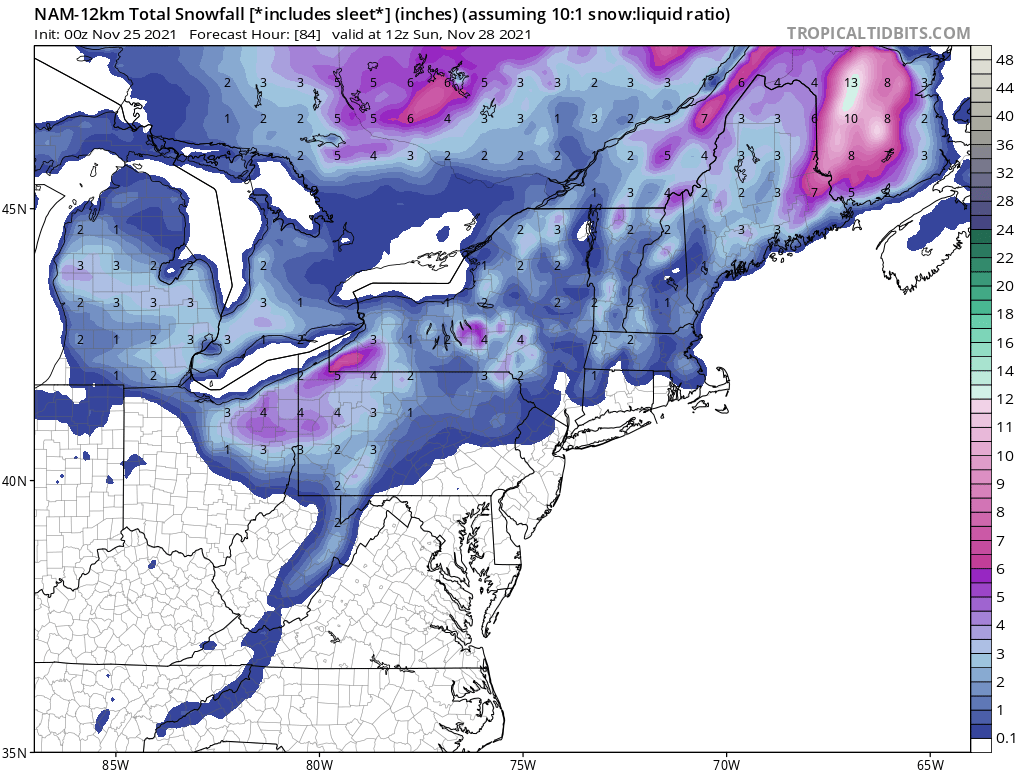
Happy Thanksgiving! It's nice to see snow in the air. Picked up a dusting. Any ideas on tomorrow night into Sunday? NWS Pit seems to think 1-2 maybe. Maybe some good snow shower activity into Monday. -
Western PA/Pittsburgh Fall Weather Discussion
north pgh replied to Ahoff's topic in Upstate New York/Pennsylvania

-
Western PA/Pittsburgh Fall Weather Discussion
north pgh replied to Ahoff's topic in Upstate New York/Pennsylvania
I think there is a good chance much of the area may see an inch if a good squall or 2 comes off the lakes. -
Western PA/Pittsburgh Fall Weather Discussion
north pgh replied to Ahoff's topic in Upstate New York/Pennsylvania
I’m driving back from southwest New York this afternoon. I’ll give an update if any snow accumulates on my drive. -
Western PA/Pittsburgh Fall Weather Discussion
north pgh replied to Ahoff's topic in Upstate New York/Pennsylvania
The timing couldn't have been any better. Next time I want to see a snow squall do the same thing. -
Western PA/Pittsburgh Fall Weather Discussion
north pgh replied to Ahoff's topic in Upstate New York/Pennsylvania
Sunday night we may see our first coating at least. -
Western PA/Pittsburgh Fall Weather Discussion
north pgh replied to Ahoff's topic in Upstate New York/Pennsylvania
Yes I agree. I watched that rotation on radar as it went about 5 miles north of me. Duncan ave all the way down to route 8 and then on toward Hartwood Acres. Looking at some damage on the news I’m guessing E-F 1. It could have been a microburst but I think there was too much rotation on radar. -
Western PA/Pittsburgh Summer Discussion 2021
north pgh replied to Ahoff's topic in Upstate New York/Pennsylvania
I like thunderstorms. Nobody on here likes destructive weather as you call it. The line is weakening. General thunderstorms now moving through. Sitting on my porch drinking a beer. Steady rain with thunder and crickets. Great sleeping weather too. Can’t beat it. -
Western PA/Pittsburgh Summer Discussion 2021
north pgh replied to Ahoff's topic in Upstate New York/Pennsylvania
This may be a historic night of thunderstorms. I have had 4 different storms go through in the last 2 hours. This line moving back north has strong winds and intense lightning. Worse than the other storms. Flooding will be an issue. -
Western PA/Pittsburgh Summer Discussion 2021
north pgh replied to Ahoff's topic in Upstate New York/Pennsylvania
For not having any thunderstorms in April and May...... June July and August are overperforming. -
Western PA/Pittsburgh Summer Discussion 2021
north pgh replied to Ahoff's topic in Upstate New York/Pennsylvania
I can't believe the airport hasn't reached 90 today. My car thermometer was 95 and my weatherstation has 92. -
Western PA/Pittsburgh Summer Discussion 2021
north pgh replied to Ahoff's topic in Upstate New York/Pennsylvania
My thoughts exactly. Last night’s storm was one of the better overnight thunderstorms in a while. It was kind of like some storms I remember lying awake to when I was little. Light winds, steady rain and lots of lightning and thunder. No severe wind or hail threat but only lightning strike probability. I was one of those complaining as I myself, like thunderstorms (not too severe however) its been a great 2nd half of June and so far in July. I’m getting some distant rumbling as I type this so we may be in for more today. -
Western PA/Pittsburgh Summer Discussion 2021
north pgh replied to Ahoff's topic in Upstate New York/Pennsylvania
My station is reporting 93. I don't know how accurate but my dewpoint says 74 and heat index is 103. I am looking forward to some thunder tomorrow and 70's later this week. -
Western PA/Pittsburgh Summer Discussion 2021
north pgh replied to Ahoff's topic in Upstate New York/Pennsylvania
My home thermometer just hit 90. With less cloud cover out there now I believe airport should reach 90 today. -
Western PA/Pittsburgh Summer Discussion 2021
north pgh replied to Ahoff's topic in Upstate New York/Pennsylvania
I agree 100%. I live 1 mile next to a neighborhood that lost close to 100 trees in a 5 to six block area. -
Western PA/Pittsburgh Summer Discussion 2021
north pgh replied to Ahoff's topic in Upstate New York/Pennsylvania
Rain is easing up a bit. Picked up .76 inches of rain. A few cloud to ground strikes still around. Keep alert over in Eastern Ohio. HRRR showing a possible second line developing and moving through the metro area in the next several hours. -
Western PA/Pittsburgh Summer Discussion 2021
north pgh replied to Ahoff's topic in Upstate New York/Pennsylvania
Rain pounding here. .56 so far. Winds haven't been too bad. Maybe 45 mph gusts. Flash Flooding may be the new threat as storms training a bit. -
Western PA/Pittsburgh Summer Discussion 2021
north pgh replied to Ahoff's topic in Upstate New York/Pennsylvania
Not so fast. Getting a decent thunderstorm here now with some decent lightning.