
anthonyweather
-
Posts
1,888 -
Joined
-
Last visited
Content Type
Profiles
Blogs
Forums
American Weather
Media Demo
Store
Gallery
Everything posted by anthonyweather
-

Sunday 1/19 Eagles Game Snow and Stuff
anthonyweather replied to Ralph Wiggum's topic in Philadelphia Region
6-10^** -
Sunday 1/19 Eagles Game Snow and Stuff
anthonyweather replied to Ralph Wiggum's topic in Philadelphia Region
WSW for 6-10 LV and Poconos woooo -
1Mb stronger then 6z, with slightly more precip….
-
Sunday 1/19 Eagles Game Snow and Stuff
anthonyweather replied to Ralph Wiggum's topic in Philadelphia Region
The old Smell the rain to get the best snows… -
Sunday 1/19 Eagles Game Snow and Stuff
anthonyweather replied to Ralph Wiggum's topic in Philadelphia Region
-
Sunday 1/19 Eagles Game Snow and Stuff
anthonyweather replied to Ralph Wiggum's topic in Philadelphia Region
For sure, wsw will go up for many -
E PA/NJ/DE Winter 2024/25 Obs/Discussion
anthonyweather replied to JTA66's topic in Philadelphia Region
This was the originally forecasted heavier stuff. I’m anxious to see what it does as it advances across the state.
-
E PA/NJ/DE Winter 2024/25 Obs/Discussion
anthonyweather replied to JTA66's topic in Philadelphia Region
Ya euro is nice
-
E PA/NJ/DE Winter 2024/25 Obs/Discussion
anthonyweather replied to JTA66's topic in Philadelphia Region
Gfs gives a sizable NW shift at 6z for Sunday
-
E PA/NJ/DE Winter 2024/25 Obs/Discussion
anthonyweather replied to JTA66's topic in Philadelphia Region
Real breath of fresh air seeing such agreement between UK, CMC and euro at this range for the Sunday system. -
E PA/NJ/DE Winter 2024/25 Obs/Discussion
anthonyweather replied to JTA66's topic in Philadelphia Region
Call it a coating in Bethlehem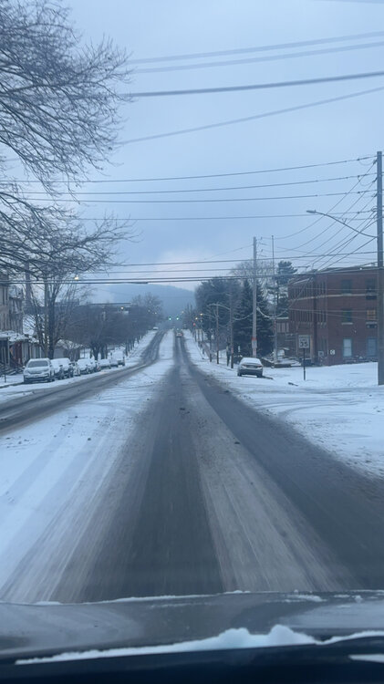
-
E PA/NJ/DE Winter 2024/25 Obs/Discussion
anthonyweather replied to JTA66's topic in Philadelphia Region
2” at home, under an inch in the LV
-
Jan 11th-12th Super Bomb or Super Bummed?
anthonyweather replied to Rjay's topic in New York City Metro
I mean realistically, they only have 180k followers. Getting posts out to grow your following organically helps down the road when it matters Imo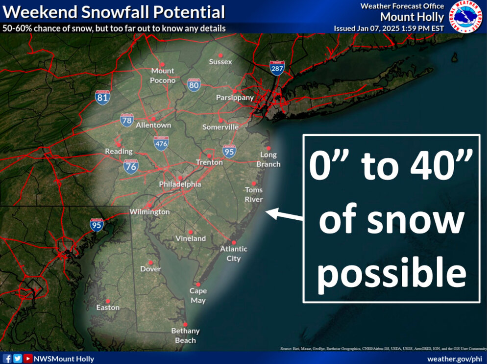
-
Jan 11th-12th Super Bomb or Super Bummed?
anthonyweather replied to Rjay's topic in New York City Metro
A NWS in the mid west did something similar a few days ago and was a hit. They tried it. They shouldn’t have took the image down either because a select few cried about it. weather forecasting is a joke anymore because every body and their brother open a Facebook page and post OP runs. let them grow their fanbase a little bit organically with some laughs.- 993 replies
-
- 1
-

-
- metsfan vs snowman
- bomb
- (and 2 more)
-
Central PA Winter 2024/2025
anthonyweather replied to Voyager's topic in Upstate New York/Pennsylvania
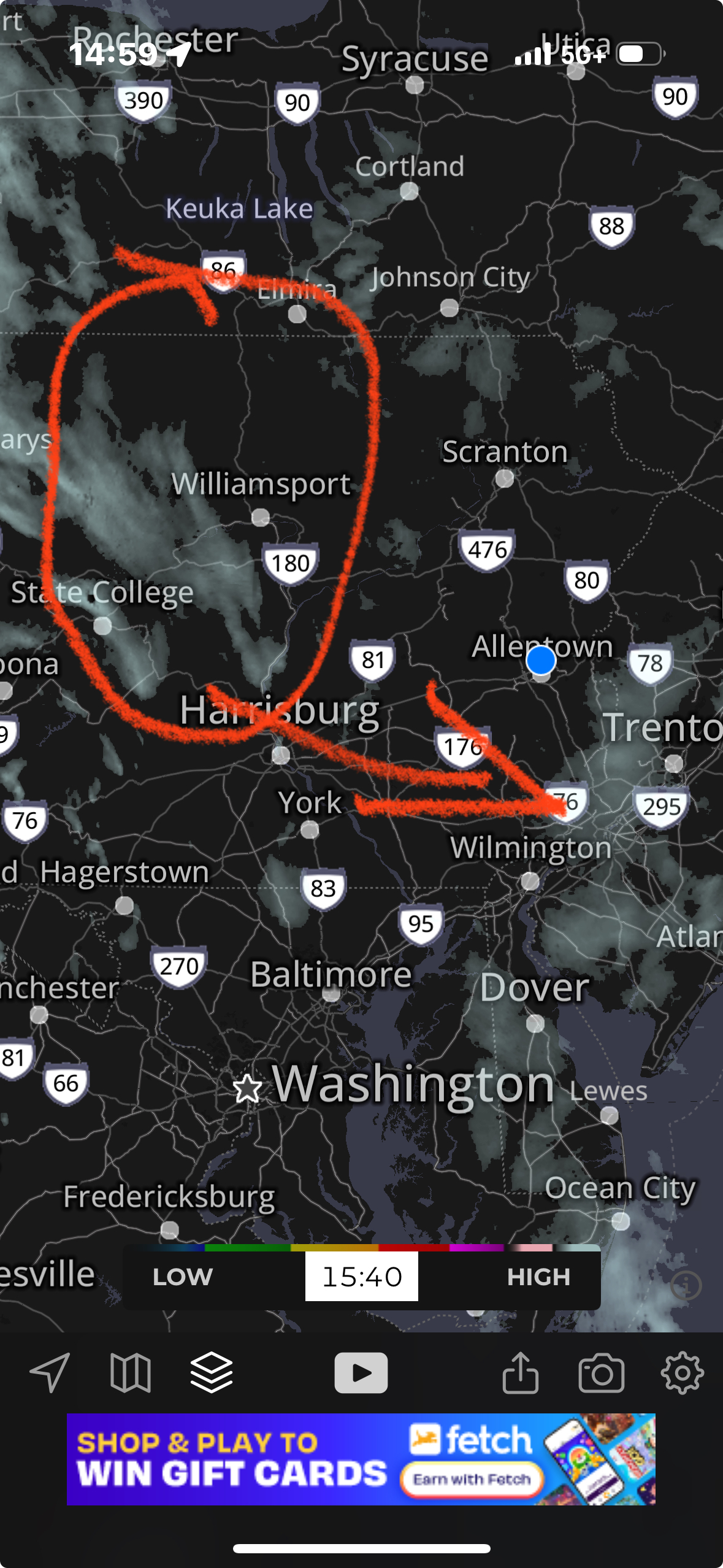
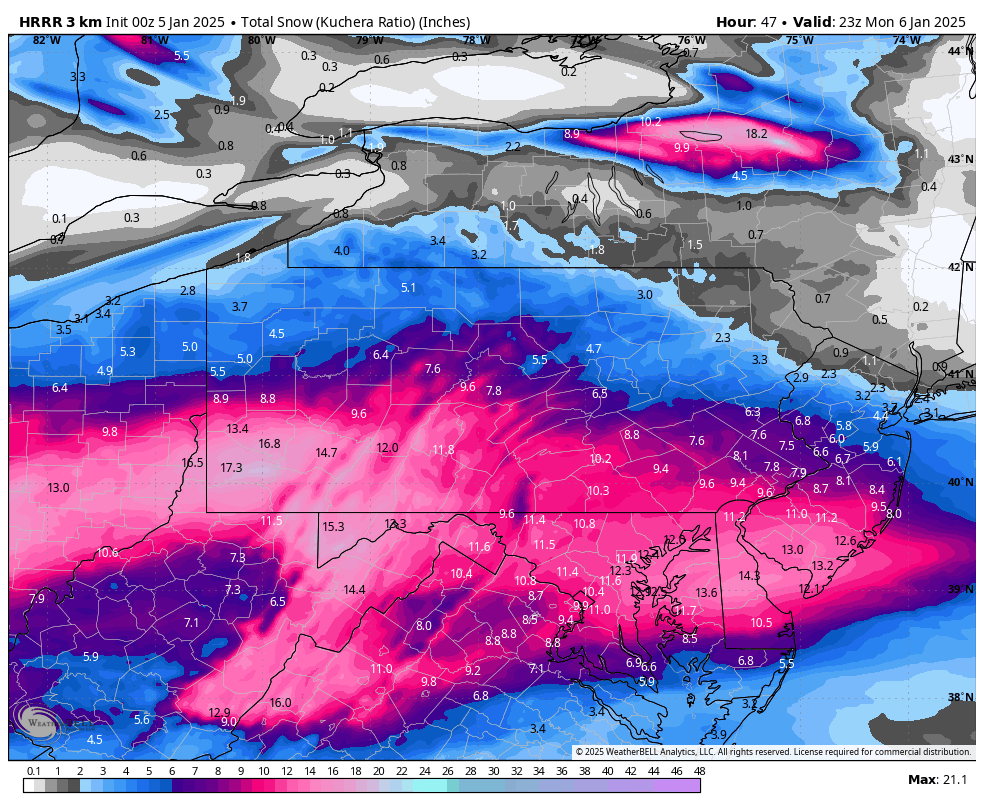
12z hrrr slightly expanding precip for the northern flank -
Central PA Winter 2024/2025
anthonyweather replied to Voyager's topic in Upstate New York/Pennsylvania
Damnit. LOL duh -
Central PA Winter 2024/2025
anthonyweather replied to Voyager's topic in Upstate New York/Pennsylvania
6z hrrrr time -
Central PA Winter 2024/2025
anthonyweather replied to Voyager's topic in Upstate New York/Pennsylvania
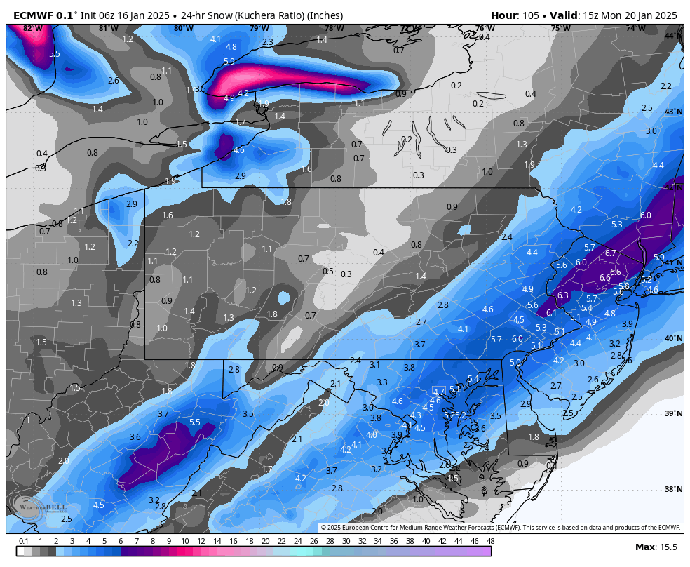
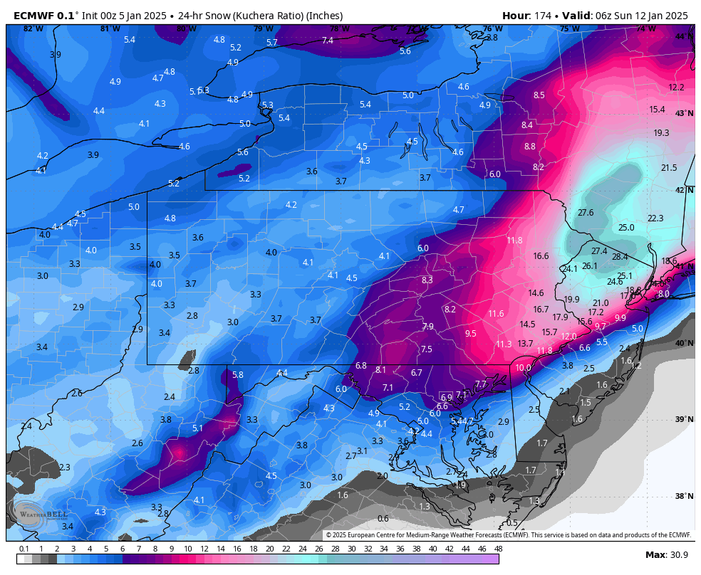
Euro and GFS for next weekend wowwww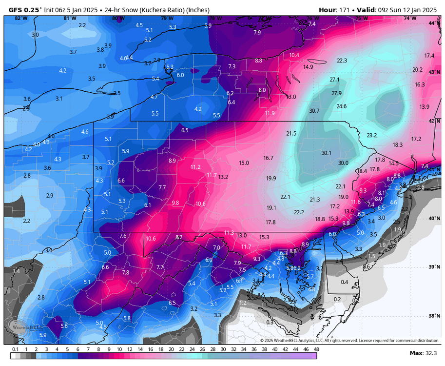

-
1/6 snowstorm - nuisance event or something bigger?
anthonyweather replied to LVblizzard's topic in Philadelphia Region
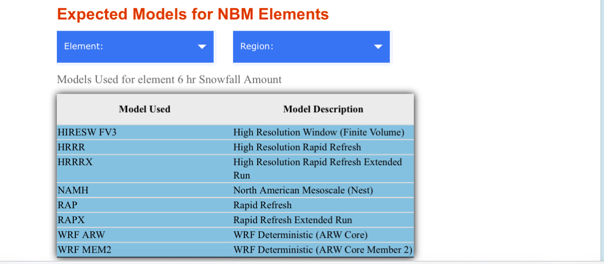
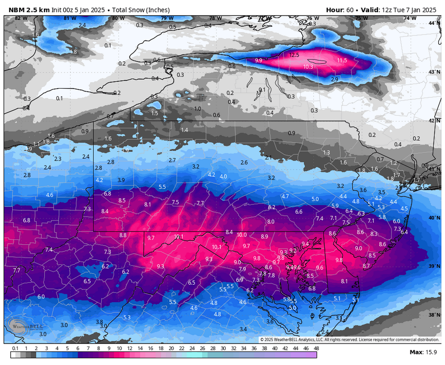
Latest NBM here’s some Info, https://vlab.noaa.gov/web/mdl/nbm appears most of the data comes from the latest HRRR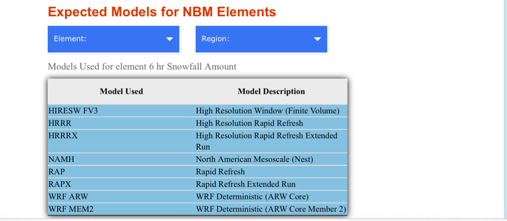
-
Central PA Winter 2024/2025
anthonyweather replied to Voyager's topic in Upstate New York/Pennsylvania
So in this case, the latest NBM utilizes the HRRR as its primary forecast


-
Central PA Winter 2024/2025
anthonyweather replied to Voyager's topic in Upstate New York/Pennsylvania
Thank you sir -
Central PA Winter 2024/2025
anthonyweather replied to Voyager's topic in Upstate New York/Pennsylvania
So what models does the NBM take into account for? -
Central PA Winter 2024/2025
anthonyweather replied to Voyager's topic in Upstate New York/Pennsylvania
Mmmm
-
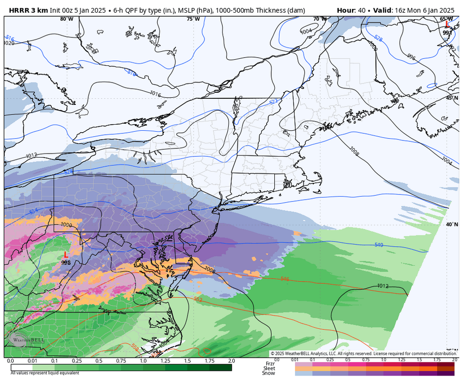
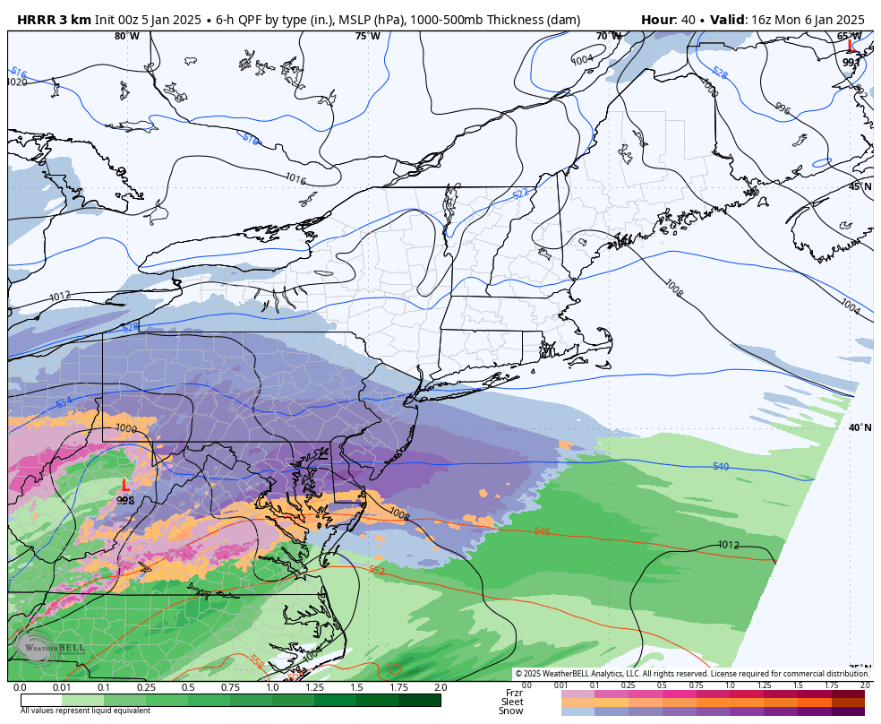
1/6 snowstorm - nuisance event or something bigger?
anthonyweather replied to LVblizzard's topic in Philadelphia Region
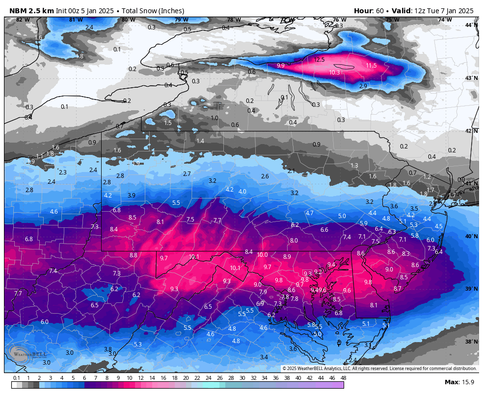
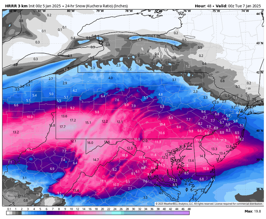
Hrrr smoke job for just about everyone
-
Central PA Winter 2024/2025
anthonyweather replied to Voyager's topic in Upstate New York/Pennsylvania
11am Monday