

CoastalWx
-
Posts
160,919 -
Joined
-
Last visited
Content Type
Profiles
Blogs
Forums
American Weather
Media Demo
Store
Gallery
Posts posted by CoastalWx
-
-
There have been cave drawings by the Mashantucket Peqout of teepees buried in OES from SE winds.
-
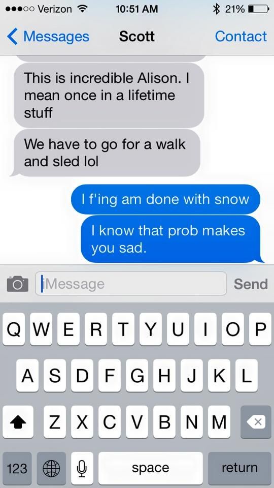
I would have preferred 45F and sunshine than live through that storm again
I know...I don't mean to put salt on the would.

-
Ahhh the classic unblocked flow depositing the heaviest precipitation downwind of the topographic barrier.
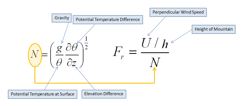
I wonder what the Froude Number would be for that event in the Tolland Hills?
More like Fraud number.
-
I get more effects from land/sea convergence than he does from noslope at 1k.
-
When that wind direction it actually makes sense the higher totals were w and SW of Union as the enhanced echoes there fell downstream from wind direction.
You crack me up. -
I know he hates when we say that...lol..but it is true.
-
Maybe not in true sense.. But if you loop the radar from that storm.. It clearly shows the snow enhancing as that air hits the higher elevations of Eastern and then North eastern CT. Even over NW Ri a bit
That was really a firehose band though. I didn't notice any enhancement other than a mesoscale band that probably was nothing to do with low level processes. You are actually at the end of the higher elevations in NE CT so using your logic..you should receive less than Union.
-
?
There was no upslope really.
-
It was like -4 to -6 at 900mb too...the warm forecasts were looking too much at surface outputs. Overlay a firehose on those 900mb temps and it's gonna be hard to get mostly rain or non-accumulating snow. You are hoping the rates will be pretty light in that type of forecast which is a dubious thing to pin your hopes on when we have that type of fetch in the mid-levels.
It was kind of the inverse scenario of what happened to DC in that storm...they had plenty of cold aloft at 850mb, but once down to like 900-925mb, it was getting pretty warm. So they got a white rainstorm at 36F.
In a way, a little mid level magic for that storm as well.
It was certainly cold just off the deck. Those plots from the RAP that aftn were awesome. We were talking about those that day and they nailed it...even more than other guidance IIRC. Good storm all around, but man...that dryslot in RI. I think I remember Ekster posting an AWIPS graphic of the RAP and it showed a semblance of the subsidence zone. Must have been one of the deep easterly flow, standing wave features where the lift occurs along the coast and the exhaust is 40 or 50 miles downstream..only to pick up again further west. I think some of that snow in srn CT was also caught in a mini deformation zone in between s/w's.
Anyways, not to make Ryan and Cory drive into the CT river...just was an interesting storm.
-
That was the storm where the NAM brought the 0C 850 line all the way back to like Pittsfield.
Some mets were saying mostly rain for BOS up until nearly start time.
LOL, yep..what a disaster forecast from the NAM.
That storm certainly had some red flags for a bust on the snowier side. As you said, respect the firehose.
-
Yeah that's a whole other level of screw. That's not a "models showed big hit but we got fringed" or "the rug got pulled out 12 hours from start time."
That's a "perfect storm track that delivered 20"+ amounts all around us while we got 3-6 inches." That synoptic set up 10/10 times would deliver big snows.
That was a tough storm to forecast in Boston. I certainly did not think we would get that much on the coast, but when the euro was bullish on actual CAA from the NE at 925mb...I started to believe the day before. The deep 700-500 RH/VV also was another clue. Certainly a lesson learned on the coast. I will say that some OCMs went down with their ship right up to game time. Rip and reading NAM and GFS.
-
What a swan dive for RI.
-
We have talked about that storm quite a bit. Is pretty much ranked up there with the most awe inspiring storms of all time. Needham was ground zero for that band of TSSN.
-
Since it missed the US, and is following the typical path of hurricanes the past thousands of years, I guess you'd agree that climate change took a break on Joaquin?? I mean, if Sandy is "evidence" of CC, then Joaquin is the "anti evidence".
Your above crap was written based on long range weather models......lol!!! That, in and of itself, is evidence/proof of confirmation bias at it's best!!!

-
I said that more than once for a couple of things. And then 96 is blown away and 34 too. Have to agree unlikely but damn ya never know
Yeah nothing is definite, but if you think about it for return rate, I think the other two examples would go down a lot sooner than a widespread late October 6-24"+ storm. And oh yeah...gave DC-NYC-BOS snow as well.
-
Snowtober still grabs my attention more than any of the recent blizzards. The shotguns and flashes all night and the destruction that was visible in the morning with that epic deform band of the ages over GC. Still don't think we will see anything like that again in our lifetimes.
Certainly not as widespread. We may see a narrow area get a siggy October snow, but the widespread nature of that storm like will not be matched in our lifetime.
-
Ryan H.

-
By the way, excellent site for radar data for those who don't know.
https://mesonet.agron.iastate.edu/GIS/apps/rview/warnings.phtml
-
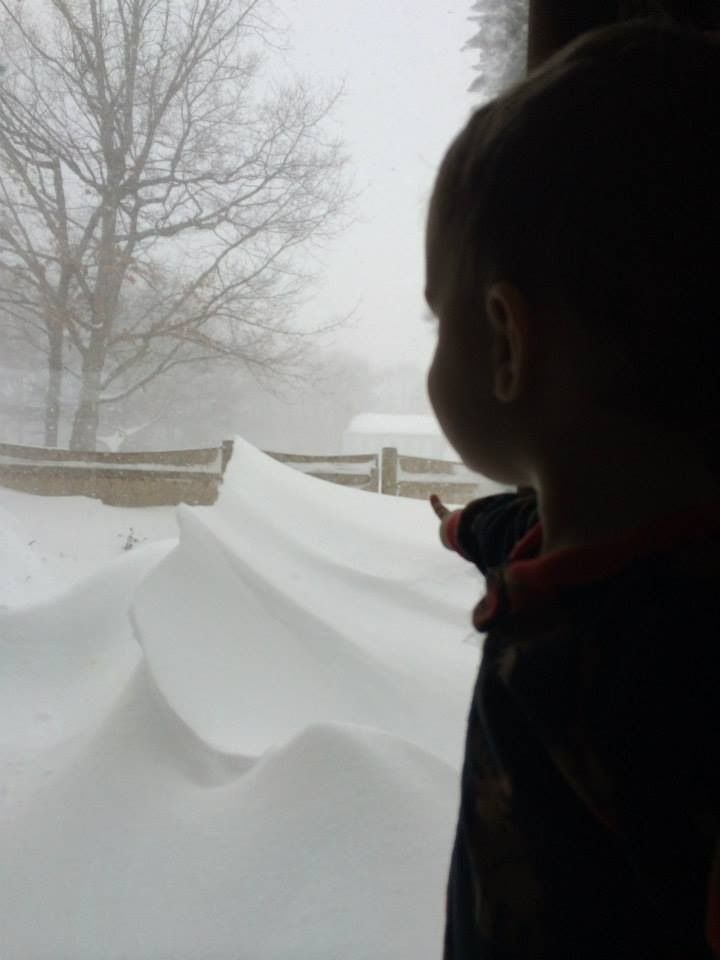
Great shot! Keep that one save on an external hard drive to show the boy when he's older.
In fact everyone should back up their photos from last winter, one crash on the computer and you can't get that back.
You have anything saved from December? You guys had that really interesting storm that had some crazy mesoscale rain and snow lines.
-
You'd never know there was a path cleared and a deck 5' below that drift. 2/15 storm.That radar sums up last winter, haha. Just pummeling eastern New England, especially Mass/BOS. Aimed right at BOS.
-
I have work to do:
-
I was at south station on the bus headed back to NYC when this happened. Pretty cool to have experienced that. It went from rain to heavy wet snow almost instantly
That was a strange event. Dropped 7 degrees in 10 minutes and started straight as snow where I was. Very convective with colder air working in from N and NE of all places.
-
The record breaker. Kind of a special event for me.

-
Dem PCź kidz has deez days is tougher dhen nailz to figures out.


New England snowstorm memories.
in New England
Posted
Wigwams submerged in drifts.