

CoastalWx
-
Posts
176,996 -
Joined
-
Last visited
Content Type
Profiles
Blogs
Forums
American Weather
Media Demo
Store
Gallery
Everything posted by CoastalWx
-
After next weekend things may get a little fun.
-
Let’s get it to stay green another week. If I could go from green to white in one day, that would be heaven. And then white to green in April. Haha.
-
My plants look like poop so maybe they gave up. Now that you hate to see.
-
Haha. We round up then.
-
What’s ORH latest 32?
-
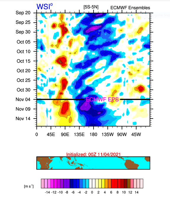
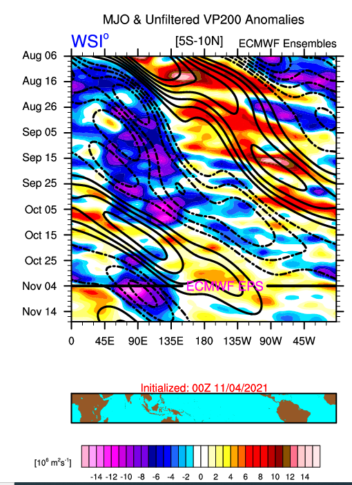
Some shifts in 850 wind anomalies to east and the OLR anomalies as well. You want those closer to dateline. Probably why we see a change for the time being in the PNA, after next weekend.
-
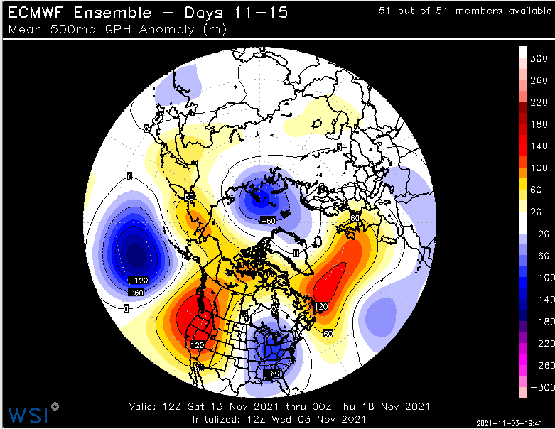
After we milder and screaming sou'easter, looks like we PNA change. If that holds, one would thing first snow for at least the interior.
-
Beer
-
Anyways, go snow.
-
No not really.
-
A MPM 32. 32.3.
-
Man snooze fest, but at least we Stein for weekend. Finally. Milder next week.
-
Let’s get a raging +AO from this solar storm.
-
Maine snow hole this winter?
-
When it briefly tries to coat but melts 5 minutes later, I’d probably say trace.
-
Like near 2k? That’s some good accumulating snow.
-
That is fake too
-
I'll say 30.9
-
Fake cold.
-
This is pretty nice.
-
Graupel is like adding hail to snow accumulations. Just seems false.
-
We grow.
-
Is that the access road?
-
Later in the 11-15 day on the EPS looks good to me as it has last few days. The moderation prior to that has been in the cards. Nothing has changed.
-
I'll give some oaks up.


