CoastalWx
-
Posts
176,041 -
Joined
-
Last visited
Content Type
Profiles
Blogs
Forums
American Weather
Media Demo
Store
Gallery
Everything posted by CoastalWx
-
87 I saw.
-
First 32F readings coinciding with first snow?
-
They told my parents Saturday evening in Marshfield. Same in Weymouth, but I think my house gets it back late today or tomorrow judging by the progress. I am surprised actually for Marshfield given the issues they have had.
-
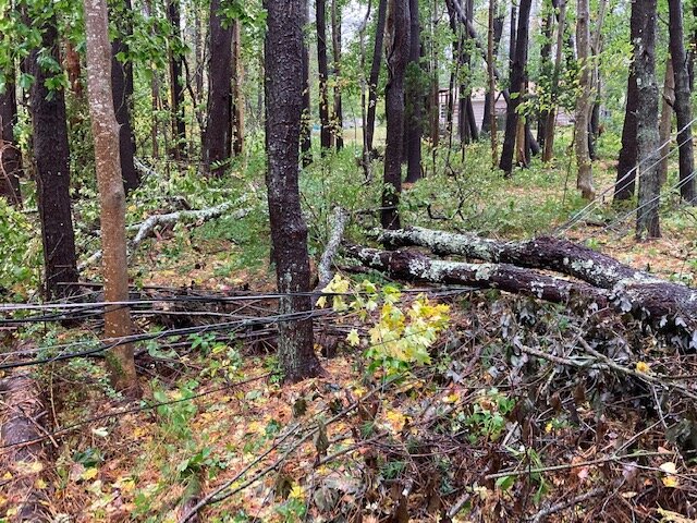
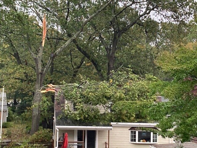
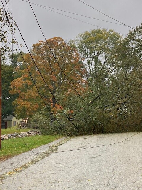
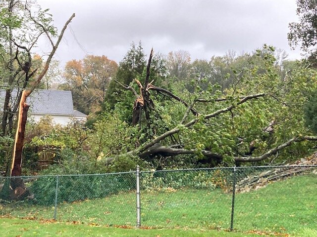
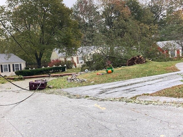
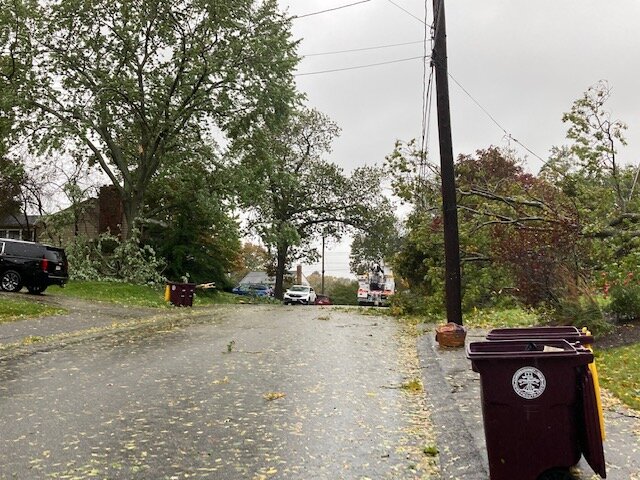
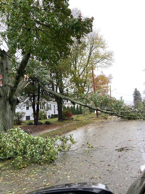
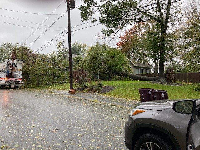
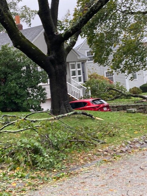
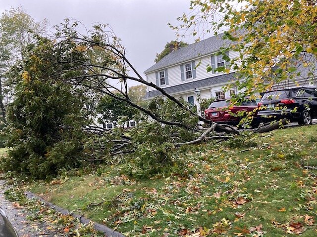
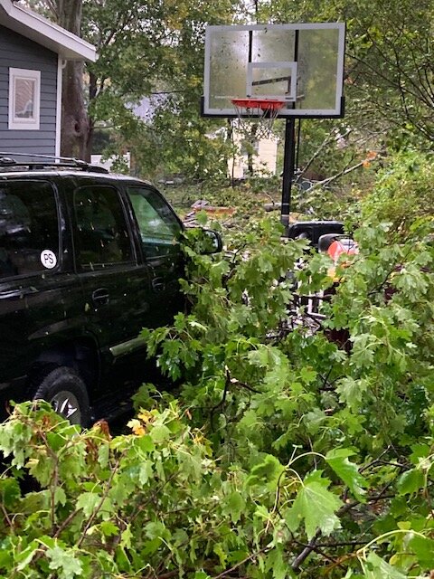
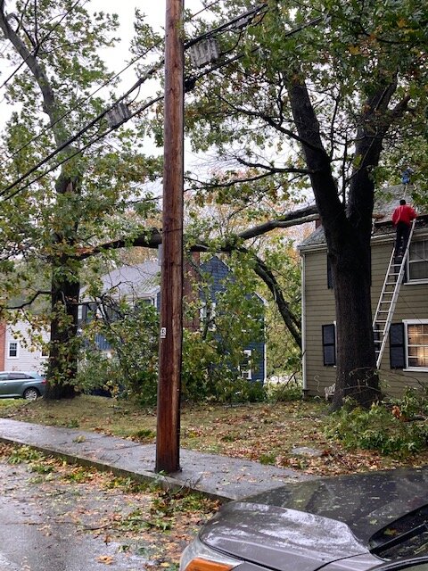
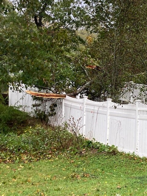
Grab some damage pics.
-
Our friends there were crapping their pants the other night. She texted me at 4:30am about when this will stop. Phil was all over dragging his weenie across the region.
-
-
South shore is used to damage though. Damage capitol. They’ll be fine.
-
We CJ.
-
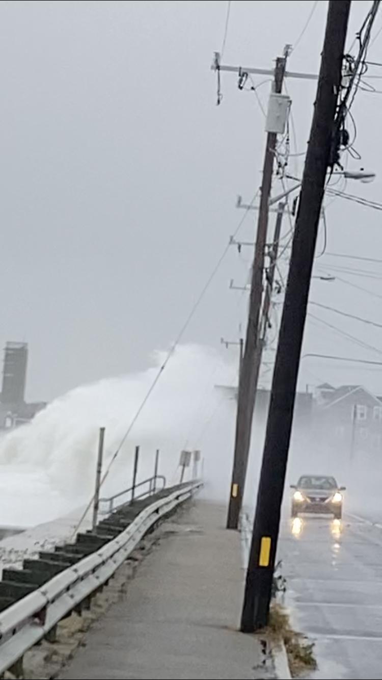
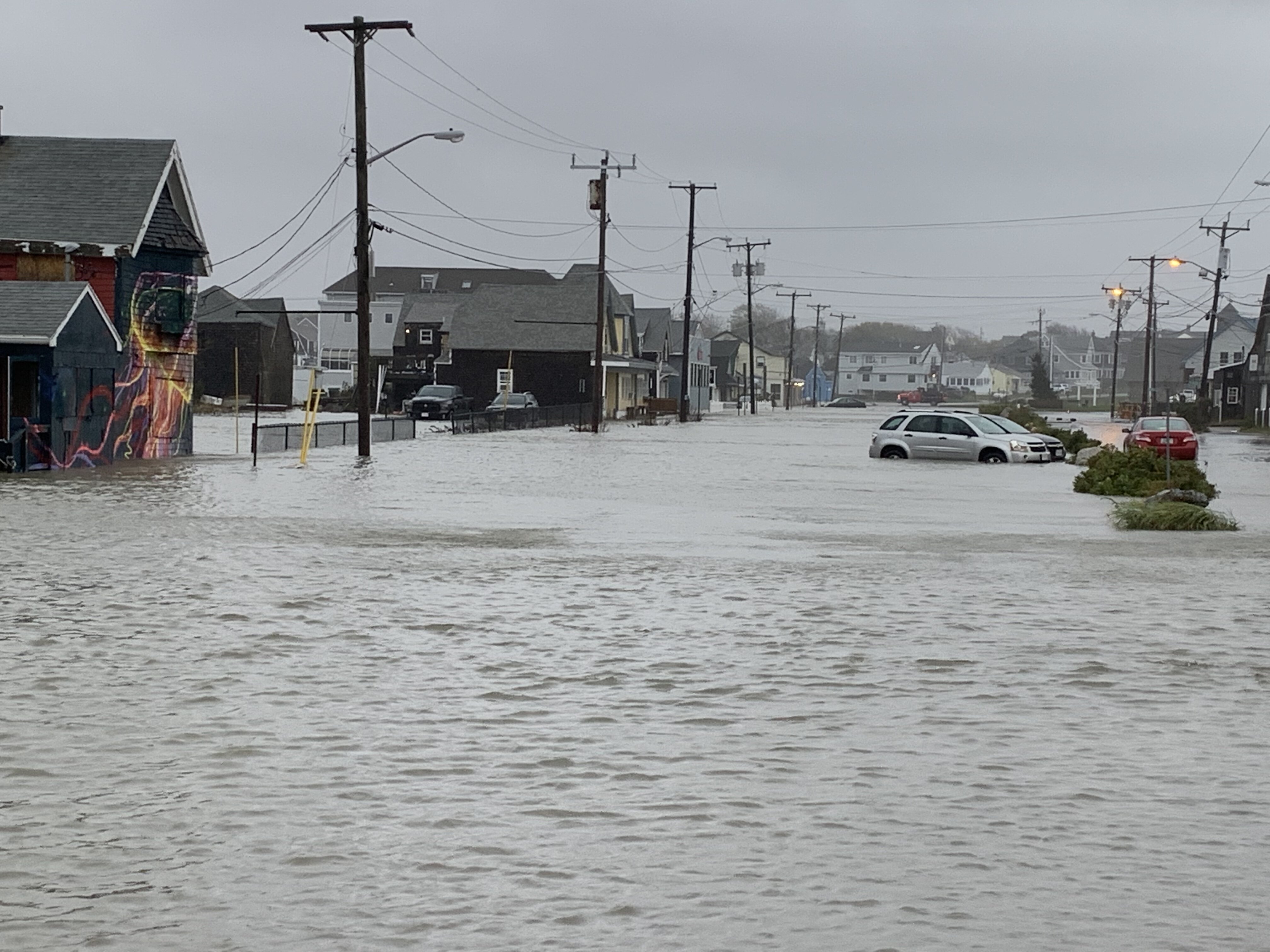
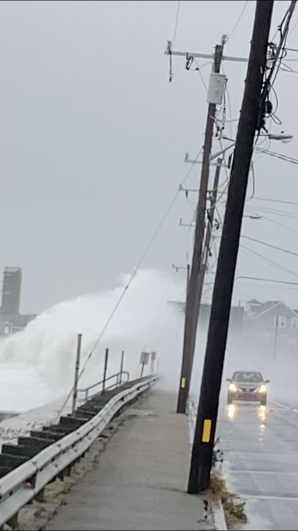
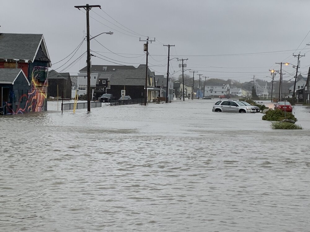
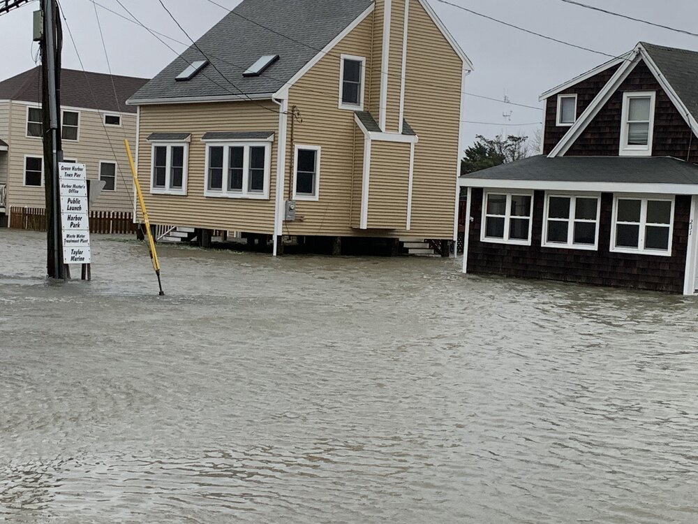
Flooding still in Marshfield. Epic waves.
-
March 2018 may be worse lol. Although to be fair I haven’t seen much of Plymouth county this go around.
-
I was surprised. Some hoods were trashed. Luckily my yard didn't have anything big down.
-
-
Dropping trees down the chimney left and right.
-
Gonna be over 4".
-
Worse to my south. Reminds me of 2019 when we got rocked, but Braintree a few miles west didn't have much. At my folks on generator so I can work, but Phil stopped by here too.
-
He’s got it covered

-
Was supposed to be minor flooding. This is Marshfield. If tides were even 2’ higher...complete nightmare.
-
Got some good pics. Will post a little later.
-
Will get some. Didn’t have phone with me. Was dead. No power.
-
3.5”. Trees all over. Pole snapped. Trees on houses.
-
Lots limbs and trees snapped in hood.
-
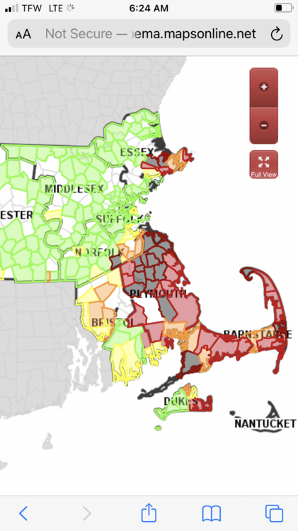
420k now.
-
94 on Ferry in Vineyard Haven.
-
Property looks ok, but I heard breaking last night and and some Thumps. Phil was partying last night.
-
390K. Holy shit. Mostly on south shore and near Cape Anne. Wonder where the LLJ was.