

CoastalWx
-
Posts
176,078 -
Joined
-
Last visited
Content Type
Profiles
Blogs
Forums
American Weather
Media Demo
Store
Gallery
Everything posted by CoastalWx
-
March 2022 Obs/Disc: In Like a Lamb, Out Like a Butterfly
CoastalWx replied to 40/70 Benchmark's topic in New England
I saw the gfs and want to puke. Meteorological stomach bug. Wheel of Rhea. Better get snow out of that lol. -
March 2022 Obs/Disc: In Like a Lamb, Out Like a Butterfly
CoastalWx replied to 40/70 Benchmark's topic in New England
Oh man. What a disaster to start April. -
March 2022 Obs/Disc: In Like a Lamb, Out Like a Butterfly
CoastalWx replied to 40/70 Benchmark's topic in New England
He also had a melt about these last 10 days of the month. -
March 2022 Obs/Disc: In Like a Lamb, Out Like a Butterfly
CoastalWx replied to 40/70 Benchmark's topic in New England
Boy it looks potentially active too. -
March 2022 Obs/Disc: In Like a Lamb, Out Like a Butterfly
CoastalWx replied to 40/70 Benchmark's topic in New England
I know right? Lol. -
March 2022 Obs/Disc: In Like a Lamb, Out Like a Butterfly
CoastalWx replied to 40/70 Benchmark's topic in New England
Noticing forsythia blooming. -
March 2022 Obs/Disc: In Like a Lamb, Out Like a Butterfly
CoastalWx replied to 40/70 Benchmark's topic in New England
Chevy maybe? -
March 2022 Obs/Disc: In Like a Lamb, Out Like a Butterfly
CoastalWx replied to 40/70 Benchmark's topic in New England
Next commercial? -
March 2022 Obs/Disc: In Like a Lamb, Out Like a Butterfly
CoastalWx replied to 40/70 Benchmark's topic in New England
What happened to that boy........ -
March 2022 Obs/Disc: In Like a Lamb, Out Like a Butterfly
CoastalWx replied to 40/70 Benchmark's topic in New England
Make music great again. -
March 2022 Obs/Disc: In Like a Lamb, Out Like a Butterfly
CoastalWx replied to 40/70 Benchmark's topic in New England
Septic filled from massive poops? -
March 2022 Obs/Disc: In Like a Lamb, Out Like a Butterfly
CoastalWx replied to 40/70 Benchmark's topic in New England
Probably couple weeks away from doing mine. -
March 2022 Obs/Disc: In Like a Lamb, Out Like a Butterfly
CoastalWx replied to 40/70 Benchmark's topic in New England
You or anybody else have this book for kids? I just picture Steve.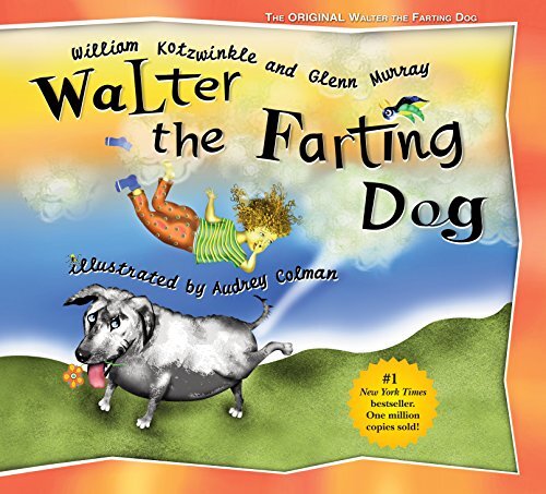
-
March 2022 Obs/Disc: In Like a Lamb, Out Like a Butterfly
CoastalWx replied to 40/70 Benchmark's topic in New England
What a melt by Kevin. -
Saturday, March 19, 2022 Elevated Convection w/Severe Potential
CoastalWx replied to weatherwiz's topic in New England
Sounds like a violent night. -
March 2022 Obs/Disc: In Like a Lamb, Out Like a Butterfly
CoastalWx replied to 40/70 Benchmark's topic in New England
As a well known philosopher once said, “Beer.” -
March 2022 Obs/Disc: In Like a Lamb, Out Like a Butterfly
CoastalWx replied to 40/70 Benchmark's topic in New England
Lots of Breweries. -
Saturday, March 19, 2022 Elevated Convection w/Severe Potential
CoastalWx replied to weatherwiz's topic in New England
When are the baseballs arriving? -
March 2022 Obs/Disc: In Like a Lamb, Out Like a Butterfly
CoastalWx replied to 40/70 Benchmark's topic in New England
Nude on the roof of cruiser tanning? -
March 2022 Obs/Disc: In Like a Lamb, Out Like a Butterfly
CoastalWx replied to 40/70 Benchmark's topic in New England
Euro is a little more interesting mid week. After leading the torch solutions, it’s cooled off a lot. -
March 2022 Obs/Disc: In Like a Lamb, Out Like a Butterfly
CoastalWx replied to 40/70 Benchmark's topic in New England
45 here. Temp falling LOL. -
March 2022 Obs/Disc: In Like a Lamb, Out Like a Butterfly
CoastalWx replied to 40/70 Benchmark's topic in New England
About 10 degrees warmer to my south in Hanover. Wedged in Weymouth. -
March 2022 Obs/Disc: In Like a Lamb, Out Like a Butterfly
CoastalWx replied to 40/70 Benchmark's topic in New England
I know it. If I’m -7 at 850, would be nice to take advantage of it. -
March 2022 Obs/Disc: In Like a Lamb, Out Like a Butterfly
CoastalWx replied to 40/70 Benchmark's topic in New England
With those low 40s temps. Deep summer. -
March 2022 Obs/Disc: In Like a Lamb, Out Like a Butterfly
CoastalWx replied to 40/70 Benchmark's topic in New England
Discs disappearing in the air as Tip throws to his pals?


