CoastalWx
-
Posts
176,090 -
Joined
-
Last visited
Content Type
Profiles
Blogs
Forums
American Weather
Media Demo
Store
Gallery
Everything posted by CoastalWx
-
Should be a good drink in most areas.
-
Considering how I flopped with the event last week, this one working out well.
-
0.6 here. I guess we take. Hopefully some more later.
-
Another beast cell near the canal.
-
Those who don't forecast with emotion ftw.
-
For the CT folks, lets see what comes from NYC area. You may get that later. Looks like Kevin on SE gets some rains.
-
You will. He knew.
-
WTTTE
-
bulk misses to my SW I think.
-
Rain has been perfect here. Other than a quick downpour, steady light to mdt. Just helping to soak in.
-
HRRR did well with the meso low idea.
-
About 0.25" now. Jus had a quick downpour.
-
Nice MDT rain.
-
Man right on western edge here. Hopefully a decent soaking.
-
They'll be scattered downpours tonight too. Tomorrow may be best CT into NE MA..but guidance has storms in many areas.
-
Yeah more will develop.
-
There should be more this aftn.
-
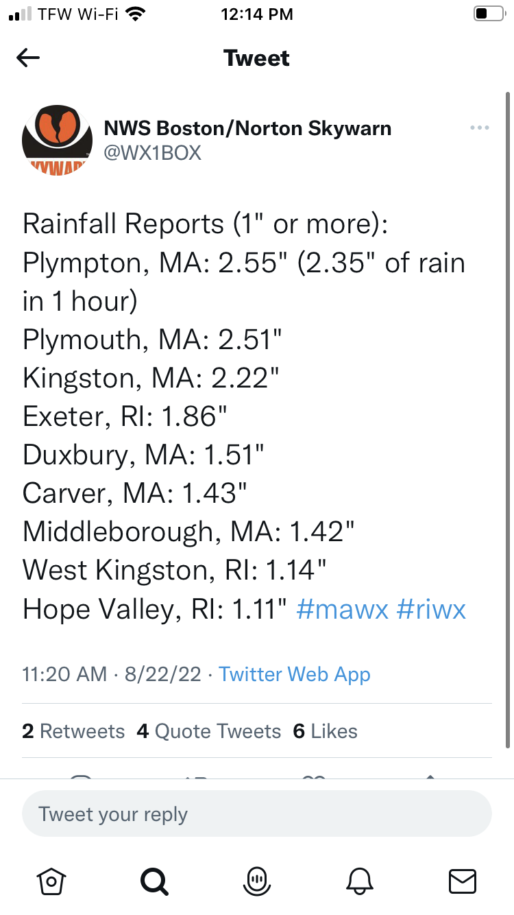
Congrats PYM with 2". Looks like it slides east of me. Sigh.
-
Nice rain here with these tepid echoes. Hope that stuff to my SE doesn't slide too far east of me.
-
I think more could fill in later today?
-
I think the two part jack will work out well. One with the synoptics out west and one with meso low. Tomorrow offers more chances too.
-
Please please please…
-
Send that cell NW please
-
You’re keeping it emotional