
allgame830
-
Posts
2,526 -
Joined
-
Last visited
Content Type
Profiles
Blogs
Forums
American Weather
Media Demo
Store
Gallery
Everything posted by allgame830
-
 I’d say 1-3 is good for the southern portion of the boroughs with 3-5 for northern parts including a good portion of northern LI. 5-8 locally 10 NW
 -
Right. I’d like to see a bit of south trend so then the whole region is 4-8
-
I get that this is NYC subforum, but it would be helpful just to saw a map because not everyone lives in the NYC proper.
-
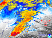
Snow map? I never can seem to find it lol
-
Ahhh I gotcha sorry if I misunderstood. Just hit 32 here and mostly everything is encased in ice except the streets since they plowed and salted but probably still very slick in places. What’s your thoughts for the weekend?
-
This one will be much different north of the city… only reason for the cancellations was due to the ice. This event looks much better organized and has more QPF
-
Yeah that’s one reason why I posted the point and click! Do you believe I’ll fair well being 30 miles N of the city Thornwood/Hawthorne NY?
-
Saturday A 20 percent chance of snow after 1pm. Partly sunny, with a high near 33. Northwest wind around 6 mph becoming light and variable in the afternoon. Saturday Night Snow before 4am, then snow and sleet. Low around 26. Chance of precipitation is 100%. New snow and sleet accumulation of 3 to 7 inches possible. not sure how this next event is the same. Same type of system yes, but the air mass and position of L looks different.
-
My guessing delays are to make sure the storm happens but for areas NW most likely closures as the end result. I got a text saying decision will be made by 730am my kids schools are closing.
-
What’s the QPF output on most models? Just from the look of maps looks to be a decent moderate hit.
-
That seems doubtful especially for areas NW
-
Yeah idk I was trying to figure that out earlier. However it’s still only Monday
-
Where whole subforum or city?
-
Huh what are you talking about lol
-
4.5” measured at 830
-
I can verify that. Heavy snow now
-
Probably but in last few frames you can see it advances back north
-
Temp down 25 now. Dropped 5 degrees since 5pm


