

weathercoins
-
Posts
797 -
Joined
-
Last visited
Content Type
Profiles
Blogs
Forums
American Weather
Media Demo
Store
Gallery
Posts posted by weathercoins
-
-
What is the area in black?

-
 2
2
-
 6
6
-
-
Would not want to be a Boston meteorologist rn
-
GFS upgrade really seems like it has made a significant difference. Maybe that’s an obvious understatement. But starting to really question the value of the former King in the 3-6 day range, beyond creating fun snow maps
-
Front end looks fine for a fun advisory event, but coastal won’t get us anything
-
Same zoom link as a couple of weeks ago?
-
 1
1
-
-
Was the level of rapid intensification on the NAM while the coastal was still well south of here consistent with the Euro modeled solution?
-
Many runs with the storm last weekend had a nice improvements in early frames only to screw us later, so fingers crossed…
-
1 minute ago, Paleocene said:
Ol' trusty ICON says yeah that's gonna be a no from me dawg

The ICON is only a good model in very specific situations, specifically when it somehow finds a way to inexplicably predict that a coastal snow hurricane will ride the coast in the medium range. Otherwise it’s trash
-
1
-
-
Current collective status

-
2
-
5
-
 1
1
-
-
1 minute ago, Leaking Gut said:
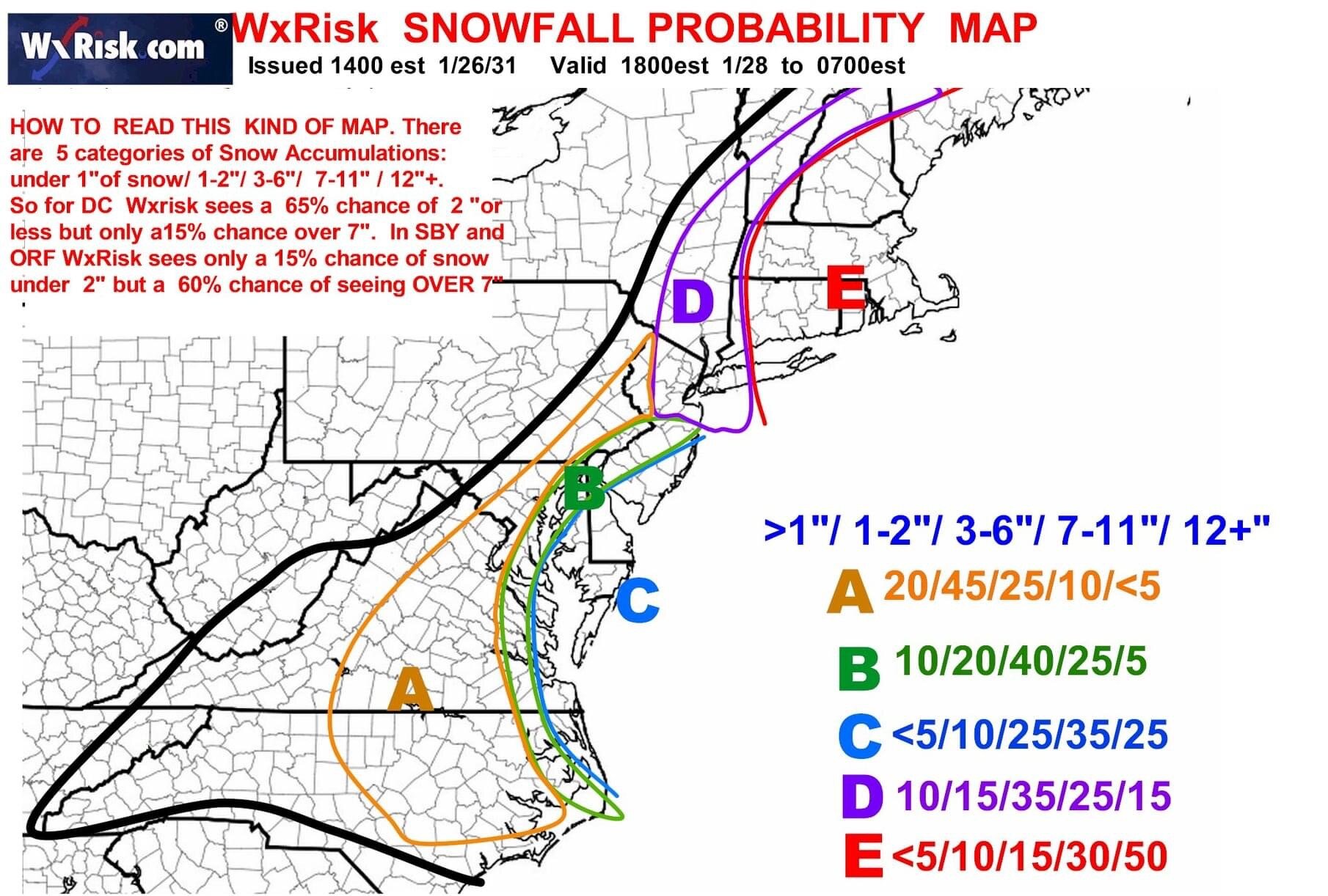
Ryan Maue ported this map, very different from Kuchera
Not too different for Ocean City!
-
2
-
-
Just now, mappy said:
Oof, Euro snowmap is way too overdone. Has my area getting 10+ on ~.4 qpf
yeah. okay.
Especially closer to coast when actual ratio likely even lower.
-
1 minute ago, CAPE said:

Don’t think we’ve had a map giving anything in this area 40 inches (only a few days out) in 5+ years
-
Just now, Steve25 said:
This is absurd for Ocean City. I have to imagine if this is even close to realistic, there's going to be a lot of chasers heading down there
If this is even close to realistic, the chasers should plan on staying there for a while. Can’t imagine those roads will be dug out for a bit.
-
1
-
-
Canadian welcomes the coastal to our party
-
Solid advisory storm with the small but increasing possibility that the coastal puts us into warning criteria, coming on the weekend when more of us can enjoy it. And 25 hours ago it looked like we’d get nothing. I like it.
-
Just now, IronTy said:
How is weatherbell so GD slow with their maps? It's like their system is running on a 486SX or something.
They keep their servers connected to the Amtrak WiFi
-
6
-
-
1 minute ago, BTRWx's Thanks Giving said:
Is that we're doomed or hold my beer?
It’s “we’re doomed to have a lot of snow because the storm is inexplicably riding the coast”
-
2 minutes ago, DDweatherman said:
If the GFS evolution looks anything like the RGEM During the prime frames, prepare yourself for the jaws music
And for six pages of thread to happen in about 3 minutes
-
4
-
-
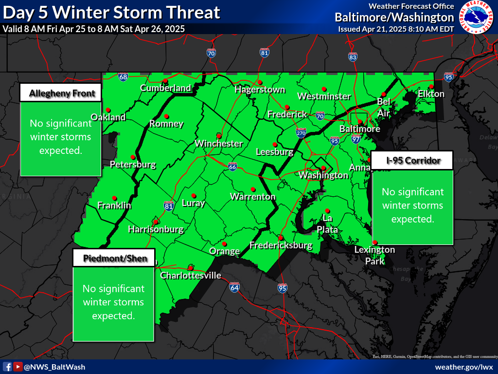
Coming next month

-
3
-
-
1 minute ago, The Ole Bucket said:
This thread to the GFS:

Also

-
1
-
-
2 minutes ago, psuhoffman said:
Not very similar. Miller A in a classic pattern with a -NAO with departing 50/50. Some called it a “thread the needle” at the time simply because we were in a Nina but I always thought it was a pretty classic big storm setup Nina or not.

Incredible level of rapid intensification off the coast for that one. Seems like it did it at exactly the right time so it “threaded the needle” in terms of giving the I95 corridor stupid amounts of snow though?
-
Media hardcore hyping this one up already, especially north. That was fast
-
1
-
-
4 minutes ago, nj2va said:
Let's get this to be red and purple by tomorrow. It was issued prior to the 12z runs so curious if their thinking changed at all based on those.
1. They always seem to conflate confidence with potential impact on this product (i.e. if very uncertain if a major storm will impact, always a low confidence and low potential impact)
2. Interesting to have higher confidence west -
28 minutes ago, Scraff said:
We should start a storm thread.

I like how our sub waits a bit to jinx the storm with a thread. SE and NE subforums sometimes seem to start a thread twelve days out based on a single ensemble outlier snow map
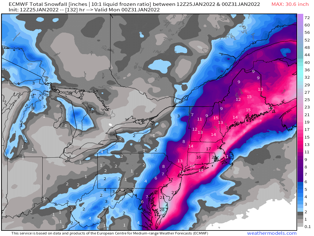
January 28-29, 2022 Miller abcdefu Storm Threat
in Mid Atlantic
Posted
What a week this has been. At the very least, a few of the earlier in week model runs gave us some really nice Kuchera snow maps that we can sell as NFT’s to the Boston crowd to cheer them up