

Sey-Mour Snow
-
Posts
6,865 -
Joined
-
Last visited
Content Type
Profiles
Blogs
Forums
American Weather
Media Demo
Store
Gallery
Everything posted by Sey-Mour Snow
-
NERDS
-
Torch today going to hit 70+ easily if we don’t seabreeze.. 66 already here.
-
That run verbatim was extremely cold for late March. Legit Arctic shot
-
That's a deep mid winter GFS run 7+ day stretch of snow chances and brutal cold
-
70% of the day was cloudy.. Midday had some nice breaks of sun, cloudy again
-
65 DXR. Hit 64 at home
-
He’s always confused poor guy
-
Down in Bridgeport pack 100% wiped just some piles left..
-
63-67 around here on the home stations
-
Seasons in seasons has fully transitioned to morch welcome aboard the warm train.
-
46/46 down to about 50% coverage .. 50s with dews entering western CT. Should be left with just piles by this evening ..
-
There is a period late Saturday into first half of Sunday with dew 48-58 across SNE .. That will cause some damage .. Then again late Tuesday
-
Still looks like 55-65 Potential Sunday through early Wednesday for most of SNE even into CNE . DXR may pull a 70 one day..
-
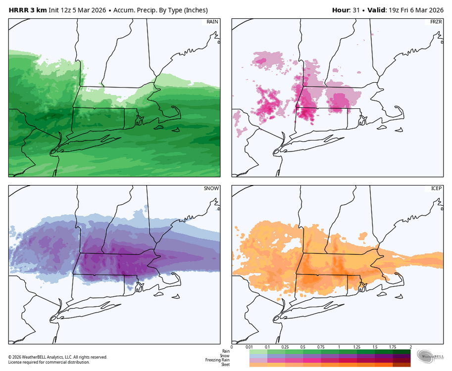
NBM never bit on big snow amounts
-
1.10" in the gauge .. nice event for the stein worries
-
Still 100% pack up here besides exposed areas from drifting .. with cold temps overnight I think we hold pack until Monday. Sunday ripens it and then it goes Monday
-
-
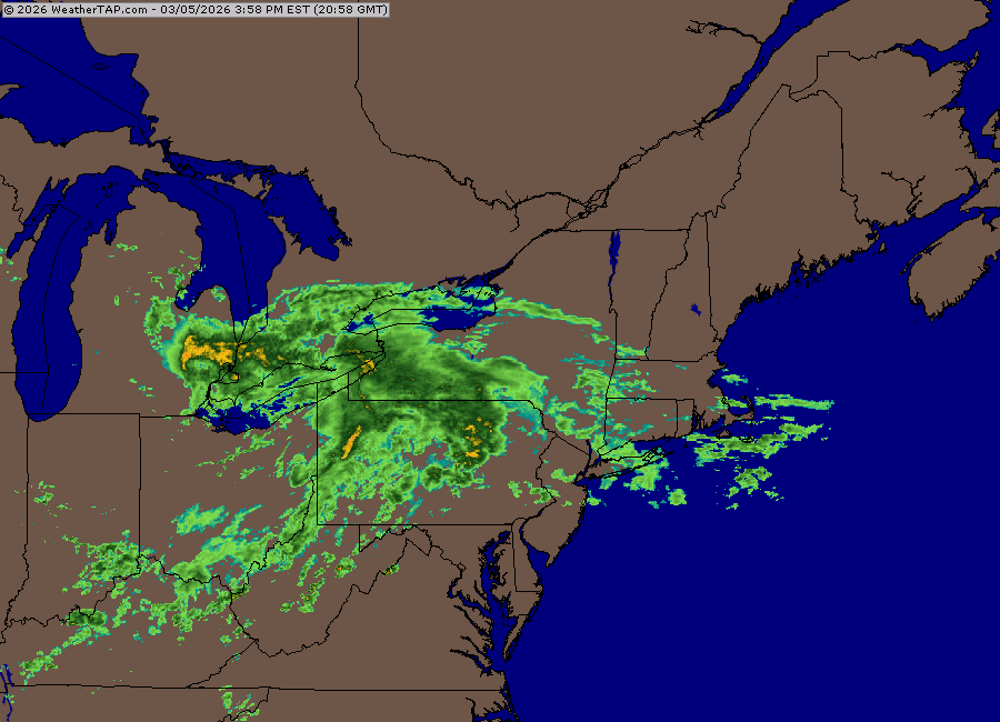
This has been a good drink for the area. Should be widespread 1.25-1.75” rain totals by tomorrow. Already half inch in the gauge from round 1.
-
-
Warm stretch is pretty set in stone for SNE .. 50-60 Sunday / 55-65 Monday / 60-70 Tuesday / Wednesday 65-75+ / Back to winter Thursday PM .. Shore will be colder than those numbers
-
DAMN 56 here not a cloud
-
Solid melt day today for many , highs 48-52 dews 35-40 bright March sun, can hear the gutters already pouring water at 10am
-
Ya I hate winter rain and we didn’t have much of it this year, that was nice.
-
Definitely elevation aided wet roads down the hill , sheet of ice up here 30.1
-
I agree with a lot of this.. mostly the missed chances and the blizzard left me sour missing out on historic snow bc of the SE bump ..


