Sey-Mour Snow
-
Posts
6,748 -
Joined
-
Last visited
Content Type
Profiles
Blogs
Forums
American Weather
Media Demo
Store
Gallery
Everything posted by Sey-Mour Snow
-
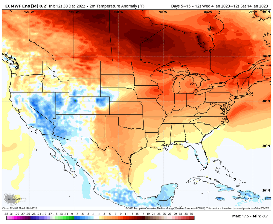
1-2 degrees from being 6-12” for a lot of us
-
Good sign that means 00z will be epic inverse rule .
-
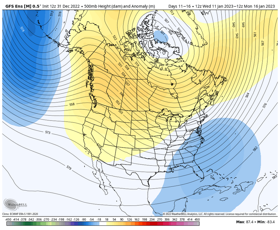
Pattern after next weekends threat looking promising on GEFS.
-
First 00z 12z run to show it that favorable.
-
I’ve noticed almost every 6z and 18z run have had the storm for 4-5 days now and the 00z and 12zs lose it. Weird.
-
Record high of 64 BDL. Mild as far as the eye can see. As others have said doesn’t mean we can’t sneak in a snowstorm.
-
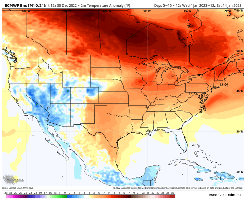
What does the major thaw being in early January instead of late January do to your forecast? You stated cold and stormy early and thaw late. But we most likely thaw Jan 1-5/6.
-
There’s been a stretch of days with highs between 55 to 65 almost every winter. It’s pretty normal. We had a stretch of 70s in January I think in 2019?
-
We have record highs to look forward to.
-
6z gfs is Kevin’s dream storm for Jan 6-8. That storm has had a wintry signal on gfs for the past 3-4 days.
-
Ya true, definitely would prefer the EPS to verify verbatim.
-
Looks like GEFS and GEPS pushed back a bit. EPS looked fine but GEFS led the charge in pacific last pattern change.
-
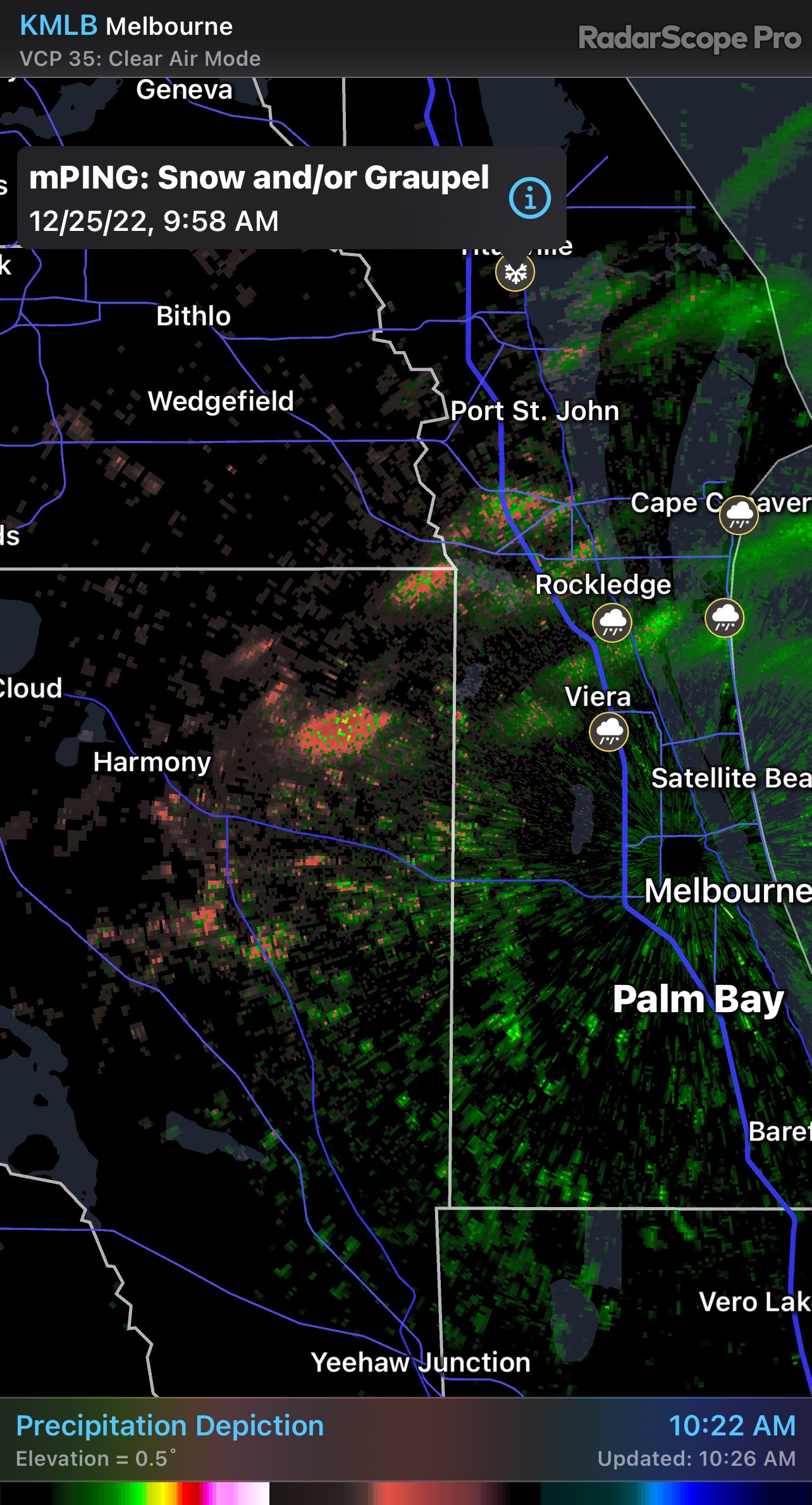
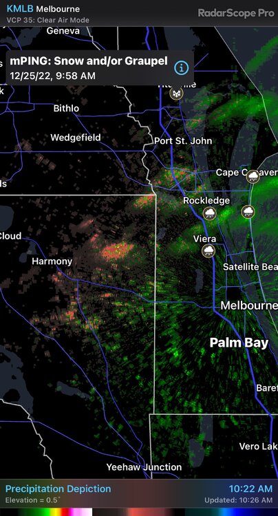
 Florida reporting wintry precip
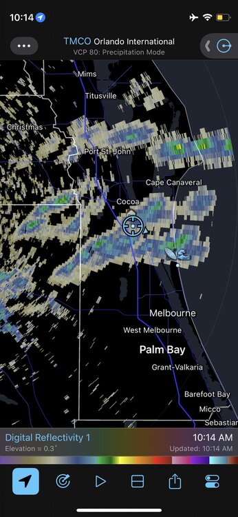
-
Rumors of White Christmas’ another 20 years and it will be a summer holiday.
-
What radar are you using?
-
27.8 here steadier snow moving in. 18-21 degrees from nyc metro to SWCT .
-
Look at western CT forming overhead like I said before. Light snow here was a good squall training to my north earlier.
-
No . Our squalls will form overhead.
-
5 degree drop in 10 min now holding steady
-
37-39 in extreme western CT
-
Flash freeze threat really increasing. With rain changing to snow squalls as temps drop quickly. Already 44 here. Won’t have to drop much when the front comes.
-
6z hrrr hinted at some intense squalls / hi res Reggie too