

Burghblizz
-
Posts
1,742 -
Joined
-
Last visited
Content Type
Profiles
Blogs
Forums
American Weather
Media Demo
Store
Gallery
Everything posted by Burghblizz
-

Western Pa / Pittsburgh area Winter Discussion ❄️☃️
Burghblizz replied to north pgh's topic in Upstate New York/Pennsylvania
GFS is looking a bit like the Euro. Runs a first wave out on Monday. We get a decent shot of snow out of it. That’s great, but here is the question. Does that work to erode the high a bit, and thus let the bigger storm ride north farther? Maybe, maybe not. It’s a good run for Western PA overall, just something to watch as to it being a tad warmer. It’s a mess farther east. -
Western Pa / Pittsburgh area Winter Discussion ❄️☃️
Burghblizz replied to north pgh's topic in Upstate New York/Pennsylvania
Looking Cleaner. HP doing it’s job (honestly it’s probably not worth mentioning the 12”+ swath yet - but I guess I just did ) -
Western Pa / Pittsburgh area Winter Discussion ❄️☃️
Burghblizz replied to north pgh's topic in Upstate New York/Pennsylvania
Warm. Tongue. Of. Death. :-) Euro looks to show 3 separate waves. An inch or so Saturday, a couple Monday, and then the bigger storm Monday night into Tuesday. The bigger storm tries to cut, but runs into a wall in Kentucky. Looks like it then redevelops in NC and runs up to the Delmarva. Might not be completely clean, but certainly 8-10” through that period. -
Western Pa / Pittsburgh area Winter Discussion ❄️☃️
Burghblizz replied to north pgh's topic in Upstate New York/Pennsylvania
yeah, It’s not the typical WTOD. We would keep our snow pack and still stack 7-8” on top. -
Central PA - Winter 2020/2021 Part 2
Burghblizz replied to MAG5035's topic in Upstate New York/Pennsylvania
Got some nice fat flakes falling - 1.5” -
Western Pa / Pittsburgh area Winter Discussion ❄️☃️
Burghblizz replied to north pgh's topic in Upstate New York/Pennsylvania
We aren’t going to nearly have the moisture fetch that we had the other night. But again the frigid ground is making every flake count. Part of the reason roads became a mess quickly -
Western Pa / Pittsburgh area Winter Discussion ❄️☃️
Burghblizz replied to north pgh's topic in Upstate New York/Pennsylvania
Monday/Tuesday - Basically has 6-10” in six hours just north of the city. I mean a 80 mile wide 150 mile long swath of those rates. Obviously way too early to be looking at that Still makes up west of us before a late redevelopment. So not great, but close to something big. -
Western Pa / Pittsburgh area Winter Discussion ❄️☃️
Burghblizz replied to north pgh's topic in Upstate New York/Pennsylvania
I’d probably take it one out of ten (but this might be the one since we would be preserving snowpack, and for once in my life I’m not commuting daily) -
Western Pa / Pittsburgh area Winter Discussion ❄️☃️
Burghblizz replied to north pgh's topic in Upstate New York/Pennsylvania
Canada loving Morgantown and the border counties tonight -
Western Pa / Pittsburgh area Winter Discussion ❄️☃️
Burghblizz replied to north pgh's topic in Upstate New York/Pennsylvania
Snowing in Dallas with a 1048 H to the north. Doesn’t seem likely it would cut that hard -
Western Pa / Pittsburgh area Winter Discussion ❄️☃️
Burghblizz replied to north pgh's topic in Upstate New York/Pennsylvania
I think pre-1950 they were at the KAGC site. Similar elevation, just a tad south -
Western Pa / Pittsburgh area Winter Discussion ❄️☃️
Burghblizz replied to north pgh's topic in Upstate New York/Pennsylvania
Airport definitely lighter than the city this time. Probably missed that intial real heavy band. Solid 5-6” closer to city -
Western Pa / Pittsburgh area Winter Discussion ❄️☃️
Burghblizz replied to north pgh's topic in Upstate New York/Pennsylvania
Another band is trying to slip south, and then maybe train a little bit. -
Western Pa / Pittsburgh area Winter Discussion ❄️☃️
Burghblizz replied to north pgh's topic in Upstate New York/Pennsylvania
Until 10 months later :-) But no, everything about ‘93 (the scale, the wind, etc) was probably once or twice in a lifetime. Nov 1950 is the twice for those above a certain age. -
Western Pa / Pittsburgh area Winter Discussion ❄️☃️
Burghblizz replied to north pgh's topic in Upstate New York/Pennsylvania
Funny how that works! Watch a big storm for 5 days and all the intricacies of what can go wrong. Now a front basically gets held up in the right place, and most of of AGC scoring a quick 6” -
Western Pa / Pittsburgh area Winter Discussion ❄️☃️
Burghblizz replied to north pgh's topic in Upstate New York/Pennsylvania
Really goes to show you what a huge factor rates are. This came in thumpin -
Western Pa / Pittsburgh area Winter Discussion ❄️☃️
Burghblizz replied to north pgh's topic in Upstate New York/Pennsylvania
Reminds me a little of just a fat Lake Effect band training. Seems to be some 4” and 5” totals already south/south west of Columbus (while CMH itself is looking a bit shafted) I think some from that area to here sees 6” if we can keep the goods training. -
Western Pa / Pittsburgh area Winter Discussion ❄️☃️
Burghblizz replied to north pgh's topic in Upstate New York/Pennsylvania
It was all nickel and dimes. I think there might have been a couple 5” type storms. -
Western Pa / Pittsburgh area Winter Discussion ❄️☃️
Burghblizz replied to north pgh's topic in Upstate New York/Pennsylvania
Parkway East taking a beating already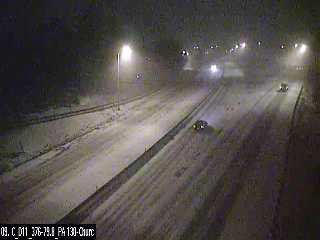
-
Central PA - Winter 2020/2021 Part 2
Burghblizz replied to MAG5035's topic in Upstate New York/Pennsylvania
Nice start out here. Ramped up fairly quickly -
Western Pa / Pittsburgh area Winter Discussion ❄️☃️
Burghblizz replied to north pgh's topic in Upstate New York/Pennsylvania
Definitely every flake sticking so far. Could be an efficient little storm -
Western Pa / Pittsburgh area Winter Discussion ❄️☃️
Burghblizz replied to north pgh's topic in Upstate New York/Pennsylvania
I can see how this week is shaping up... Looking like some nice little snow events this week. But we may not enjoy them since we will be obsessed chasing what the GFS is advertising Sunday. Reminder - enjoy the snow that’s falling since the 6 day GFS is likely going to change :-) -
Western Pa / Pittsburgh area Winter Discussion ❄️☃️
Burghblizz replied to north pgh's topic in Upstate New York/Pennsylvania
Your bar for cold is pretty high. 12 degrees out right now, and hasn’t hit 40 this month. Hasn’t hit 50 since just after Christmas. Some bitter cold still chances in the pipeline Not sure if “84” is your birth year...but if it is...trust me it will start to feel colder the next 10 years -
Western Pa / Pittsburgh area Winter Discussion ❄️☃️
Burghblizz replied to north pgh's topic in Upstate New York/Pennsylvania
Looks like a good shot at two separate 2-4” snows this week. Latest GFS also shows a bigger storm for Valentines Day. Verbatim it cuts a deepening storm towards a 1036 high up the Ohio River. Would be a big hit for central Ohio, with a rain to snow here. But plenty of time there. -
Western Pa / Pittsburgh area Winter Discussion ❄️☃️
Burghblizz replied to north pgh's topic in Upstate New York/Pennsylvania
It’s likely too progressive for anything big


