

dendrite
-
Posts
63,260 -
Joined
Content Type
Profiles
Blogs
Forums
American Weather
Media Demo
Store
Gallery
Everything posted by dendrite
-
You're better off tracking a d7 NAM thunderstorm than a d12 GFS cane.
-
Fleeting shots of warmth. It's been a benign, near normal pattern which I know is devastating for Mr. Damage himself.
-
Meh...the interior is cold there over the cap. That's nothing new. A lot of those ice cap stations are relatively new so the record period has a small sample size. You can gain snow and ice in a warming climate...it's still well below freezing there.
-
He's sounding like a broken record with the d10 Dewey defeats COC posts.
-
Lock it in? Almost a 92 repeat?
-
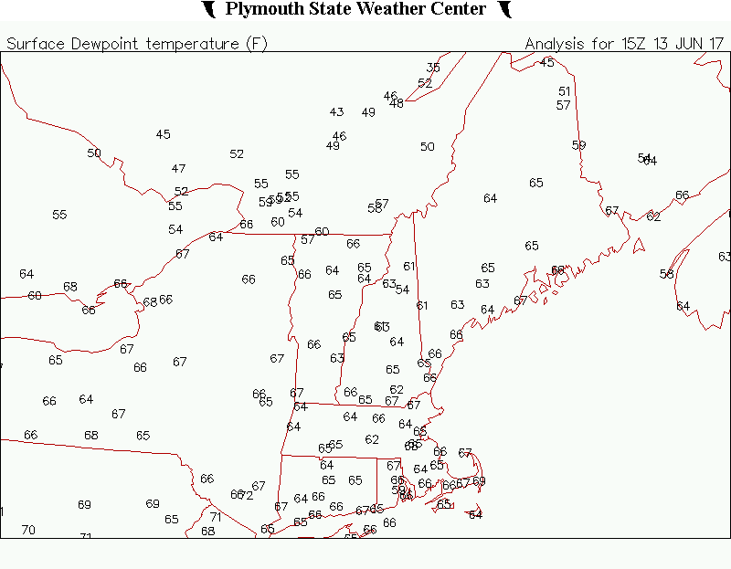
Those record 80F dews yesterday were brutal.
-
Not looking good for verification.
-
102hr GFS op dews. I'm not sure even Theo Epstein would buy that. And he bought Carl Crawford for 7 years.
-
Does anyone remember that old terrible sitcom Herman's Head? That's how I picture his mind functioning.
-
A few hours of low 90s in April versus 36hrs of 40s in June. Hrmmm...
-
AC in April sounds like a smart energy decision
-
His windows aren't very energy inefficient. Maybe having the units in saves on heating costs?
-
It's a good thing these always correct east otherwise it would've cut to BUF.
-
I wonder how much money was lost for those who installed in April yet ran the heat for 6 weeks?
-
Of course now that I look I see the GFS has CON mixing up to H8. lol
-
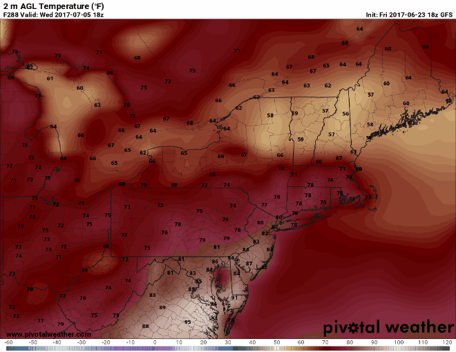
Yeah Sunday is a little under the radar. The GFS is getting 19-20C 850s into the region during peak heating now with a lot of sun and SW flow. That could be pretty torchy from ASH-CON (and the whole region really). MOS seems to often underestimate that first hot day of every warm spell too. Usually it comes with SKC and drier air so I guess we're more conducive thermodynamically for heating and mixing. I haven't peaked yet, but forecast soundings seem to always want to keep the mixed layer from reaching H85 too so that may be part of the problem. That works in Jan with snow cover and low insolation, but the June sun will overcome that.
-
I'm just looking at the crappy ewall images at 24hr intervals. Looks like the boundary is in CNE based on H85 RH 12z Mon and pushes up into C ME 12z Tue. At this time range that's enough to give me some pause for big heat in my area.
-
Euro is having some hesitation on the Monday heat? Looks a little BDish 12z Mon.
-
Yeah I probably should've said it was more east than west.
-
It's definitely more NNE centric. Hot Saturday seemed more centered around TAN/PVD. I give 1911 the advantage because of BOS. 103F in 1911 vs 102F in 1975. Plus 1911 was over a week long of near 100F whereas 1975 was a handful of days with most in the 90s.
-
Does the heat wave definition change for Hawaii? I know some sites there have seen 3 straight days of 90+ before.
-
I think 7/4/1911 is still tops. Unfortunately many climo stations don't go back that far.
-
GFS is a whiff.
-
Another 1"+ on the NAM here for today.
-
Bump

