dendrite
-
Posts
74,758 -
Joined
Content Type
Profiles
Blogs
Forums
American Weather
Media Demo
Store
Gallery
Everything posted by dendrite
-
Why? Just eyeballing the terrain I don’t see why there would be much, if any, of an advantage.

-
You can’t be much different than EEN?
-
Damn. Making your wife get the forecast from the webpage. Couples therapy?

-
Again in comes down to nucleation in the cloud layer. The profile can be completely below freezing, yet you can still get ZR or IP. Once that dryslot kicks in aloft, if the top of the cloud layer isn’t cold enough for ice nucleation you just end up with water droplets.
-
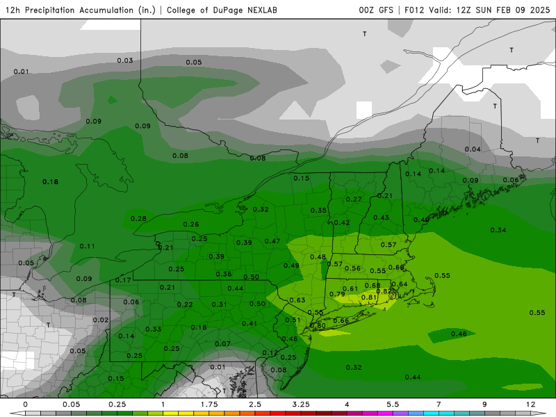
GFS QPF was bong worthy down there. This was your 00z 12hr QPF with the event already underway and then actual totals.
-
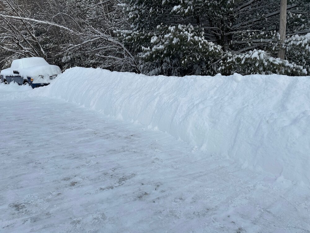
It’s one of those deals where you throw a shovel full into a fresh snow bank and it actually goes down.
-
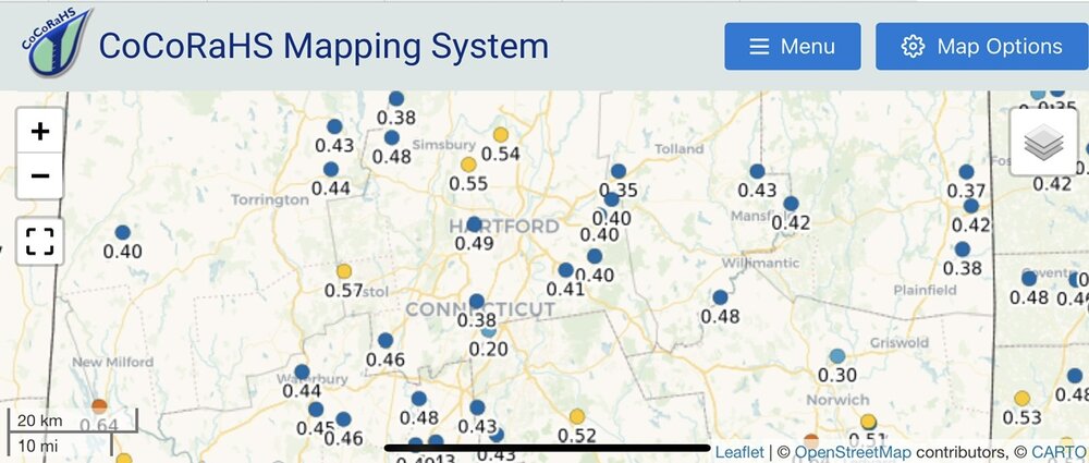
8.6”/0.49” final 18:1 champagne
-
Rev this is for you @Damage In Tolland
- 670 replies
-
- 12
-

-

-
I figure if I croak I won’t have to watch the Chiefs 3peat.
-
Not sure why, but I’ve decided to shovel this by hand like old school Kev.
-
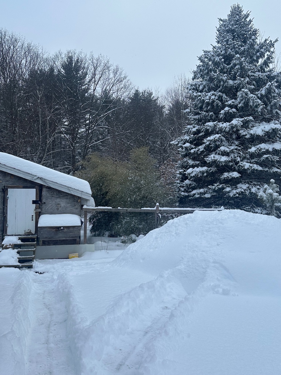
Same here, but there’s so much fluff it’s settling more than it accumulates.
-
-
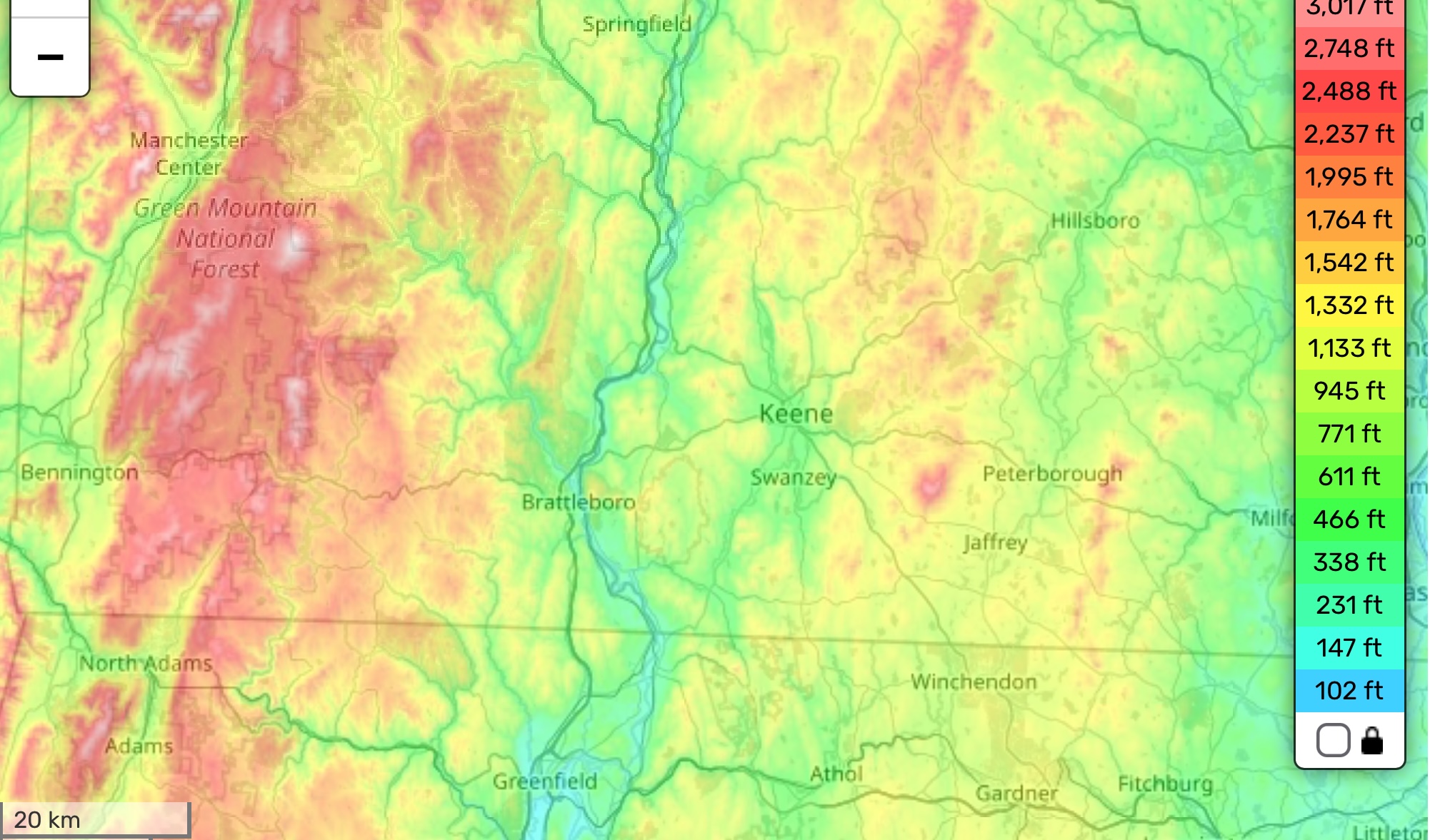
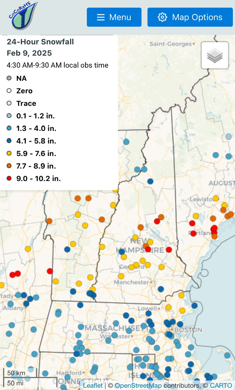
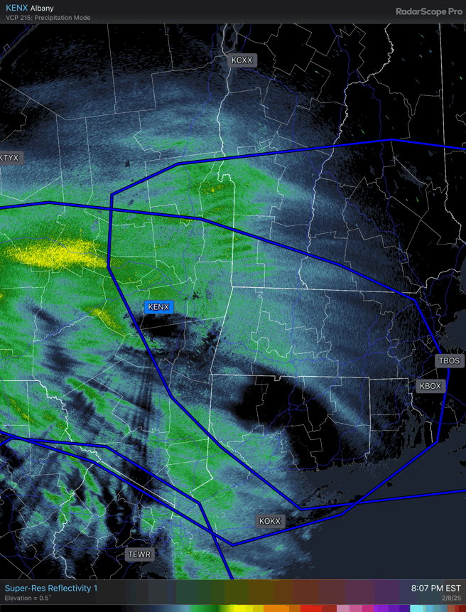
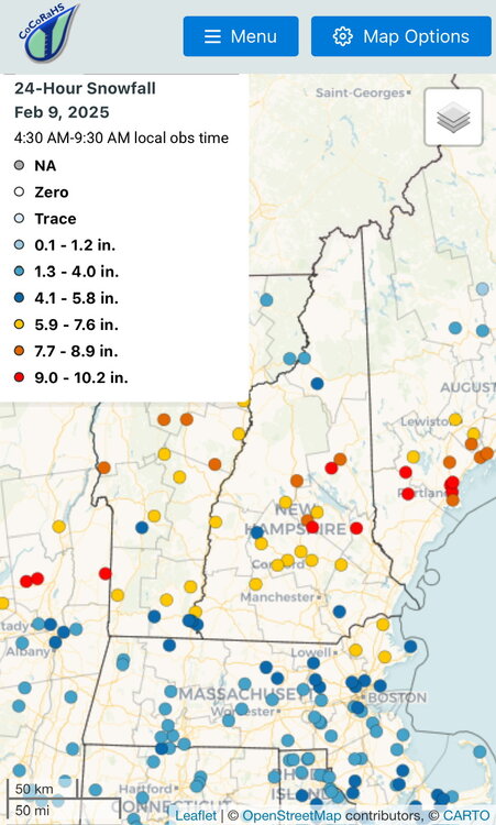
Max zone was pretty much from Saratoga Springs through here and over toward PWM/GYX.
-
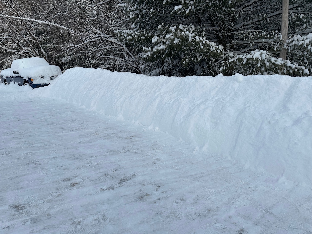
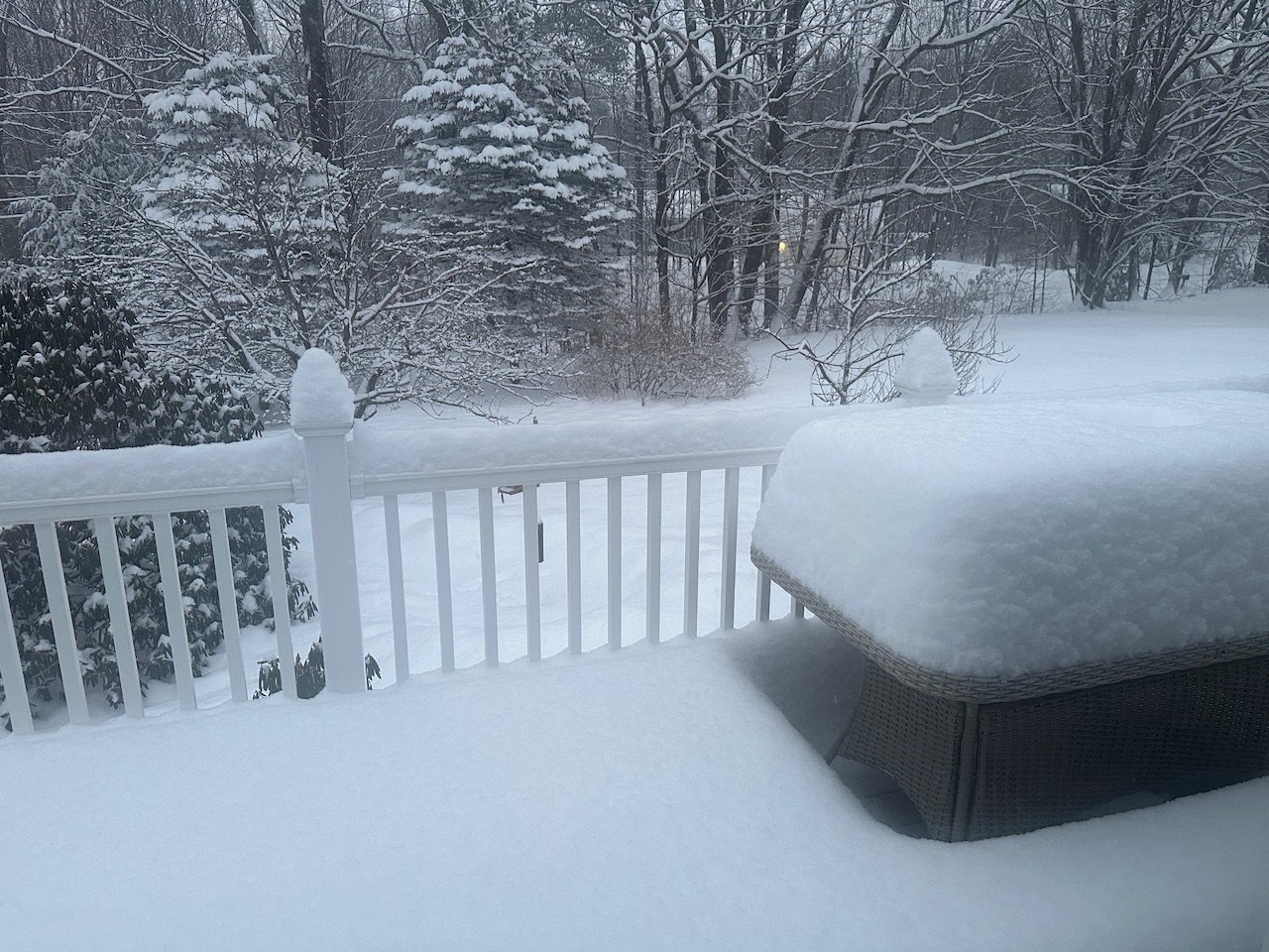
A fun dig out to the girls. This 8.6” is pretty easy to shovel.

-
19.5° -SN 8.6”
-
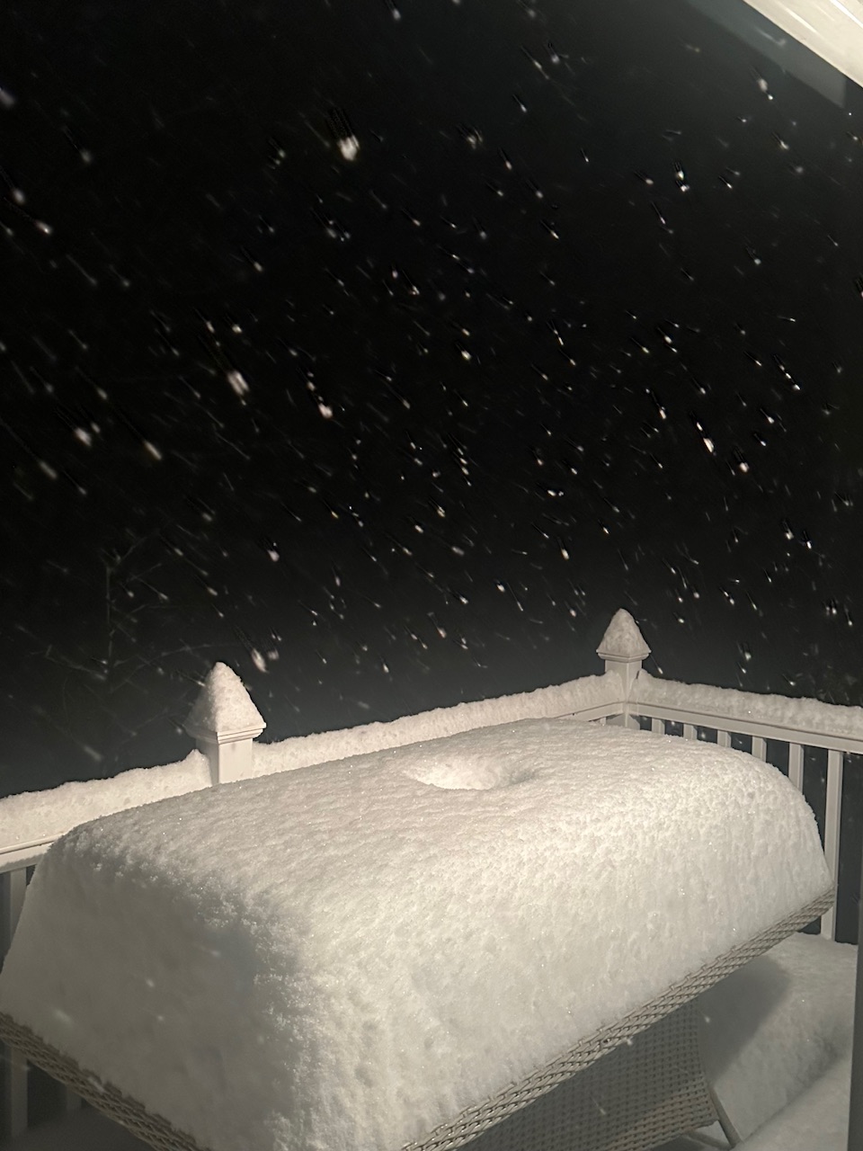
Yeah this is great. Pack must be around 20” now. The table is looking meaty. Still snowing decently although not as insane as earlier.

-
It’s still pounding up here too despite meh returns. So you’re good down there for awhile longer.
-
As for SNE, I wasn’t a fan of the aggressiveness of that dryslot early last night in E PA/NY. It thumped good initially, but it went to hell quickly once the DGZ dried out and the DGZ was wayyy up there around H5-6. You could almost see the line setting up along the S NY/N PA border where in NY you were getting the fronto banding and in PA it was more ragged and showery…and that all translated east quickly. GFS has lately been overly juicy too. Looks like it was 1.5-2x too high on QPF in some parts of CT.
-
19.8° -SN 7.1” IMG_1402.mov
-
Pretty good growth in this midlevel banding.

-
07-08?
-
20.1° -SN 5.5” already of pow. Nice event.
-
Congrats Mitch
-
Pound town in S VT/NH

-
23° Steady -SN That fronto looks tasty