dendrite
-
Posts
63,276 -
Joined
Content Type
Profiles
Blogs
Forums
American Weather
Media Demo
Store
Gallery
Posts posted by dendrite
-
-
3 minutes ago, SnowLover22 said:
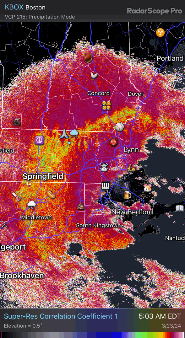
Latest metar for MHT
METAR KMHT 231153Z COR 05004KT 1SM R35/P6000FT -SN BR FEW008 OVC021 M01/M03 A3018 RMK AO2 SFC VIS 1 1/4 SLP237 P0009 60038 70038 T10111033 11006 21011 58004
There may be some grains mixing in but it isn’t all snow. Mostly sleet. There’s been some UP obs in 5 min obs too. The ASOS won’t report PL unless the observer feels like augmenting it today.
-
Just now, CoastalWx said:
What 05 ice? You’ll be above 32 in 2-3 hrs.
Even at 31.8° he probably won’t get any daytime glazing with a trace of that late March insolation.
-
13 minutes ago, SnowLover22 said:
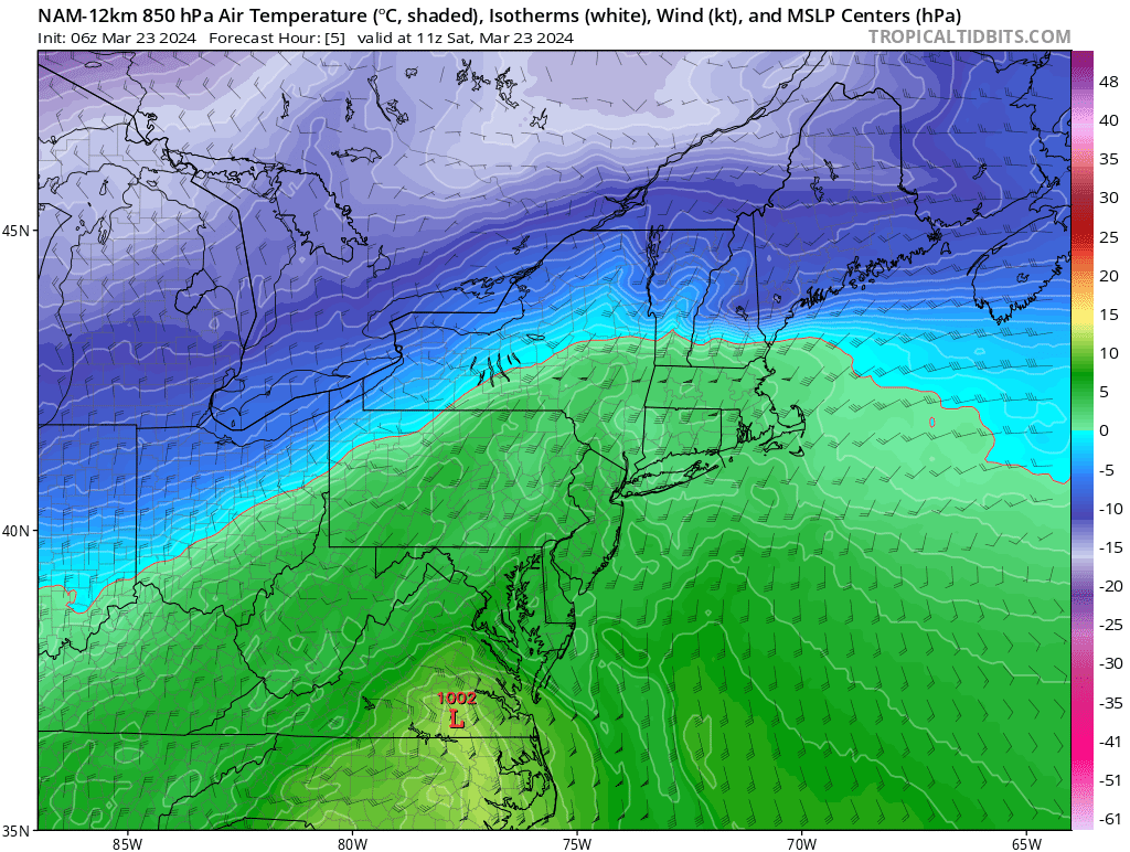
Do you think the NAM is right with the mid level warm surge. Now casting says the depiction is full of shit.
Current 850s
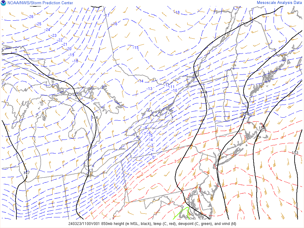
NAM 850s

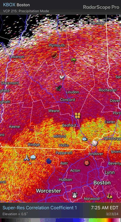
Here’s the problem. The mix line on dual pol was already up to MHT at 11z. My mom in Hooksett is reporting a mix right now so it’s near CON.
-
When I took my core 20 mins ago it was 4.8”/0.50” so a hair under 10:1. This stuff is dense powder. Classic cold SWFE snow.
-
 3
3
-
-
5.0” on the nose so far
-
3
-
-
Haven’t been out to measure, but it looks like a few inches out there. 25.9° with about 1/2sm mod snow…occasionally heavy. Growth isn’t that great, but there’s a dense amount of flakes. Fairly SWFE like.
-
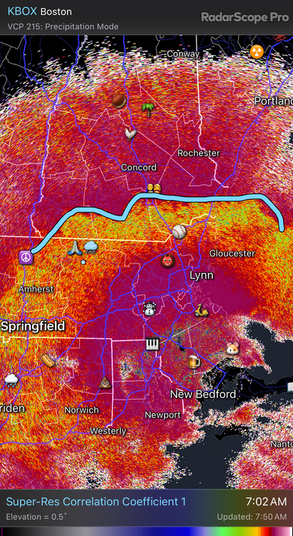
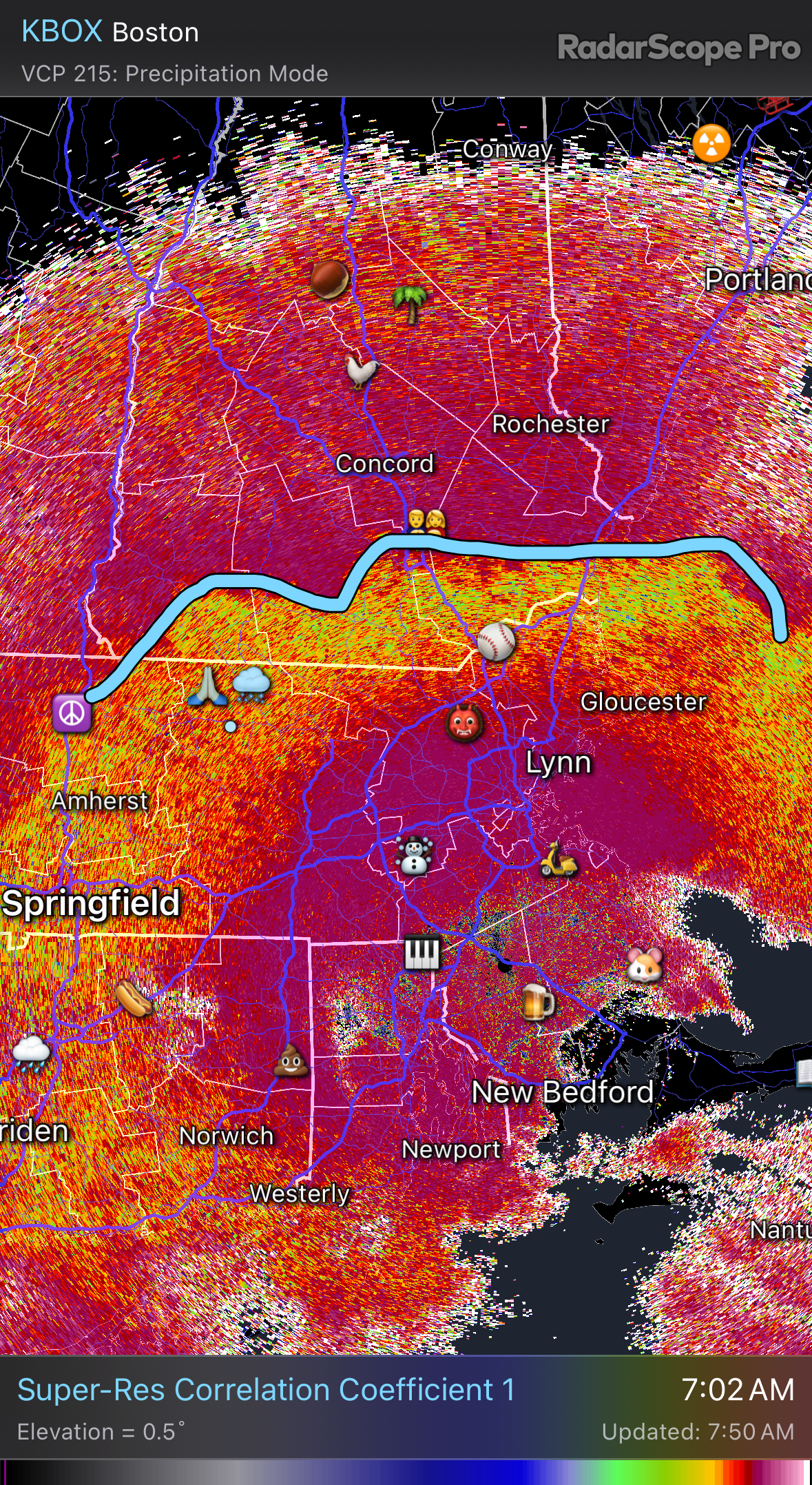
Here’s the mid level mix line. Looks like it’s drifted back south a bit.

-
 1
1
-
-
13 minutes ago, ineedsnow said:
0z HRRR coming in slightly colder again
That’s all frozen here and all snow for Gene.
-
3
-
-
42 minutes ago, Prismshine Productions said:
Lol all 18z guidance busted with the current 21z temp in Brattleboro:
Current temp: 33
18z GFS: 35
18z NAM: 36
18z HRRR: 35
Sent from my SM-S146VL using Tapatalk
Doesn’t mean a thing
-
1
-
 1
1
-
-
19 minutes ago, dryslot said:
The 18z HRRR is colder then the 12z run, Pretty bullish, A couple more tics south again.

Damn.
-
6 minutes ago, wxeyeNH said:
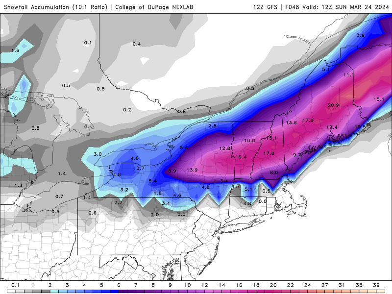
Brian, give me a guess for my area? Clown maps are crazy but showing 20" of snow but I think they are including sleet. 8-12" or would you go higher? I have not been on the forum much..
I’d plan for about 10” with a period of IP in there. Mid levels start warming and we know how that goes with ratios. The nose is around H85 instead of the usual H75-H8 SWFE, but the best lift is still a bit below the DGZ.
-
1
-
-
Lots of beer that run
-
1
-
-
4 minutes ago, CoastalWx said:
Look how excited Dendrite is when he tries to tell us he doesn't want it. #canseethroughtheBS.
lol I don’t. But I want a colder solution for less rain and less QPF. But if I could make it whiff I would.
-
RGEM is cold
-
1
-
-
Nammy has a decent flip back to snow up here at the end. That would probably create some power issues.
-
1
-
-
14 minutes ago, Ginx snewx said:
Crushed. Chicken coop pieces scattered across the lawn
LCI usually works well here because the gradients tend to run in the same direction.
-
13 minutes ago, Prismshine Productions said:
I got to get used to snow in March don't I...
Sent from my SM-S146VL using Tapatalk
And sometimes May. But it doesn’t snow in April.
-
 1
1
-
-
5 minutes ago, #NoPoles said:
What does it look lite for Bretton Woods?
I just got my generator wired into my panel box so, I'm ready...hopefully
Enjoy the heavy snow
-
1
-
-
2 minutes ago, Ginx snewx said:
Not on the list CON is like 5 snow .65 frz and .5 sleet
LCI works on here
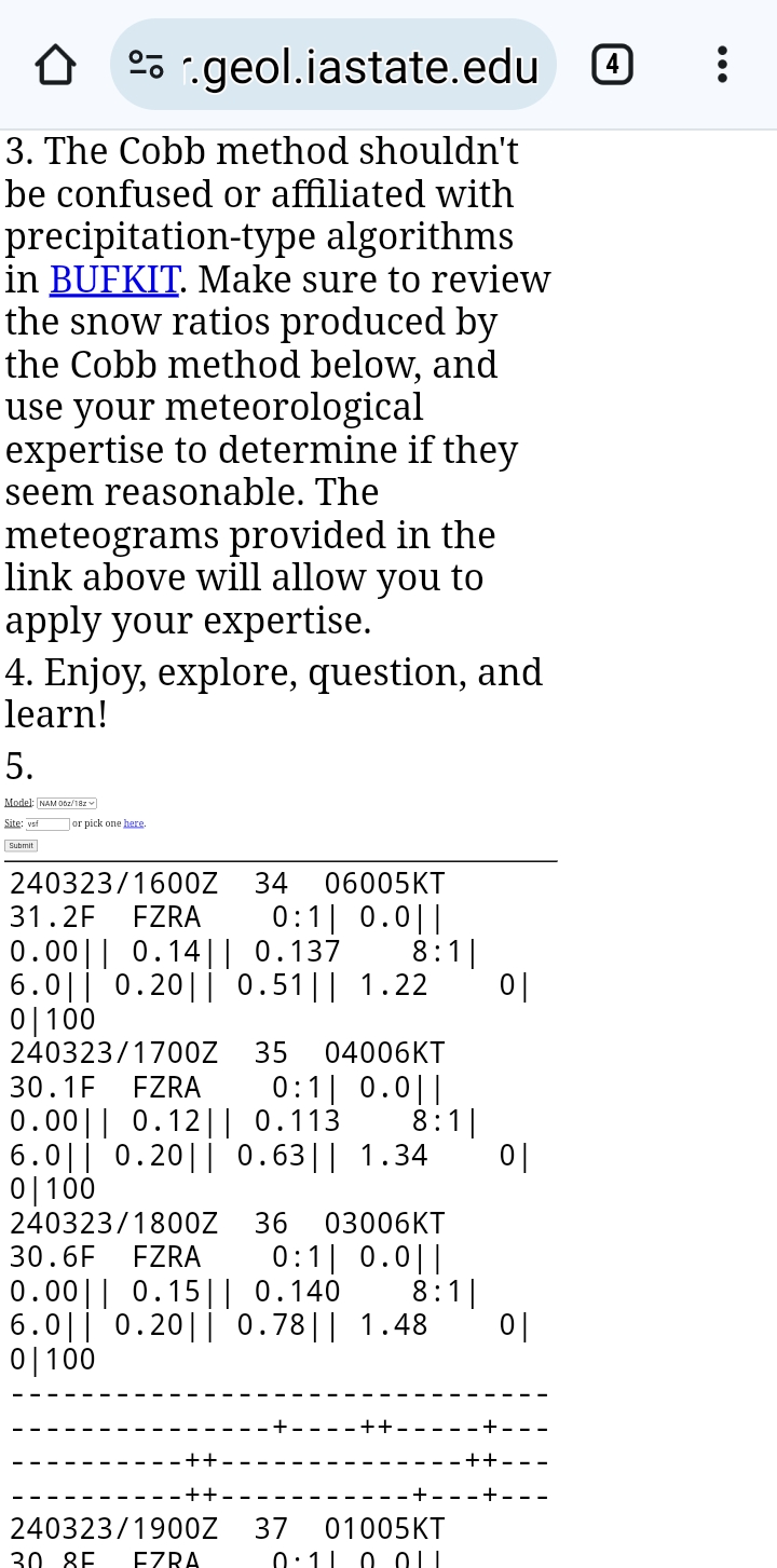
https://meteor.geol.iastate.edu/~ckarsten/cobb/cobb.php?model=gfsm&site=klci
-
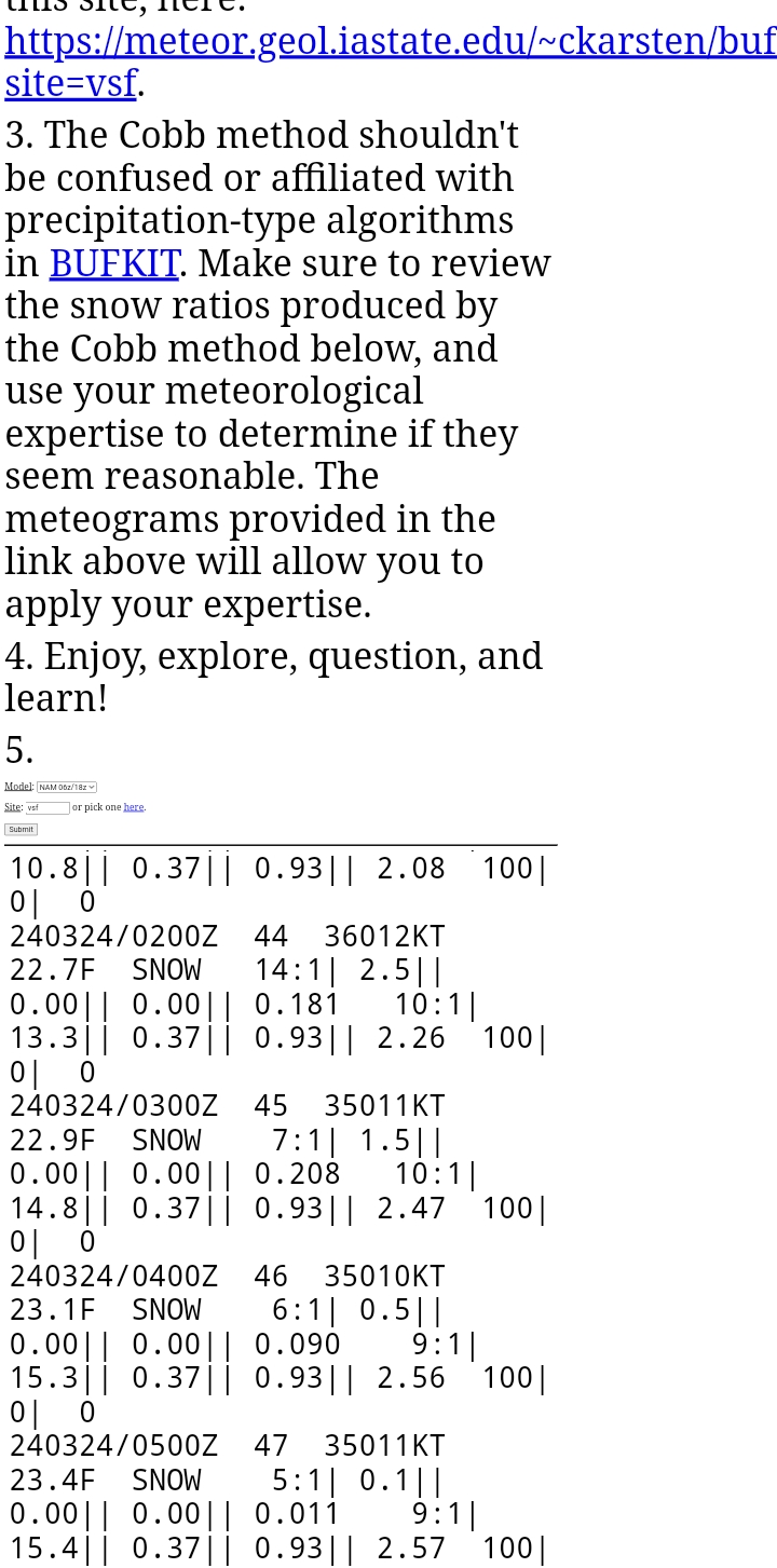
15 minutes ago, Ginx snewx said:
Hey Brian realize this is Claremont but close?
https://meteor.geol.iastate.edu/~ckarsten/bufkit/image_loader.phtml?site=vsf
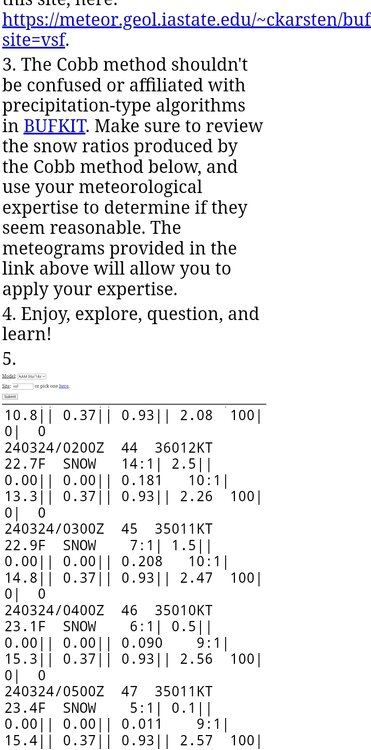

Claremont is on the VT border…big longitude advantage there with this system. Can’t you use LCI?
-
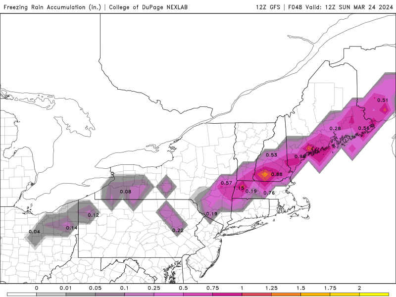
I’ll take the under on ZR here and the over on IP
-
6 minutes ago, dryslot said:

Keep it coming
-
Goofus is all snow here through 15z Sat. Then we start losing H85. But we’re at warning criteria by the changeover. The RGEM is one good tick south away from being wild here.
-
1
-
-
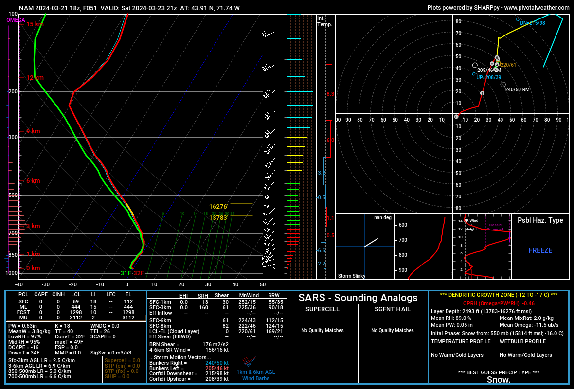
2 hours ago, Ginx snewx said:
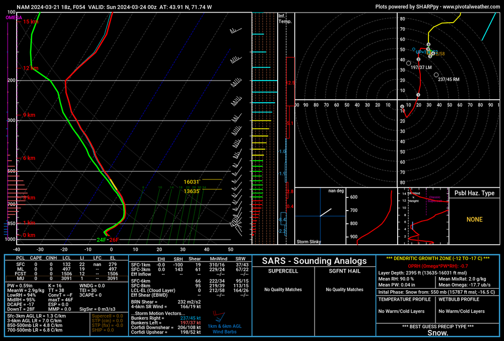
Based on soundings on 12 K looks like 3 hrs of sleet but that looks very close to being saturated below 32 top to bottom at hr 51
Guy
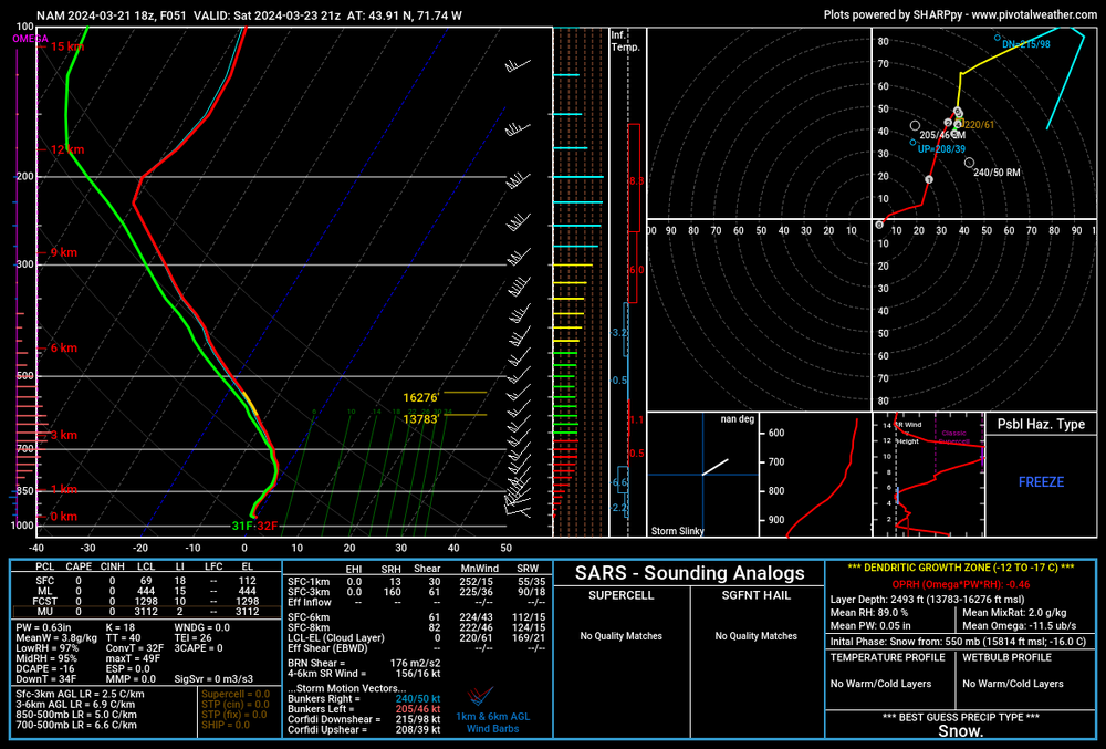
43.9N? I’m at 43.43


The Congrats Dendrite Deck Destroyer 3/23-3/25 obs discussion
in New England
Posted
I mean maybe the NAM is a little too aggressive, but it’s a lot closer than the HRRR to my eyes. 11z still has MHT as all snow at 14z while the 3k nammy has the mix line up to me. So we’ll see where we stand at 10am.
But CC really doesn’t lie in these situations. The cold and occasional stronger lift is helping to fight the mix line off at times but it’s coming eventually. Boyd Hall up at 1P1 will probably stay mostly snow though.