

dendrite
-
Posts
74,488 -
Joined
Content Type
Profiles
Blogs
Forums
American Weather
Media Demo
Store
Gallery
Posts posted by dendrite
-
-
Just now, Damage In Tolland said:
It’s been an issue for about the past week . And no one answers when you ask
Haven’t noticed any slowness until today
-
 1
1
-
 1
1
-
-
27 minutes ago, Typhoon Tip said:
Western Europe is now five of these nuclear synergistic heat bombs since 2003, compared to our zero spanning the same years
That being the case when there is a codified positive correlation tele connector between eastern North America western Europe
This is somewhat odd
Our continent just seems too wide for the global wavelengths in summer to be able to get one of your Sonoran airmasses up here before the “ridge runs out”. Get the ridge more on our side and the Bermuda high going and then the airmass just becomes GoM soup and we thermodynamically are limited on the warming potential…but we make up for it with 97/77 type days.
We basically have to time it right with brief strong mixing like July 2011 when that prefrontal trough mixed out the dews during the morning and then the CAA lagged until evening so we had a 6hr window with torched mid levels, strong mixing, and downsloping.
And obviously any flow from the east side of our meridien is tainted too.
-
6
-
-
Just now, vortex95 said:
I'm not too keen on persistent heat in the NEUS. 00Z ECMWF say no go. The ridge axis is well to the W so that makes NEUS susceptible to BDFs/onshore flow/more clouds/pcpn. GFS says yes to big heat tho but even that suggests it won't last. Mean trough position near/along the E Coast has been tough to shake overall.
There’s definitely a weakness there with the ridge axis that far west to sneak some north Atlantic stank our way. 00z euro op is definitely a way to taint the heat in our region…like you said. With that said…the ridging won out in early June so I won’t buy that yet. But we’ll be prone to backdoors or at least late digging s/w’s north of us that at least bring the dews down and moderate the heat.
I’ve actually been enjoying the last few days. As long as mins are well into the 50s I’m okay with daytime 70s…even for my heat loving plants.
-
4 hours ago, Damage In Tolland said:
What a furnace next week
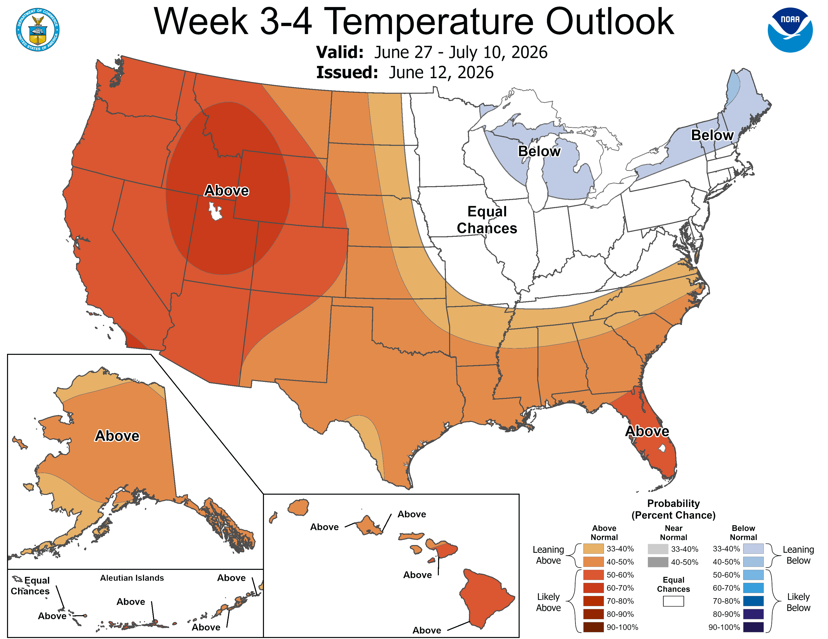
This outlook may turn into TP for the Midwest and Lakes.

-
1
-
1
-
-
-
 2
2
-
-
2 hours ago, Damage In Tolland said:
You had soaking , heavy rains all night and day lmao . It drizzled / light rain on and off . Look at your posts . Another W for Kev
Sounds horrible. Lots of sun here.
+1
-
1
-
2
-
-
GWDLT
Hopefully the circulation around the coop had something to do with it.
Welch was also hit hard. Lots of open lake for that SW wind right into Cow too. It’s all in line with that path of higher wind.
-
-
We sun. Up to 67°
-
38 minutes ago, Typhoon Tip said:
Wait, that seems like a decent dose/time there. which way is your sarcasm pointing ?
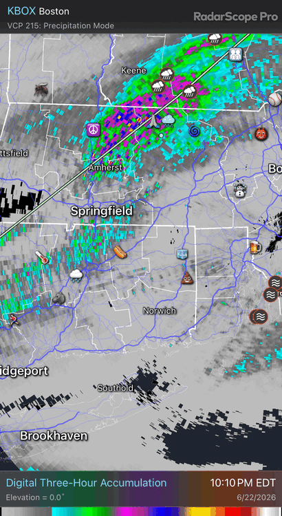
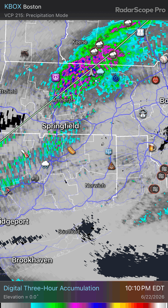
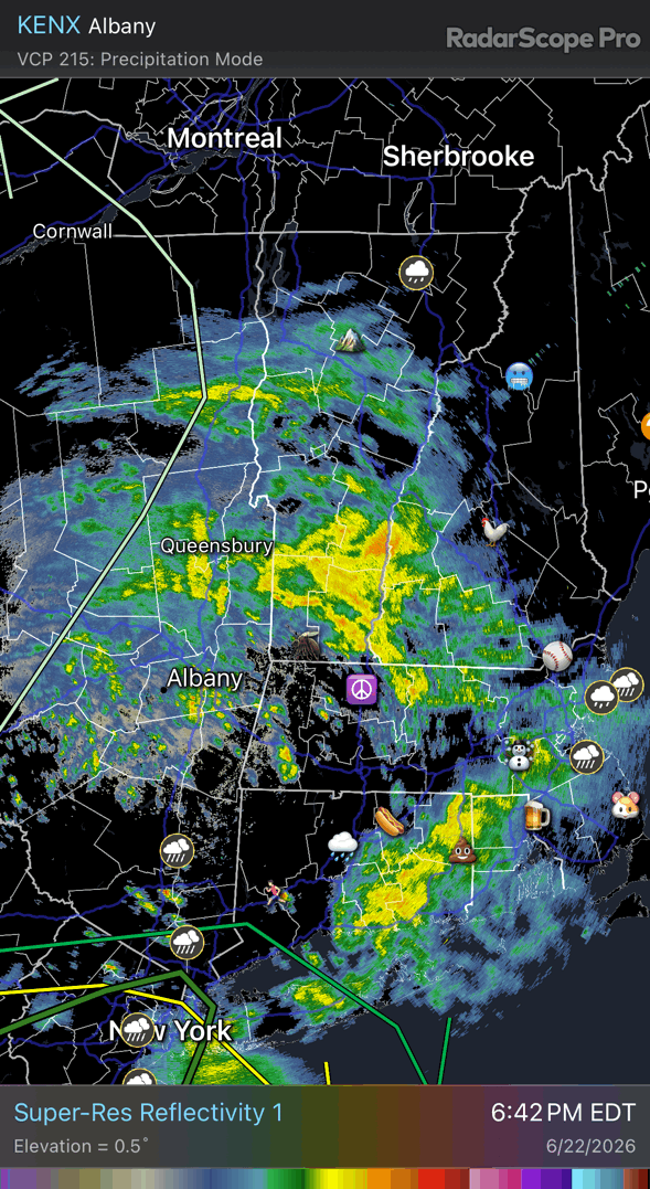
1.3" for the 2-day total here. Looks on rad like we're about to go languid mist from here on out N-W of ORH-BOS. Might clear at 5 o'clock ?
The NAM nailed this thing from about 30 hours out. The Globals might have been a little rich on QPF? not totally sure there.
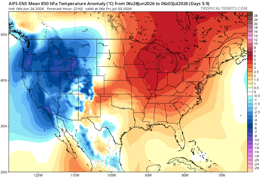
General audience:
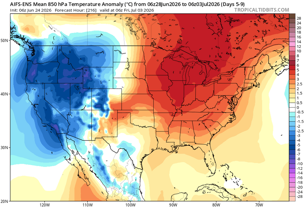
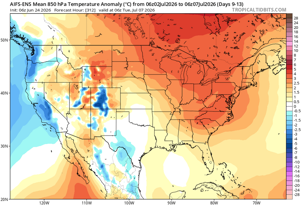
Ensembles look very close to a major heat headline-able event from ~ D8+ thru model fuzziness. This was a vague signal some 10 days ago, way out along the emergent modeling horizon. It has since been inconsistently showing up and fading ... something like a 1.3 steps ahead by 1.10 steps back... but slowly gaining coherence. This overnight looks 70-ish percent confidence for a N/A mid latitude heat dome with less certainty whether it gets in here. If so, it would be over the top - the ridge axis being 90-ish W instructs the NW delivery. Which looks plausible in the ensemble means of the EPS/GEFS and GEP. The GEPs in fact looked quite fantastic/best for purer heat delivery around D9, as it was an over top delivery that then morphs into this,
So the uncertainty with all this is the operational versions are being cute with convective shrapnel if not meso-beta scale synoptic waves ejecting out of the trough in the west, racing over the ridge top and probably sending outflow this and general warmth denting that, and seeing as we're at the eastern fragile end of that wave-space/curvature field, I'd go ahead a call that the operational models engineering any means plausible to physics to stop a heat wave signal from actually taking place LOL. seems like that some times.
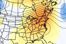
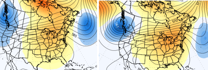
Here are the EPS/GEFs ensembles in the meantime, for D9-ish
Yeah it was sarcasm. I was still in D1 last week.
-
lol you got 7-10’d nostradamus
-
2
-
-
6.40” in the last 26 days.
Tough way to run

The next drought monitor should be fun.
-
1
-
 1
1
-
-
-
2 minutes ago, Damage In Tolland said:
Hope so . Would love to be wrong
Should be used to it
-
9
-
 1
1
-
1
-
1
-
-
Just now, kdxken said:
I hope you get 17 inches. Maybe then you'll stop.
Hopefully your chainsaw breaks!
-
4
-
-
30 minutes ago, Damage In Tolland said:
Well sure. We said a few more showers could move thru . But the main stuff is over
Lots of convection down there
-
Should go over 1” here. Looking good back to NY

-
1
-
 1
1
-
-
25 minutes ago, WxWatcher007 said:
.75” so far. All in the last three hours.
11.75” up at WXW2
12.37” here
-
1
-
-
17 minutes ago, CoastalWx said:
Hopefully an infestation of grubs and fungus.
9.5” since 4/1. Not bad.
-
1 minute ago, CoastalWx said:
Guy bitched his way to a Jack. I’ll be lucky for a half inch with this batch.
Ha. He’s about to hit 1”
-
1
-
-
16 minutes ago, kdxken said:
Not sure why folks were wishing for this. To each his own I guess.
60s and rain after a high of 73F here.
Congrats on the 59s to the cars on blocks in the Berks though.
-
1
-
-
3 minutes ago, CoastalWx said:
Haven't you had enough rain?
After last summer keep it coming.
I fertilized and put compost around the fruit trees this morning so I want it drenched in. There's no fungi or water in the basement yet so we good.
-
60.7F 0.30"
-
Just started and dumping. Love it.
63F +RA
0.17" 2.14"/hr


Junorch obs and discussion 2026
in New England
Posted
Hopefully cold, rainy, and foggy for the 4th. I don’t want any 250th anni fireworks BS going on around me.
Shut’em down