dendrite
-
Posts
74,744 -
Joined
Content Type
Profiles
Blogs
Forums
American Weather
Media Demo
Store
Gallery
Everything posted by dendrite
-
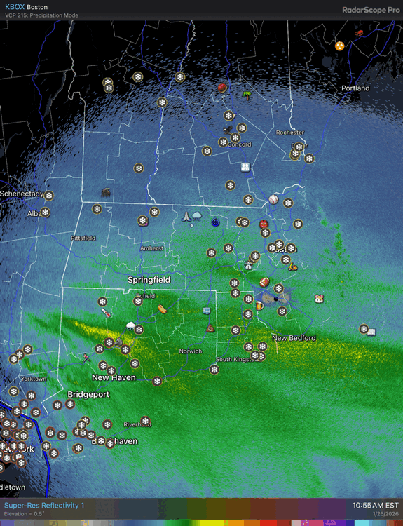
 Mix line is approaching NYC now, but if you view CC from CCX radar you can see the warmth aloft keep getting washed out whenever it tries to make a push north. That’s probably what will happen along the south coast later…a battle of ptypes toward the end.
 -
How much for Toms River before they changed over?
-
I think some of that is the lower beam height as it approaches the radar
-
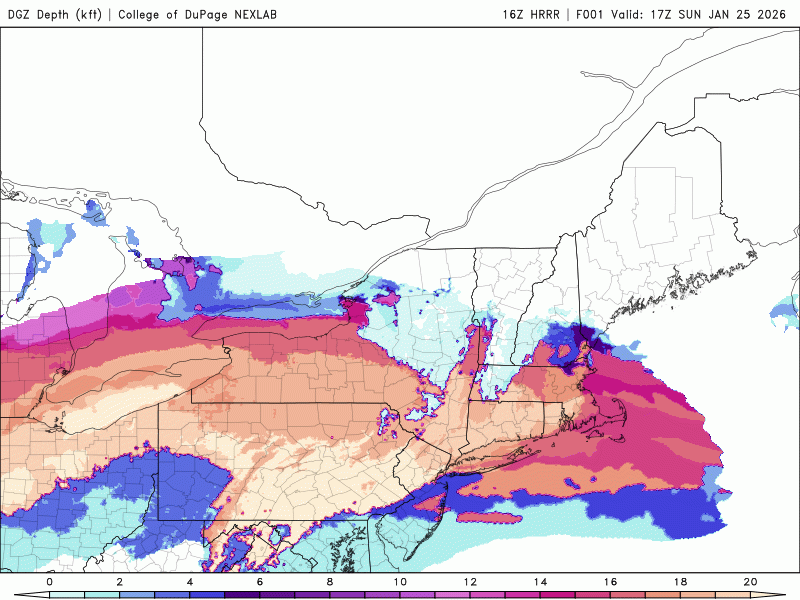
Really deep DGZ down there right now. That should translate northward through the afternoon and evening.
-
Scope is fine
-
ALB -5° +SN
-
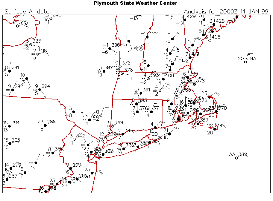
1/14/99 vibes except less ice
-
2.5/-12 here we wait
-
I fall to pieeeeeces
-
Let’s take the Grand Ole Opry down
-
My new combustion blower fan for the pellet stove that I got 2 weeks ago is already getting noisy. Apparently it doesn’t like running on high.
-
Yeah there’s the easterly enhancement for AEMATT Getting it from both ends

-
I swear ISU had an autoplot for frequency of a wx variable at a given temperature, but I can’t find it.
-
I meant like 9.2/0.92 or 10.7/1.07
-
I feel like I remember a few really cold ones. I recall a SWFE over a decade ago that was pounding below 0F here to start. Wasn’t there another event a handful of years ago that was near 0F too?
-
I didn’t see one rip and read 10:1
-
? I checked obs from the state and they’re all over the place as you’d expect since people don’t know how to measure.
-
ineedsnow in the lead. Metfan falling behind slowed by a protester
-
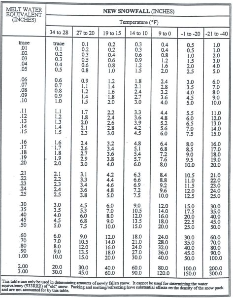
When in doubt just use this old weenie table BOX had on their site in the early 2000s. 100:1 in the -20s!
-
One ob. What’s the 9.2 next to it have?
-
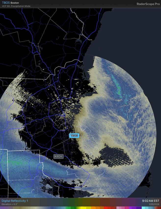
Should be reaching the ground at BOX soon as the donut hole closes around the radar site.
-
Interesting. Looks like the habit started dendritic and then somewhat transitioned to sectored plates on the branching.
-
I mean you can clear at 8, 12, or measure at the end too.
-
Mekster who works there?
-
Everything is a little ahead of sched