buckeyefan1
-
Posts
13,470 -
Joined
Content Type
Profiles
Blogs
Forums
American Weather
Media Demo
Store
Gallery
Everything posted by buckeyefan1
-
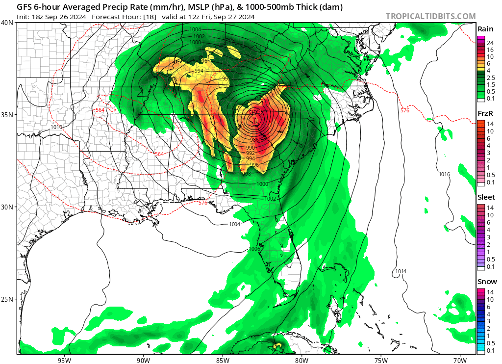
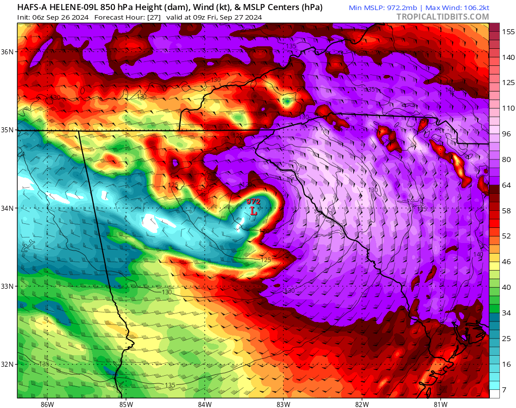
The 18z gfs has what is left of the eye going over mby

-
This does not give me the warm fuzzies at all
-
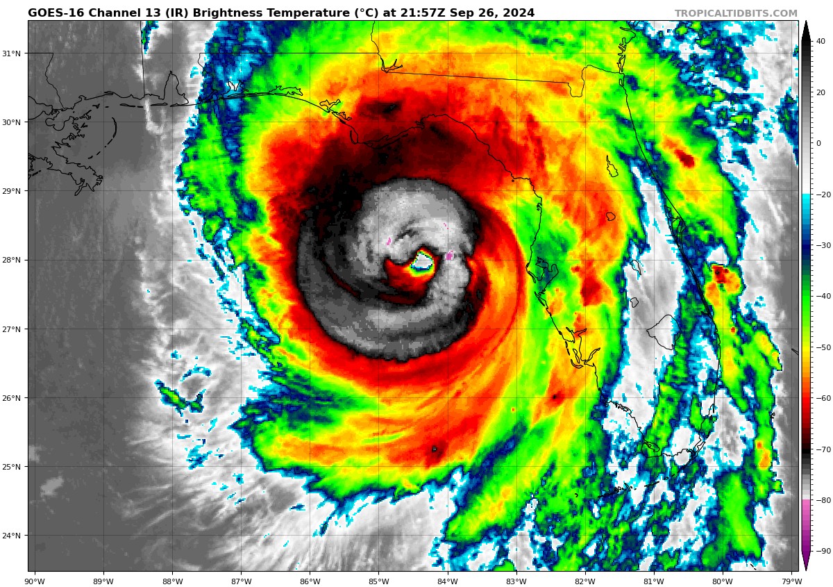
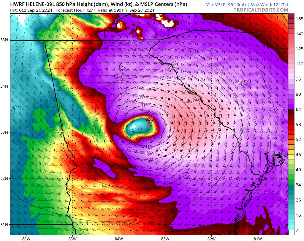
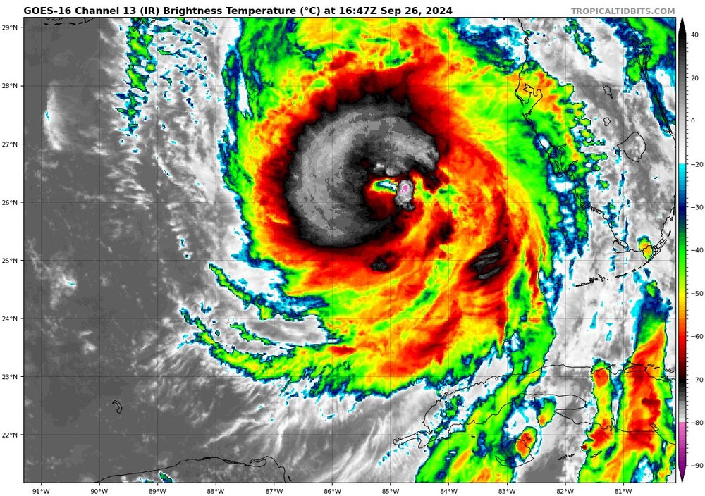
Cat 4 130mph 947mb
-
Has to be a typo
-
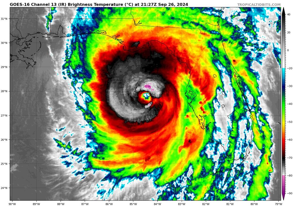
That only took 30 minutes to complete
-
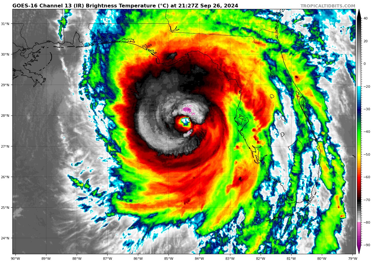
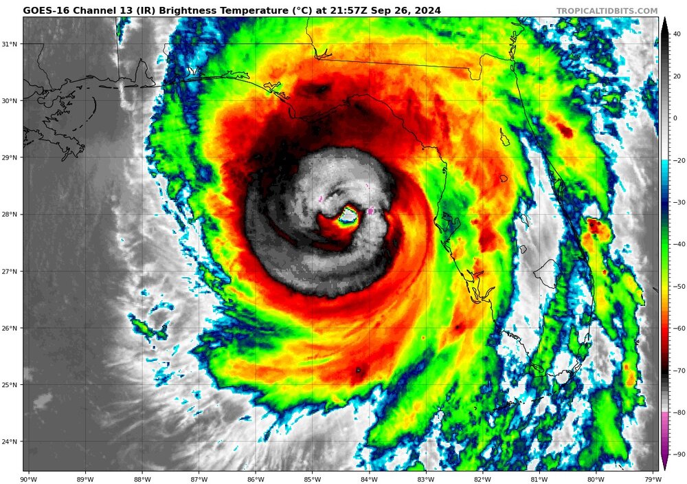
Getting closer to wrapping solid towers completely around the eye
-
It's going to be a long night and early morning for sure
-
Indeed. With each refresh it just looks better and better
-
Evidently I did and Helene is now a cat 3 with 120mph winds 959mb
-
Ya'll take the bust discussion to the banter thread. This storm is doing exactly what it was forecasted to do.
-
I know I just didn't see 115kt by recon already
-
Northern weenies are the worst for sure While they're complaining, Helene has steadily strengthened since her erc overnight and has gone from an 85mph storm to a 110mph storm with continued strengthening until landfall.
-
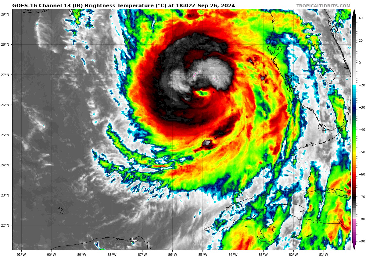
Almost a cat 3 now 110mph 959mb
-
Me too. I've been through plenty of hurricanes, but none where all of the trees already are leaning on a slope
-
I'm still in shock with the hurricane force winds possible as stated by GSP with 60-70mph to the south. Insane
-
That's a sweet looking tower going up to close off the eyewall
-
It's real
-
Ewwwwww
-
4.4 here so far
-
It doesn't matter what model you look at either
-
Well isn't that just a bundle of sunshine
-
Indeed. MBY is up to 5” and counting, while those just to my north are reporting almost 7”
-
I had a little break from the rain last night, but it’s been pouring now for a few hours. Eyeballing the bucket, I’m over 3” and there’s no end in sight yet.