

Chase
-
Posts
486 -
Joined
Content Type
Profiles
Blogs
Forums
American Weather
Media Demo
Store
Gallery
Everything posted by Chase
-
Will this one bring the true "flash freeze?"
-
MLK Weekend Event - Making Lemonade Out of Lemons
Chase replied to Bob Chill's topic in Mid Atlantic
Not in Virginia, but I was being only quasi-snarky. -
MLK Weekend Event - Making Lemonade Out of Lemons
Chase replied to Bob Chill's topic in Mid Atlantic
95 runs north to south -
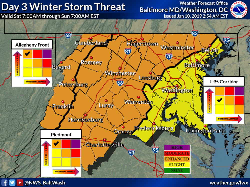
LWX has it as a Code Yellow (Slight) for everyone west of 95.
-
KDCA 132021Z 01012KT 1/4SM R
-
Can you link me to the model you're using? Thanks.
-
It's snowing nicely in Warren and Page counties. Eyes are turned toward the moderate/heavy forming in Orange County. More bubbling in southern Stafford, too.
-
Only 13 more inches to go.
-
Grew up in the Valley. Not a dry slot, the radar shadow caused by Bull Run Mountain.
-
Just kidding. Better now.
-
I’m under it in Mt Vernon. Not impressed yet.
-
Out with the plow crews at Mt Vernon. Still waiting for appreciable flakes.
-
Advisories in the immediate metro. Watches are replaced with Warnings, plus one county north.
-
What’s with the 6 in Stafford?
-
Could convection (like those NC thunderstorms) rob the northern precipitation? I recall this happening before. Is that a possibility with this storm?
-
LWX also modified how they will do the Winter Weather Outlook for the week... interesting dividing lines. The Shenandoah Valley in me also resents being named the "Piedmont."
-
WTOP ignored it though... recorded weather reports. No mention by traffic nor anchors.
-
When is storm mode? What is all this mess?
- 1,839 replies
-
- 1
-

-
- we just jinxed it
- helluvaway to run a torch
- (and 1 more)
-
First warnings along Allegheny Front. Mineral, Grant, Allegany, Hampshire, and a sliver of Hardy warned.
-
And now warned into DC and PG
-
Things blowing up in central Fairfax too.


