


colonel717
-
Posts
2,917 -
Joined
Content Type
Profiles
Blogs
Forums
American Weather
Media Demo
Store
Gallery
Everything posted by colonel717
-

Pittsburgh/Western PA WINTER ‘25/‘26
colonel717 replied to Burghblizz's topic in Upstate New York/Pennsylvania
Ray Petelin just said 1-2 for most through tomorrow but there could be persistent bands that give localized much more. -
Pittsburgh/Western PA WINTER ‘25/‘26
colonel717 replied to Burghblizz's topic in Upstate New York/Pennsylvania
Detroit and Toledo over performed, so maybe we can get an over performer here -
Pittsburgh/Western PA WINTER ‘25/‘26
colonel717 replied to Burghblizz's topic in Upstate New York/Pennsylvania
-
Pittsburgh/Western PA WINTER ‘25/‘26
colonel717 replied to Burghblizz's topic in Upstate New York/Pennsylvania
Looking at the short term models, the favored areas for possibly more than an inch through tomorrow are North Hills thru Butler Co, someone could see 2 or maybe 3 inches. Snow should start mixing in around 8pm west to east. -
Pittsburgh/Western PA WINTER ‘25/‘26
colonel717 replied to Burghblizz's topic in Upstate New York/Pennsylvania
3K and FV3 show 1-3 for tomorrow. Cut back some. -
Pittsburgh/Western PA WINTER ‘25/‘26
colonel717 replied to Burghblizz's topic in Upstate New York/Pennsylvania
EURO had a huge one last Feb for Upper OHV thru Michigan, but not as much widespread as this one. -
Pittsburgh/Western PA WINTER ‘25/‘26
colonel717 replied to Burghblizz's topic in Upstate New York/Pennsylvania
Where is everyone? This place is dead. -
Pittsburgh/Western PA WINTER ‘25/‘26
colonel717 replied to Burghblizz's topic in Upstate New York/Pennsylvania
Only 80 inches over Bethel, lets wait for a better run. -
Pittsburgh/Western PA WINTER ‘25/‘26
colonel717 replied to Burghblizz's topic in Upstate New York/Pennsylvania
-
Pittsburgh/Western PA WINTER ‘25/‘26
colonel717 replied to Burghblizz's topic in Upstate New York/Pennsylvania
-
Pittsburgh/Western PA WINTER ‘25/‘26
colonel717 replied to Burghblizz's topic in Upstate New York/Pennsylvania
Sweet mother HH GFS wow -
Pittsburgh/Western PA WINTER ‘25/‘26
colonel717 replied to Burghblizz's topic in Upstate New York/Pennsylvania
Tomorrow evening around 7pm looks to be the heaviest snow 3-4 per GFS -
Pittsburgh/Western PA WINTER ‘25/‘26
colonel717 replied to Burghblizz's topic in Upstate New York/Pennsylvania
-
Pittsburgh/Western PA WINTER ‘25/‘26
colonel717 replied to Burghblizz's topic in Upstate New York/Pennsylvania
-
Pittsburgh/Western PA WINTER ‘25/‘26
colonel717 replied to Burghblizz's topic in Upstate New York/Pennsylvania
3K looks good. 2-4 for AGC 4 is near NAGC, rest is 2-3. Butler Co is 3-4 in -
Pittsburgh/Western PA WINTER ‘25/‘26
colonel717 replied to Burghblizz's topic in Upstate New York/Pennsylvania
Just go thru the EURO and GFS each run from yesterday 12z until today. https://www.tropicaltidbits.com/analysis/models/?model=ecmwf®ion=us&pkg=mslp_pcpn_frzn&runtime=2026011300&fh=150 -
Pittsburgh/Western PA WINTER ‘25/‘26
colonel717 replied to Burghblizz's topic in Upstate New York/Pennsylvania
Saw KDKA weather playing up lake effect and squalls from Wed Thru weekend. Also, the GFS looked loaded after day 10. Parade of juicy storms. -
Pittsburgh/Western PA WINTER ‘25/‘26
colonel717 replied to Burghblizz's topic in Upstate New York/Pennsylvania
Looking more and more like as JWilson said last week these next 2 "events" are going to likely be just minor NS driven clipper type snows, which may not be a bad thing as we have had some good results so far. While we likely won't have consistent area wide snows, Lake effect enhancement should help boost possibilities and at times dynamics of the squalls. We likely won't be able to have an idea until the short range models come into range as to true potential. Moving ahead towards 23rd or so, looks like it could be a pattern that gets the southern stream involved for a bigger storm, but far too early at this point. -
Pittsburgh/Western PA WINTER ‘25/‘26
colonel717 replied to Burghblizz's topic in Upstate New York/Pennsylvania
I went out to measure about 5 different areas. Had anywhere from 7/8 inch to almost 2 inches. So better than I expected. -
Pittsburgh/Western PA WINTER ‘25/‘26
colonel717 replied to Burghblizz's topic in Upstate New York/Pennsylvania
Just a guess as the heaviest wraps up. Had meltage through the day in between squalls, so guessing at least an inch for the day. -
Pittsburgh/Western PA WINTER ‘25/‘26
colonel717 replied to Burghblizz's topic in Upstate New York/Pennsylvania
Nice bout of snow rolling through a lot of the area. -
Pittsburgh/Western PA WINTER ‘25/‘26
colonel717 replied to Burghblizz's topic in Upstate New York/Pennsylvania
Short but got near whiteout.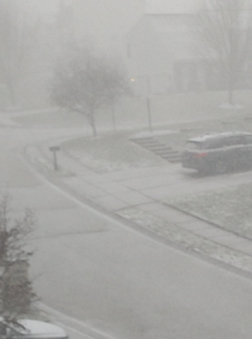
-
Pittsburgh/Western PA WINTER ‘25/‘26
colonel717 replied to Burghblizz's topic in Upstate New York/Pennsylvania
Looks like squall line about 9am tomorrow. Not as exciting as the last one but something to look for early tomorrow. -
Pittsburgh/Western PA WINTER ‘25/‘26
colonel717 replied to Burghblizz's topic in Upstate New York/Pennsylvania
As we know these little events are the bread and butter of our winters. Hopefully we can pull an inch or 2. -
Pittsburgh/Western PA WINTER ‘25/‘26
colonel717 replied to Burghblizz's topic in Upstate New York/Pennsylvania
Even though today were good runs for WPa on CMC and EURO, my fear, like you say, is these are late developing and areas south and EC are the winners like on the GFS.
