

HoarfrostHubb
-
Posts
58,730 -
Joined
-
Last visited
Content Type
Profiles
Blogs
Forums
American Weather
Media Demo
Store
Gallery
Everything posted by HoarfrostHubb
-
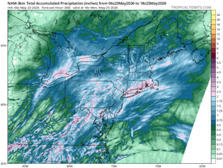
Yeah... I've seen flakes in later May, but nothing has accumulated here that I recall. I just showed my students the NAM 10:1 just to make them sad...
-
I don't recall the latest I've seen accumulating snow... maybe Mother's Day 1977? I know there was one in the early 2000's ... maybe 2004? in early May I think.
-
Still should get into the 80s here I suspect
-
Nice 'cane on the GFS late next week
-
We had a big chonky one in our driveway yesterday evening. Our dog started going bonkers and I yelled for my wife to come down to look. Unfortunately (?) it went down the driveway into the woods. our dog hadn’t seen a bear before and she was shook.
-
ineedweenies is getting that tingly feeling in his nether regions...
-
0.2” today so far but just getting into the heavy stuff.
-
0.65” the last 24 hours 3.90” this month
-
Our son played around 3 of his disc golf tournament in RI today in this stuff. he still finished second overall. Not bad
-
This would keep the webbed handed gardener away for a bit
-
AC off now (at least downstairs)
-
I’ll take that for the next month. Plus a little rain.
-
2 nights ago I forgot to adjust my heating system thermostat. Our bedroom AC was on high and it cooled our room down that it kicked on the heat. Heated up parts of our upstairs a lot. oops. Expensive oil being burned.
-
TVS east of Clinton
-
Big thunder off to my south and east. But nothing here. Just a little rain. Clear now.
-
A PWS in Templeton hit 96F with rounding. ineedAC
-
A little rain here.
-
Yeah. I saw that 97. Sweet for the middle of the harbor. Winds make all the difference. It was upper 60s there yesterday
-
95 on my porch thermometer. Shaded but not a great unit. my car thermo was reading 100-102 as I was going past KFIT so 95-97 seems likely there.
-
I still prefer cool and comfortable during this time of year, but this heat is interesting. It's really nasty in my classroom right now, and I'm on a more shaded side. Across the hall it is terrible
-
It has happened before. Highest temp in May (maybe even April for someone on here one year?)
-
I was thinking that might be the case for me
-
85 at home, 85 at work before 10AM Let's add 10!!!
-
I didn’t realize until recently how much of an effect Merino sheep had on our landscape. Most of those walls I guess were from sheep fever in the 1800s. I had always thought they were from “normal” farms
-
89F here in the forest. 95 tomorrow?


