-
Posts
9,775 -
Joined
-
Last visited
Content Type
Profiles
Blogs
Forums
American Weather
Media Demo
Store
Gallery
Posts posted by wxeyeNH
-
-
40.6F RN temperature is just starting to fall.
-
30.3F SN
-
39.5F Dreary. About .60" rain earlier. Temperature has been slowly falling all morning.
-
 1
1
-
-
27.5F Light to moderate snow. Good snow growth. Most of the precip in the last hour has been a mix of sleet and with some snow. It has switched now to all snow. Vis about 3/4"
-
27.2F light snow grains, sleet. Precip has been going back and forth. Some heavier sleet showers 30 minutes ago. At the moment light snow but my vis to the south is over 8 miles so I'm right on the line it seems
-
26.9F Light snow 1/4"
Light snow started around 630am. It changed to light sleet for awhile. Then went back to light snow. Bigger flakes an hour ago. Then is basically stopped and I could see south for 25 miles while it was snowing in Plymouth. During the last 10 minutes light snow has resumed, vis about 1 miles but very small flakage.
-
40.8F Light drizzle. Winds calm.
-
For what it's worth....31/19 snow just started. We have about 75% of old snow remaining. We are still in a drought so I will take all the QPF thrown my way over the next few systems
-
 1
1
-
-
70.7F Warmest since I believe Oct 6, 2025
-
 2
2
-
-
29.8F Snow final was 3.5". It was an over achiever. I don't believe we were ever under a winter advisory and my point and click said 1". Okay, I'm ready for spring weather.
-
 2
2
-
-
28/22F Light snow stated about 1/2 hour ago
-
36 minutes ago, mahk_webstah said:
GYX generally very good with their snowfall predictions. But yesterday they underestimated. I think they’re gonna bust badly tonight. I’m surprised there’s no winter weather advisory. That’s a juicy ass radar and it looks like Southern New Hampshire’s gonna be right in the best part.
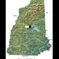
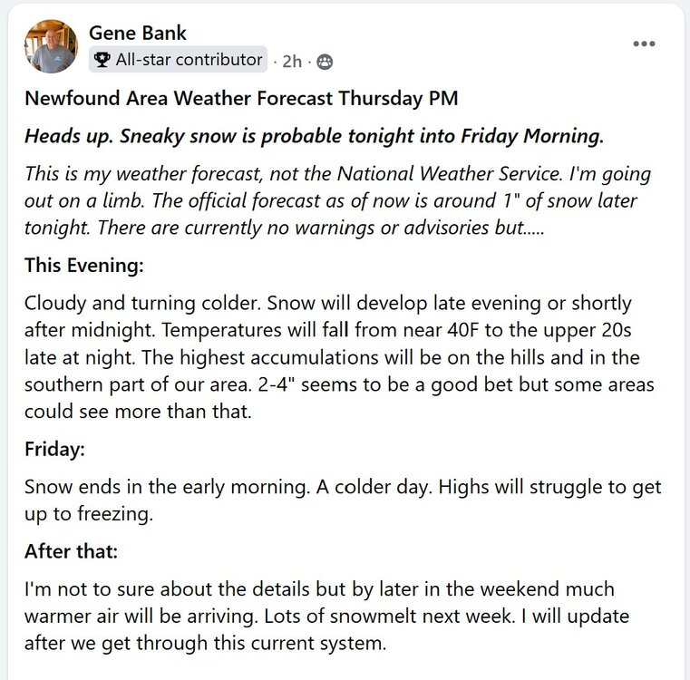
I put out a forecast for our 13K Newfound Lake facebook group. Since our weather is so different than Manchester, NH only TV station and because GYX is so far east I usually do pretty good. I totally disagreed with GYX when I posted this around 4pm. Let's see how bad I bust...
-
39.7/27.7F
We were far enough north that we had some bright sun this morning into mid day. The temperature maxed out at 49F. Over the past couple of hours the temperature has been falling as well as the dew's. Especially the past hour. The point and click in our area is around 1" of snow. No advisories are up. The trend is your friend and I could see my area of the Lakes Region getting 2-4", maybe up to 5 or 6" if we can get the precip up here. It will be interesting to watch.
-
26.9F SN+ Vis 1/4"
-
39.7F first batch of showers were elevated here. Brightening to the west now.
-
I'm happy with my 1/4" of snow and more happy for the people who got 35 to 40". I see lots of pictures of people posting snowbanks and drifts. I'm looking for a video clip of someone who is able to drive and just video a neighborhood that got that much. Cars and areas not plowed should be pretty much buried. It is a good way to really judge. Most social media posts want to show the highest snowbank or drifted area. I just one to see a longer, honest video in the ground zero area. If anyone has a link I would love to see it!
-
 1
1
-
-
24.5F -SN Vis 3 miles. I am happy that we got .25". For fun over the last few years I have forecasted for our 13K Newfound Lake facebook group. I had predicted 2-4" but thought with White Mountain downsloping it might not be even that. All morning not a flake but we did get into some light snow so everything is dusted with new stuff. I am amazed that there has been almost no wind. Not even a breezy day. I don't understand why?
-
We did it! 25.4F Visibility 6 miles. -SN
Regarding the snowfall amounts. I think they are going to be all over the place with the amount of wind.
-
 1
1
-
-
6 minutes ago, tamarack said:
Nothing here except wind, and the 2 flakes that flew by at 10:30. Grandkids in SNJ get to play in 15"+.


We just had a flake too! 1150am!
-
1 minute ago, dendrite said:
Finally a steadier -SN. Let’s see if we can pull an inch.
24.1°
Kearsarge to my south is now hidden from view. I can still see Ragged clearly.
-
 1
1
-
-
4 minutes ago, dendrite said:
Seems precarious to me. Looks like it tries to throw it back a couple hours once the E MA forcing wanes. I’d probably hope the NW CT band pivots and comes east with time.
Brian, not a flake here. I can see all the way south to Kearsarge and it has been in and out of the snow. No wind either. HRRR says NADA for me. Globals still say some. When would you say the furthest NW the sheild will get in our area?
-
23.7F Cloudy. Vis 30 miles. Barely a breeze. HRRR says we may get by without a flake.
-
 1
1
-
-
13 minutes ago, dendrite said:
Yeah the nams are still very impactful WOR…it would just be the lower end of forecasts verifying. But I get it…it would feel like a rug pull if this verified and I’d want to break Ray’s kids’ toys too.
It's the NAM. The 12Z gives me 0.00"
-
Yawn for me. Perhaps 2-4" with strong downsloping off the Whites. A day with light snow and windy conditions. Enjoy down there!!
-
 2
2
-


Napril 2026 Discussion/Obs
in New England
Posted
38.9F Light rain mixing with sleet over the past 5 minutes