

wxeyeNH
-
Posts
9,326 -
Joined
-
Last visited
Content Type
Profiles
Blogs
Forums
American Weather
Media Demo
Store
Gallery
Posts posted by wxeyeNH
-
-
4 minutes ago, CT Rain said:
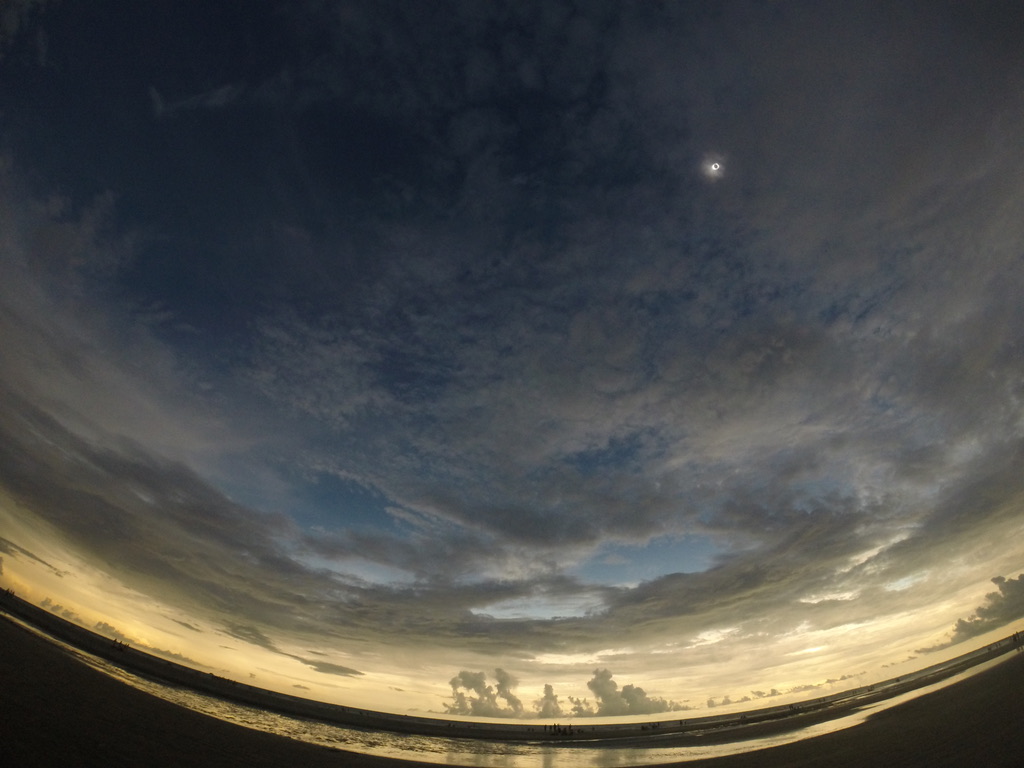
This was my view in 2017 in Sullivan's Island, SC.
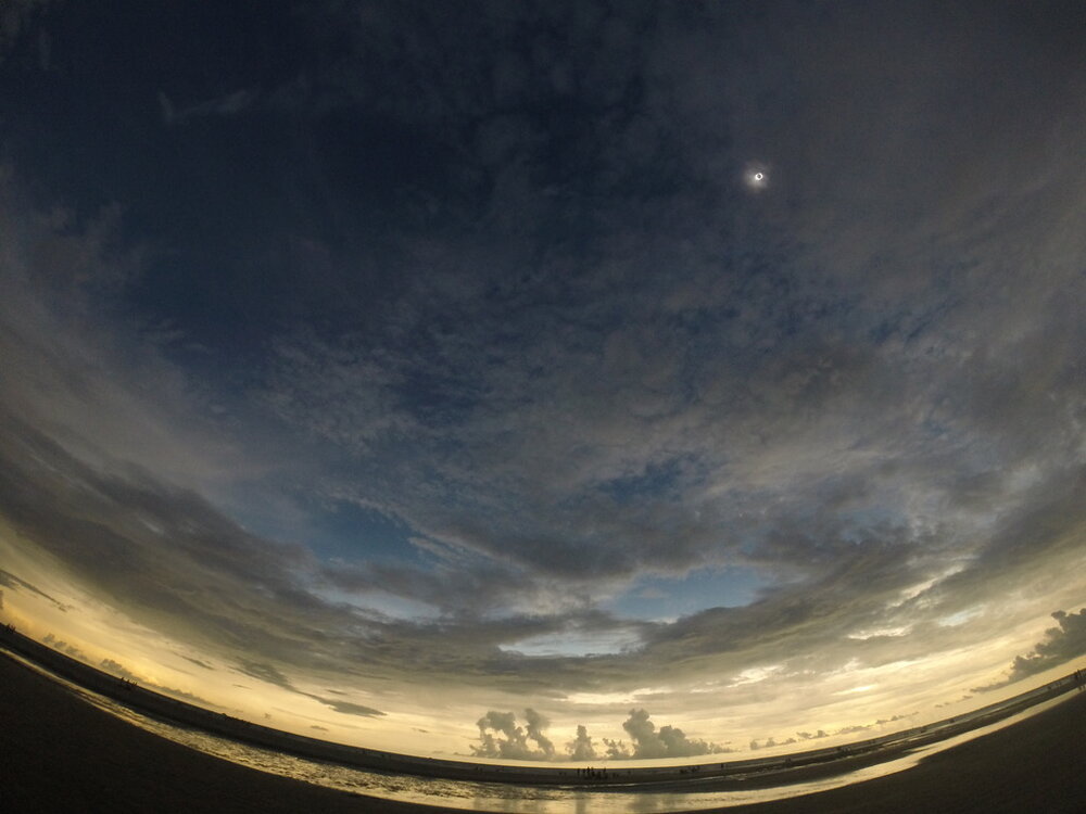
If we do have cirrus to the SW it will add to the spectacular as the sunlight returns right after totality
-
1 hour ago, weathafella said:
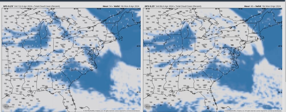
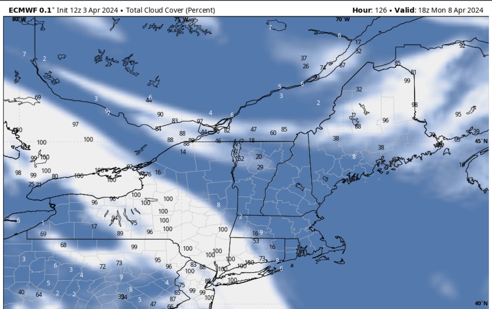
Our plan is to head to Newport, VT-hopefully far enough ne of the approaching high clouds. But high cirrus shouldn’t really be that much of a damper so keep that in mind. Euro cloud algorithm is all high clouds.
I think the cirrus will block out the corona and you will not be able to see any planets but all and all it should be good. I have been watching the Euro and GFS every run. Weatherbell has tools that even break down cloud cover by type. The good thing is that on the 12Z runs the cirrus are slightly slower to move in.
On thing is that I can tell you because I am very active in our Newfound FB group is that so many people are planning to head north. So really plan on that. The other thing that strikes me is how many people are planning to go up to Lincoln. With a solar eclipse either it is totality or bust. Good luck Jerry. Take some pictures!

-
The 12Z GFS is ever so slightly slower with the cirrus to the SW.. Good trend. I would like to see the Euro go that way too. I didn't post the NAM but it has a fair amount of CU in NNE. As totally approaches the sun will progressive dim so that cloudiness should be able to wane somewhat??
-
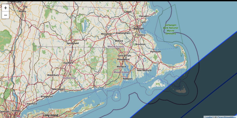
For New England The 1970 total eclipse is the closest anology to this one. There was an annular eclipse in May 1994. That past over me in Central NH. 93% sun coverage and it was barely noticable. In 1970 only Nantucket was had a total eclipse. Everyone else just saw a partial. Partial is interesting but no big deal. Okay, I'll stop honking about Monday. By the way I don't like how the Euro is bringing in the high clouds so early.
1970 path is below
-
49 minutes ago, Ginx snewx said:
Full in southern RI. Way cool but I just won't fall for all this hype. I don't want this to seem as a slight bu I am just going to watch the WCAX camera atop Mansfield .
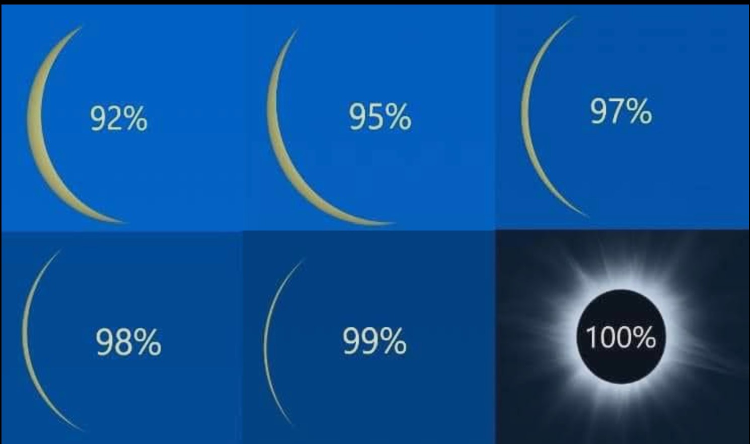
Steve, I "totally" get it that you would not want to travel to NNE and deal with all the traffic. I bookmarked the Mansfield cam. The only thing I can say is a 99% eclipse vs 100% totality is literally night and day. I will never forget the wall of darkness coming up the beach. I was curious about 1970. Only Nantucket got into totality. SE Rhode Island had a 98% partial eclipse. That is similar to what I am goin to experience. I keep telling locals even a 98% eclipse is no big deal. It is 100% or it is a bust.
-
 2
2
-
-
1 hour ago, Ginx snewx said:
I remember when I was a kid in 1970 it was NBD just don't look at it. But money and hype has to be made. I guess some are looking for some out of body experience. Don't get me wrong it's way cool just it isn't life changing.
Steve, you and I are of the same age. I remember that 1970 eclipse. I was 14 and the family and I skied at Wildcat. I think it was perhaps 95% totality. It got a bit darker. Then in 1998 I traveled to Aruba and saw a total eclipse. I can't say it changed my life but it was by far the coolest natural type event of my lifetime. I went on a tornado chase many years back and saw 2 tornadoes. Not extremely close but within a couple of miles. The eclipse was way better.
-
1
-
-
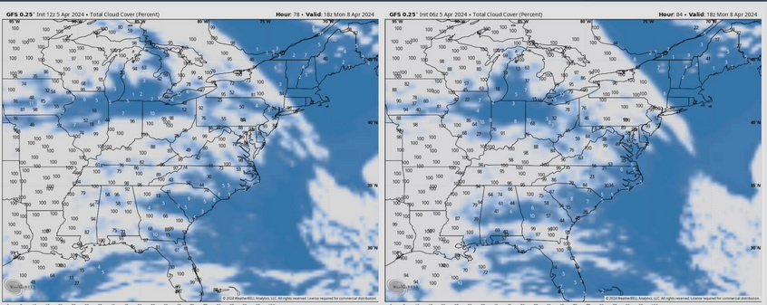
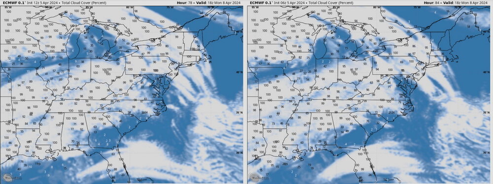
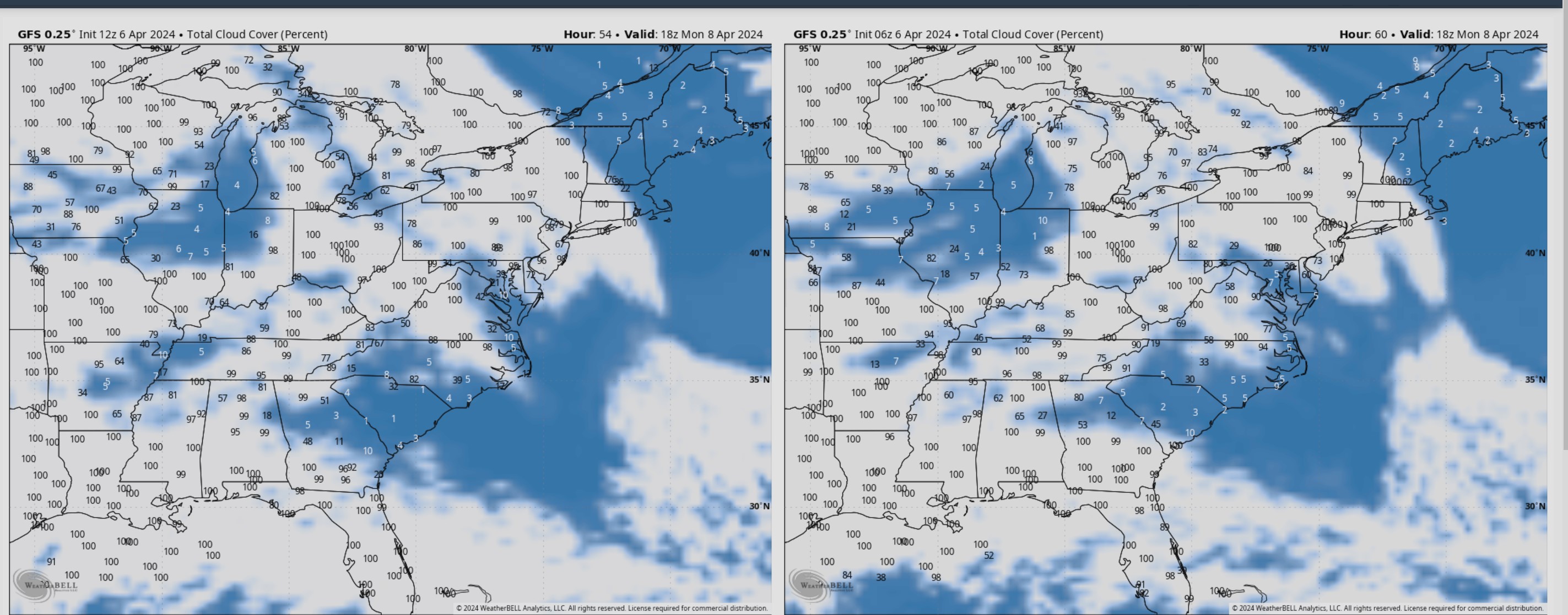
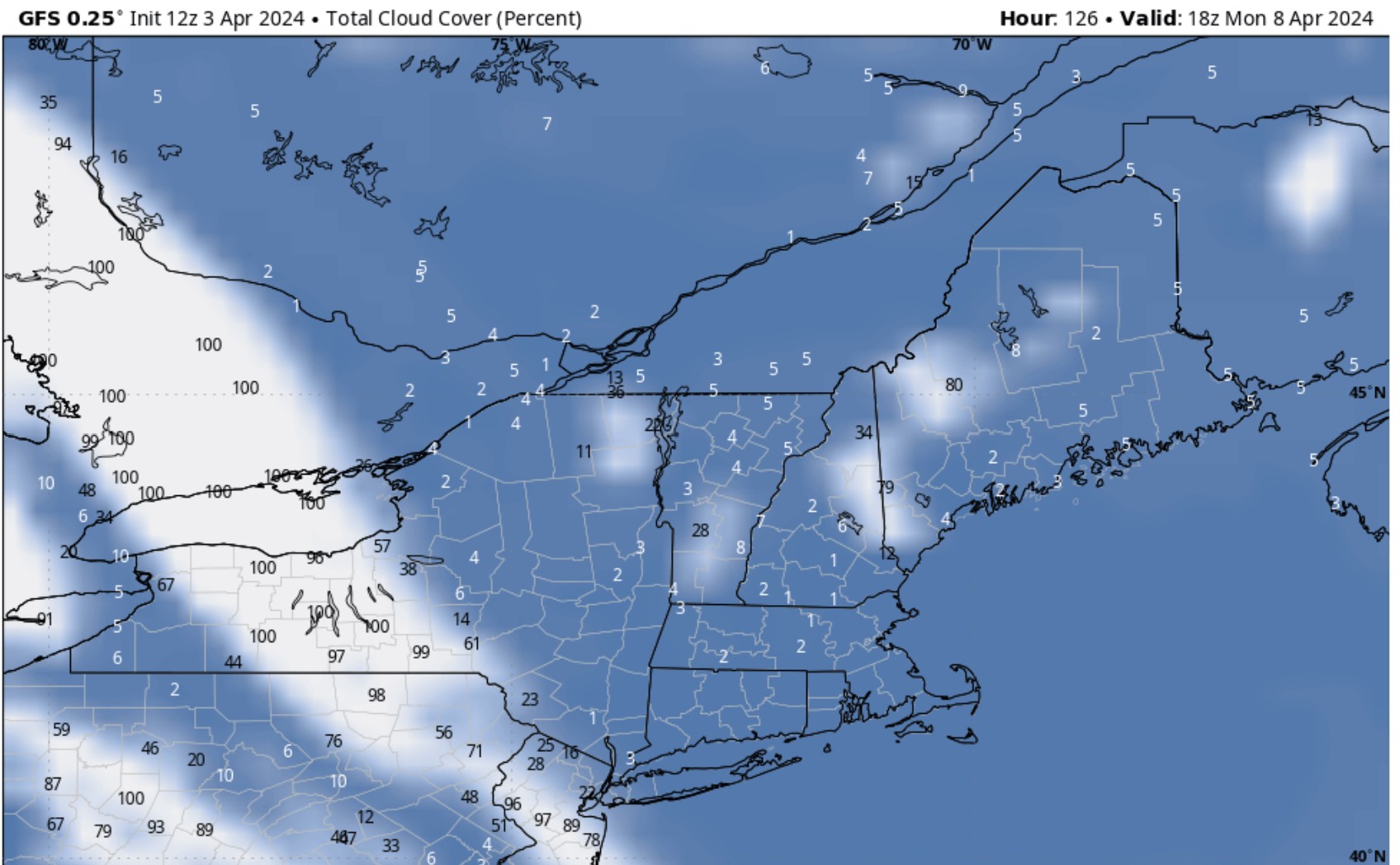
I just looked at the 12Z GFS and Euro. I am getting a bit more concerned about the high clouds to the SW getting into New England by eclipse time. GFS still looks good but Euro is a bit faster. At 3:30pm the sun will be somewhat to the west so high clouds in that direction is not good.
Here are both model runs and comparison to the former runs.
-
Wow, felt from Wash DC to Central NH. Wide area
-
This eclipse is going to blow people away. The sun is spectacular but what I noticed in Aruba was how fast the light changes. This is a good example.
-
8
-
-
Extremely heavy snow falling after a long lull this morning. 28.6F Vis has to be down around 1/8th
-
28.9F Very light snow and blowing snow. 8" but so much drifting. Looking 300 feet below me the trees are caked but here it was drier and did not adhere on trees
-
1
-
-
More exciting eclipse news. Check this out. Spaceweather.com says the "Devil" comet is now visible to the naked eye near the sun. According to them the comet might be visible during totality. I don't think that has ever happened before in modern times.
https://www.space.com/horned-comet-visible-total-solar-eclipse
-
1
-
 1
1
-
-
31.5F SN+BS Wind E gusting to 30mph 2"ish
-
3
-
-
31.5F -SNBS 1.25" ish
-
31.7F SN+ 1" Snow flipped to a mixture of sleet an hour or so ago but has flipped back to heavy snow. Snow is accumulating even on my asphalt driveway.
-
1
-
-
32.2F SN Parachutes
-
1
-
-
33.1 Parachutes.... snow whitened the ground a bit earlier and then with a lull it all melted. These parachutes are huge
-
23 minutes ago, dryslot said:
A bit easier reading the colors on this map.........

That map is confusing to me. Look at Plymouth NH. Most people see the 8-12". Looking at the side bar Plymouth is in the 12-18" with lollies to darker reds over 18". There has got to be a better way
-
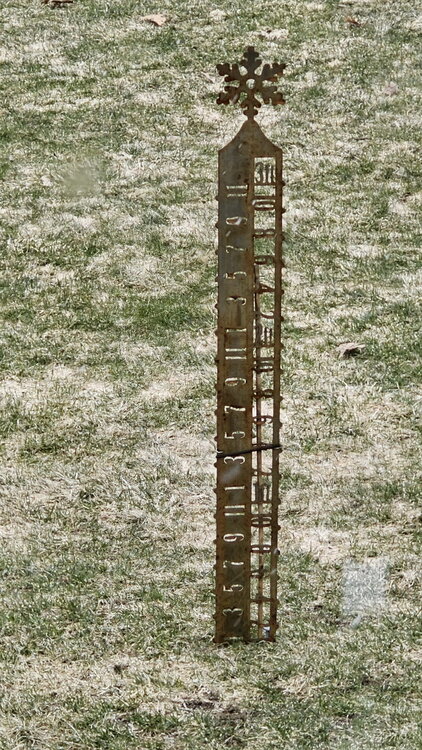
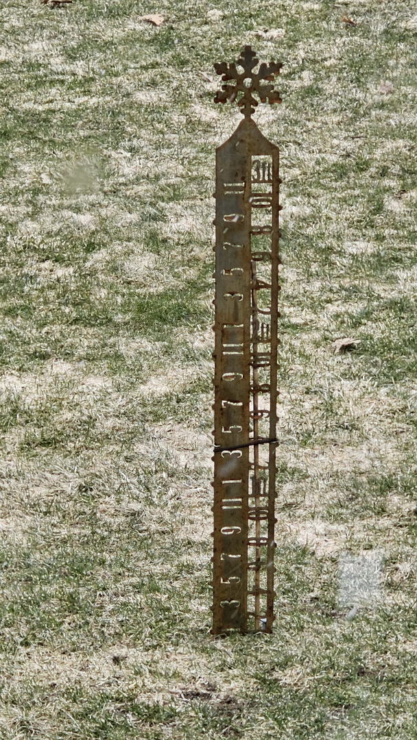
33.2F Light snow. Vis 3/4 Large aggragates and the snow is starting to accumulate on the grass. I took this picture of my snow stake just before the snow. Just so I'm on the up and up that 1" line on the stake looks pretty close to the grass so we can take 1/2" off my total when we are done. Any guesses? The winner will get to come up here on Friday and can snowblow the driveway, at least enough to get the cars in and out. I'm not going overboard on April 3rd.
-
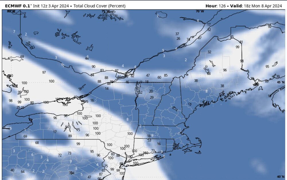
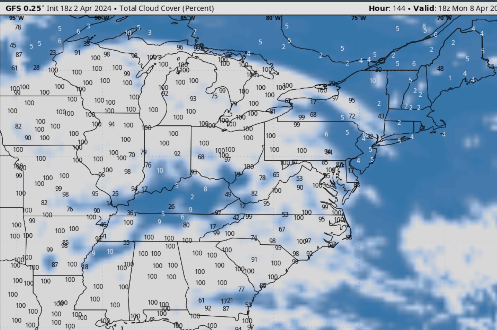
12Z 4/3 GFS and Euro looking good! Some high clouds to the SW and a back door cold front from the north but all and all can't complain compared to the rest of US

-
I just started an obs thread as the first flakes are in the air up here
-
1
-
-
35.8/29 First few flakes
Bridgewater NH. I'm at 74" on the season. Let's go out big and make a run at 100"
-
36.9/28 That roaring sound is starting in the forest trees. Davis high gust last hour E 27
-
2
-
-
1 minute ago, Saguaro said:
My original plans for Texas aren't looking good. Have backup plans for Maine, tip of NH or Quebec, will lose a minute of totality but that seems the best bet currently.
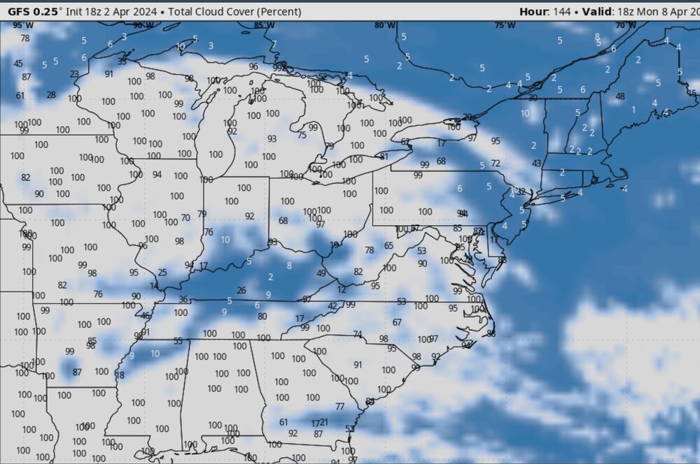
18Z GFS cloud parameter says New England is the place to be!
-
2
-


Total Solar Eclipse, April 8, 2024
in New England
Posted
I just heard that Burlington VT is now expecting 200,000 extra people. Especially because New England may have the best viewing people that were heading to other areas like upstate NY may try to come east with less chance of that cirrus deck. So traffic jams and few services may end up being the big story. I still have 10" of heavy wet snow on the ground (that is melting quick) so people thinking they can just pull off the pavement into some snow are going to have a rude awaking. With the 18" in the last storm and a foot or so the other day. Also whenever i drive NW of my area there is no cell service in vast rural areas so people that get stuck or rely on GPS maps are going to be in trouble. The whole social element of this is very interesting to me.