
Thundersnow12
-
Posts
11,414 -
Joined
-
Last visited
Content Type
Profiles
Blogs
Forums
American Weather
Media Demo
Store
Gallery
Posts posted by Thundersnow12
-
-
Beavis sounding like a butthead
-
 1
1
-
 4
4
-
-
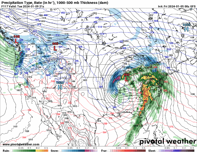
R/S line collapsing nicely on CC now to the SE and S across Chi metro as heavier returns move in.
-
21z HRRR is really legit with the front end thump, especially from about ORD on westward. 0.60”+ QPF by 15z
-
2
-
-
1 hour ago, RCNYILWX said:
If anyone has specific LOT centric questions on forecast stuff from today, ask away and I'll try to reply a bit later.
Apologies for the lack of a more in depth meteorological dissertation in the AFD lol - just less and less time available for us on days like this.
Sent from my SM-G998U using Tapatalk
Hi, first time long time. What speeds do you think you'll reach on the road driving into LOT on snowy surfaces and will it be a repeat of the other afternoon with large parachutes falling from the sky under 35-40dbz but struggling to accumulate? Thanks, I'll hang up and listen.
-
1
-
1
-
-
-
8
-
 1
1
-
 1
1
-
-
12 minutes ago, Sciascia said:
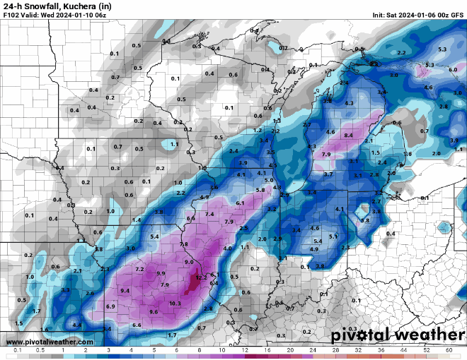
So that’s why my P&C went from 5-9 to 2-4 for daytime tomorrow with the removal of the heavy snow terminology.

Bozochardt has only 3-5” now for areas like Dekalb tomorrow. Kid is going to learn the hard way.
-
Borchardt coming into work tonight for LOT and just straight up disagreeing with previous shifts snowfall forecast. Loser
-
3
-
-
5 hours ago, A-L-E-K said:
$$$
-
1
-
-
8 hours ago, Chicago Storm said:
I’ve been at the point for years now that the only things that excite/interest me snowfall wise are big dogs (or at least medium dogs), record/near record occurrences, and abnormal/significant conditions. This one will be none of the aforementioned most likely, so overall interest is low.
However, looks like a solid 2-5”/4-7” kind of situation from SE to NW across the area, with lower amounts near the lake and downtown.
.Or parties on I-355
-
6 minutes ago, RCNYILWX said:
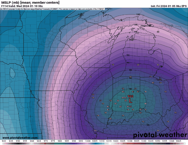
Every storm is different and you may very well be right, but the GFS/GEFS has been a bit too amped at this range with southwest type systems at this range over the past few winters. It's gonna be close and I feel better out here than I would in the city. The EPS mean SLP track has also jogged NW some vs. previous cycles.
-
6
-
-
14 minutes ago, hawkeye_wx said:
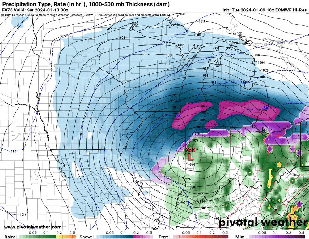
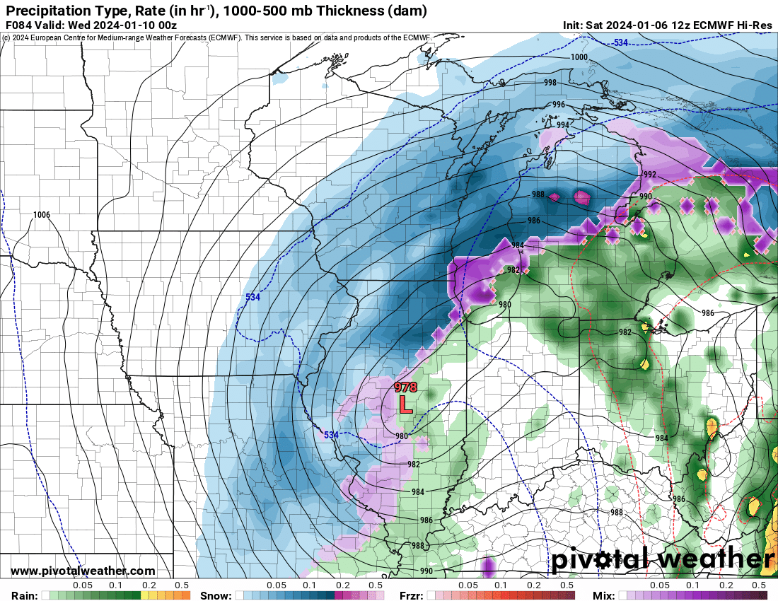
12z Euro... the only gripe I have with this run is the defo zone across eastern Iowa is rather weak-looking considering there is a 978 mb low over central IL.
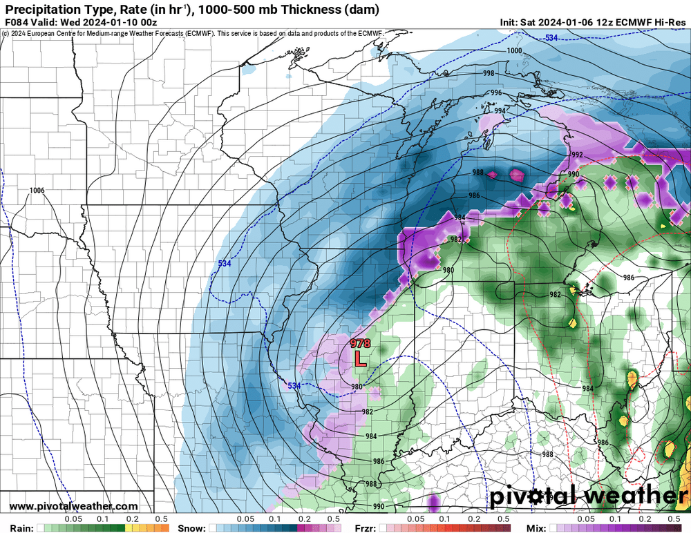
850mb and sfc low are occluding so you're losing your moisture advection into the CCB back that ways.
Chicago area continues to look like a 4-8"ish event of cement off 1"+ of QPF.
-
2
-
-
1 minute ago, Baum said:
Everything before today was fun. Now it starts to get real.
Actually, not until 3:30pm tomorrow up in hillbilly country.
-
1
-
-
-
5 hours ago, A-L-E-K said:
Ready 2 crown joe if this one delivers
-
3
-
-
4 minutes ago, SchaumburgStormer said:
NAM is wayyy north
A tradition unlike any other
-
1
-
1
-
-
6:1 ratios in the heart of winter with a deep SLP is rough
-
1
-
2
-
-
Gotta jinx a rainer somehow. Have at it.

-
2
-
1
-
-
1 hour ago, Muskegon Mauler said:
-PNA makes this ripe for a NW trend.
Alek already sniffing rain
-
1
-
1
-
2
-
-
5 minutes ago, hlcater said:
Looking at the 12z runs

Future winner in 2024
-
1
-
2
-
-
That euro run be p hot. Probably should get a thread rolling
-
2
-
 1
1
-
-
Couple hot GEFS members for the local Kesha fans
-
1
-
3
-
-
1 hour ago, MNstorms said:
uh, are we restricting this strictly to severe thunderstorms? Minnesota and Wisconsin may receive anywhere from 0-15'' on the back side (could bust). All in 6-8 hours with thundersnow likely.

The real winners of this system
-
1
-
-
30 minutes ago, ILSNOW said:
Not liking the look of this. How far west is this going to go?

Denver
-
1
-
-
1 hour ago, Hoosier said:
Your call is due by 9 pm tomorrow.
Good luck getting an accurate one


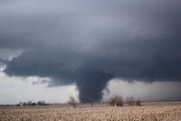
February 27-28 Severe Threat
in Lakes/Ohio Valley
Posted
Knocking out three airports in one shot. RIP ORD wx office