Greensnow
-
Posts
132 -
Joined
-
Last visited
Content Type
Profiles
Blogs
Forums
American Weather
Media Demo
Store
Gallery
Everything posted by Greensnow
-
BGM As is typical with early season events, snow accumulations will be somewhat elevation dependent with the valleys seeing less than the hilltops. This should especially be the case across Northeast PA, where any wintry mix may completely change over to rain by early Wednesday morning there. Ice accumulations should be rather light, mainly less than a tenth of an inch, and mainly across the higher elevations of the Poconos and Catskills. Widespread 2-4 inch snowfall accumulations is looking more and more like a possibility.
-
And so it begins in NEPA BGM Tuesday Night A chance of rain and snow before midnight, then snow likely. Mostly cloudy, with a low around 31. Chance of precipitation is 60%.
-
Over 6" now for the month up here. Heavy rain last night and this AM. No drought in Northern PA and the mowing season will be a long one- unless we get some October snow!
-
Just passed 4" here in Clarks Summit. Moderate rain for over 24 hours. Nice!!!
-
Wanted to see what an excessive heat warning meant for Death Valley, CA Saturday Sunny and hot, with a high near 121. Light and variable wind becoming south 5 to 8 mph in the afternoon. Saturday Night Mostly clear, with a low around 92. South southeast wind 5 to 13 mph becoming east in the evening. Sunday Sunny and hot, with a high near 120. Southeast wind around 5 mph becoming west southwest in the morning.
-
Central PA Spring 2022
Greensnow replied to Itstrainingtime's topic in Upstate New York/Pennsylvania
High was 81 and sitting at 64 right now. 40's Friday and Saturday night?! -
Central PA Spring 2022
Greensnow replied to Itstrainingtime's topic in Upstate New York/Pennsylvania
Went through 4 separate rounds of storms and heavy rain. Last one now done. 3.12" for the day. -
Central PA Spring 2022
Greensnow replied to Itstrainingtime's topic in Upstate New York/Pennsylvania
Shit got real! e National Weather Service in Binghamton has issued a * Severe Thunderstorm Warning for... Lackawanna County in northeastern Pennsylvania... West central Wayne County in northeastern Pennsylvania... Northeastern Wyoming County in northeastern Pennsylvania... * Until 530 PM EDT. * At 504 PM EDT, a severe thunderstorm was located over Clarks Green, or over Waverly, moving southeast at 30 mph. HAZARD...Two inch hail and 70 mph wind gusts. SOURCE...Radar indicated. IMPACT...People and animals outdoors will be injured. Expect hail damage to roofs, siding, windows, and vehicles. Expect considerable tree damage. Wind damage is also likely to mobile homes, roofs, and outbuildings. * Locations impacted include... Scranton, Dunmore, Carbondale, Archbald, Blakely, Taylor, Dickson City, Moosic, Olyphant and Clarks Summit. -
Central PA Spring 2022
Greensnow replied to Itstrainingtime's topic in Upstate New York/Pennsylvania
Flurries and 38 right now. Make it stop-I need 70 and sunny! -
Central PA Spring 2022
Greensnow replied to Itstrainingtime's topic in Upstate New York/Pennsylvania
AVP down to 32 BGM down to 28 -
Central PA Spring 2022
Greensnow replied to Itstrainingtime's topic in Upstate New York/Pennsylvania
Pictures from yesterday AM up here NEPA. 4" up here in Waverly with close to 12" north of me in Montrose.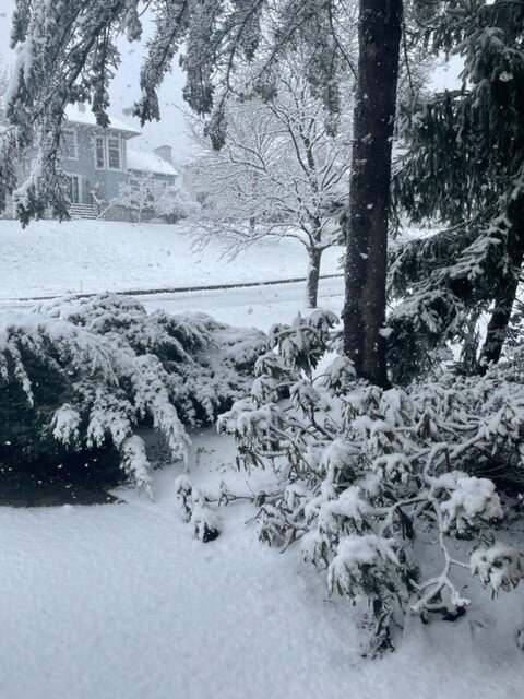
-
Central PA Spring 2022
Greensnow replied to Itstrainingtime's topic in Upstate New York/Pennsylvania
It never ends. Made some adjustments to PoPs, QPF and even snow amounts for tonight into Saturday morning as a compact surface low tracks across the Poconos and Catskills. This low will produce an area of enhanced 850-700mb frontogenesis across and east of the I-81 corridor, and in turn enhanced omega in the 850-300mb layer. Strong PVA is also rolling into the area by 8 AM Saturday from central PA. This should allow and band of steady rain to break out during the predawn hours and pivot across NE PA and east- Central NY through midday or early afternoon Saturday. Blended in some of the latest NAM and GFS QPF to the existing forecast, which increased amounts...with around or just over 0.50" of QPF possible in the 2AM to 2 PM Saturday timeframe. The other concern will be for some wet snow to mix in across the higher elevations, especially when the precip rates are moderate to heavy. The best chance to see this wet snow mix in will be along and east of I-81 into the northern Poconos and Catskills, above 1600 feet or so. For the highest elevations up to an inch or two of snow is possible before the precip pulls out to the northeast by afternoon. During the morning, temperatures should range from 33-39 in the area where the steady precip is falling. By afternoon, high temperatures reach the mid-40s to lower 50s in most locations. -
Central PA Spring 2022
Greensnow replied to Itstrainingtime's topic in Upstate New York/Pennsylvania
3-Day Total of 2.9" with 2.2" yesterday. Ready for 75 and sunny! -
Central PA Spring 2022
Greensnow replied to Itstrainingtime's topic in Upstate New York/Pennsylvania
36 with snow and rain showers at noon. Looks like flakes tomorrow night as well. -
Central PA - Winter 2021/2022
Greensnow replied to Bubbler86's topic in Upstate New York/Pennsylvania
Tornado Warning here for a strong storm that just ripped through. Northern Lackawanna into Susquehanna and Southern Wayne. Was crazy for 10 minutes but just heavy wind and rain. -
Central PA - Winter 2021/2022
Greensnow replied to Bubbler86's topic in Upstate New York/Pennsylvania
19 up here right now. Brutal this AM. Down to 9. -
Central PA - Winter 2021/2022
Greensnow replied to Bubbler86's topic in Upstate New York/Pennsylvania
23 and the heavy band now setting-up here NW of Scranton. -
Central PA - Winter 2021/2022
Greensnow replied to Bubbler86's topic in Upstate New York/Pennsylvania
Love that this is forum wide. Living up here we are going to get snow. I am only jealous of the LSV crew when you are in the wheelhouse four a coastal and I am smoking cirrus. Hopefully everyone gets one great event. Also happy that we will be seeing snow and SNE will be seeing rain. That crew is great but whiny bitches for going over climate in terms of snow more often than not! -
Central PA - Winter 2021/2022
Greensnow replied to Bubbler86's topic in Upstate New York/Pennsylvania
BGM Bullish and that is unusual! By midday Saturday there will be a subtropical jet streak aligned from the Gulf Coast towards central PA with a second arctic jet streak aligned from the west to east generally from the Saint Lawrence Valley towards the Gaspe Peninsula. This will put areas of central NY and northeast PA in both the right front exit region of the subtropical jet and the right rear quad of the northern jet structure. This allows for both the thermal direct and indirection jet circulations to promote substantial sloped synoptic ascent over the region by Saturday afternoon. One of the main concerns with this system is the likelihood that we`ll see a mesoscale band develop. With the strong sloped frontogenetical ascent and plenty of aforementioned synoptic lift we anticipate that a mesoscale band will form and will had the potential to see rates from 2-4" an hour at times Saturday morning. Trends in the guidance were to show this potential banding feature very close to the rain/snow transition line and I tend to think that there will be bit of separation between the heaviest snow and the rain/snow line. -
Central PA - Winter 2021/2022
Greensnow replied to Bubbler86's topic in Upstate New York/Pennsylvania
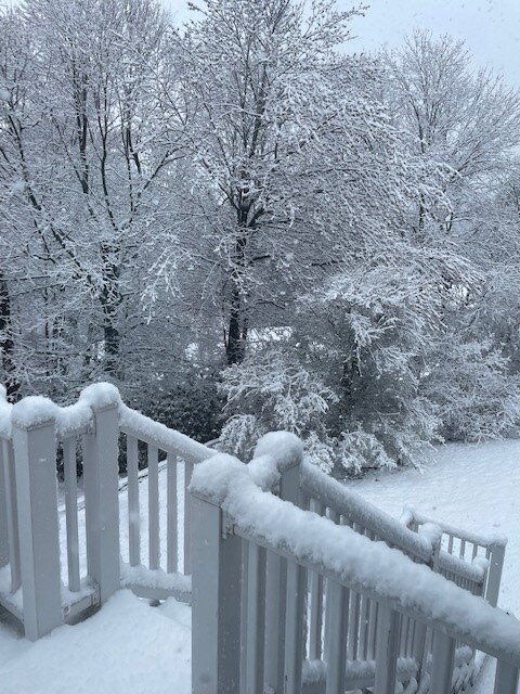
***UPDATE WINTER STORM WARNING ISSUED FOR TWIN TIER REGION OF NY AND PA***A band of heavy snow has set up in the Twin Tiers of NY and PA with up to 2" of snow per hour at times. The snow will taper off between 5 pm and 7 pm. Total snowfall will range between 5" and 9" in the Twin Tiers with 2" to 5" over the rest of northeast PA and across north central NY. See total snowfall map. If you must travel please use extreme caution!!! #pawx #nywx #winter2022 Crazy-this is usually the set-up where I do well up here. Elevated and marginal temps but with good precip. Saturday looks interesting in NEPA. -
Central PA - Winter 2021/2022
Greensnow replied to Bubbler86's topic in Upstate New York/Pennsylvania
OFF the table LOL. -
Central PA - Winter 2021/2022
Greensnow replied to Bubbler86's topic in Upstate New York/Pennsylvania
Going to be tough call up here on how much snow. I think the FRZ will be on the table. We are snow/sleet up here regardless of the models in this set-up. Never see a lot of FRZ in my 20 years here but shoveled a ton of sleet. Current temperature gradient really evident NE to SW across the state. I am sitting at 19 currently. -
Central PA - Winter 2021/2022
Greensnow replied to Bubbler86's topic in Upstate New York/Pennsylvania
-
Central PA - Winter 2021/2022
Greensnow replied to Bubbler86's topic in Upstate New York/Pennsylvania
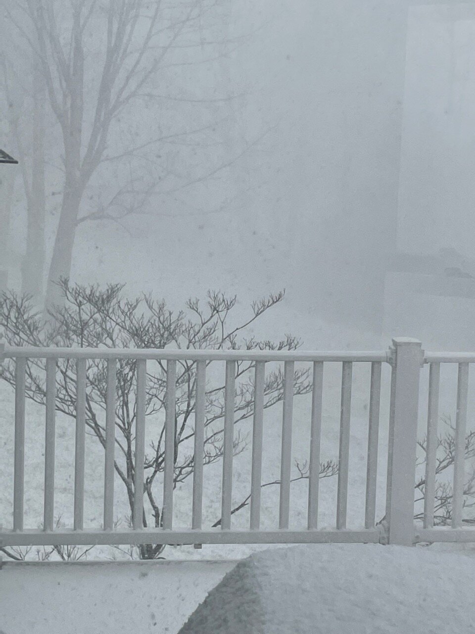
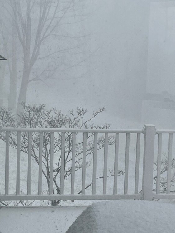
Getting crushed right now. Snow Squall Warning for... Lackawanna County in northeastern Pennsylvania... Southern Wayne County in northeastern Pennsylvania... Luzerne County in northeastern Pennsylvania... Wyoming County in northeastern Pennsylvania... * Until 115 PM EST. * At 1214 PM EST, a dangerous snow squall was located along a line extending from Lake Carey to Elysburg, moving east at 45 mph. HAZARD...Whiteout conditions. Zero visibility in heavy snow and blowing snow. Wind gusts greater than 30 mph. SOURCE...Radar indicated. IMPACT...Dangerous life-threatening travel. Locations impacted include... Scranton, Wilkes-Barre, Falls, Hazleton, Muhlenberg, Dunmore, Kingston, Nanticoke, Plains and Carbondale. This includes the following highway exits... Interstate 80 between 256 and 273. Pennsylvania Interstate 81 between 143 and 202. Interstate 84 between 1 and 17. Interstate 380 between 13 and 24. Interstate 476 between 105 and 131. -
Central PA - Winter 2021/2022
Greensnow replied to Bubbler86's topic in Upstate New York/Pennsylvania
16 up here at 3:30PM. Done with this cold without snow. Ready for yard work!