
Interstate
-
Posts
4,222 -
Joined
-
Last visited
Content Type
Profiles
Blogs
Forums
American Weather
Media Demo
Store
Gallery
Posts posted by Interstate
-
-
They dropped the watch for the northern counties and went with a WWA
-
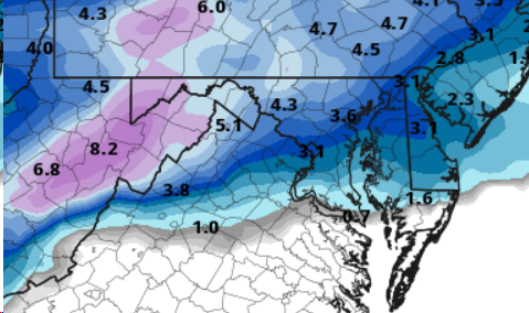
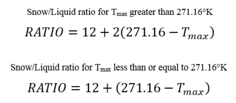
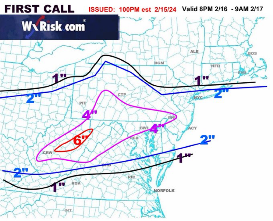
This is Kuchera
-
 1
1
-
-
7 minutes ago, Terpeast said:
My thoughts too. I’m at 37/19
37.9/22.8 here in 21057
-
1
-
-
1 minute ago, MillvilleWx said:
Was this the same storm someone said they didn't believe you had two inches of snow, so you took a picture with a newspaper with the date on it in the background of the ruler in the snow and a thumbs up?

One of my favorite things I've ever seen on this forum.
Newspapers…. What are those
-
1
-
 1
1
-
-
7 minutes ago, pazzo83 said:
DCA jumped up to 50
The rain earlier that washed the brine away must have been a warm front
-
10 minutes ago, WEATHER53 said:
Frederick spiked from 39 to 50,
sumtim spooky goin on
I jumped to 37.9
-
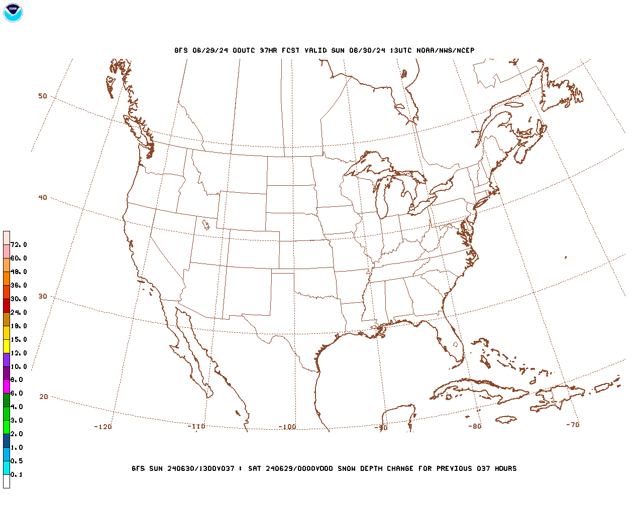
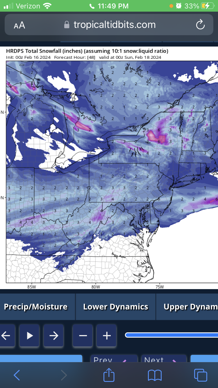
HRDPS is not happy.

-
 1
1
-
-
-
1 minute ago, Stormchaserchuck1 said:
Temps don't support those ratios. Here's what the GFS shows
Oh boy. You are going to piss some people off
-
2
-
-
On a side note. Jalapeño stuffed olives are awesome
-
2
-
 1
1
-
-
I was right about the purples.
-
7 minutes ago, WVclimo said:
Wow. Front passed through here and temp shot up to 51°. Compressional heating on a 35 mph west wind.
I thought you were joking as I was giving my obs. That is crazy the temp jump
-
I think the thread is fine. It has all been noise tonight. Same general theme. It is not like it moved north or south.
-
1 minute ago, stormtracker said:
GFS time homies!
Odds on the the GFS showing purples in central MD area?
-
1
-
-
Don’t look at the RGEM
-
33.6/32.8 in 21057
-
No ICON. I think it looks good
-
33 minutes ago, Weather Will said:
Yah, forgot about the small amount of rain tonight.
Yeah. Good thing they Brined today
-
10 minutes ago, psuhoffman said:
Most years I’d be very nervous. But this year there really hasn’t been any north trend once inside 100 hours. The storms that did shift north all did it way before now. Under 48 hours the trend has been south really. Obviously every situation is different but the seasonal trend does matter some.
Don’t tell Boston about trends within 100 hours.
")
-
5 minutes ago, paulythegun said:
Kuchera (as I understand it) is highly sensitive to the maximum temperature in kelvin in up to 500mb (Tmax below). I ran the calculation for DC for the Euro where the max temp is 273..15 in Kelvin (0 degrees C) during the height of the storm and that translates to 8.01 to 1 ratios using the Kuchera method.
150% upside
-
1
-
-
Just remember everyone... Boston is getting shutout again
-
1
-
 2
2
-
1
-
-
3 minutes ago, stormtracker said:
We root for the RGEM/NAM....Bmore roots for the ICON. You know what I'm rooting for? Forum Peace.
There is only
Love andWar when it comes to snow IMBY -
5 minutes ago, Scraff said:
Can’t wait for 2nd and 3rd call…
Poor Boston
-
2
-
1
-
-
Who was it that was asking for a Special Weather Statement on Tuesday... well here you go
The Weekend Rule? Saturday 2/17 - The Icon Storm
in Mid Atlantic
Posted
I doubt it... I think LWX is doing a good job. Most will not see 5+ inches, which is the criteria for a warning level event.