Baroclinic Zone
-
Posts
46,024 -
Joined
-
Last visited
Content Type
Profiles
Blogs
Forums
American Weather
Media Demo
Store
Gallery
Everything posted by Baroclinic Zone
-

March 12/13/14 Blizzard/Winter Storm/WWA etc
Baroclinic Zone replied to Bostonseminole's topic in New England
Poof, powers out -
March 12/13/14 Blizzard/Winter Storm/WWA etc
Baroclinic Zone replied to Bostonseminole's topic in New England
-
March 12/13/14 Blizzard/Winter Storm/WWA etc
Baroclinic Zone replied to Bostonseminole's topic in New England
Love it. 2 hrs in a row now of 1/4 or less visibility. -
March 12/13/14 Blizzard/Winter Storm/WWA etc
Baroclinic Zone replied to Bostonseminole's topic in New England
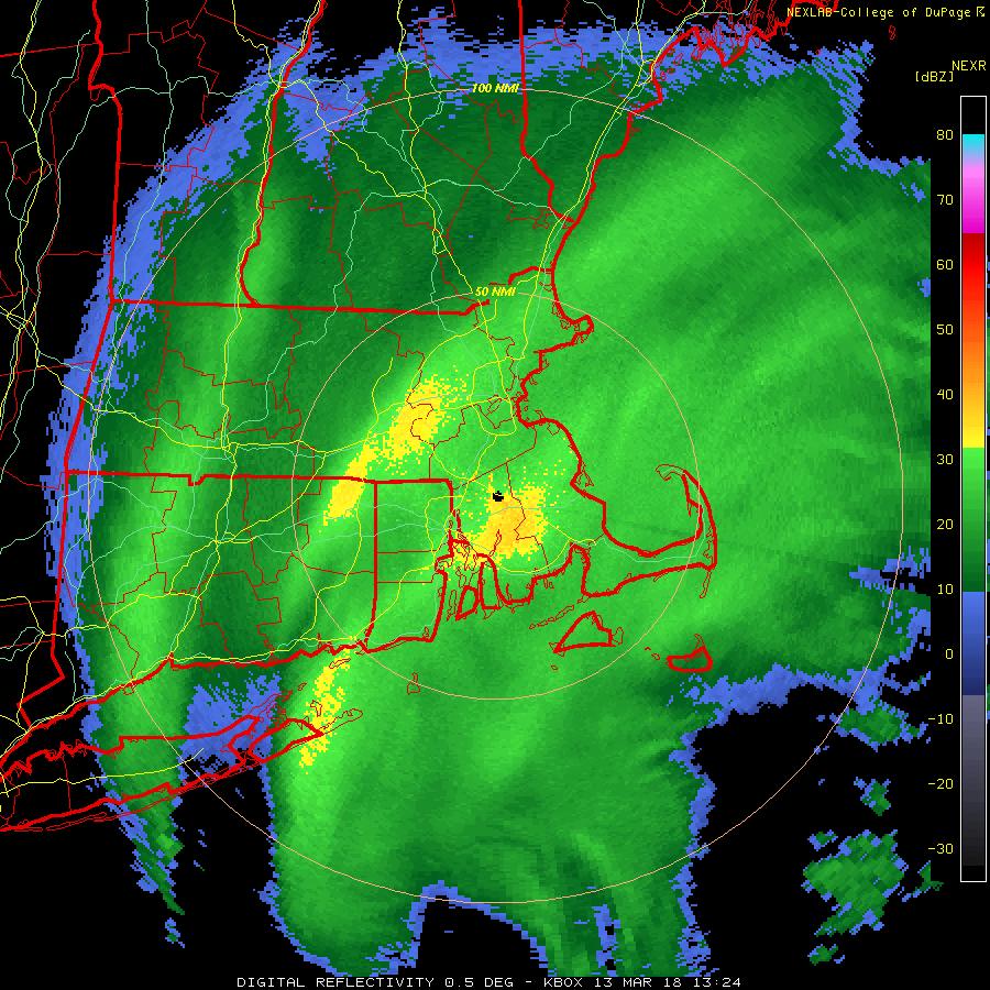
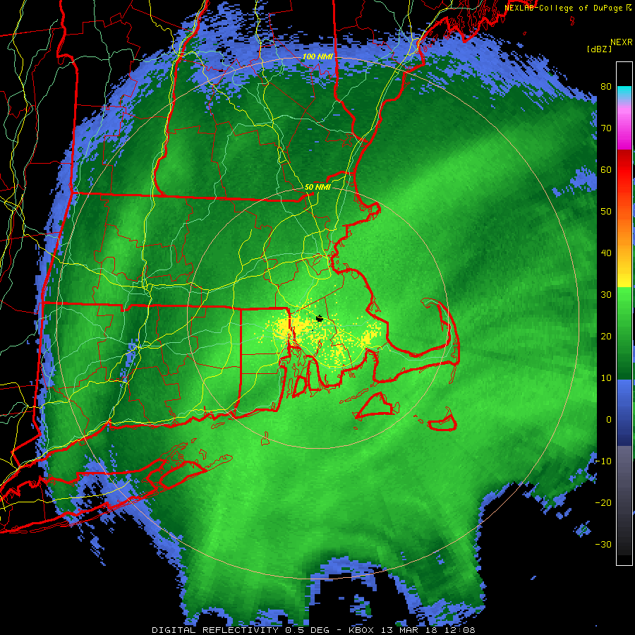
Ground truth to radar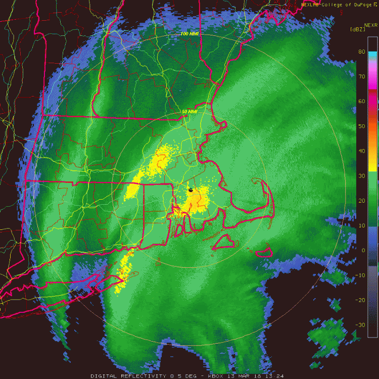
-
March 12/13/14 Blizzard/Winter Storm/WWA etc
Baroclinic Zone replied to Bostonseminole's topic in New England
Vis down to about 100-200 yds. -
March 12/13/14 Blizzard/Winter Storm/WWA etc
Baroclinic Zone replied to Bostonseminole's topic in New England
-
March 12/13/14 Blizzard/Winter Storm/WWA etc
Baroclinic Zone replied to Bostonseminole's topic in New England
It's is DUMPING! -
March 12/13/14 Blizzard/Winter Storm/WWA etc
Baroclinic Zone replied to Bostonseminole's topic in New England
fyp -
March 12/13/14 Blizzard/Winter Storm/WWA etc
Baroclinic Zone replied to Bostonseminole's topic in New England
Boom! SPECI KTAN 131224Z AUTO 02015G25KT 1/4SM +SN FG 01/00 A2945 RMK AO2 PK WND 02031/1210 P0004 T00060000 $ -
March 12/13/14 Blizzard/Winter Storm/WWA etc
Baroclinic Zone replied to Bostonseminole's topic in New England
METAR KTAN 131152Z AUTO 02011G25KT 1/4SM SN FG VV005 01/00 A2946 RMK AO2 PK WND 02033/1138 SLP976 P0014 60071 70075 T00060000 10028 20006 58019 $ -
March 12/13/14 Blizzard/Winter Storm/WWA etc
Baroclinic Zone replied to Bostonseminole's topic in New England
Looks great to me. Still showing 1.5" QPF. I've already got 0.75" down. This snow is like 7:1 mashed taters. -
March 12/13/14 Blizzard/Winter Storm/WWA etc
Baroclinic Zone replied to Bostonseminole's topic in New England
Good AM.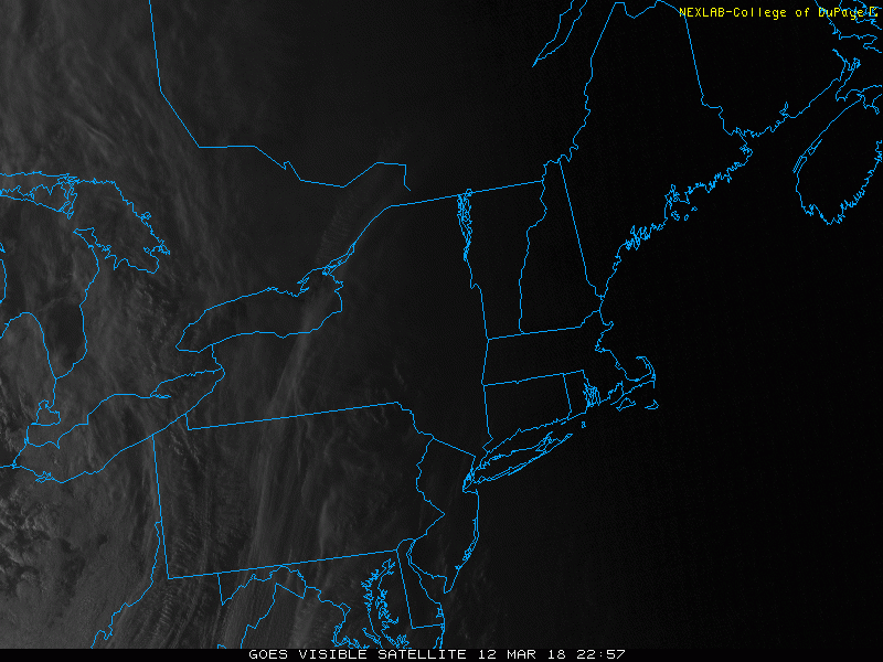
-
March 12/13/14 Blizzard/Winter Storm/WWA etc
Baroclinic Zone replied to Bostonseminole's topic in New England
It's dumping. Vis reports not doing justice. -
March 12/13/14 Blizzard/Winter Storm/WWA etc
Baroclinic Zone replied to Bostonseminole's topic in New England
Stuff has some meat to it. Beautiful band setting up shop. You can see the ML band out west as well. Watch out in between for the subsidence.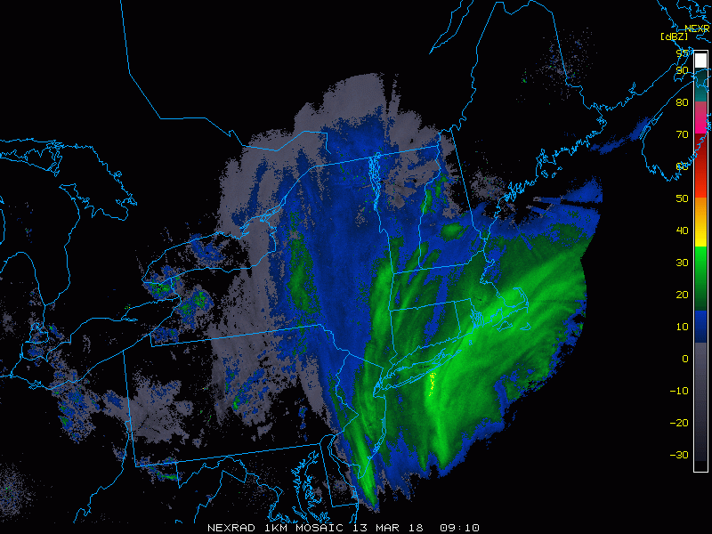
-
March 12/13/14 Blizzard/Winter Storm/WWA etc
Baroclinic Zone replied to Bostonseminole's topic in New England
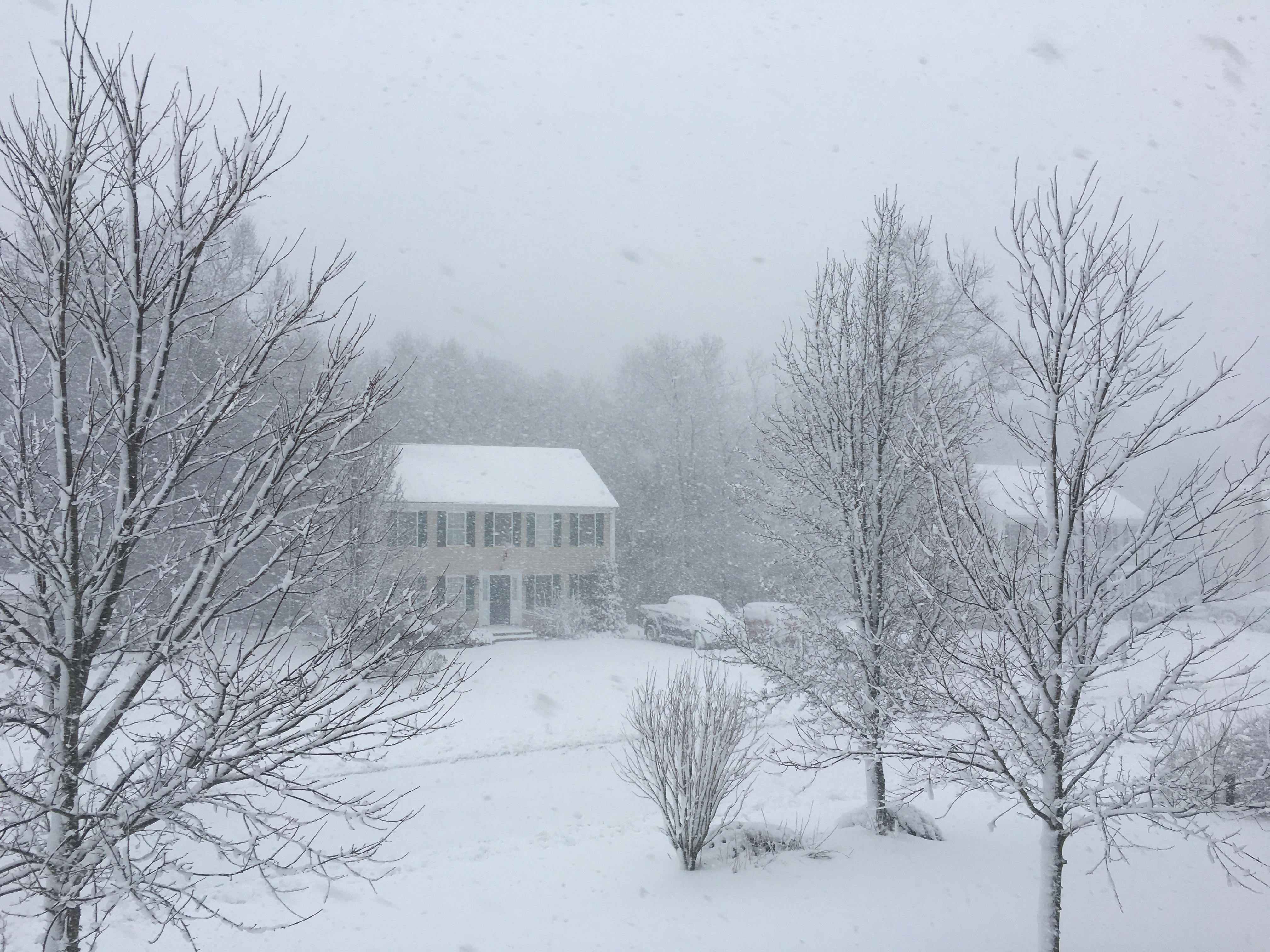
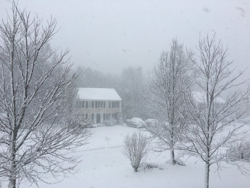
1st light pictures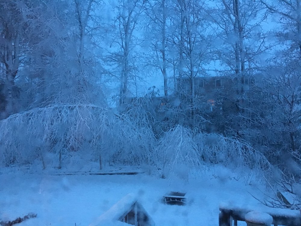
-
March 12/13/14 Blizzard/Winter Storm/WWA etc
Baroclinic Zone replied to Bostonseminole's topic in New England
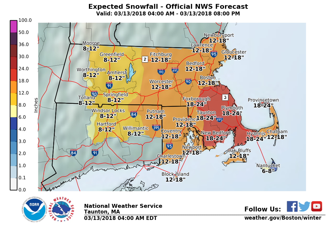
000 FXUS61 KBOX 130807 AFDBOX Area Forecast Discussion National Weather Service Taunton MA 407 AM EDT Tue Mar 13 2018 .SYNOPSIS... Low pressure off the Carolina coast rapidly deepening into a coastal storm, affecting southern New England tonight into Tuesday night. This storm will deliver significant accumulating snow, strong to damaging winds, coastal and marine impacts. Blustery and chilly weather continues Thursday and Friday followed by moderating temperatures this weekend. Dry weather probably dominates late in the week through next weekend. && .NEAR TERM /UNTIL 6 PM THIS EVENING/... * Highlights... - Moderate to heavy snow, some locations seeing upwards of a foot to perhaps two feet total accumulation - 1-3"/hr snowfall rates at times, producing visibility less than a quarter of a mile. Winds expected to yield blizzard conditions to the east coastal shoreline of MA. - Strong to damaging winds, E gusts up around 65 mph possible for far E/SE MA coast, brunt of the winds around Tuesday morning into early afternoon - Impacting the Tuesday AM commute with difficult, near impossible travel - Especially the Tuesday morning high tide, strong E onshore flow yielding around a 2 to 3+ foot surge, minor to moderate coastal flooding issues, especially ocean-facing shores, vulnerable areas impacted by earlier storm systems */ Discussion... Precipitation intensity is a critical piece determining precipitation type early this morning. Initial precipitation type early this evening was light rain. As precipitation intensity increased, seeing a rapid switch to snow across the interior. Still some rain towards nantucket early this morning. Overall, the ongoing forecast remains on track. Mainly minor tweaks to snowfall forecast. The other change was to expand the Blizzard Warning along the east coast of Massachusetts. It`s possible, further expansion could occur later this morning. Just don`t have enough confidence in the persistence requirement away from the immediate coastline. 13/00Z guidance continues to converge towards a common track of a low pressure offshore. There are still enough differences where a consensus approach is preferred. Seeing more signs in the guidance of two frontogenetical bands. The primary band still appears to be across SE MA, with another farther west across southern New England. Snow totals may need to be adjusted if this western band lingers in place longer than currently expected. * Snow... Looking at snowfall totals of 12-18 inches along the Worcester Hills and far NE CT eastward, with some higher totals around 20 inches possible. Where the mesoscale banding sets up will ultimately indicate where the highest snowfall totals will be. Closer to the I-91 corridor from Greenfield to Hartford and vicinity, thinking snowfall totals will range mainly from 8-12 inches. Blizzard Warnings issued earlier today for coastal Essex County MA, Plymouth County and the Cape and Martha`s Vineyard. Elsewhere across southern New England Winter Storm Warnings remain in effect for overnight thru Tuesday. * Winds... 925-850 East winds 3-5+ standard deviation from normal, with 925 mb winds 50-70 kts along far eastern SNE. Low level lapse rates indicate sufficient mixing, when combined with precipitation drag, to generate very gusty winds along the east coast of MA, particularly the Cape and Islands. Continuing thinking that N/NE winds will gust up to 60-65 mph for the east coastal MA shoreline, with the exception of the immediate Boston area. Blizzard Warning area includes the area where these strongest wind gusts are expected, with the exception of Nantucket. For Nantucket a switchover or mix with rain should keep this area from hitting blizzard criteria. Hence a High Wind Warning has been issued for Nantucket. Again, the brunt of the winds will be this morning into early this afternoon. Have gone with snow/liquid ratios comparable to previous forecast, which is a model blend. Expecting a mainly dry/fluffy snow for much of the interior. Plymouth County and the Cape and islands are at greatest risk for a heavy/wet snow plus strong winds, yielding some potential tree damage and power issues. && -
Still too dark to tell, but either we have huge flakes or large aggregates. They're like 1/2" or greater in size.
-
March 12/13/14 Blizzard/Winter Storm/WWA etc
Baroclinic Zone replied to Bostonseminole's topic in New England
Eyeballing 2" now, so looks like this band is 2"/hr type stuff. -
March 12/13/14 Blizzard/Winter Storm/WWA etc
Baroclinic Zone replied to Bostonseminole's topic in New England

-
March 12/13/14 Blizzard/Winter Storm/WWA etc
Baroclinic Zone replied to Bostonseminole's topic in New England
METAR KTAN 130952Z AUTO 03010G20KT 1/2SM SN FG VV005 01/00 A2951 RMK AO2 SLP994 P0014 T00110000 -
March 12/13/14 Blizzard/Winter Storm/WWA etc
Baroclinic Zone replied to Bostonseminole's topic in New England
Yeah, moderate bordering on heavy now. Caking everything. Looks like it started just after midnight as rain for about an hour. Ramping up now though. We should see 1-2"+ rates developing now. -
March 12/13/14 Blizzard/Winter Storm/WWA etc
Baroclinic Zone replied to Bostonseminole's topic in New England
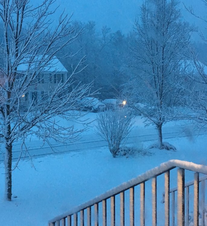
1st inch down looking outside now. -
I'm already looking at close to 24". Maybe I go James and see 3'?
-
Rain was so brief on the run, you'd lose next to nothing.
-
NAM verbatim is a top 2 storm for my location since I've been here. Still don't believe it will occur.