

Dark Star
-
Posts
786 -
Joined
-
Last visited
Content Type
Profiles
Blogs
Forums
American Weather
Media Demo
Store
Gallery
Posts posted by Dark Star
-
-
Thought I heard some sleet mix in around 8:15 AM as a heavier line went through Linden NJ?
-
Flurries here in Linden NJ at 8:30 AM. Thought I saw a flake in Garwood at 6 :15 AM, but figured it was just wishful thinking.
-
1 hour ago, North and West said:
I feel like our running theme the past few years is who can call out Winter's Over the quickest. I feel like someone just said we're running out of days in December... it's December 7th. Enjoy the journey.
When we are at January 15th, and there is no tangible signs of colder weather progged, you can pretty much kiss winter goodbye. Otherwise, by the time a cool down would start, you have very little time left, unless a complete long term pattern change occurs.
-
 2
2
-
 1
1
-
 1
1
-
-
2 hours ago, Brian5671 said:
Mid January's usually the time-if the pattern doesn't show by then, it's not likely to.
Exactly!
-
2
-
-
1 hour ago, doncat said:
Well the original two storm and heavier precip totals idea worked out well.
I would have guessed the second storm would not have affected NYC Metro area due to the principle of the conservation of energy. However, at times, the atmosphere "does what it wants".
Just a few wet flakes were struggling to work in here in Garwood, if you imagined really hard.
-
18 hours ago, romba said:
https://www.washingtonpost.com/weather/2020/10/28/hurricane-zeta-track-louisiana/
Flight-level winds during a midafternoon Hurricane Hunter reconnaissance flight hit 138 mph; extrapolated down to the surface, that would suggest 101 mph winds at the surface. A dropsonde, or probe, released shortly after found a surface wind of 115 mph in the southern eyewall. That would indicate Zeta is near or at major hurricane status.
The National Hurricane Center did not upgrade Zeta in their most recent advisory, raising the potential that the measurement was suspect. Regardless, Zeta continues to increase in strength and could approach Category 3 intensity as it makes landfall.
NHC: 115 mph winds? Naaahhh, we toss
Okay, so riddle me this. I was watching TWC right before landfall of the mainland. The coast was already in the eyewall. Gusts were only around 50 mph on the beach. I checked the New Orleans Int'l Airport and they registered one 68 mph gust with sustained winds only at 40 mph, at any one point. How can this be with winds around 110 mph? Are we really classifying the intensity of hurricanes correctly? As I found out, the storm surge is probably the most destructive part, but isn't the the impact at the surface the area to classify?
-
1 hour ago, Will - Rutgers said:
absolutely premium weather outside. not quite indian summer but close. bright blue sky, warm sun and breeze. this is a long stretch of mostly uninterrupted great weather a la SoCal. week after week of gorgeousness. i almost wish i played golf.
Almost...
-
57 minutes ago, Allsnow said:
.27. Has the back of the summer heat finally broken? Looks normal to below normal going forward
Sacrus' forecast would beg to differ, but I hope no more hot days...
-
1
-
-
34 minutes ago, gravitylover said:
Yes. The land is very warm and in many of the areas it's going to run through also quite wet from the last few weeks of heavy rains. There should be plenty of heat energy to be gained from the warm land and it will be wrapping in lots of moisture off a very warm ocean just offshore. It's going to be an interesting one to watch.
26 minutes ago, donsutherland1 said:Morning thoughts...
Isaias remains on track to pass through the region later tomorrow into tomorrow night. The guidance has shifted a little to the west overnight, but the general idea of passage over the Chesapeake Bay across New Jersey and then into southern/central New York State still remains reasonable.
With some interaction with a trough, the potential exists for a period of baroclinic deepening. This deepening will likely help the fast-moving system retain a measure of its strength as it passes through the region.
Rainfall amounts from New York City eastward will likely need to be reduced, based both on Isaias' track and somewhat faster forward motion than had been forecast yesterday. An area of 3"-6" rain still looks reasonable, especially for cities such as Allentown, Baltimore, Philadelphia and Washington, DC.
In its wake, the western Atlantic ridge that helped steer it along its inland course will likely result in a rebound of temperatures. The predominantly warmer than normal pattern will continue. No significant cool shots appear likely through at least the first half of August.
As a closed low opens up, much energy is released. This energy many times is translated to speed of movement of the system. I would think it would be difficult to project if this "opening of the closed low" would intensify the system for both precipitation amounts and wind. I always feel wind is over forecasted.
-
2
-
-
2 hours ago, Rtd208 said:
Tropical Storm Warning in effect here. 40-50 mph winds w/gusts up to 70 mph expected Tuesday afternoon and evening.
I'll believe it when I see it. Looks to be a soaker. I wonder if any sport betting sites have the odds for the wind field? I'd like a piece of that action...
-
2
-
 3
3
-
1
-
-
2 hours ago, lee59 said:
I think Laguardia and Newark temperatures during heat waves are the highest around, especially night temperatures. They are open concrete and tarmac and Newark surrounded by chemical and industrial like plants. Kennedy not as bad because of the ocean and smaller airports are not surrounded by as much concrete.
Are there any chemical plants left in northeast Jersey? There are no major industrial manufacturers left in Linden NJ, just a few relatively clean power producing plants, except fro the Bayway refinery. Newark is certainly paved over pretty good, like you said.
-
1
-
-
1 hour ago, forkyfork said:
87 in springfield
86.5 degrees and humid in Garwood NJ, yech!
-
34 minutes ago, psv88 said:
This weather is horrible. Cold outside right now. Brutal
It was beautiful today in Garwood NJ (central Union County). Close to one of the ten best, in my opinion. I guess you'll have your nice days in the summer, when the rest of us are all sweltering?
-
3
-
-
35 degrees in Garwood, with ice on my patio table!
-
DEFINE YOUR WINTER EXPECTATIONS
As I read through many of the differences and arguments in these threads, it seems there are as many definitions of winter as there are people posting. While I prefer cold and snowy, you can’t expect much more than “normal”. Please enter your definition of winter in the format below:
Type: Romanticist (Note: Type should reflect if you are a “snow hater”, “snow lover”, “realist”, “rationalist”, “pessimist”, etc.)
Temperature: Near normal – enough for the local ponds to freeze for at least four weeks
Snow: Normal, with conditions that don’t allow every snowfall to melt within 2-3 days; sustained
snow cover.
Duration: Mid December through mid March
Comments: If winter conditions have not materialized (cold, snow) by mid January, and most long range models don’t see any cold air in place for the next 2-3 weeks, I usually write off winter. Yes, we could still receive a snowfall or two, and there “can” be an abrupt pattern change, but without winter conditions by mid February, the “Romanticist’s” winter never really was.
-
1.8" in Garwood NJ. Mostly sleet now...
-
Already a dusting here (central Union County, NJ). Surprised it started so early, I thought the dry air would eat away at the snow.
-
1
-
-
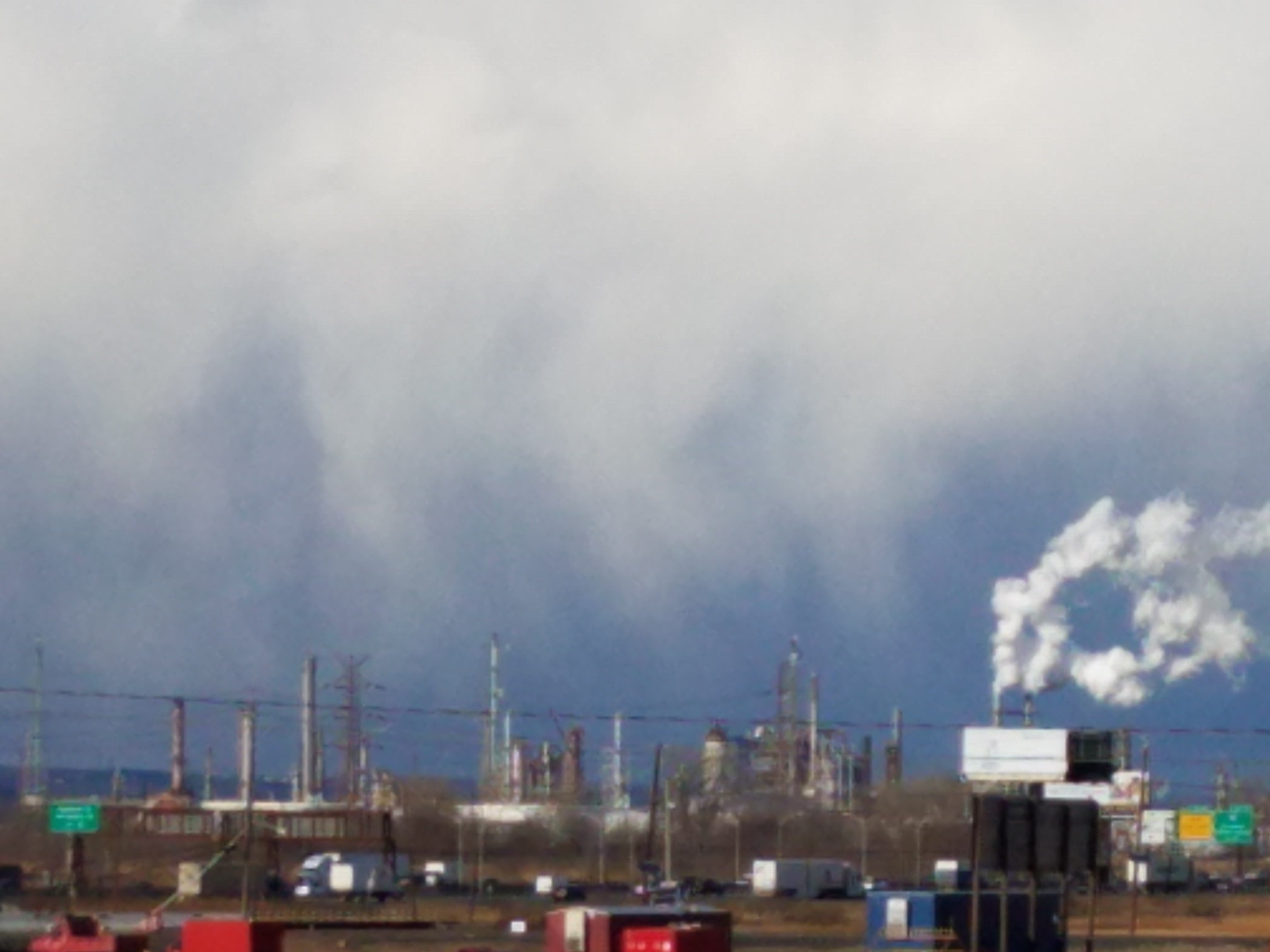
Snow showers approaching the Bayway Refinery in Linden from the west?

-
1
-
-
Interesting at 7:30PM the NEXRAD radar was showing the precipitation shield "leap-frog" northeast NJ about 50-100 miles northeast. This would seem that there was an energy transfer just as the storm approached our area? Quite a tease, as we watched the precipitation move in a uniform manner from West Virginia, and then all of a sudden, skipped over our area. Then again, precipitation doesn't actually act (or move) as a vehicle driving along a highway. Rather, the low pressure system is continually propagating itself, as if the low pressure system is actually continually building the road out ahead of the vehicle. -
15 minutes ago, WestBabylonWeather said:
I don't understand these elementary posts
feb and march ? lol winter started like 16 days ago...
Meteorological Winter began December 01st and ends February 28th. The general consensus is that most of January seems lost to receiving much snow, barring a significant change in the persistent Pacific jet and its influence on the overall pattern. That leaves February...
-
4
-
1
-
-
Flurries invaded Linden NJ around noontime.
-
1
-
-
Had a slight amount of sleet mixed in with drizzle yesterday afternoon around 2 PM. After that, it was all plain rain in central Union county NJ.
-
1 hour ago, bluewave said:
This is certainly the most extreme snowfall gradient between Albany and NYC for early December.
Time Series Summary for Albany Area, NY (ThreadEx)
Click column heading to sort ascending, click again to sort descending.RankEnding DateTotal Snowfall Dec 1 to Dec 11NYC Snowfall 1 2019-12-11 24.5 1.8 2 2003-12-11 19.2 14.0 3 1977-12-11 13.9 T 4 1926-12-11 12.7 9.4 5 2014-12-11 11.7 1.0 thanks for the analysis!
-
1
-
-
27 minutes ago, gravitylover said:
Was it supposed to be flurrying this morning?
Flurrying here also in Linden NJ (Tremley Pt.). There was a slight chance of snow showers predicted for last night (but not by the NWS).
-
1
-
Wet snow Monday Dec 14, 2020?
in New York City Metro
Posted
Melted snowflake thought to be detected in Linden around 12:45 PM. A little mixed precip looking to occur at 2PM.