
Jake Wx
-
Posts
193 -
Joined
-
Last visited
Content Type
Profiles
Blogs
Forums
American Weather
Media Demo
Store
Gallery
Everything posted by Jake Wx
-
 643 ACUS11 KWNS 161404 SWOMCD SPC MCD 161403 MDZ000-VAZ000-DCZ000-WVZ000-161630- Mesoscale Discussion 0269 NWS Storm Prediction Center Norman OK 0903 AM CDT Mon Mar 16 2026 Areas affected...Central Virginia into Maryland Concerning...Severe potential...Watch possible Valid 161403Z - 161630Z Probability of Watch Issuance...60 percent SUMMARY...The severe weather threat will increase through the morning. DISCUSSION...Low-level moisture advection and cooling mid-level temperatures will continue to destabilize Virginia into Maryland this morning. Limited capping evident on the RNK and IAD 12Z RAOBs has resulted in scattered warm sector development ahead of the primary squall line. These messy-mode storms will continue to limit heating, but may have some severe threat as above mentioned destabilization continues within a strong wind profile. Low-level shear, already strong at 12Z, will continue to strengthen through the day. Therefore, any stronger/deeper updrafts could have some tornado threat late this morning into the early afternoon. The primary threat still appears to be the wind/embedded tornado threat later this afternoon as the secondary mid-level jet streak ejects east of the Appalachians and wind fields strengthen rapidly. However, even this threat is contingent on the evolution of these morning storms. A tornado watch will likely be needed at some point, potentially by later this morning if the morning storms start to show more organization/structure. ..Bentley/Thompson.. 03/16/2026 ATTN...WFO...PHI...AKQ...LWX...RNK...
- 1,093 replies
-
- 1
-

-
- severe
- thunderstorms
- (and 1 more)
-
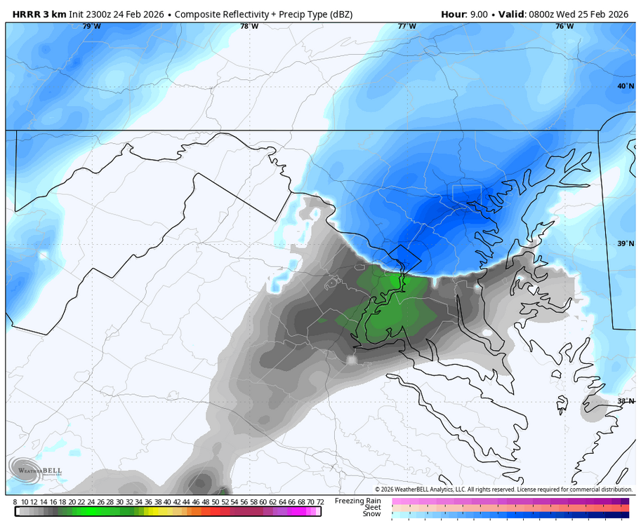
Already a STW up to Culpeper
-
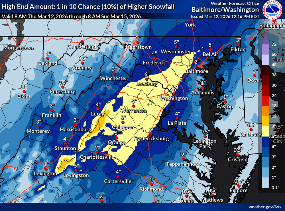
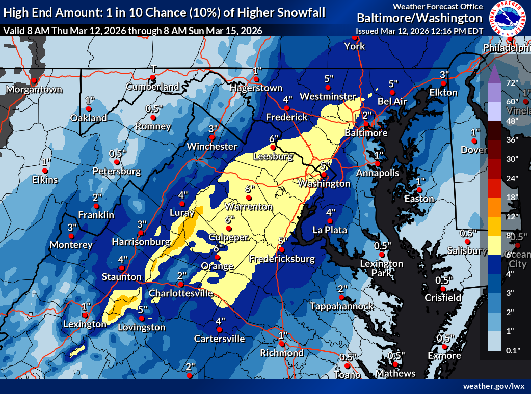
nws highend, what they seeing?
-
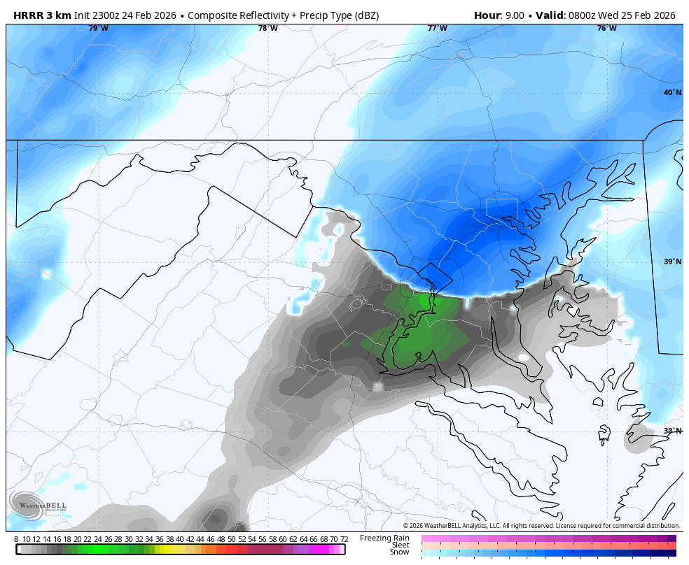
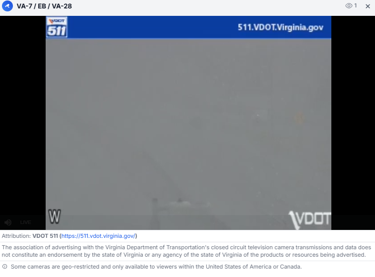
complete whiteout west of ashburn
-
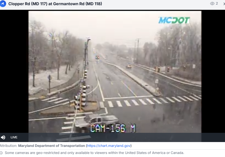
germantown...
-
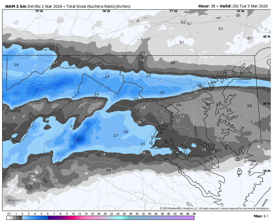
radar looks like its filling in the east side
-
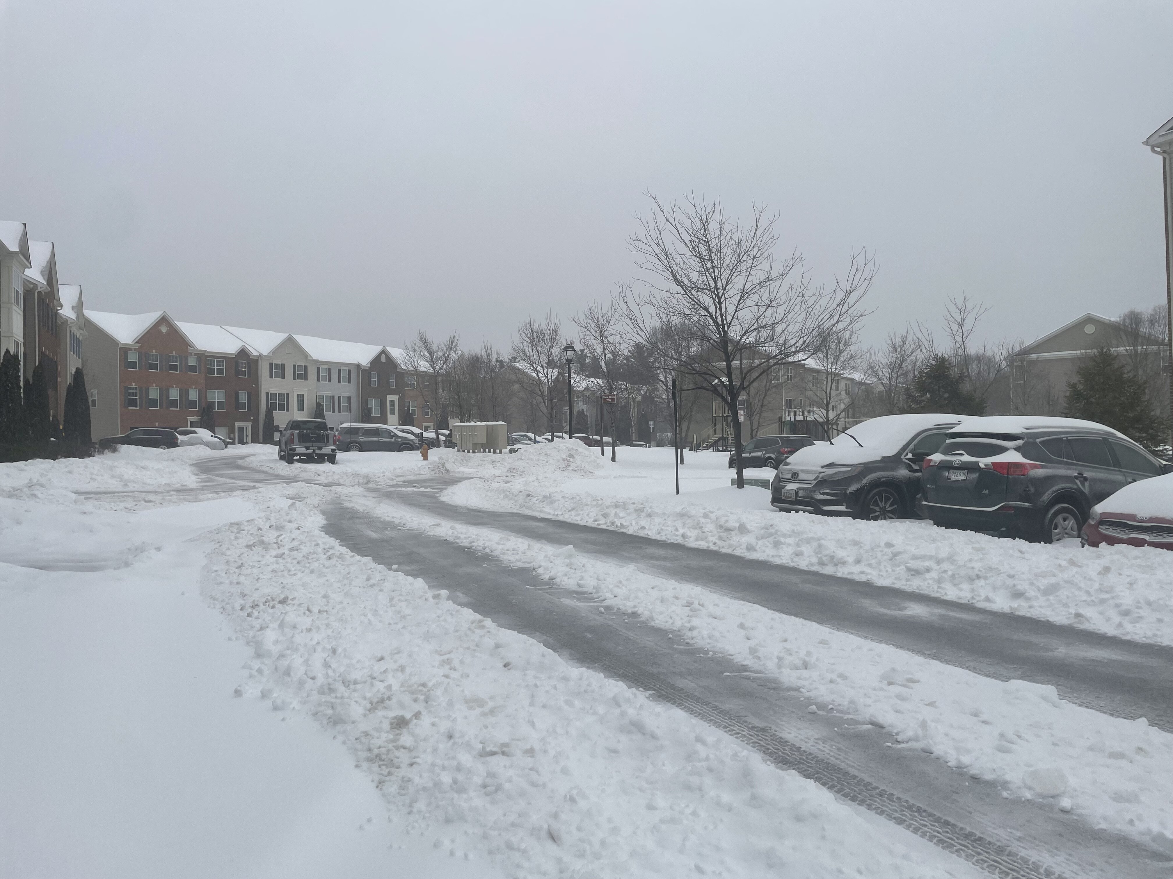
Steady snow here in Columbia, temp is 35.2
-
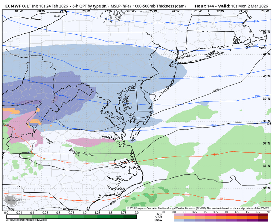
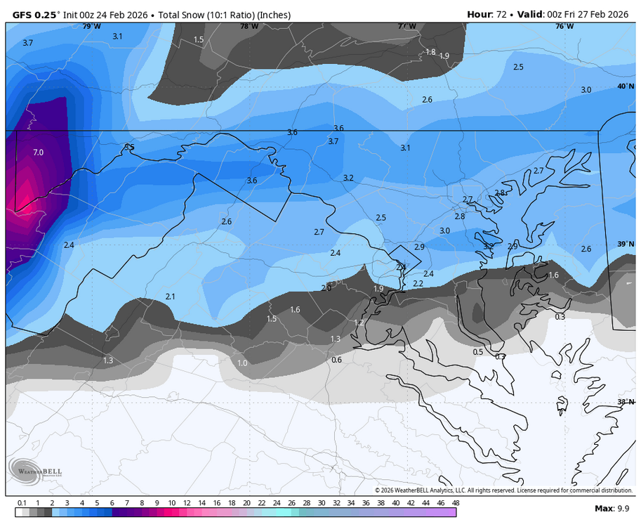
Outta gas and Outta Time: Early March Winter Storm finale
Jake Wx replied to Ji's topic in Mid Atlantic
radar def looks good out west with a eastern movement -
Outta gas and Outta Time: Early March Winter Storm finale
Jake Wx replied to Ji's topic in Mid Atlantic
jeez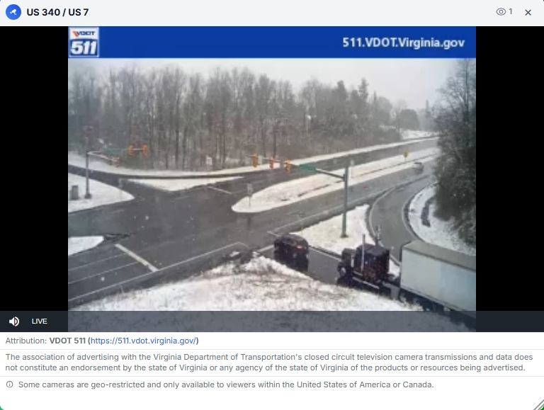
-
Outta gas and Outta Time: Early March Winter Storm finale
Jake Wx replied to Ji's topic in Mid Atlantic
-
Outta gas and Outta Time: Early March Winter Storm finale
Jake Wx replied to Ji's topic in Mid Atlantic
this would be perfect
-
Outta gas and Outta Time: Early March Winter Storm finale
Jake Wx replied to Ji's topic in Mid Atlantic
euro!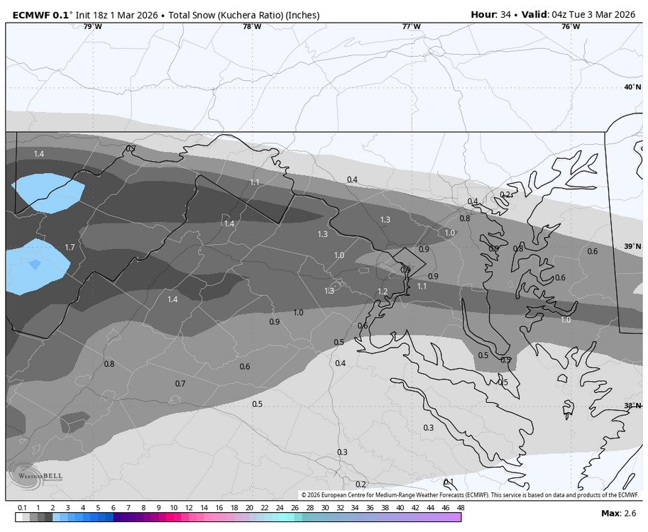
-
Outta gas and Outta Time: Early March Winter Storm finale
Jake Wx replied to Ji's topic in Mid Atlantic
suppression in march, man i hate this place -
Outta gas and Outta Time: Early March Winter Storm finale
Jake Wx replied to Ji's topic in Mid Atlantic
euro is practically the same run but jus les precip -
Outta gas and Outta Time: Early March Winter Storm finale
Jake Wx replied to Ji's topic in Mid Atlantic
euro ai goes north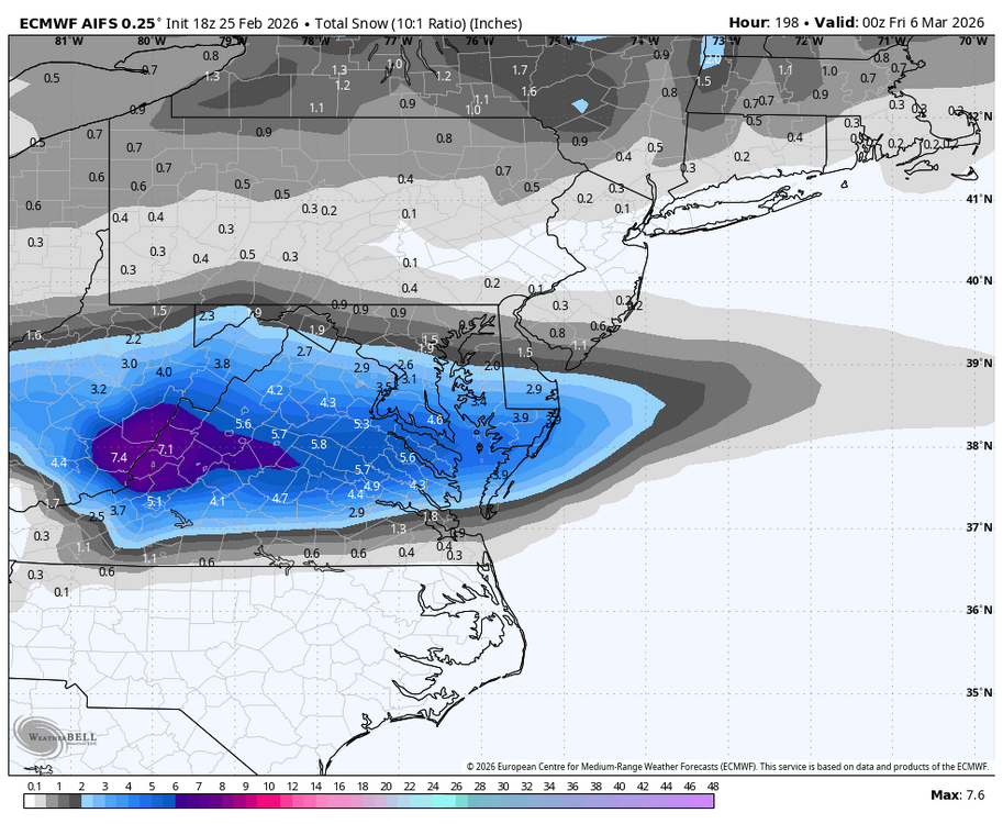
-
Outta gas and Outta Time: Early March Winter Storm finale
Jake Wx replied to Ji's topic in Mid Atlantic
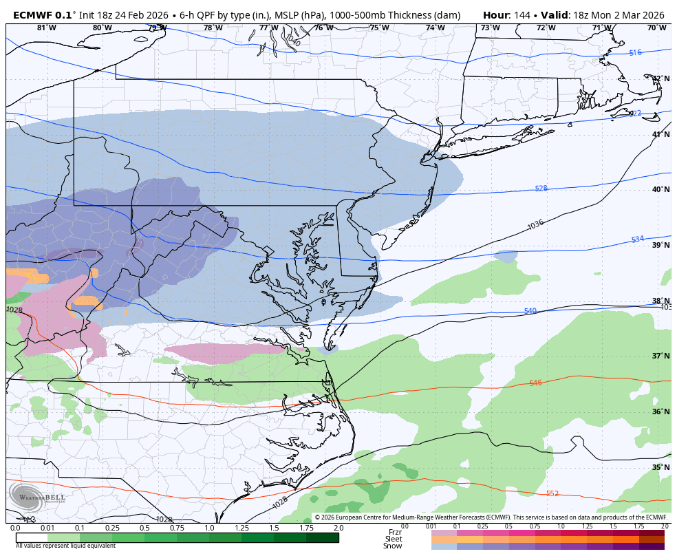
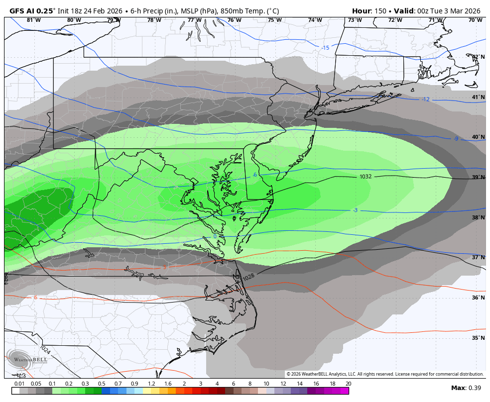
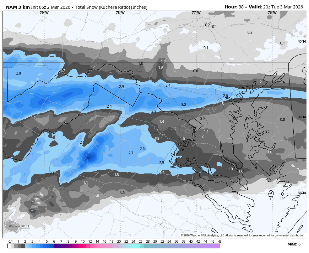
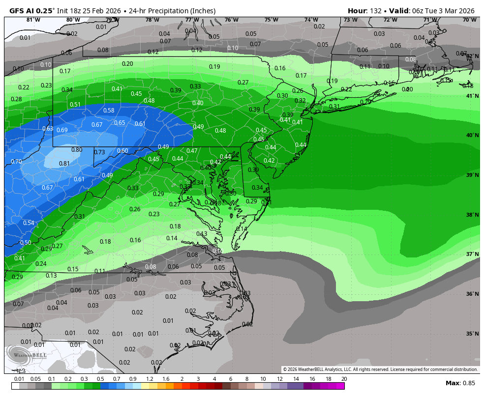
gfs ai precip, 3-5 most likely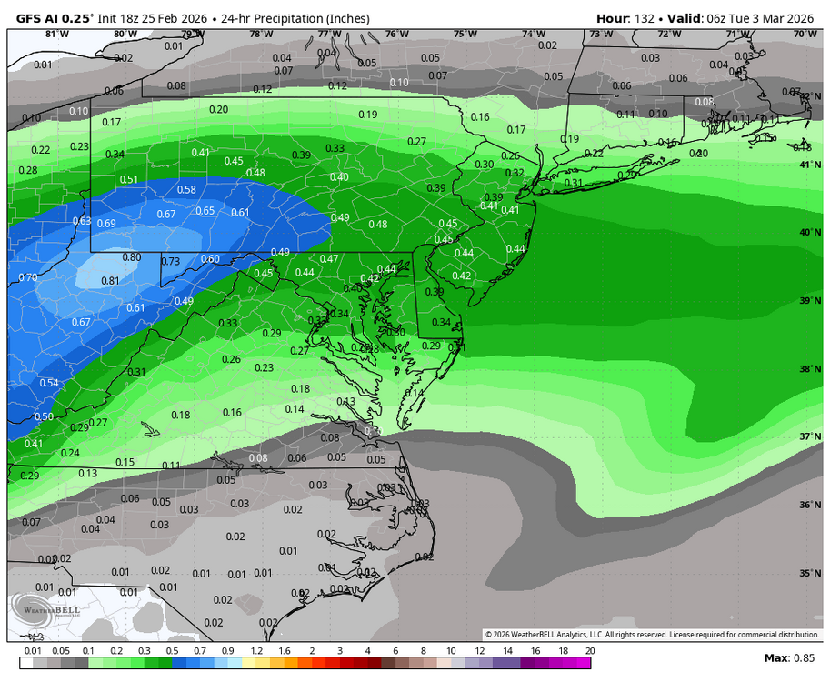
-
Outta gas and Outta Time: Early March Winter Storm finale
Jake Wx replied to Ji's topic in Mid Atlantic
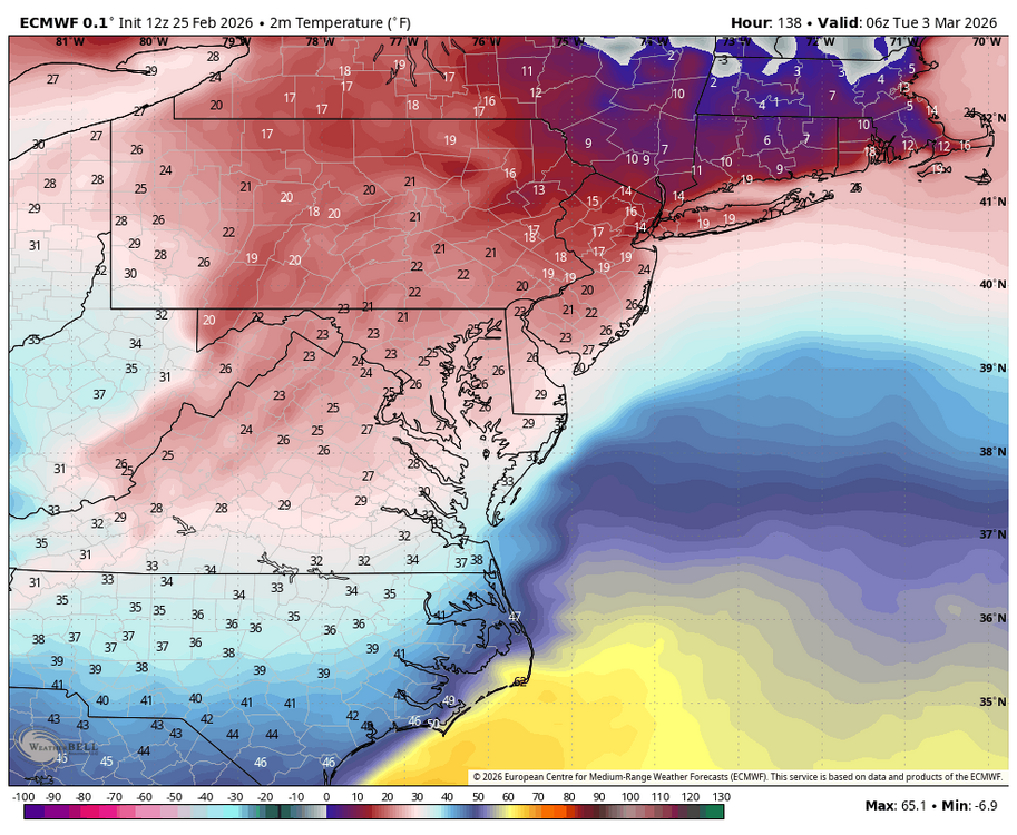
Wow euro with a overnight storm with temps in the mid 20s.thumb.png.87e1113ef47338d7adc7f48475c01114.png)
-
Outta gas and Outta Time: Early March Winter Storm finale
Jake Wx replied to Ji's topic in Mid Atlantic
Euro ai ens more north of op
-
maybe some over night snow showers ??
-
Outta gas and Outta Time: Early March Winter Storm finale
Jake Wx replied to Ji's topic in Mid Atlantic
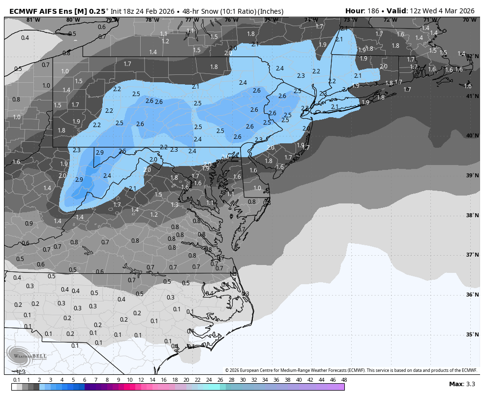
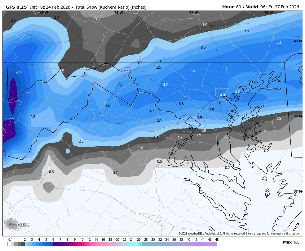
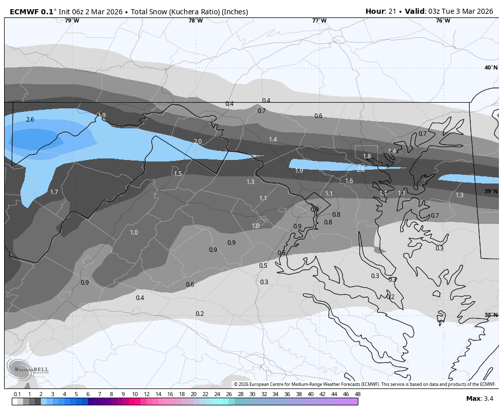
looks like it would have been 3-6 -
Outta gas and Outta Time: Early March Winter Storm finale
Jake Wx replied to Ji's topic in Mid Atlantic
sheesh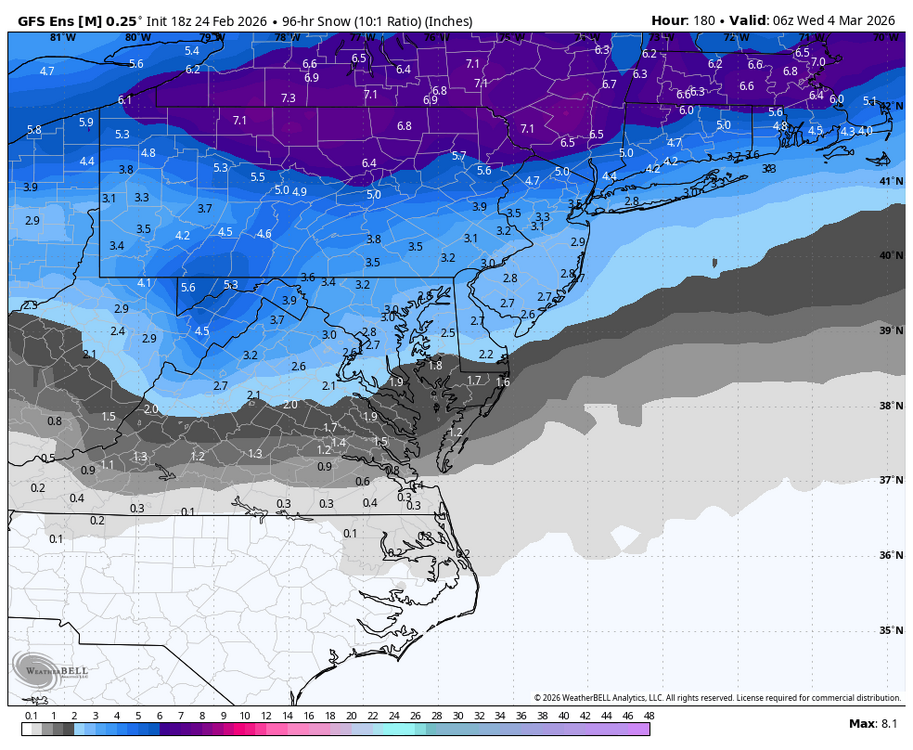
-
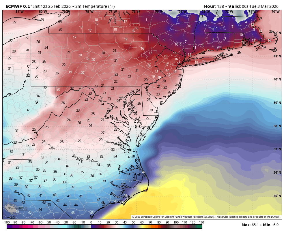
this for sure would have been something, temps are cold too
-
ai gfs with a pure snow event...

-

-


.png.a354fc485dd20edb0c0a97e9c0bad7d4.png)