

WxKnurd
-
Posts
1,428 -
Joined
-
Last visited
Content Type
Profiles
Blogs
Forums
American Weather
Media Demo
Store
Gallery
Posts posted by WxKnurd
-
-
2 minutes ago, Met1985 said:
Yep I did! Would have been great to have met you up there. It is absolutely beautiful.
Hate I couldn’t join but I figured work wouldn’t like me getting stuck or wrecking the truck if the worst happened lol. I drove up that way yesterday evening but turned around at Hurricane Gap, tried to get an idea of how far the drive from the new place is. Next storm I plan on doing some driving around and hiking as long as I’m home. A good old fashioned NWF event would suit me just fine, especially to compare my new place to the old one for those events. Neighbor was telling me last year they had a 36 hr duration one that dropped 12+. I think I know which one he was talking about but I also don’t remember those totals unless you got up on the state line and above 4k’. Of course he’s also on the next mountaintop over up around 4100’ so maybe his place did break the foot mark.
-
 1
1
-
-
15 minutes ago, Met1985 said:
Finally
Make the trip up to Max Patch? Backside light snow/flurries were starting up when I headed out, at least will keep things looking frosted over.
-
1
-
-
Congrats guys, y’all cashed in with that band. Hope y’all can reel in the possible late week storm. Maybe I can hitch a Miller A with me on my way back from Oklahoma in a week.
-
1
-
-
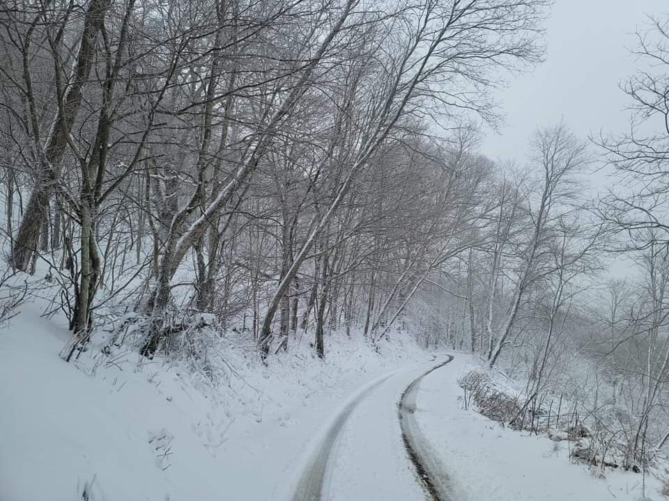
Measurements vary on surface and even from spot to spot. Wind blowing the snow won’t help with accurate measurements anyway. 1-2” on gravel road, 3.5-4” on my one flat, grass spot that doesn’t have any limbs over it, 2-3” on the deck, 3.25” on the truck bed cover. If I had to guess, I would figure doing an official measurement every hour on a snowboard would have probably resulted in maybe close to 4”. Light snow as the last bit swings through.
Overall forecast on switchover was correct for my place, I’m guessing precipitation amounts AFTER changeover ended up busting low down this way. Taking a wild guess, that along with overall rates being lower than modeled was the limiting factor here in Haywood (and points SW) outside of right along the state line .
-
4
-
-
18 minutes ago, SnowNiner said:
Got about 3 inches on waterrock knob. Looks like radar is done, got a bit dry slotted back of the low. A bit disappointing but nice to see snow on my trip.
Yea that good band setup too far to the north, wouldn’t be surprised to see that the ULL traversed a touch more north than modeled. Thought for sure you’d end up with 6” up there.
-
1
-
-
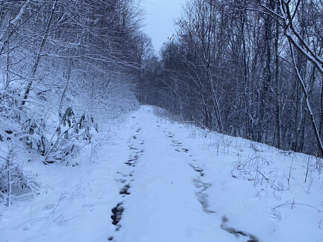
Time to take a jebwalk and take some measurements. A balmy 25 degrees out there.
-
4
-
-
When these gusts hit it’s a bit crazy, strongest yet. I think I can hit 6” here if I can get some of those heavier returns to rotate in from TN, I bet my ol’ bugaboo of dendrite size struck again from what I’ve seen since 4 am. Hard to pile up above 6” with lackluster flakeage for lack of a better term. One of these days I’ll get some quarter-sized flakes.
-
4
-
-
3 minutes ago, Buckethead said:
Picked up close to 3.5" in the past 45 minutes.

Sent from my SM-G970U using Tapatalk
Killing it up there like I figured you would, think I’m closing in on 4 here just eyeballing it.
-
2
-
-
Just a bit off on my estimation, an easy inch on the deck. Everything is caked. Hard to tell what flake size is with all the blowing snow but mostly look like maybe some dime size at best currently.
-
3
-
-
Looks like a half inch on the front deck railing, hard to tell with no light currently out there. Can tell the ground is covered at the back of the house looking out the kitchen window. All uphill from here now.
-
1
-
-
34.5 when I woke up at 4, 30.9 now. Temps continue to crash.
-
4
-
-
Wind and rain woke me up at 1:30, it was 42. Alarm just woke me up again and it’s 34 with wind whipped snow, maybe some sleet mixed in.
-
2
-
 1
1
-
-
5 minutes ago, SnowNiner said:
Visiting up in Jackson County for this storm, 5200 feet near waterrock knob. Not familiar with the mountain patterns up here. Worried a bit on the speed of the system, as it's out of here early tomorrow morning. With the need to drop the Temps, cool the ground, no real nw flow event to speak of, I don't see how my back yard gets much higher than 4-5 inches. Don't see very high amounts up here other than the border peaks but could be wrong I guess.
You are in a great spot. 6”+ for sure like Franklin said. I used to live at the base of the mountain, you should see some flow snow on the backside as well as the system exits. I’m guessing you are staying somewhere off Greenspire?
-
2
-
1
-
-
I’ll be the bullish Haywood County one and say 4-6” will be the minimum in the county even taking into account melting early on, leaning closer to the 6” mark at that when looking at the totality of the models and then nowcasting with current conditions and having our system come together to the west during the day. Of course it’s still a tricky forecast and mets from the NWS to local guys like Ward and Local Yokel are usually in a no win situation with the public with setups like this (They either go conservative and things are not that in the least or it goes the other way around and people give them grief about honking the horn on a nothing burger).
Temps never got up to was forecast I don’t believe, at least Waynesville and points North. Cloudy all day and struggled to hit 53 here for a daytime high at the house after high of 60-61 at midnight. Already dropping down below 49. All that helps IMO in this scenario coming on the heels of the torch fest we were in, both in setting the stage before the storm as well as helping the high soil temps for early January here. Much better than sunny and 60 would have been. Either way, I’ll be up early to take it all in no matter what. Hopefully it’s ripping at daybreak for a jebwalk around my property.
-
3
-
-
2 minutes ago, Met1985 said:
Yep we pretty much are on the same playing grounds.
I figured we are close to one another so our observations should match up pretty close. I’m glad I could bring some mojo my first couple days back up here lol.
-
1
-
 1
1
-
-
@Buckethead looks to get smoked. My point and click is the same as Met, 3-5” tonight and 1-3” tomorrow.
-
2
-
-
1 minute ago, Met1985 said:
Ill be making a trip up that way.
If I hadn’t had to switch out trucks to get my work truck up here so I could leave tomorrow I’d meet up with you there. That Dec 2020 NWFS event I talked to a couple hiking the AT that had come from there and told me about waist deep drifts. Alas I’ll be headed west to Oklahoma at some point in the afternoon.
-
1
-
-
1 minute ago, Maggie Ace said:
It hasn't been mentioned, but I will not be surprised to see near blizzard conditions for some areas early tomorrow morning. Wind gusts to 40 are not out of the equation.
Max Patch for sure would be a prime candidate for that.
-
3
-
-
1 hour ago, Met1985 said:
I know we are all stoked about the snow but who got blasted this morning by them storms?
Woke me up a little before 3. Fair amount of lightning and weather station says I ended up with 3/4” of rain. It was coming down hard for about 5-10 minutes at one point.
-
1
-
-
7 hours ago, Met1985 said:
Yeah hopefully this sticks. We will see though. Im still very pessimistic.
I like where you and I sit for Sunday into Monday, I think we see a couple inches. would be a nice house warming gift from Mother Nature before I head out to work in Tulsa for a week.
-
4
-
-
Those are some good bulls, especially the one. I am officially a Haywood County homeowner again, now to get the weather station setup so I can provide reports from 3800’ on a mountaintop in the Newfound Mountains.
-
3
-
-
Merry Christmas!
-
4
-
-
Good to see some snow reports guys. Hopefully I can bring a pattern change with me when I close on the new house next Tuesday.
-
2
-
-
Nothing in Hickory, buddy said it was sleeting pretty good in Charlotte earlier.
-
2
-
2021-2022 Fall/Winter Mountains Thread
in Southeastern States
Posted
Looking at my weather station history the sun must have come out over my house after noon because the temp shot up from 26 to 34, back down to 30 now. Figure a snow shower moved in overhead. Thursday into Friday looks interesting, SW folks not up against the state line need that energy to dig a little bit more for more than dusting/inch.