Nomz
-
Posts
639 -
Joined
-
Last visited
Content Type
Profiles
Blogs
Forums
American Weather
Media Demo
Store
Gallery
Everything posted by Nomz
-
Could have a buzzer-beating band entering Baltimore down to Annapolis right now. Northeast edge of Baltimore County and just coming ashore near Annapolis. I assume it's cold enough to stick everywhere.
-
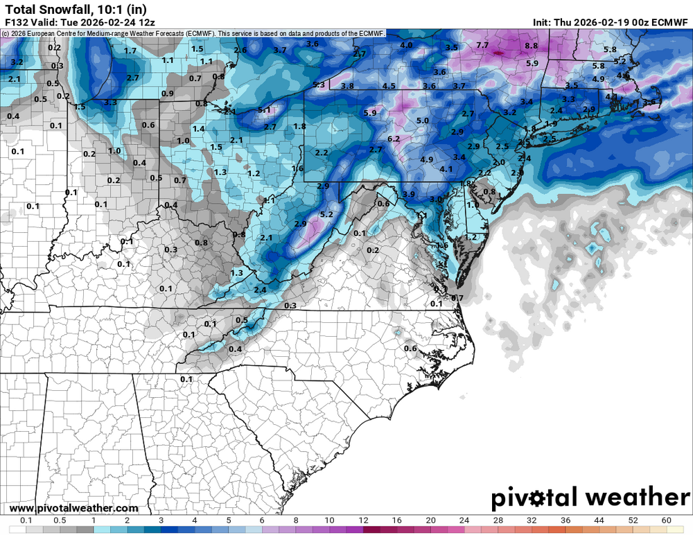
Just checked the 00z HRRR; SNE busts 6-12" low. Would make me feel a little better.
-
Some honest to god supercells in there
-
I am fully prepared for the Rosslyn 4” report while Georgetown gets .5”
-
Norlun band definitely creeping east and maybe a little south. Astonishingly narrow, like an outflow boundary. Maybe half the width of DC itself.
-
Definitely saving my bacon... forecasted 2-6" and it should get me to the low end, at least.
-
DCA still reporting a trace
-
Agree with both of you that it isn't really either. Don't know enough about 500mb of either to say which way this one went. TBF not really sure why we have the Miller B or Miller A buckets when most storms aren't gonna fit cleanly in one or another.
-
The closed surface contours came out of the Gulf Coast and really deepened off the SC coast. Miller Bs have a low cross Kentucky or Tennessee and don't really explosively deepen as much as this one will. https://www.spc.noaa.gov/exper/ma_archive/action5.php?BASICPARAM=pmsl.gif&STARTYEAR=2026&STARTMONTH=02&STARTDAY=23&STARTTIME=00&INC=-48
-
Lesson learned that marginal temps suck IMBY lol. Barely any snow on top of like an inch of slush here in Georgetown.

-
Definitely not a Miller B. Never had a low or associated precip over the Midwest into Pennsylvania. Not every snow that fringes us is Miller B. I'd argue it was more of a Miller A, but not all winter storms are one of the two, and it's not a really binary classification.

-
UHI, altitude, valley, surfaces, river; basically everything possible to minimize snow accumulation. DCA is particularly bad.
-
It had literally one run with DC getting 30, at a range where you should just be looking at trends. Just because it missed IMBY doesn't mean overall it got it down better than most. This was the euro Thursday night; pretty accurate for DC-BWI, but completely whiffed everywhere NE of BWI.
-
GFS still lead the way for this one though... just missed the bullseye by like 150 miles 4 days out or whatever
-
Probably. The problem is they are either not available or paywalled for most models.
-
Even though it's pure snow here, it's "raining" under trees because precip from earlier is melting and falling again as water.
-
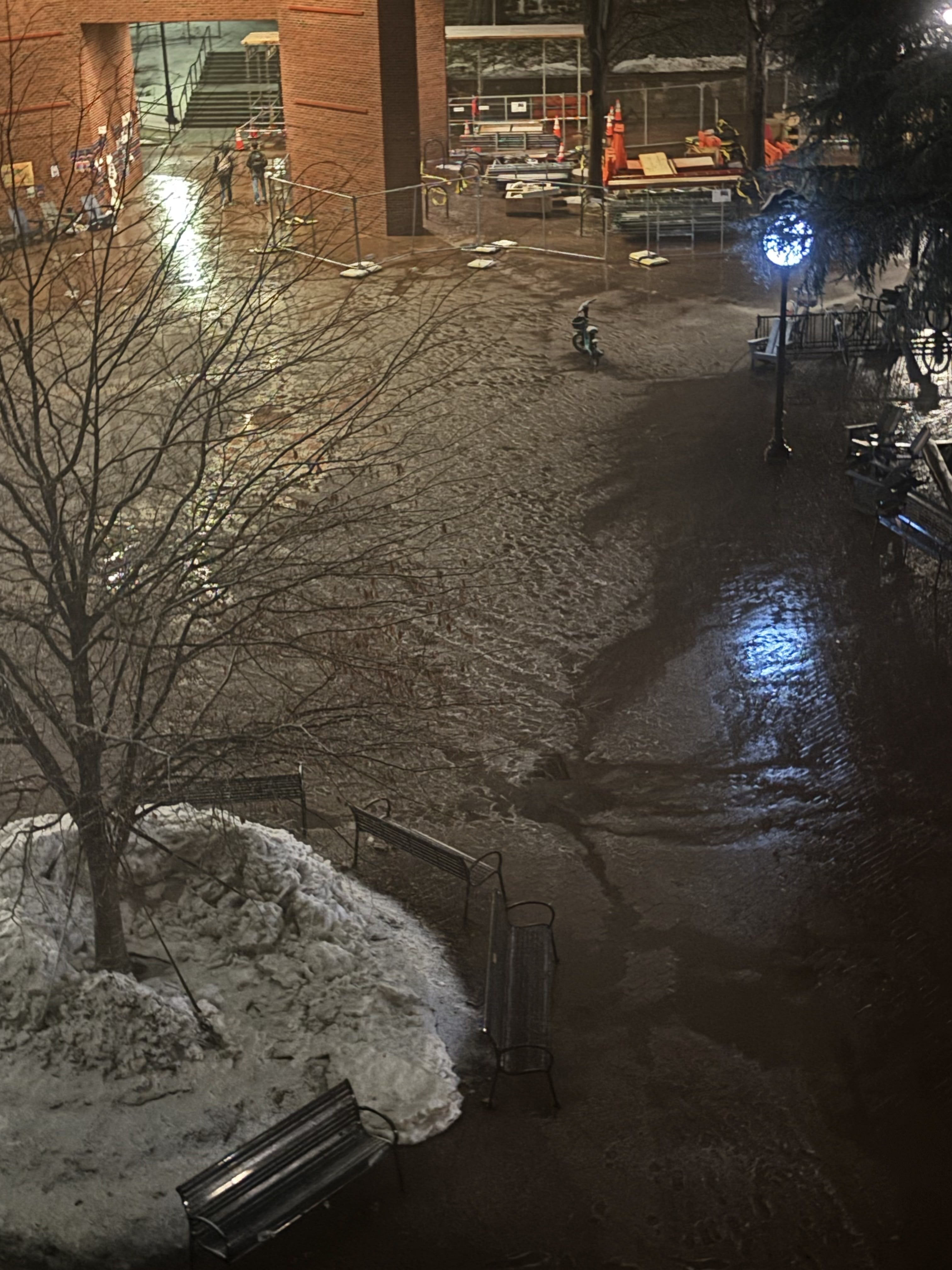
Finally starting to accumulate in Georgetown. Some areas are just puddles now and probably won't accumulate at all, but nearing an inch on favorable surfaces. Pretty hopeful we'll get to at least 2" cropped.mp4
-
It was gonna be too warm, too dry, sun was gonna be too high, accumulation was gonna pack too much
-
Looks like the western band is dwindling. Game on for DC north/south
-
Obs in houston?
-
They've definitely been bumped up for SNE though... trust me I know
-
Gonna go jebwalk to the dining hall now
-
An extra degree or two gives us like 3 more hours of accumulating snow.
-
Heavy snow in Georgetown right now. Sidewalks are slush and just now starting to accumulate on grass.
-
I think (hope) that it’s setting up a couple miles more east.