wthrmn654
-
Posts
3,953 -
Joined
-
Last visited
Content Type
Profiles
Blogs
Forums
American Weather
Media Demo
Store
Gallery
Everything posted by wthrmn654
-
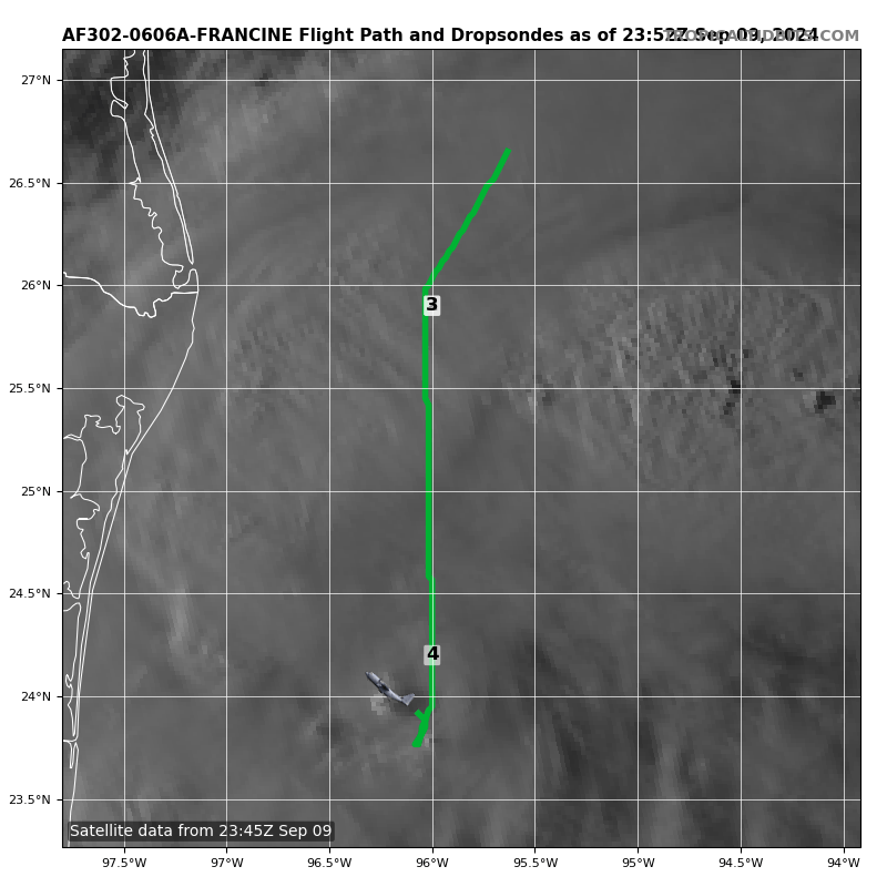
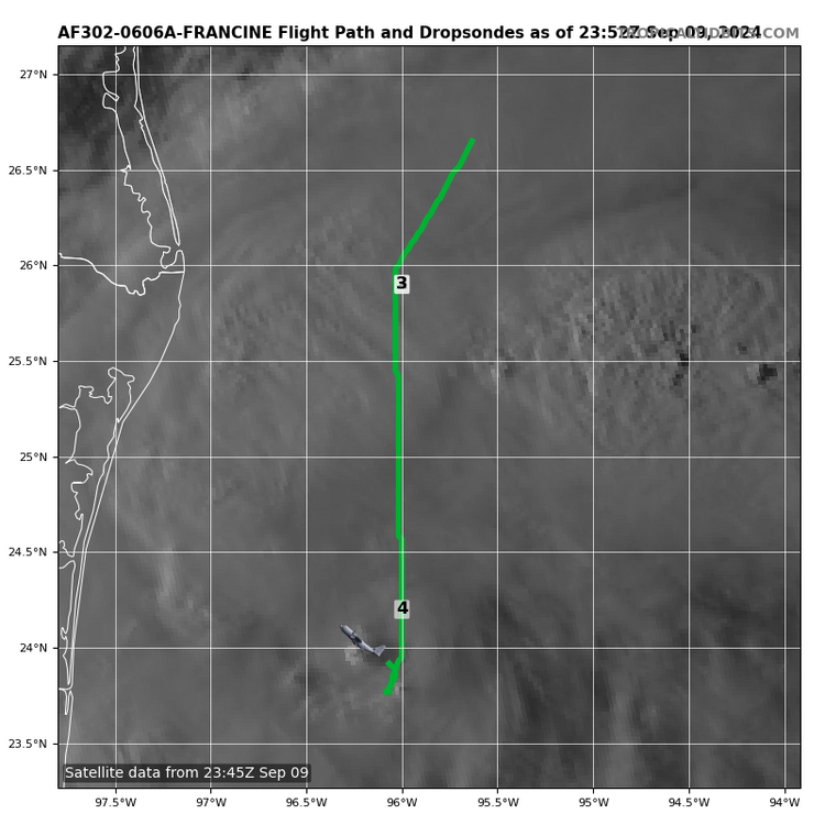
Both planes were in the eye at the exact same time/ location both doing low altitude recon, talk about ballsie!
-
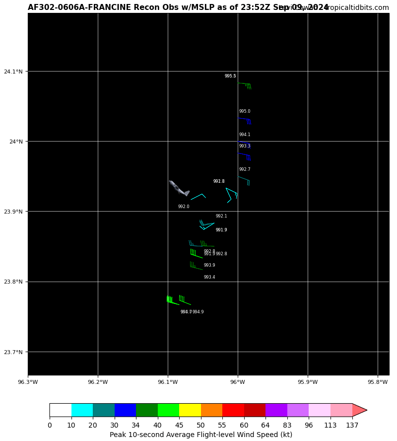
Sat estimate was 988 pressure, plane shows 988 pressure impressive ----- Current Analysis ----- Date : 09 SEP 2024 Time : 234020 UTC Lat : 24:14:55 N Lon : 96:09:58 W CI# /Pressure/ Vmax 3.4 / 988.6mb/ 53.0kt
-
The weather Channel right now.... my gosh makes it sound like it's becoming a hurricane right now really getting it's act together... A weee bit overkill at this moment
-
Barney turn around, you missed the exit!

-
Tno/CI Rules : Constraint Limits : 0.5T/hour Weakening Flag : ON Rapid Dissipation Flag : FLAG
-
997.9 mb so far
-
So far nothing exciting on recon but the first planes close now
-
Sat intensities hint/ suggest some weaker winds
-
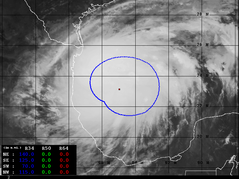
Is that dry air getting wrapped into it on the bottom right?
-
-
-
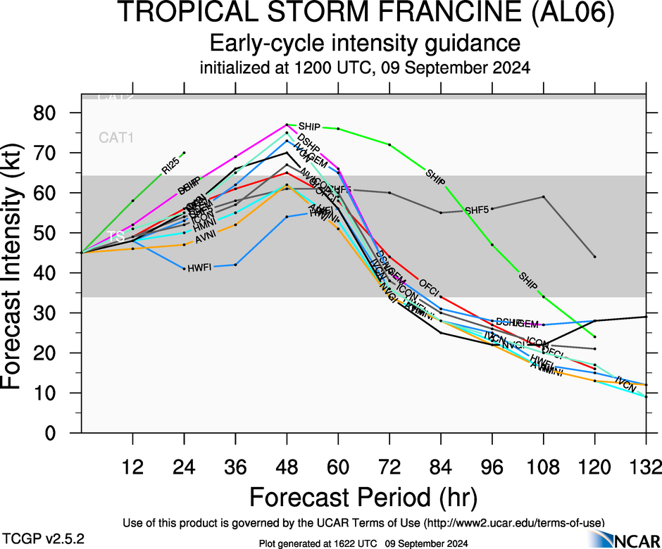
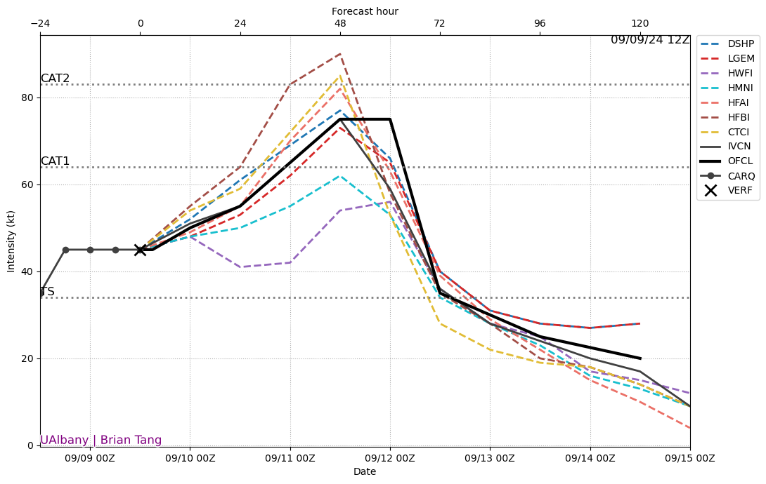
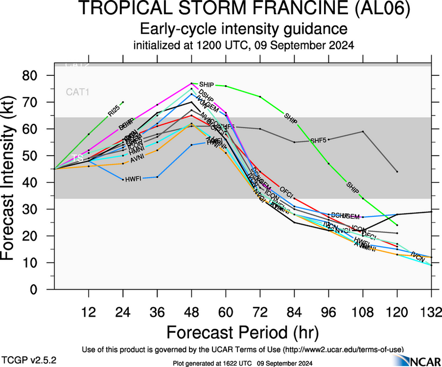
And this is 12z intensity forecast.
-
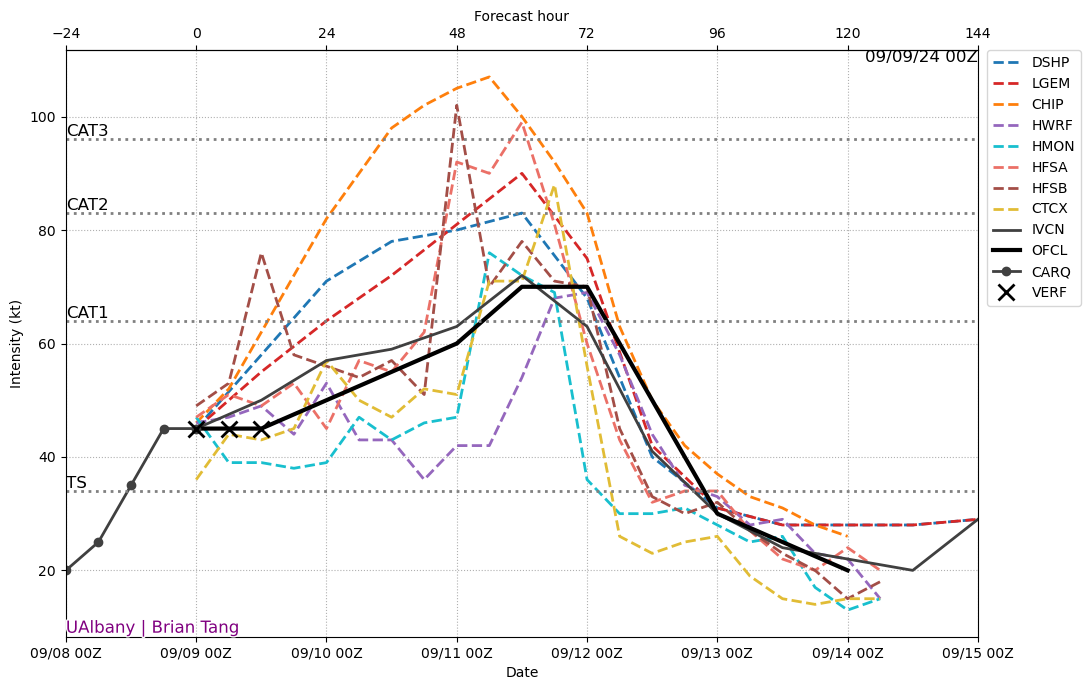
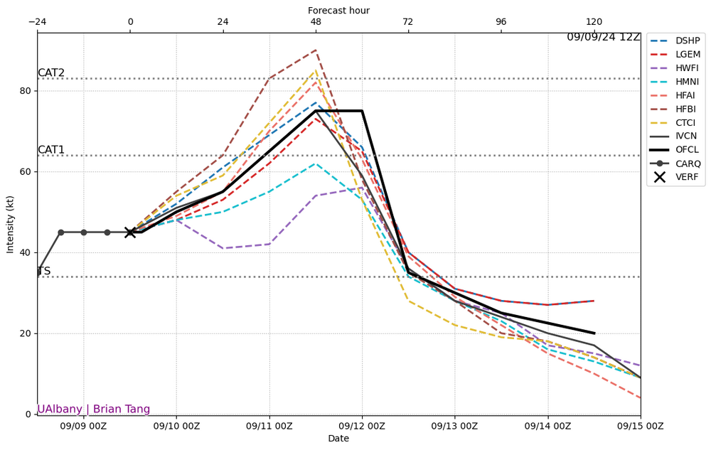
00z versus actual, shows verification versus forecasted and what has happened intensity wise.
-
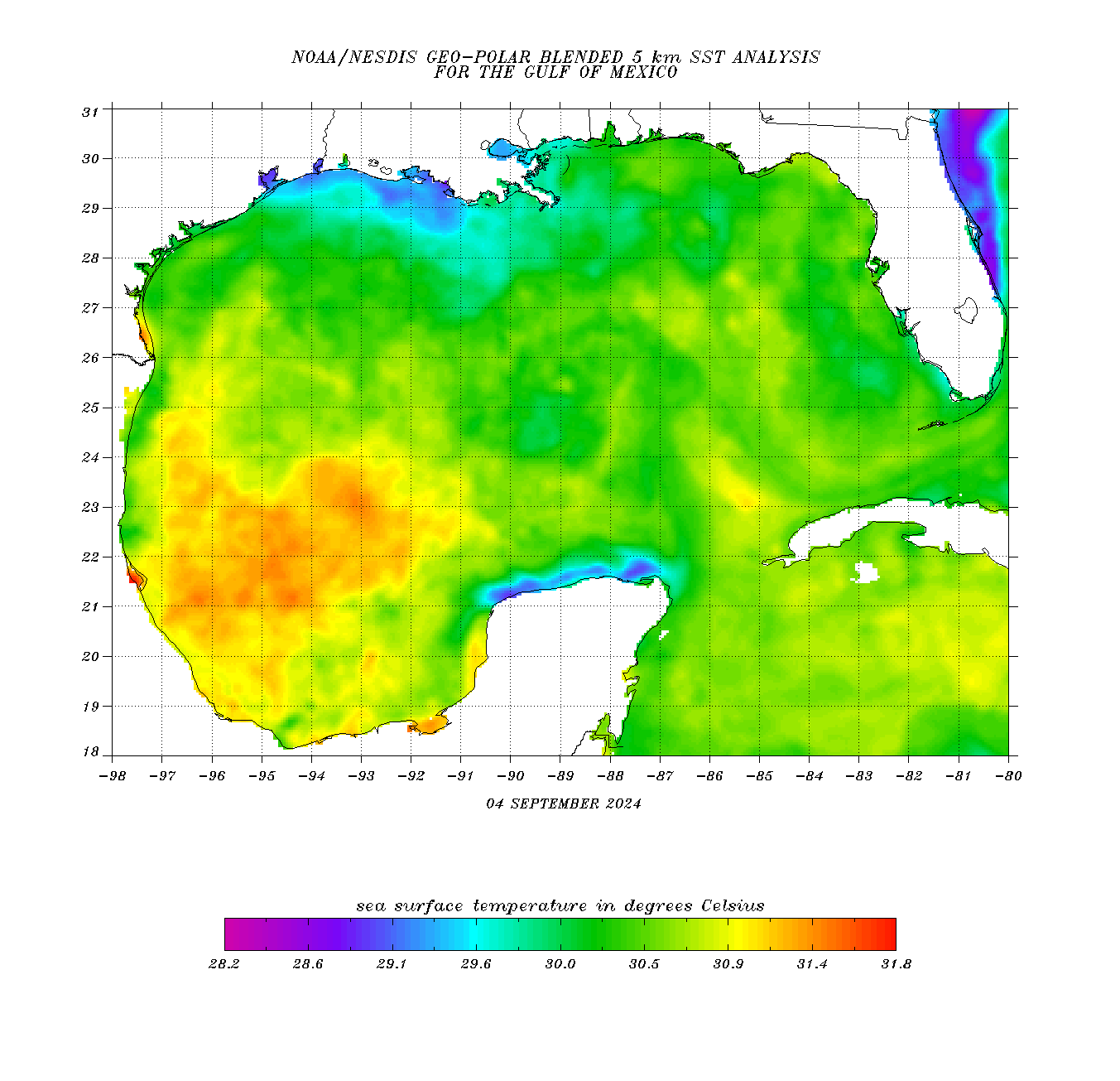
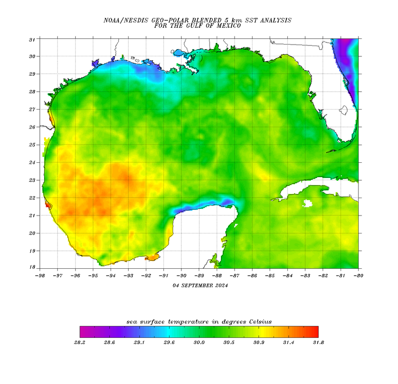
The Gulf, thing looks like a lot of blah right now while the Atlantic one looks a little bit better actually.
-

2024 Atlantic Hurricane Season
wthrmn654 replied to Stormchaserchuck1's topic in Tropical Headquarters
Do you have anything normal to say or different? You say the same stupid crap every time... -
2024 Atlantic Hurricane Season
wthrmn654 replied to Stormchaserchuck1's topic in Tropical Headquarters
i desire a hurricane to hit long island so this whole dead tropics and lack of winters past few years stops! its getting so old fast! -
2024 Atlantic Hurricane Season
wthrmn654 replied to Stormchaserchuck1's topic in Tropical Headquarters
@WxWatcher007 just making a funny while we all wait for winter, i mean tropical-ness -
2024 Atlantic Hurricane Season
wthrmn654 replied to Stormchaserchuck1's topic in Tropical Headquarters
-
2024 Atlantic Hurricane Season
wthrmn654 replied to Stormchaserchuck1's topic in Tropical Headquarters
BREAKING NEWS: we now have 2 ⁰% chances 5 things nothing over 20% Back to your regularly schedule programming!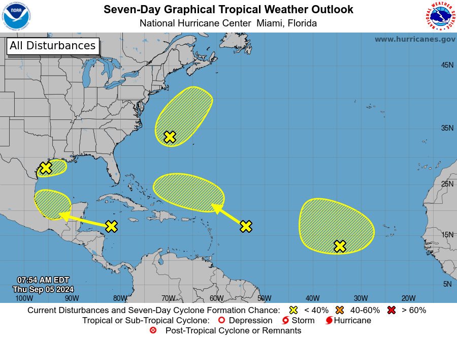
-
2024 Atlantic Hurricane Season
wthrmn654 replied to Stormchaserchuck1's topic in Tropical Headquarters
Then if you compare it to the I guess 48hr+ highest anything gets is 30%rest are 10% -
2024 Atlantic Hurricane Season
wthrmn654 replied to Stormchaserchuck1's topic in Tropical Headquarters
Lmfao at everything at 10% or 0% -
2024 Atlantic Hurricane Season
wthrmn654 replied to Stormchaserchuck1's topic in Tropical Headquarters
It's kinda a pointless tag too with it having no tropical anything really, only subtropical 1. Northwestern Atlantic: A non-tropical area of low pressure located a few hundred miles east of North Carolina is producing disorganized showers and thunderstorms. This system could acquire some subtropical characteristics over the next few days as it moves north- northeastward, remaining offshore of the northeastern United States. Additional information on this system can be found in High Seas Forecasts issued by the National Weather Service. * Formation chance through 48 hours...low...10 percent. * Formation chance through 7 days...low...20 percent.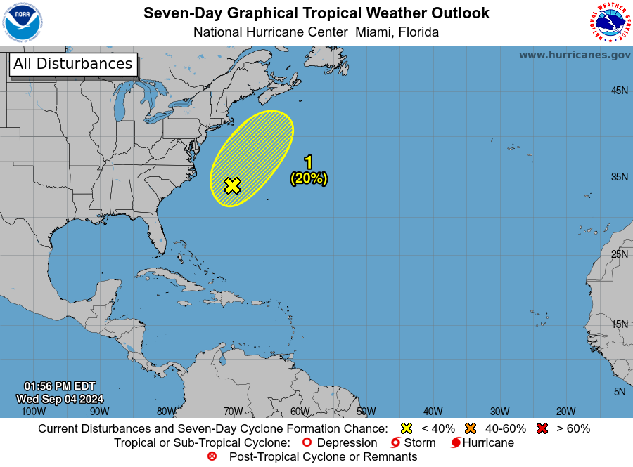
-
2024 Atlantic Hurricane Season
wthrmn654 replied to Stormchaserchuck1's topic in Tropical Headquarters
So gfs 12z unless I'm missing something, only shows 1 tropical thing, that's in the Gulf the entire run. Or am I wrong, I'm working so not fully looking at it