

WintryMixmaster
-
Posts
114 -
Joined
-
Last visited
Content Type
Profiles
Blogs
Forums
American Weather
Media Demo
Store
Gallery
Everything posted by WintryMixmaster
-
Gotta love single digit temps with a bare ground after a nice cold rain. On the plus side, the rug pull by the models happening over the course of a single model suite was better than watching it slowly slip away. And there's still plenty of winter to go
-
Well the GFS has consistently been the coldest model, and took this big jump north with the recon data, maybe that means this is the worst case scenario and the other models will have a quicker changeover to rain. CMC on the amped side of things has us at ZR for only about half as long which would make a big difference. I'm trying to sniff some hopium, I've given up on more than a light front end snow at best, just don't want to lose power before the deep freeze at this point
-
I'd think that with the moderate/heavy rates shown and during the daylight hours, the rain wouldn't freeze on contact. Hopefully anyways
-
Dusting of snow then sleet then ZR then rain... honestly if we're gonna get that much ice, I'll happily take the rain to help take the pressure off the power lines before the impending cold
-
For how conservative they usually are, this seems... extreme. Especially given that the GFS ticked north again and has Knoxville mostly ice. Is there a single model showing 4"+ for Knoxville at this point, let alone 7"?
-
I guess that's better than creeping even further north, for now. At this point I'm happy if the valley can get any accumulating snow and have it not all washed away by the rain mid-storm
-
wtf was that Ukie run...
-
It seemed like the 500mb maps looked pretty different but only a minor tick north/towards more moisture from 18z
-
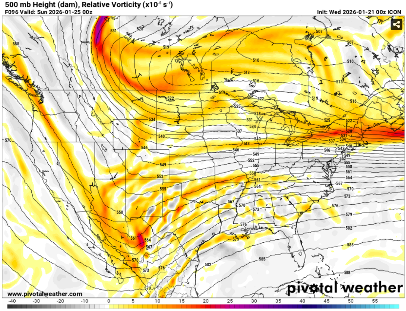
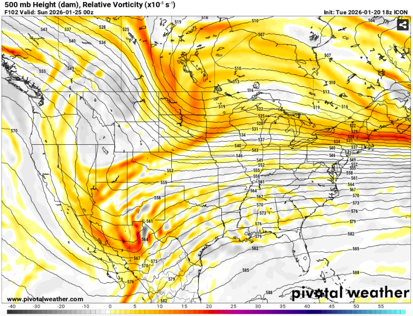
So in other words, this is a bad trend on the ICON?
-
My NAM rule is usually, "if it shows a lot of warmth or a warm nose, it's right. If it shows an unusual amount of snow or snow that no other model shows, it's wrong"
-
Yeah that's not what we wanted to see... does the long range NAM still have a bias towards over-amping things? Because it already has sleet from Knoxville southwest at 84 hours
-
Run from it, hide from it... Lakes low still arrives
-
What model suite will have the first of the recon data incorporated? Like one of the comments on the last page mentioned, it's interesting (in a bad way) like someone said that the cone of uncertainty for the heavy snow axis/amounts/snow-ice line seemed to be narrowing, and the Euro/Euro AI were very consistent over several suites, and then they suddenly made this kind of a jump. What did they see that was different?
-
Would really suck after all winter having such a northern stream dominated pattern that when we finally get the subtropical jet to cooperate, it causes our storm to phase and cut like that
-
The 00z Ukie and even at 12z seems to have a more WSW-ENE orientation to the snow axis compared to the EURO/GFS which are more west to east. CMC though further north seems similar to the Ukie in terms of the orientation. Maybe related to the placement of the high pressure over Minnesota and how fast it presses southeast? Or something else about how the energy moves east from Baja? Edit: Might just be a trick of the state boundaries on my eyes on the map, lol
-
It did look a little colder at all levels than 12z for a bit, but it looks like it sent a low west of the apps which turned us to rain and then back to sleet at the end. No big zone of freezing rain at least, unlike the CMC
-
UKMET looks maybe a tick colder than 12z?
-
Yeah, Canadian moves the storm out ahead of the high pressure which I guess lets it cut north, while the other models have the high pressure shadowing the storm to the north and walling if off?
-
Yeah definitely not taking the ICON of all models at this range as verbatim, but I feel like usually when a global model has the line in the southern valley, the higher res models start creeping that north county by county once they get into range. Granted I haven't lived here as long as most posters here so they probably know the microclimates best. I actually felt better about the suppression solution lol
-
Especially if it's snow to mix to snow, which Knox County would be if we shifted the ICON like 30 more miles north. My back already hurts imagining shoveling that
-
I feel like every big storm that's hit since I got here has had some kind of screw axis. Maryville/the foothills got screwed in January 2024. Chattanooga got screwed in March 2022. Knoxville north got screwed (a little, relative to forecast) by the January 2025 storm while Chattanooga cashed in. Now that I lived here long enough I can see why its so hard to have the whole valley from Bristol down to Chattanooga score from the same storm. I'd take rain over ice though if that warm nose is going to creep up the valley
-
Even in Knoxville, I don't like how close we are to that snow/ice line. A 50-100 mile jog north would put us in a world of pain, and a north trend with this kind of system seems like something that could easily happen. This reminds me of that arcade game where you have to steer the marble down the sidewinder-shaped course to the goal, except each model suite between now and Saturday is a new turn north or south and the goal is a snowstorm for the whole valley. Suppression! Cutter! More suppression! Notably, I could never win that game...
-
ICON at the end of its range was more suppressed than 12z too
-
I'm setting an expectation of rain with minor snow accumulation and considering anything else a bonus so I don't get my hopes up. Mentally shifting everything 100-200 miles north when I see snowfall maps haha
-
January 2026 Short/Medium Range Thread
WintryMixmaster replied to John1122's topic in Tennessee Valley
So is the difference between the UKIE/Euro AI and GFS/CMC/ICON a timing issue? If the storm takes too long to get here, it amplifies and gives time for the eastern HP to move out, letting it attack the weakness in the banana high?


