soadforecasterx
-
Posts
142 -
Joined
-
Last visited
Content Type
Profiles
Blogs
Forums
American Weather
Media Demo
Store
Gallery
Everything posted by soadforecasterx
-
Feb 22nd/23rd "There's no way..." Storm Thread
soadforecasterx replied to Maestrobjwa's topic in Mid Atlantic
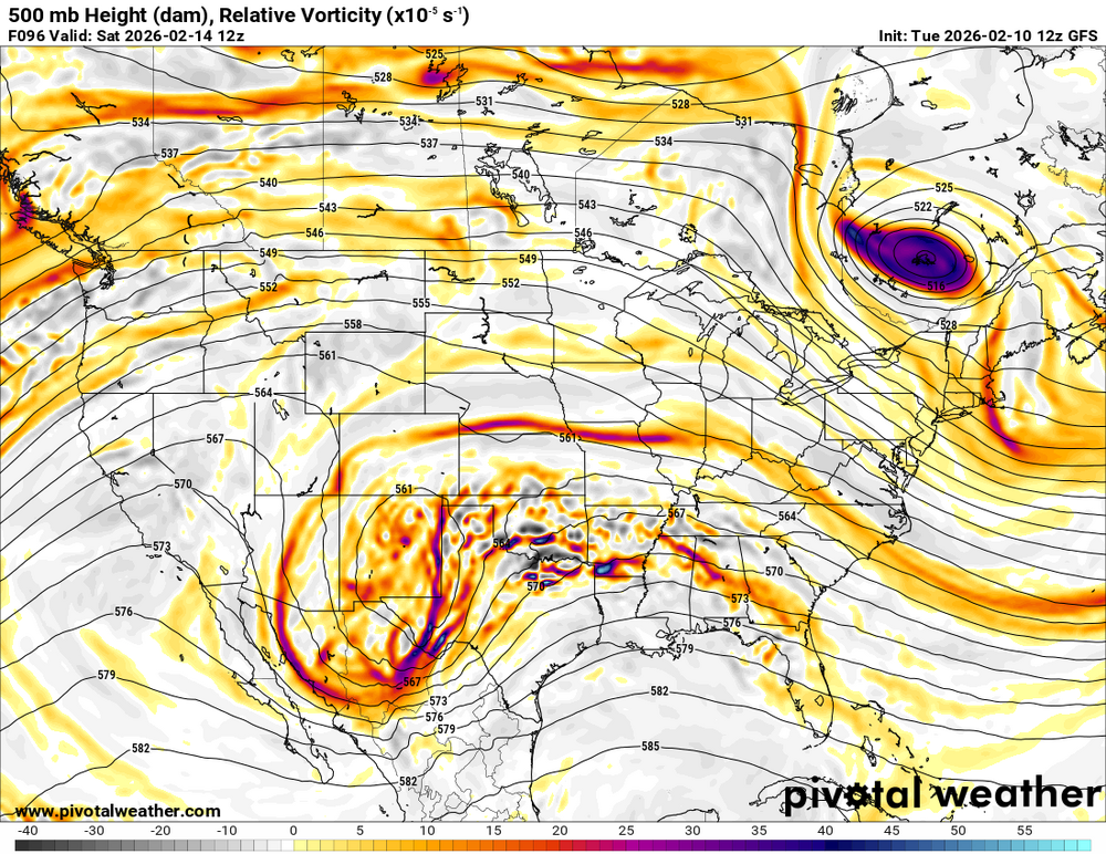
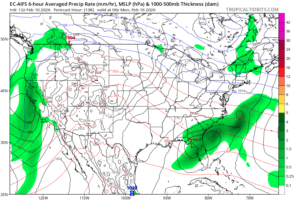
This is where we need the CRAS model, that was always the marker for an over amped system. -
Feb 22nd/23rd "There's no way..." Storm Thread
soadforecasterx replied to Maestrobjwa's topic in Mid Atlantic
RGEM still showing hope -
Late February/Early March 2026 Mid-Long Range
soadforecasterx replied to WxUSAF's topic in Mid Atlantic
I just want Nam to show a crazy amp'd solution just to show some false hope -
Late February/Early March 2026 Mid-Long Range
soadforecasterx replied to WxUSAF's topic in Mid Atlantic
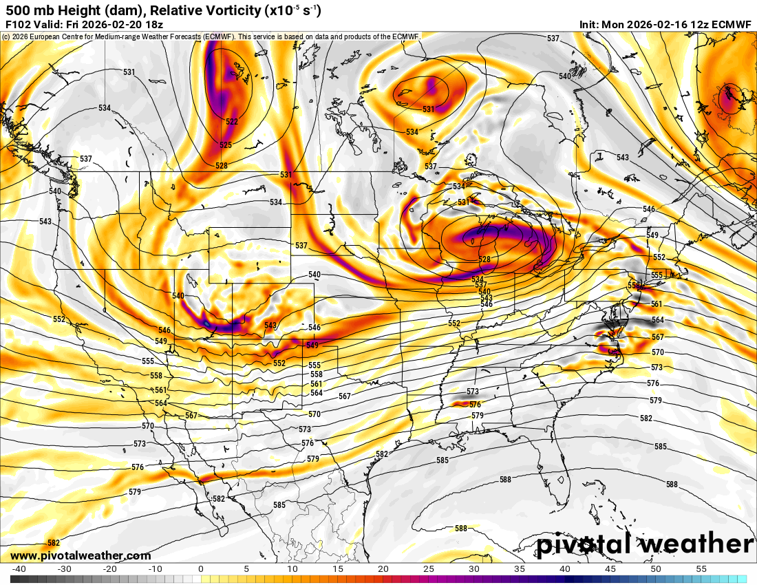
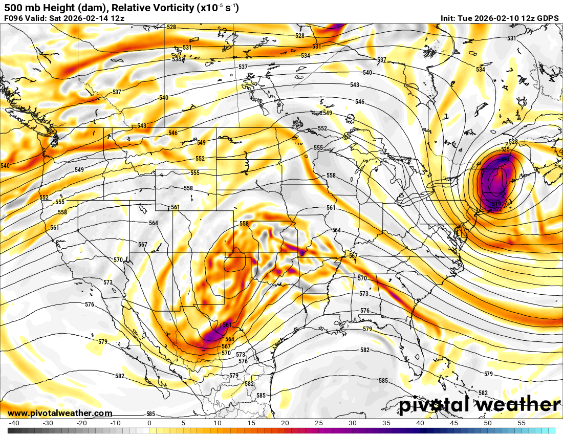
Now RGEM has my interest -
Late February/Early March 2026 Mid-Long Range
soadforecasterx replied to WxUSAF's topic in Mid Atlantic
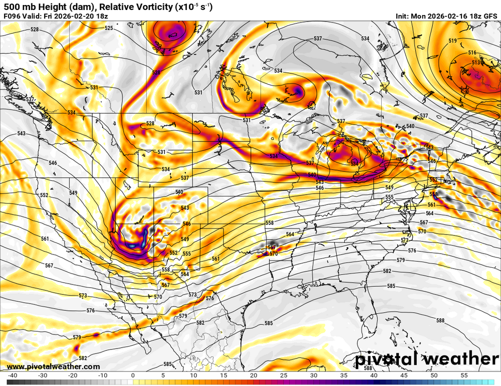
Looks like energy doesnt fully catch up in time to capture the low. still would be a good hit but low would move NE from here.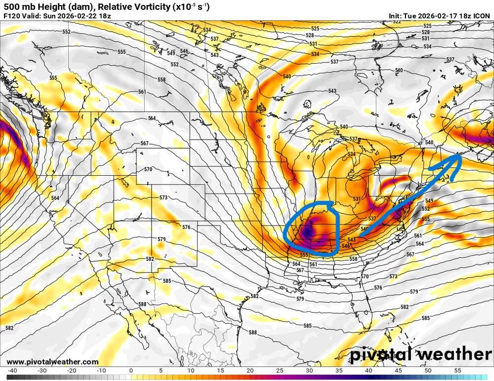
-
Late February/Early March 2026 Mid-Long Range
soadforecasterx replied to WxUSAF's topic in Mid Atlantic
GFS seems to be slowly stepping away from the storm since 00z at 500 -
Late February/Early March 2026 Mid-Long Range
soadforecasterx replied to WxUSAF's topic in Mid Atlantic
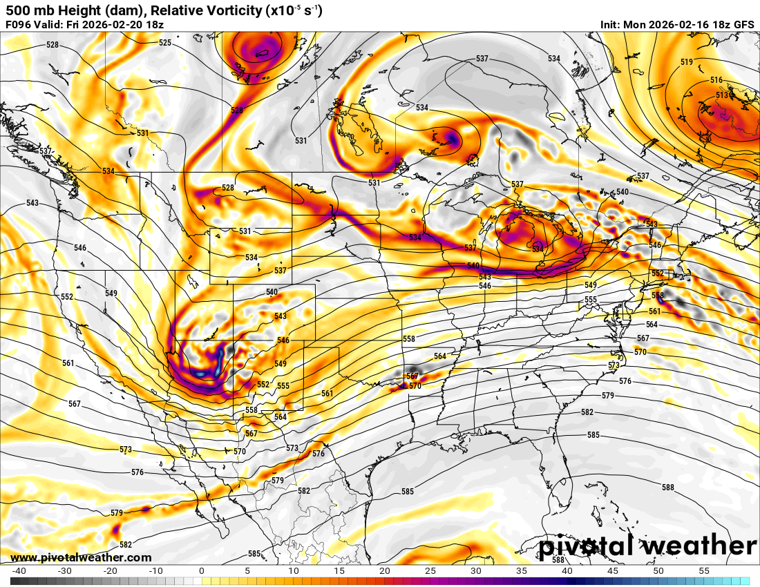
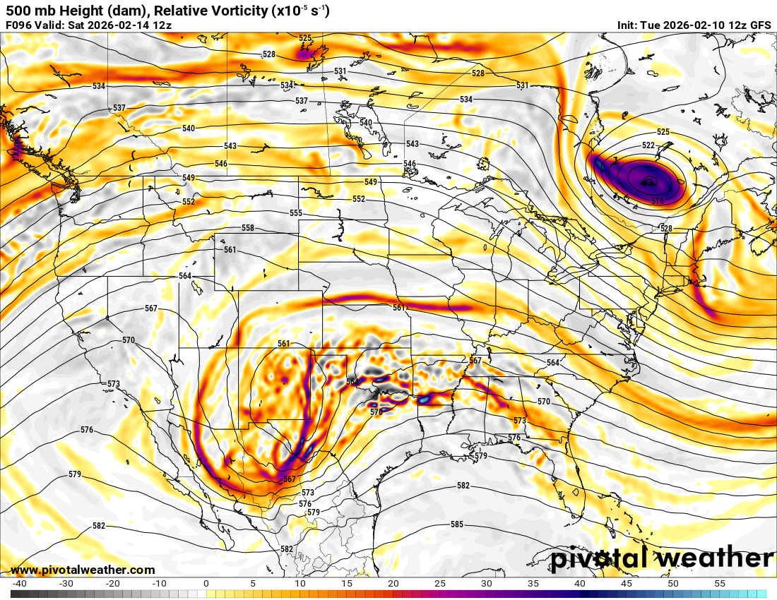
well at the 96 hour window you can start to see if there will be a storm or not. Not sure what one is right but atleast gives you a window into the idea of a storm or not.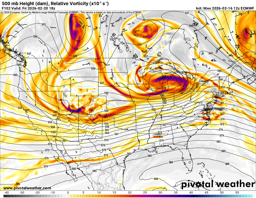
-
Late February/Early March 2026 Mid-Long Range
soadforecasterx replied to WxUSAF's topic in Mid Atlantic
IDK seems like Nam/GFS did a good job for the most part with this part storm.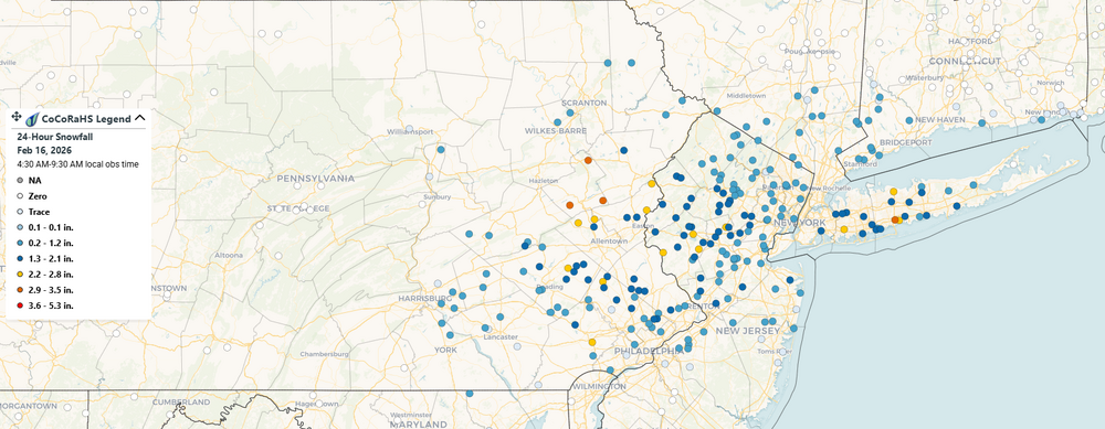
-
Late February/Early March 2026 Mid-Long Range
soadforecasterx replied to WxUSAF's topic in Mid Atlantic
-
Late February/Early March 2026 Mid-Long Range
soadforecasterx replied to WxUSAF's topic in Mid Atlantic
slowly pulling away at 174 -
Late February/Early March 2026 Mid-Long Range
soadforecasterx replied to WxUSAF's topic in Mid Atlantic
stalled and tucked. sign me up please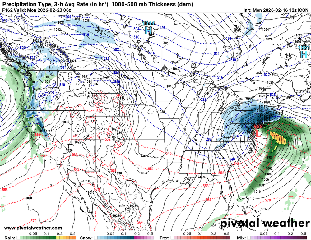
-
Late February/Early March 2026 Mid-Long Range
soadforecasterx replied to WxUSAF's topic in Mid Atlantic
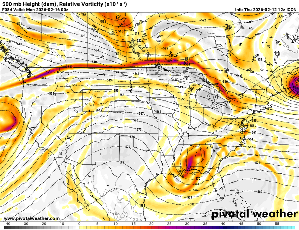
wow icon straight porn -
Late February/Early March 2026 Mid-Long Range
soadforecasterx replied to WxUSAF's topic in Mid Atlantic
Cant ask for much better a look than this.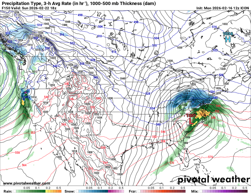
-
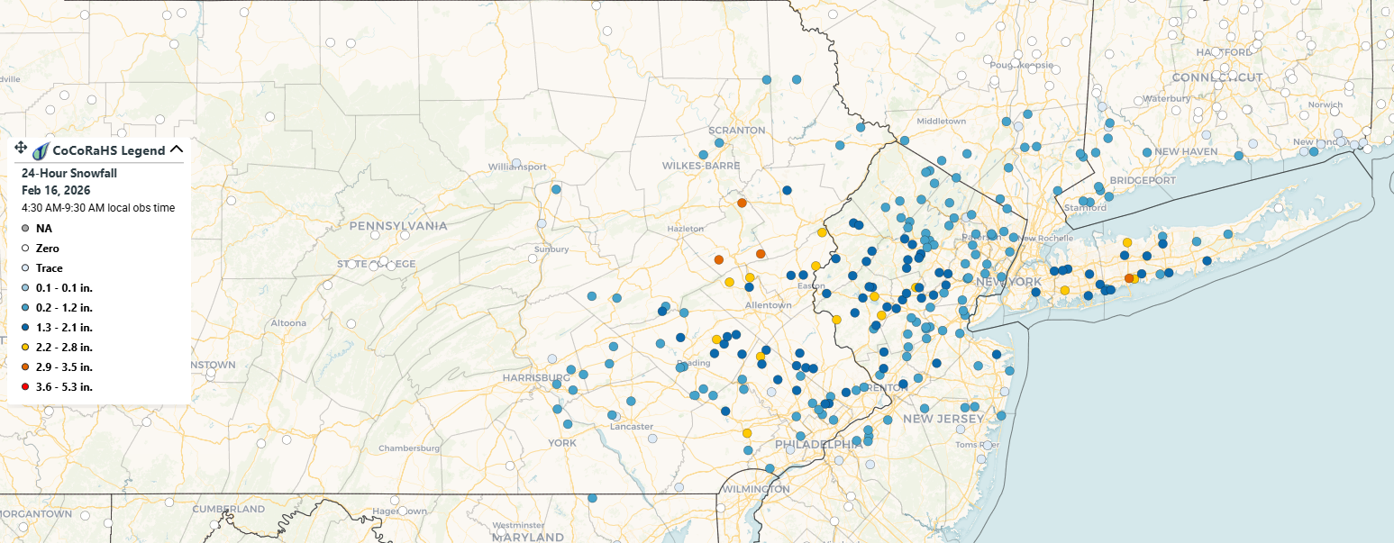
Ended up with a solid coating. Seems like you needed to be a good 20 miles north of the M/D to get into the 1" snow line.
-
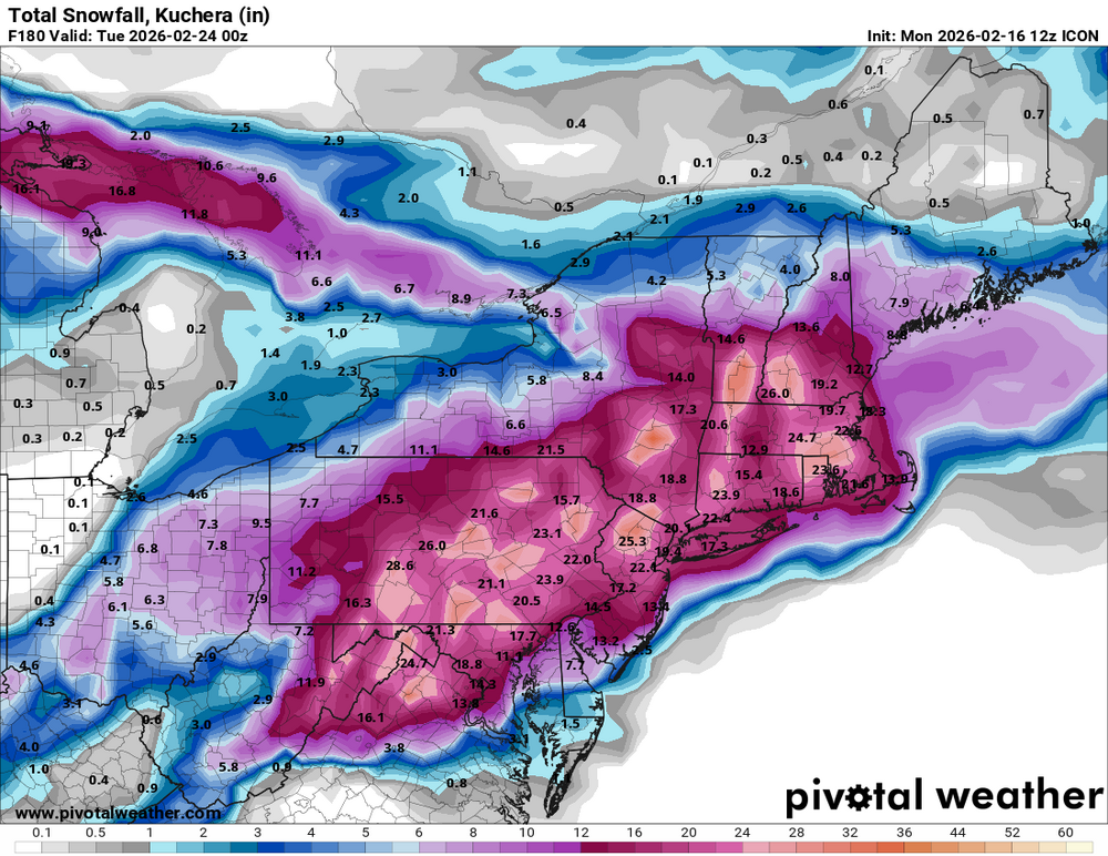
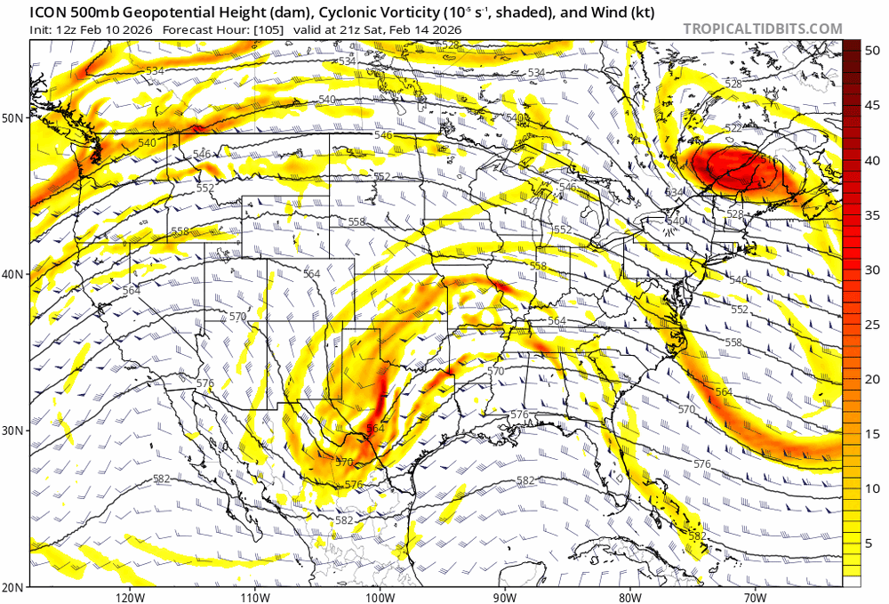
I know its the icon but you can see the slow steps towards the Euro camp
-
its a sloppy phase but a step towards euro
-
Really like what im seeing at 500 on icon at 72
-
You wont get precip to come north unless you get the phase.
-
This is what I have been trying to say. Our only hope is to get this phase. Lucky for us Euro Airs has trended towards the phase.
-
actually looks some of the euro runs where it phased. Northern energy really dives in this run but our southern vort is to slow. There is still a tiny window for a phase.
-
looks like it will be south of 6z
-
There maybe some hope yet
-
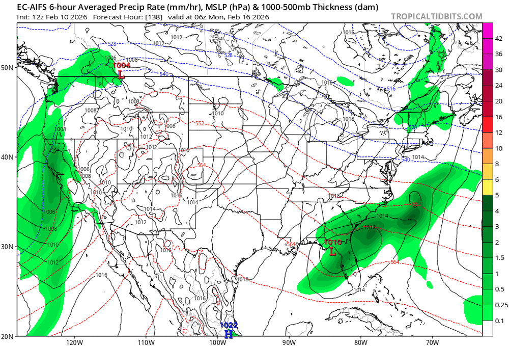
Talk about a bad model
-
I want a snowstorm just like the rest of us, but every model has been trending towards Euro Ai which has been locked in our a miss to the south.
-
So looking over the models looks like we need to route for the vort over the NE to dive as far south as possible for us to have any chance of snow.