griteater
-
Posts
9,635 -
Joined
Content Type
Profiles
Blogs
Forums
American Weather
Media Demo
Store
Gallery
Everything posted by griteater
-
For the central and southern areas of the forum, I'd want to see that confluence area created by the southern stream connecting to the Northeast trough to be solid, well-timed, and not retreat north too early...and I'd want the southern wave to make a clean sweep, unencumbered west to east and slide right off the southeast/mid-atlantic coast...and the farther south that west to east trek the better. Go take a look at the 06z FV3 GVS - it nailed it
-
Looking at the last few runs of the EPS Mean (including this morning's 06z run), there has been a subtle, though noteworthy, north trend with the system and temperatures. At 500mb, the main changes I see are that the amplitude of our southern wave has increased and the blocking confluence region ahead of the storm in the critical area of Ohio/Maryland/PA has climbed north a touch. To me, the target area for heaviest snow at the moment would be SW VA into Central VA, with the extent of wintry precip to the south of there dependent on the strength of the damming high and extent of the cold air source. Right now, the EPS mean is showing dewpoints in the teens in Virginia on Saturday as the storm approaches. For the hardcore mixed precip events in central NC down into the SC upstate and into NE GA, we typically see dewpoints in the single digits in Virginia. Now, that's a surface plot on an ensemble mean 5 days away, but nevertheless, you'd want to see a colder trend there for more mixed wintry precip to the south. In terms of precip, it does indeed look to be a heavy event as others have mentioned for the areas that take a flush hit by the storm given the solid southern stream wave and gulf intake.
-
With the northern stream now getting into the fray and diving down into the trough on the UKMet, Euro. FV3, there are going to be all kinds of wild runs this week.
-
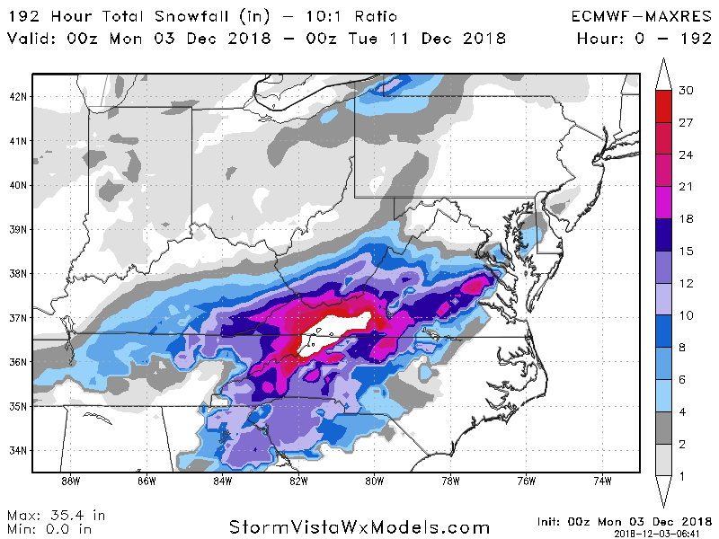
Inches. The Euro has an area in NW NC into SW VA of 3-4 inches liquid equivalent, lol. 2-2.5 liq eqiv in south central NC
-
It ended up being a southern slider thru the gulf, then it had a pretty big phase with a closed contour over W NC...and it turned up the coast and off the mid-atl coast
-
Euro Clown Map
-
Northern stream energy is diving in and phasing late....big snow totals in N NC Mtns into SW VA
-
Sfc low is just off the SC coast at 162. Snow in W NC, mix in west-central NC into northern upstate. Sfc low is over Wilmington at 168...so this favors W NC up into W and central VA for snow
-
It's a southern slider. At 156, low is over N FL / S GA. Snowing in central and western NC into SC upstate
-
The wave is about 3 hrs slower this run. The southern wave looks nice and clean, no secondary wave hitting California behind it...it's broad, has the southern slider look to it with the confluent flow firm over the NE
-
Euro out to 123 looks fine so far. No sign to me that this is going to be amped and north.
-
Yeah, ideally for the non-VA group, everything would be a farther south....the southern wave, the sfc baroclinic zone, etc....that would place the 850mb low and its associated warming farther south
-
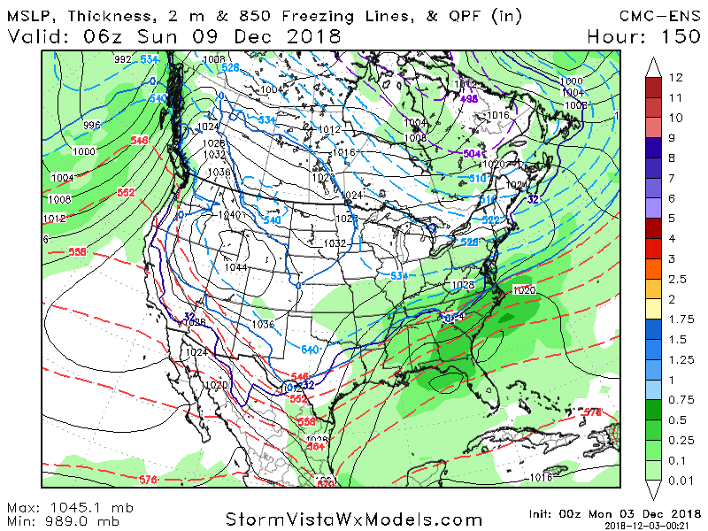
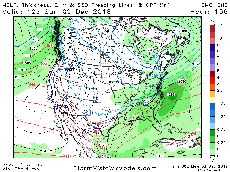
Said I wasn't going to stay up, yet here I am. Here's the CMC ENS Mean. More Miller A-ish than its Op run
-
UKMet at 144 has the low in Baton Rouge with the high on the Mid Atlantic coast. The UKMet is opposite of the GFS - it has the sfc high out ahead of our storm (a bit too far out ahead)...but UKMet looks like it's going to go Miller B if I had to guess....looks like it would be a big phasing Miller B
-
500mb looked good and normal thru 141 on the GFS, then it pulls in the northern stream from the NE trough at the end....weird run, no need to sweat that one
-
GFS is on the suppressed side but it has no interest in showing cold temps until late in the storm...strange model handling or we are just screwed
-
North of last run
-
00z GFS is a touch north, but I think it will stay fairly suppressed based on 500mb
-
00z CMC is north. Major winter storm for WNC into VA. Verbatim it has dual sfc lows in E TN and E SC
-
Tonight's map update from WPC...textbook look here for many
-
It looks pretty much the same all around except for the wave looking a touch stronger with some increased ridging behind it. Temps look the same
-
It's weird, the off hour Euro only goes out to 90, but the off hour EPS goes out to 144 At 144 the 18z EPS looks really good. Low in the northern gulf south of LA. 1038mb High draped solidly from Iowa to PA. 0 deg at 850mb runs from NE GA to a point half way between CLT and CAE, over to Wilmington. The wave is a touch stronger this run, but the NE confluence is solid. It's not perfect for everyone, but it's pretty textbook for many areas. Hard to complain
-
The thing I was thinking of was when was the last time we've had a quality wave roll from California / Baja, east into Texas for a good SE winter storm. The last one I can think of is probably Dec 2010. We've had some good winter storms since then, but I can't think of one like this specific and classic setup
-
It starts to run into that confluence over the NE, then it just slides east. Sometimes when we have this type of setup, the wave is just too weak in the southern stream and it gets shredded. With this one, it shows signs of being a quality El Nino wave. We want the NE confluence to hold firm, but with a wave that is solid like this one so that it holds its amplitude and strength
-
18z GFS