jgentworth
-
Posts
12 -
Joined
-
Last visited
About jgentworth

-
The Jan 31 Potential: Stormtracker Failure or 'Tracker Trouncing
jgentworth replied to stormtracker's topic in Mid Atlantic
Does the low being closed off over lake michigan on 12z at 60 as opposed to being more oblong and extended in the 06z make a difference or are those just lines and shapes at this point -
E PA/NJ/DE Winter 2025-26 Obs/Discussion
jgentworth replied to LVblizzard's topic in Philadelphia Region
12z ICON appears to be another step better at the surface with the low trackign just off shore of NC but then slides OTS. Just doesn't go negative -
Jan 24-26 Weekend Snow and Sleetfest Model Thread Part Tres
jgentworth replied to H2O's topic in Mid Atlantic
Yeah, pretty wild how it can go from being colder at all layers for the entire run but then at 42, the snow line is actually North of the 12z run. Overall though, I liked the steps south in the earlier hours. -
Jan 24-26 Weekend Snow and Sleetfest Model Thread Part Tres
jgentworth replied to H2O's topic in Mid Atlantic
Comparing hr21z frames between 18z and 12z NAM, the snow line was about 4 counties further South in Tennessee and the 700mb was colder and flatter across. It seemed to lose the more drastic difference though as we moved into hr00z. Snow line is still further south in TN and 700mb is better in places but not drastically. Through 33, 18z seems colder with snow line and 700mb further south, but over all precip shield seems dryer -
Compared to the same frame from 06z GFS, 12z HRRR appears to be better or similar
-
January Medium/Long Range: A snowy January ahead?
jgentworth replied to mappy's topic in Mid Atlantic
untrained eye, comparing to 12z, it looks like 18z heights out front are slightly steeper and the trough is slightly more neutral allowing the surface to be slightly (just a tick NW). 18z Precip shield seems a bit broader -
Jan 19th Snow on Snow: the this always works until it doesn't thread
jgentworth replied to psuhoffman's topic in Mid Atlantic
Found out that the HRRR is triggering for folks here. Pretty awesome jump from 06z to 12z to 18z nonetheless.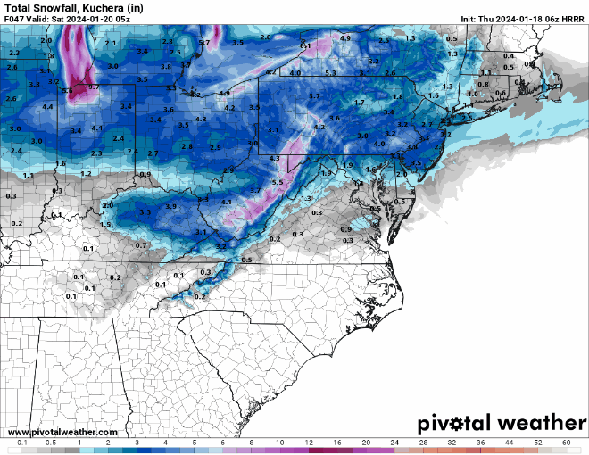
-
Jan 19th Snow on Snow: the this always works until it doesn't thread
jgentworth replied to psuhoffman's topic in Mid Atlantic
Agreed - it kept showing a giant dry slot from Front Royal up through Loudoun to Gettysburg which had me concerned but Radar and my eyeballs said otherwise. -
Jan 19th Snow on Snow: the this always works until it doesn't thread
jgentworth replied to psuhoffman's topic in Mid Atlantic
18z HRRR seems to be drier than the 12z NAM by a bit. But we're talking 15-20hrs on the HRRR which I think is probably out of its range a bit. -
Jan Medium/Long Range Disco 2: Total Obliteration is Coming
jgentworth replied to Jebman's topic in Mid Atlantic
The potential of the rare Snow on top of Snow event in Loudoun would be very much welcomed! -
The HRRR has been going bonkers with the amounts on top of the mountains to your NW. I saw 38" this morning, then 24" on the 12z & 13z runs. It is keeping the snow & mix in higher elevations until 1pm
-
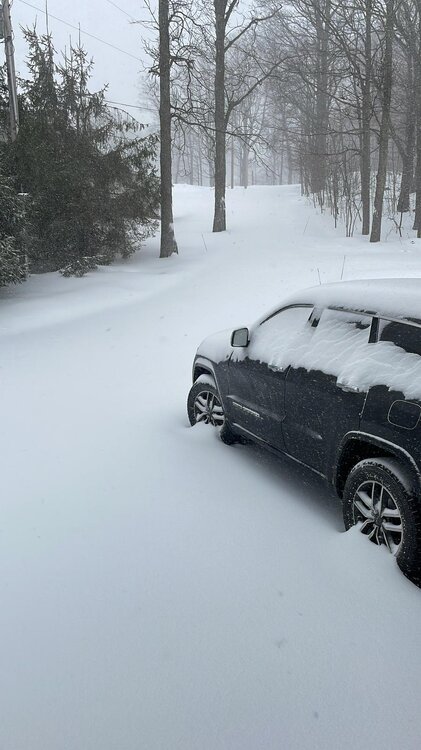
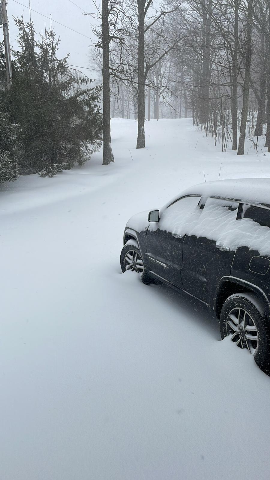
Indian Lake, PA checking in. What a wild morning. CAD is in place strong. Short range models have us staying Snow through 11am, then mixing until 1-2pm. Still have 5-8" before the change over. Have had near whiteout conditions when the wind gets going. 30° and heavy snow with 20-30mph winds.