

AtlanticWx
-
Posts
604 -
Joined
-
Last visited
Content Type
Profiles
Blogs
Forums
American Weather
Media Demo
Store
Gallery
Posts posted by AtlanticWx
-
-
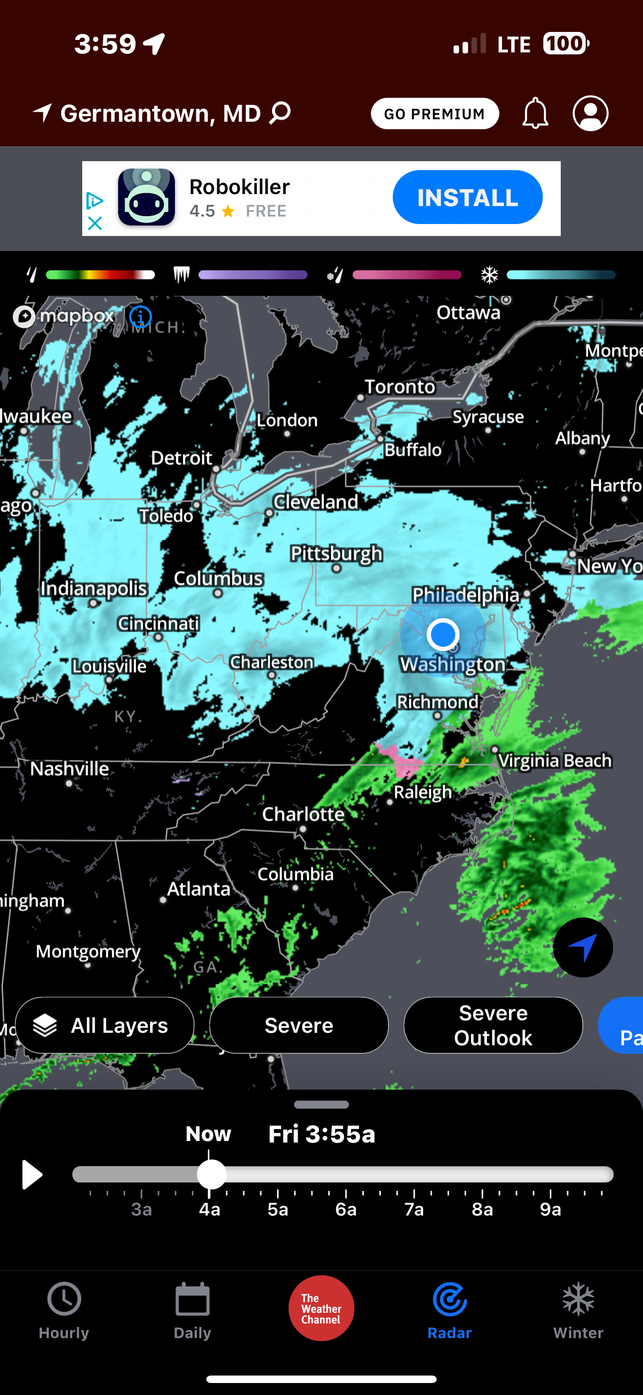
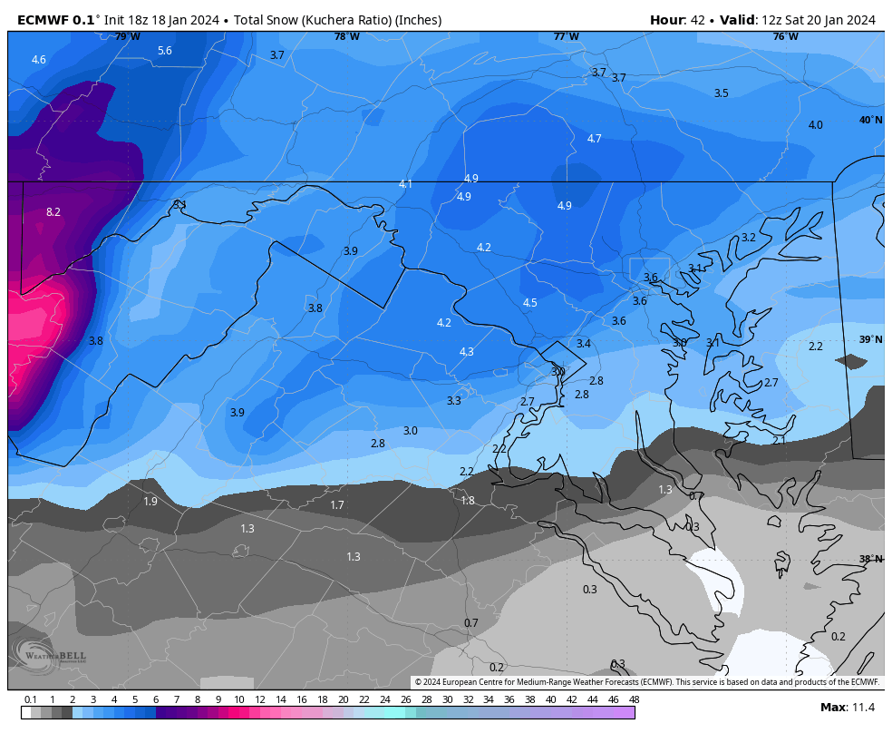
3" in Germantown right now, with more left to go! Band is leaving though so we'll see
-
 1
1
-
-
2 minutes ago, Bob Chill said:
I didn't pay attention to details last few days. Did any model hint at a WAA boom before the vort pass? I thought the goods all came on the pivot.
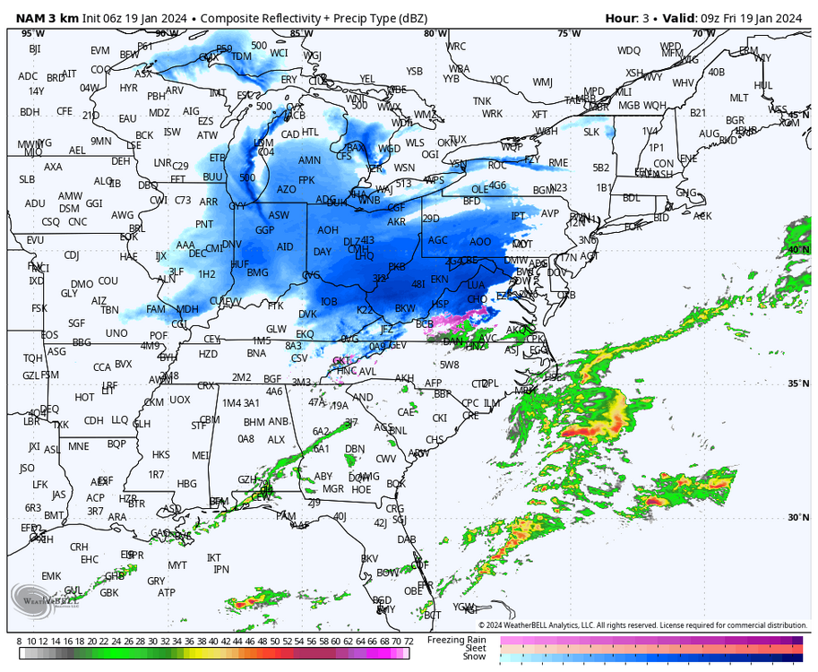
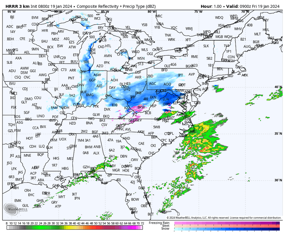
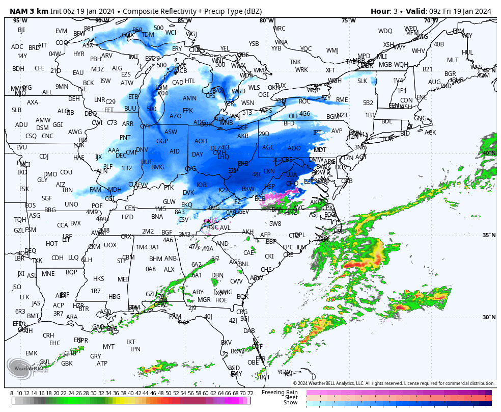
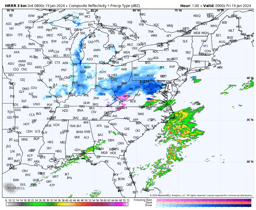
yeah most models had a WAA boom prior to the pivot. the bullish models especially (NAM 3K, HRRR). i think it's safe to say that this is overperforming, just surpassed the NWS forecast for me yesterday (2.8") probably with only the front end thump
-
2
-
-
some flakes reaching a width of an inch! really heavy stuff here in gtown w 30 dbz over us rn
-
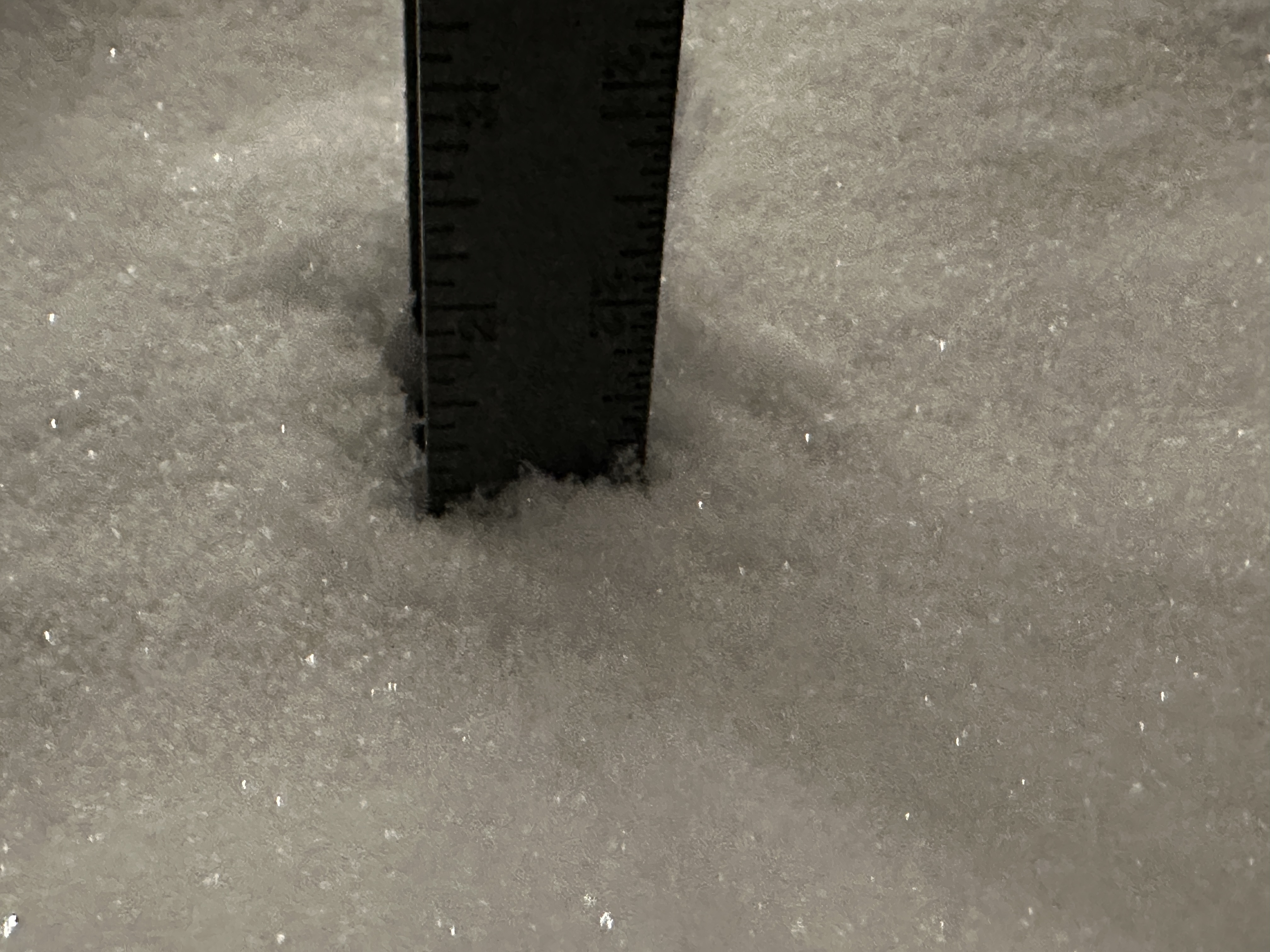
2.5" in germantown as of 5:30 am
-
1
-
-
backfilling is starting to the west as this crazy band over NOVA & moco should start to pivot as the coastal forms
-
1.2-1.3" per hour rates right now!! definitely more juiced up than forecasted cuz no model had this besides maybe the NAM 3K with one hour of 1" rates but i've had 1"+ rates for the past two hours
-
a bit over 0.6" of snow in the last 30 minutes, holy shit.
-
Just now, Buffalo Transplant said:
So is that really the back end at the VA / WV State Line or am I missing something? Thanks guys.
yeah this is just our front end thump, the snow is backfilling now. i was worried ab dry air before but i think we're okay now
-
1.9" in Germantown now. Rates are really heavy!
-
2
-
-
4 minutes ago, jayyy said:
Curious what leads to the totals in and around Baltimore on the euro / NAMs. Is it from the Norlun feature later on?i think it's the coastal and maybe the norlun
-
1
-
-
1 minute ago, BristowWx said:
Not sure if weenie cast radar is right the dry slot is approaching from SW fast. Unless it pivots. Maybe I’m looking at the wrong radar.
think it'll pivot but mostly for northern areas so
-
Inch+ rates in the last hour here because we've already made it to an inch. Dumping snow outside too rn
-
1
-
-
1" already in Germantown at 4:08. Really high ratio snow rn tbh
-
1
-
-
is it just me or is dry air building in faster than modeled? or is this not a concern (current radar vs the two model depictions for 4 am)

-
i think the key development here is the inverted trough starting to point into the DC area. i feel like we might get surprised tomorrow past the thump
-
2
-
-
Just now, Bob Chill said:
Pretty sure we had that with the Jan 19 storm. It was a weird overperformer iirc.
What's CSI?
-
Just now, Terpeast said:
Difficult call for LWX to make. Upgrade to warning or keep it as advisory level, considering tomorrow’s commute?
honestly the way this system has been continously uptrending and the radar looks juiced up compared to models, i would opt for a warning. i think snow sticking all over the roads and causing a mess is pretty likely tomorrow, and the way i see it it's much smarter to go for a warning and be safer than sorrier and risk a pile up
-
1
-
-
Just now, Paleocene said:
Agreed. Luckily MoCo schools closed for tomorrow. So did Prince George's.
yea schools closing was a must, but the roads here don't look salted and even if they are it'll be largely ineffective with how cold it is imo. roads were already horrible for 1/16, can't imagine that they could be even worse given the higher rates coupled w the fact that it lines up with peak commute time.
-
Just now, jayyy said:
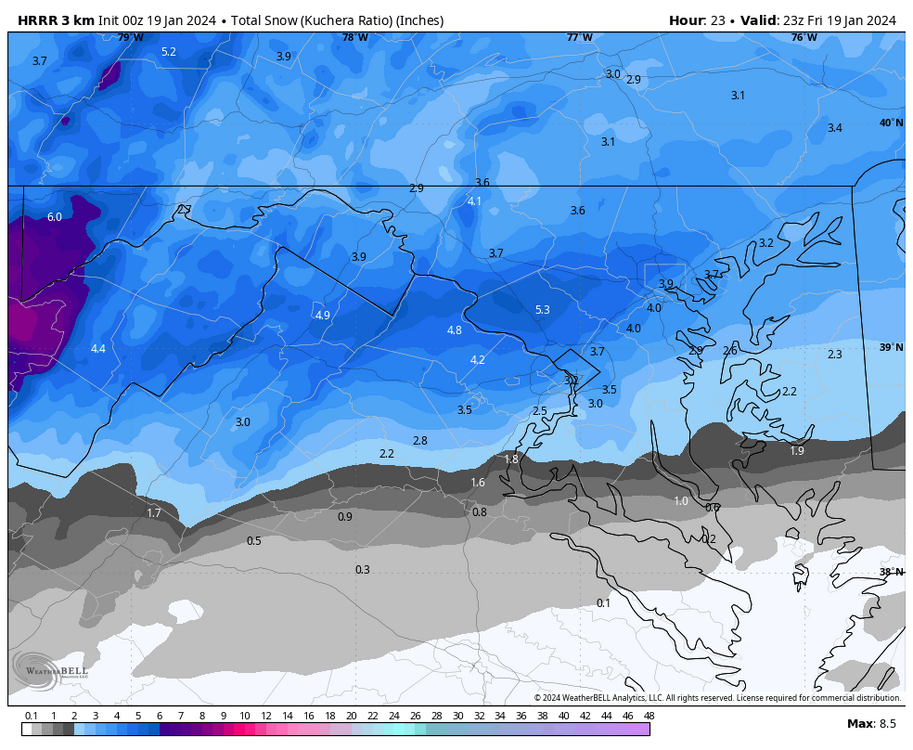
Kinda wild considering one of those cities has a warning up for 5-6” and the other has an advisory for 1-3”I'm honestly really worried about tomorrow's commuting situation. HRRR has 0.5-0.8" per hour rates from 5-8 am which is the peak commute time and right now, I feel like the situation of this event is being underplayed with only an advisory for 1-3" and isolated 5". This gives me 1/6/15 vibes in terms of the chaos commute-wise we could see tmr tbh
-
holy SHIT-
 3
3
-
-

-
11
-
 2
2
-
6
-
-
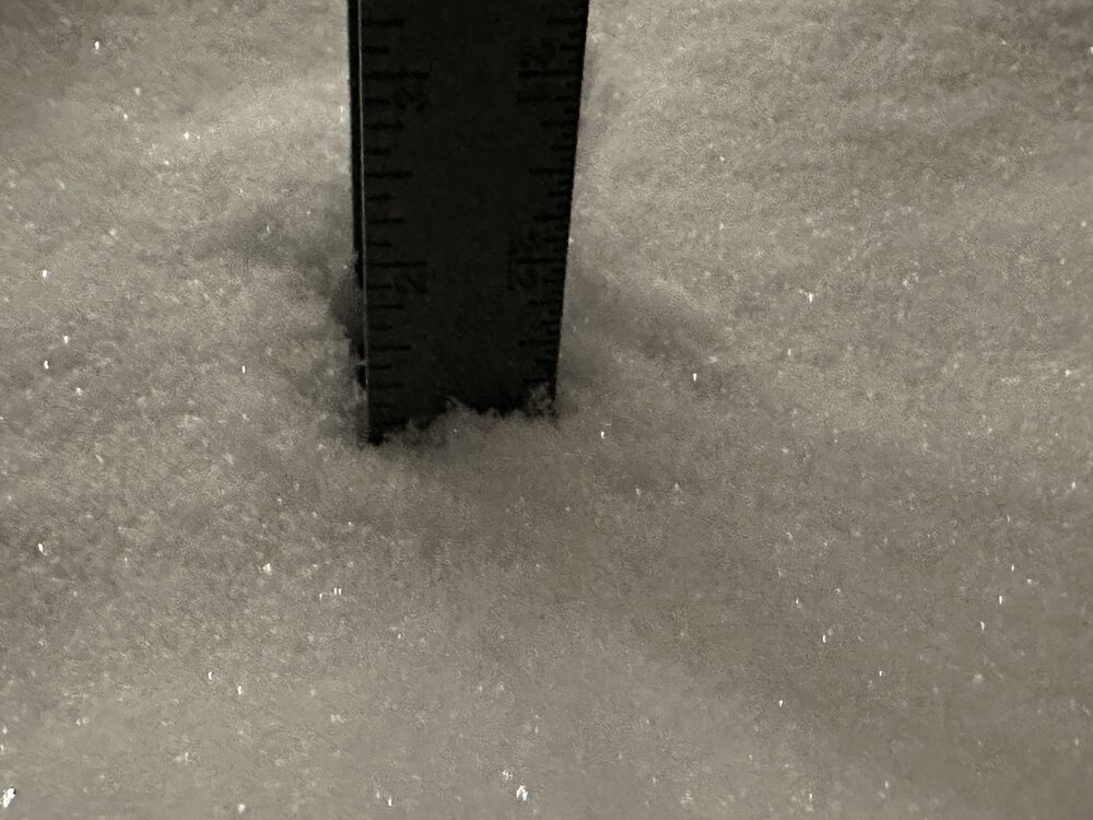
measurements between 5.2-5.5" somehow in germantown? did not expect this whatsoever lmfao
-
0.3" in germantown! don't know how we did it but we did
-
2
-
-
why were we freaking out ab the NAM again? it's the only model that shows ice here. the only model out of dozens

Jan 19th Storm OBS Thread
in Mid Atlantic
Posted
the radar keeps building back over moco lmfao, as soon as i think it's about to leave more greens appear.