-
Posts
675 -
Joined
-
Last visited
Content Type
Profiles
Blogs
Forums
American Weather
Media Demo
Store
Gallery
Posts posted by DarkSharkWX
-
-
Just now, cbmclean said:
Interesting that in that composite no WAR really shows up, but we know it was there when it counted. You can also see that the mean trough is much further west compared to say Dec 2010 or March 2018 which itself hints of higher heights in the SE.
Yeah most of the cold was placed in the Central US because of the lack of a 50/50 low and the ridge not being east enough over the Rockies. Had we had those 2 factors, this December could have gone a lot better
-
 1
1
-
-
-
1 minute ago, Maestrobjwa said:
And that -PNA....The more neutral/slightly positive look being shown on guidance a couple weeks ago never really verified, did it?
From Dec 15(around time when we were expected to go into a favorable pattern) - Dec 24(latest date available) there doesn't seem to be any sign of a -PNA/SER at all. The PNA not being east enough(not over the Rockies) and the lack of 50/50 are one of the factors that contributed into the pattern not doing well.

-
5 minutes ago, psuhoffman said:
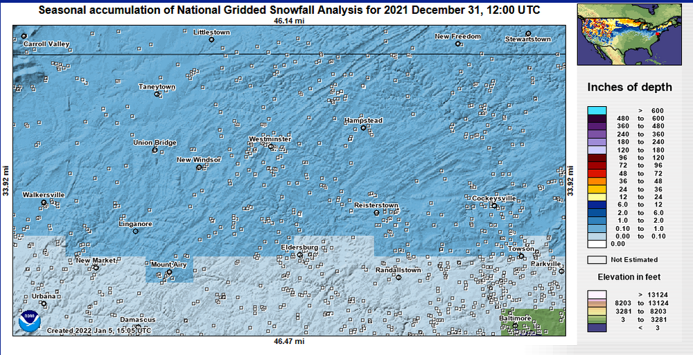
Good test of guidance v analogs. Several of this years analogs are in that set and they say don’t get your hopes up. The guidance says we head a different direction than history suggests. Place your bets.
tbf correlation doesn't equal causation - most of those years that had <1" for you before Jan 1st were bad for everyone because of a strong -PNA and SER which is different from what we've had so far and what is being shown on guidance
the reason why we will go AN for the end of dec thru first week of jan is because of NPJ overextension - quite similar to a strong nino pattern -
-
12 minutes ago, AtlanticWx said:
one thing i particularly like about the upcoming pattern is that we don't have to worry about much going wrong. the pacific jet is currently over extended and we actually want a retraction which is quite easy to get in a niña iirc
as long as that ULL near alaska retrogades and become an aleutian low, we're in business for january. ❄️❄️
and looks to be a legit +PNA over the rockies and a ridge bridge along with +SCAND in our peak climo
-
 3
3
-
-
the +SCAND should eventually build into an -NAO and that along with the aleutian low will put pressure on the pv
-
 3
3
-
-
All we need is a Canadian high, a ridge over the Rockies, and a 50/50 for a big snowstorm, high-latitude blocking/-EPO aren't necessary(though they obv help)


-
 1
1
-
-
This certainly isn't a horrible look

-
 4
4
-
-
10/-4 with -10 windchill in Gaithersburg now
-
12/-2 with -7 wind chill in Gaithersburg
-
 2
2
-
-
28/25 gaithersburg
-
 1
1
-
-
-
3 hours ago, CAPE said:
That would be putting stress on PV, with the Scandinavian ridging/high and low near the Aleutians. Good pattern for PV disruptions.
-
GEFS has the signal around 27th now

-
 1
1
-
 2
2
-
 1
1
-
-
I wouldn't fully give up on this system yet, there is front-end thump potential as well as some potential for some backend snow. If this threat doesn't work out, we also have the 27th to look to

-
 1
1
-
 3
3
-
-
NPJ gets too extended which brings warmer period and pacific puke, however maybe the 27th threat could work out before we switch to a warmer period

-
 1
1
-
-
New WPC forecast shows 10-50% of exceeding .25" of snow/sleet(liquid equivalent) for much of the mid-Atlantic/northeast, and even extending down into the southeast.


-
7 minutes ago, Imgoinhungry said:
Anyone in Frederick county MD hit the roads yet? I teach and mcps but first grader is fcps. I teach mcps while kid is fcps. Wondering if fcps will remain on 2 hour delay or close. Assuming mcps stays 2 hour delay. Need to figure out childcare plans…
.FCPS will most definitely close because of the widespread icing that is expected to continue(as well as the ISW), and MCPS might close as well.
-
Here's a wetbulb calculator if anyone needs it(<32 Tw freezing rain, >32 Tw rain):
-
 2
2
-
 1
1
-
-
Looks quite icy outside here in northern MoCo. 32/30 with Tw in 30-32F range
-
Does anyone have FRAM on pivotal for the latest HRRR?
-
-
Got to a low of 18 here in Gaitherburg, colder than I had expected. Right now 37/17


January 2023 Mid-Long Range Disco
in Mid Atlantic
Posted
Fair enough - I can see what you mean; still wouldn't say pattern was dominated by SER/-PNA, and as others have said sometimes its just luck(if the frontend was colder for just a bit longer or it snowed for a bit longer in the right areas we would have gotten accumulating snow)

