Jet Stream Rider
-
Posts
1,085 -
Joined
-
Last visited
Content Type
Profiles
Blogs
Forums
American Weather
Media Demo
Store
Gallery
Everything posted by Jet Stream Rider
-
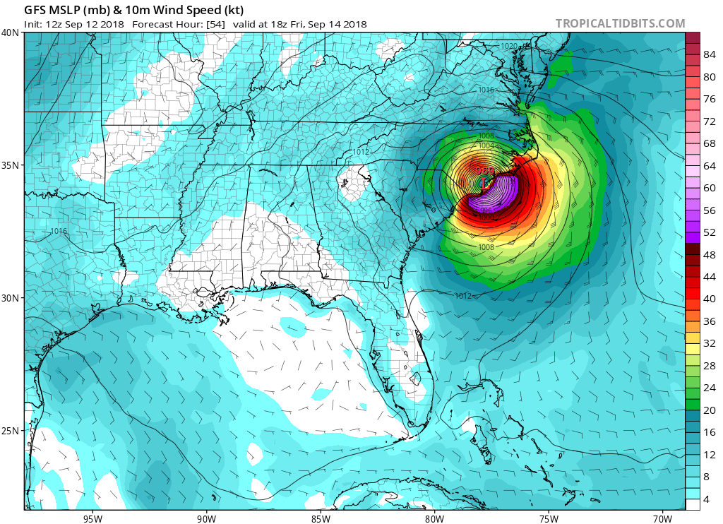
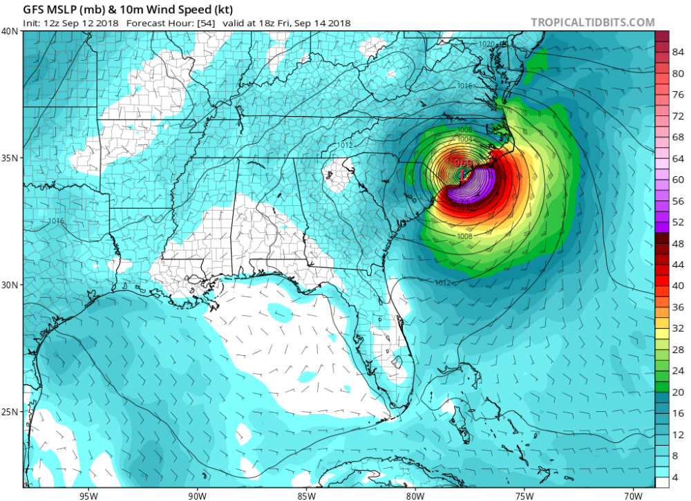
12z GFS makes landfall on Friday vicinity of Wrightsville Beach. That is far enough north to cause some power outages in parts of central and eastern NC especially downeast NC and the sandhills. Raleigh will feel it in this position. Don't let your guard down, Florence is an impressively strong storm and obviously very dangerous.
-
Good point. I'll stand corrected then. If it is useful to folks then I'm good with it too.
-
Its a misleading graphic, and I think they should change the way they present that information because it will confuse most of the general public. Why show 5% chances in that manner? The information could still be reported, but not in such an alarming and confusing manner.
-
That is ****ing amazing. Thanks. I don't recall ever seeing such a report. That energy will propagate into devastating surge for the Cape Lookout region on the projected path.
-
Keep check on your local NWS office. Your area could still get eyewall effects if the path ends up that way. If so, you could have down trees and power outages. Local flooding is possible as well.
-
Yes, and any slight change will have rather large ramifications inland as you have noted. Thursday night and Friday will be nerve wracking. We are not out of the woods yet, and I know many are still in the thick of it, but there is a chance. Carolina Beach, Kure Beach, Wrightsville Beach, the whole of Topsail Island look to be ravaged.
-
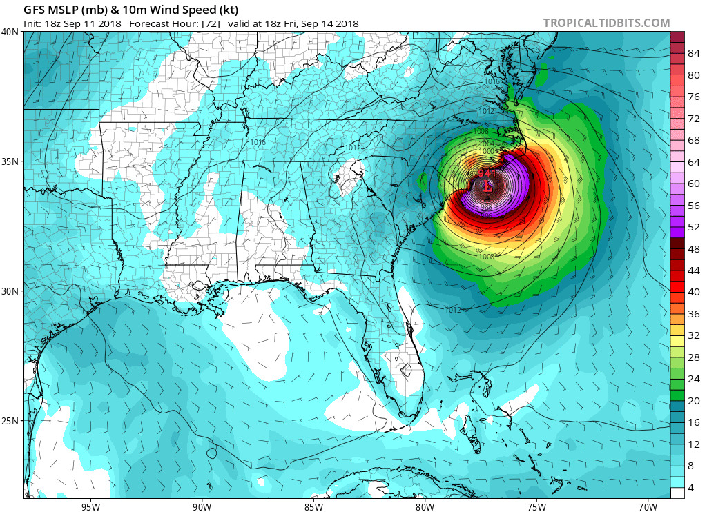
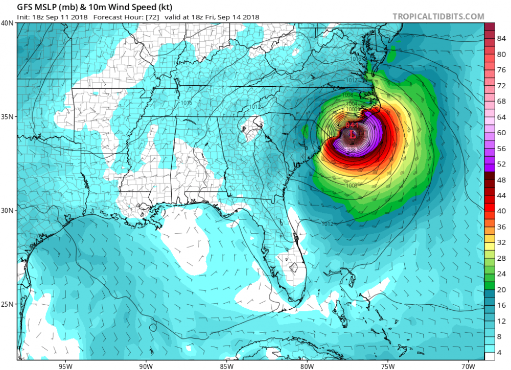
This hurricane, being the major hurricane that it is and forward motion this morning of 17mph, roaring into Onslow Bay and coming to a relatively abrupt stop and pivot if it occurs as modeled is really something to behold. I will never complain about a high pressure ridge again and always remember this time. I hope everyone fares well and stays out of the eye wall effects.
-
That's an awesome pic. Is it Wrightsville beach? My father was in the eye wall of Hazel, I was in the eye wall of Fran.
-
I hear you. It increases the uncertainty. If it does happen like this though, many inland folk will be fortunate to not have that monster eye wall get any closer. Wow. BTW - Irene and Isabel, both left trees on this house.
-
A storm that strong even the little wobbles in Onslow bay will make a difference inland. Yikes.
-
I'm intrigued by that solution as well. Is there another Ukie run soon?
-
Sure. Several models have shown this. Landfall is technically only after the full eye moves over land, so it could brush onshore without making a full landfall and then go elsewhere!
-
Agree. If it truly does lose all or practically all steering currents and is just spinning over the ocean like a top, it will tend to bounce off the land mass.
-
Incremental change from NHC for 11pm update allowing for forecast southwest motion.
-
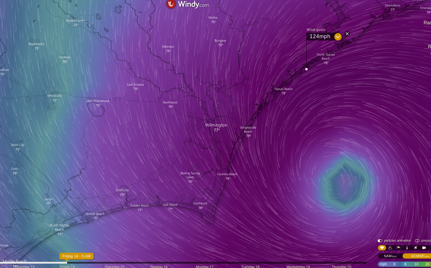
Screen grab from the Windy.com app using the 12zEuro data showing gust of 124mph on Topsail Island forecast 5am Friday.

-
Yes, go by the NWS. They may change those graphics in a day or two to adjust to changing information. They are also in lock step with the NHC. They only change incrementally. If the actual data and the models continue to show a more southern solution, they will adjust as we go through the next 2 days.
-
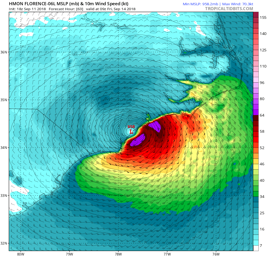
18z HMON shows landfall at 9z Friday near Topsail Island with Flo likely a cat 2 or 3 in previous frame..

-
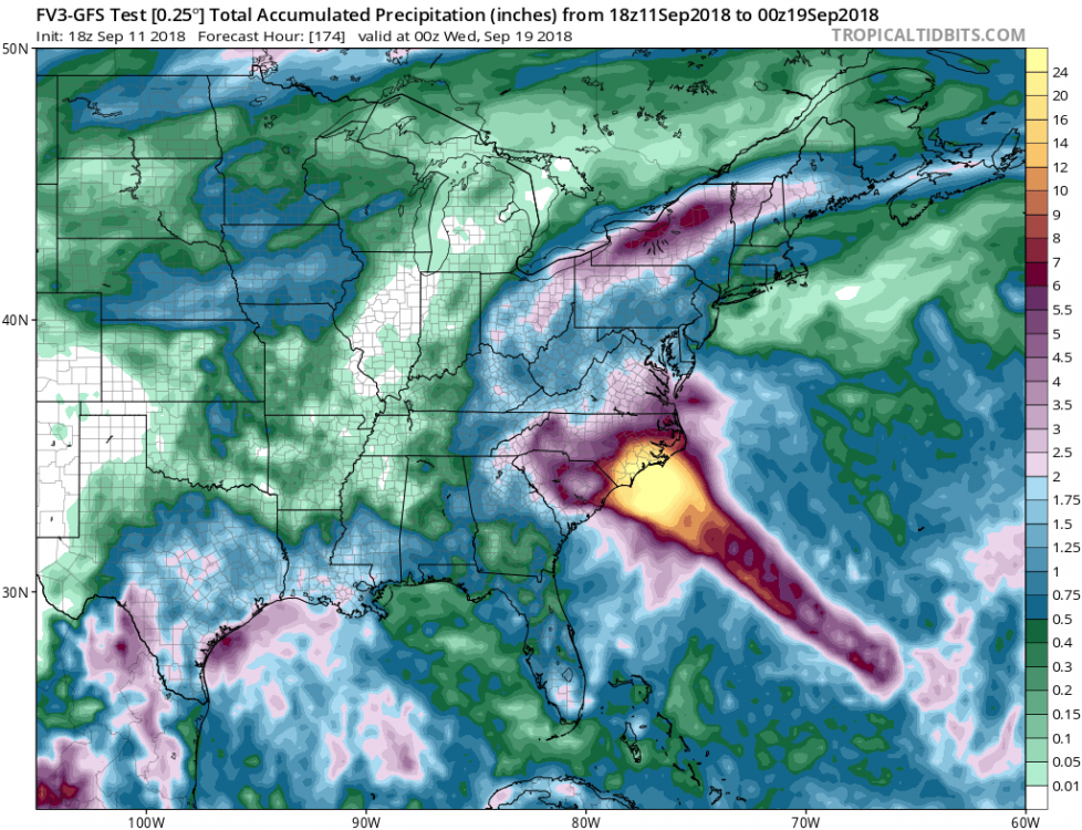
This is what the 18z FV3 shows through Tuesday. looks to be 6-8 for most mountain areas.
-
I think so yes. I suspect the NHC will continue to make slight incremental changes to the cone and positions to account for the model run changes.
-
Its a good question downeastnc. 18Z GFS stalls in Onslow bay
-
Our site right here has an excellent model center: https://www.americanwx.com/bb/models/model_center.html/ And the Tropical Tidbits site is also very good: https://www.tropicaltidbits.com/analysis/models/
-
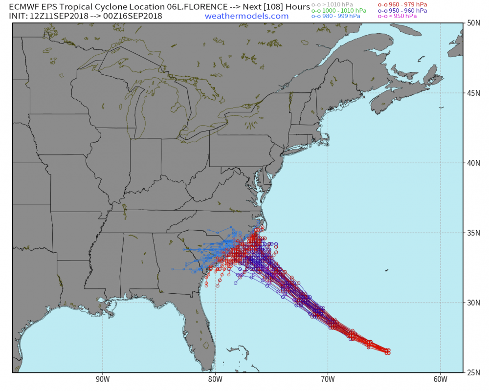
Current Euro 12z ensemble members for reference

-
12z Euro - this amount of rain along with the storm surge will flood Wilmington. Folks should evacuate if unsure of their situation.

-
This has to be a surprising look for folks along the coast south of Charleston that may have considered themselves out of the woods.
-
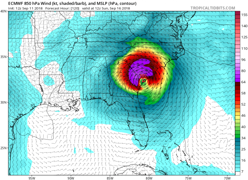
This is the first Euro run since it nailed the NC hit on day 9 (day 10?) to show a loop-like motion similar to what the (admittedly) zany GFS has shown. Not the same, and still suppressed, but that stall near Wilmington and then the motion back down the coast a bit before heading west is similar.