21chuck
-
Posts
86 -
Joined
-
Last visited
Content Type
Profiles
Blogs
Forums
American Weather
Media Demo
Store
Gallery
Everything posted by 21chuck
-
What did the central pressure for this storm bottom out at? I can't find the number.
-
Wow Rhode Island truly in BECS territory unbelievable.
-
Agree this feels way lower impact than the system 4 weeks ago ironically.
-
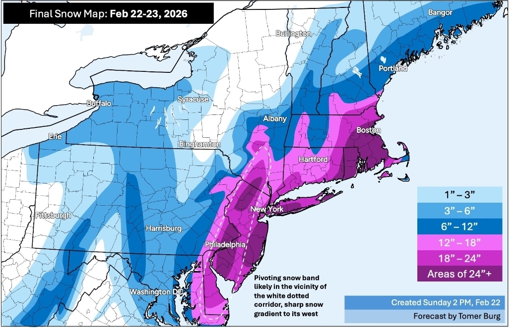
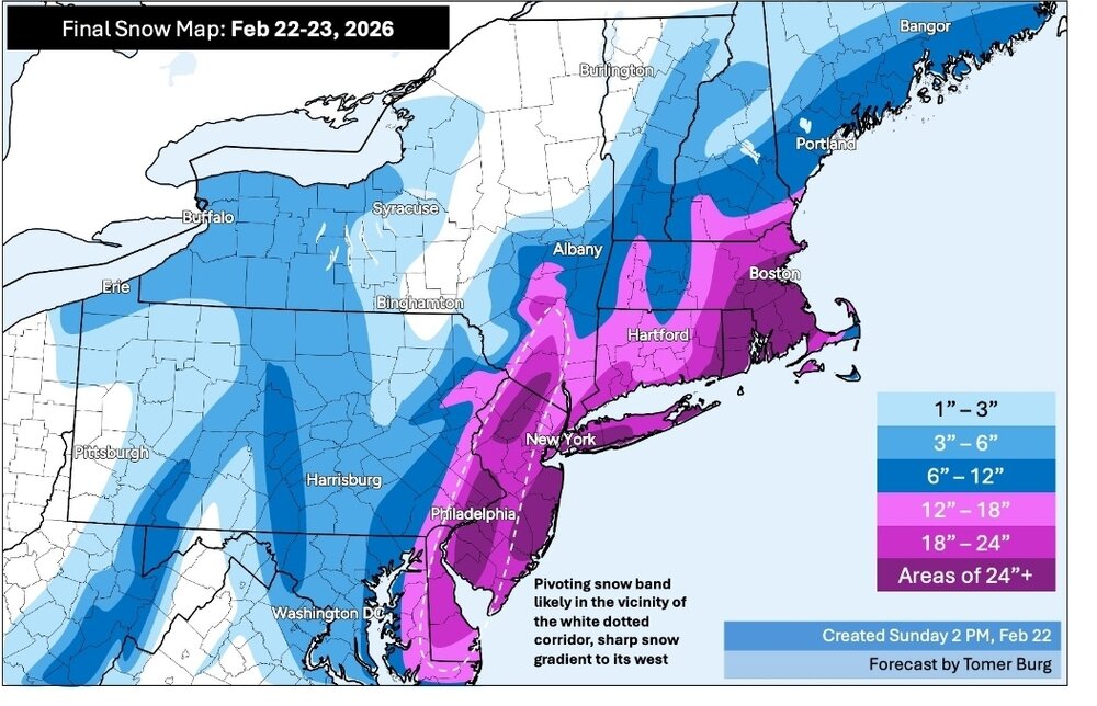
Very pleased with this storm obviously but this has to be the millionth time a historic Mid Atlantic storm ends up being a historic New England storm. Looks like they might be looking at 30" in areas there.
-
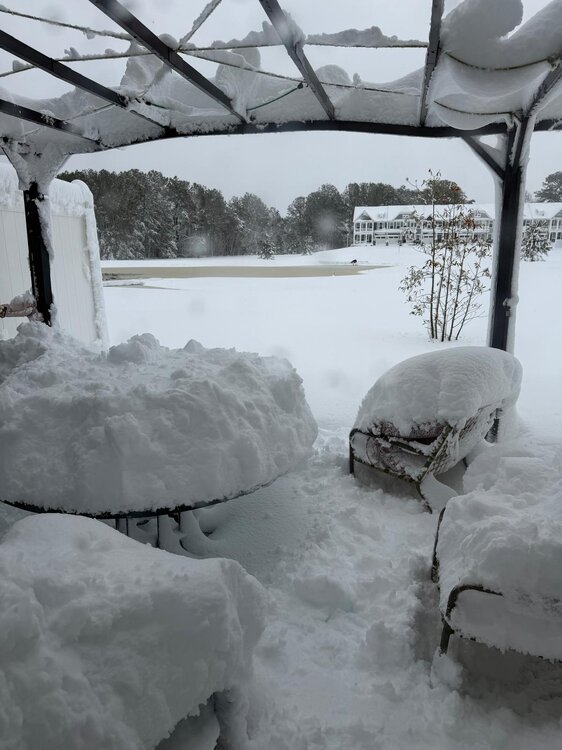
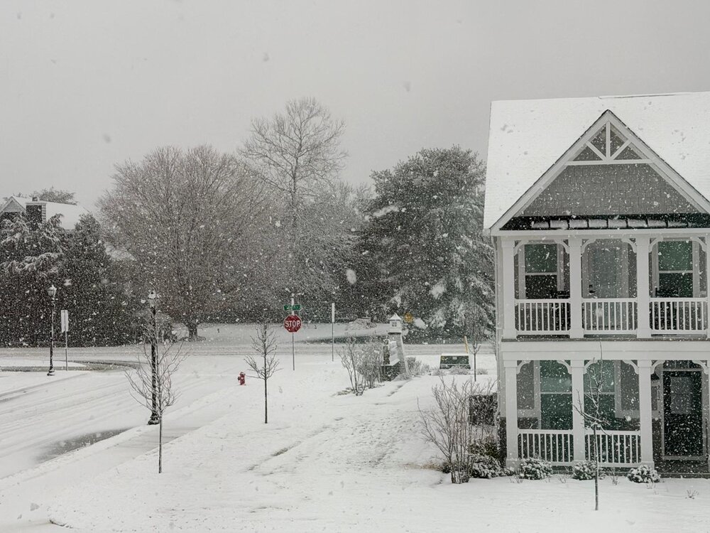
This was family's backard in lewes Delaware this morning. Totals must be huge as well.
-
So tantalizingly close
-
In south philly the depth is 12" currently but I measured 12" inches at 3 AM... so the compaction was real! Actual total probably more like 16"? I think the heaviest returns were just east of us almost all night. NWS verified. I'm sorry I ever doubted them.
-
The only other time I've seen snow fall like this was in lake tahoe, CA.
-
Difficult to say with certainty but also getting measurements between 10 and 12 inches. 10-12 was my personal final call on Saturday but the NWS forecast is looking pretty good right now.
-
This forecast from 12 hours ago is panning out in real time.
-
Watching this pan out in real time 12 hours later

-
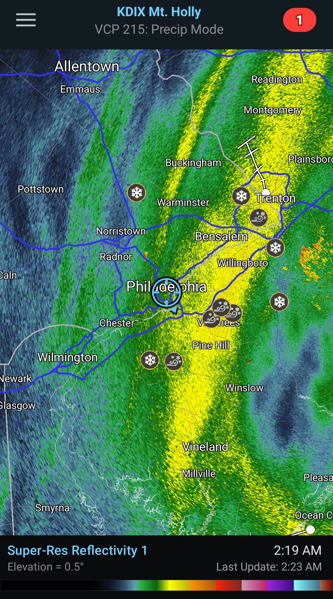
Wowwww!!! What did I just wake up to Camden County getting obliterated right now I assume
-
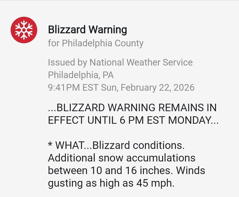
Didn't even notice Mt Holly posted updates around 45 minutes ago for an additional 10-16 inches in Philly. I have about 5-6 down in south philly currently (compressed total). That would make me on track for their 14-20 call...
-
Man looks like Delaware is getting absolutely clobbered right now.
-
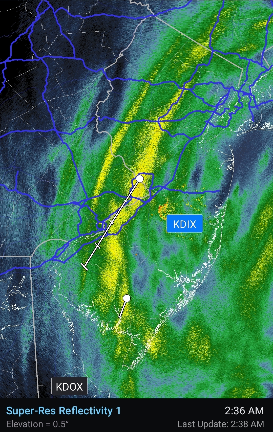
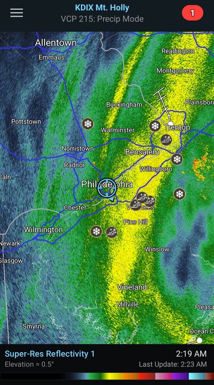
I have been jealously watching the radar bloom right over your head and then fizzle slightly as the bands hit me in south philly. Snow growth has been good in the last hour though. About 3 inches in south philly. Had a bit of catching up to do because the urban heat island had surfaces so warm to start. Minimal wind and wet flakes has made it a gorgeous snow so far.
-
Coming down heavy and piling up fast in Rehoboth DE area (shared by family)
-
Heavy rain to heavy snow transition really blossoming to our south now.
-
All the models outputting huge totals accounted for trivial daytime accumulation. It's supposed to be raining right now
-
E PA/NJ/DE Winter 2025-26 Obs/Discussion
21chuck replied to LVblizzard's topic in Philadelphia Region
That's Camden -
Only one final measurement for total compacted snow + sleet in south philly: 7.1 inches. But drifts near 2 ft! Gonna be around forever, at least by our standards.
-
So interesting to watch that sleet line climb and fall.
-
Any folks here recall sleet at temps this low? I've only been around the region for 10 years but I cannot.
-
Just going off of user reports on radarscope, maybe not the most reliable.
-
I know, but did any model show it happening for Baltimore? Also ripping sleet in south philly right now.
-
A mix of light to moderate snow and sleet in south philly. 6.0" on the dot. I see some reports of plain snow in Baltimore SW of this heavy band. Maybe a temporary switch back is possible?