WeatherWeenie87
-
Posts
55 -
Joined
Content Type
Profiles
Blogs
Forums
American Weather
Media Demo
Store
Gallery
Everything posted by WeatherWeenie87
-
Winter 2020-2021 whining thread
WeatherWeenie87 replied to BullCityWx's topic in Southeastern States
I'm snow chasing next winter! Going to the Ice Hotel! -
NAM sucks me right back in What's that song called "I knew you were trouble when you walked in"
-
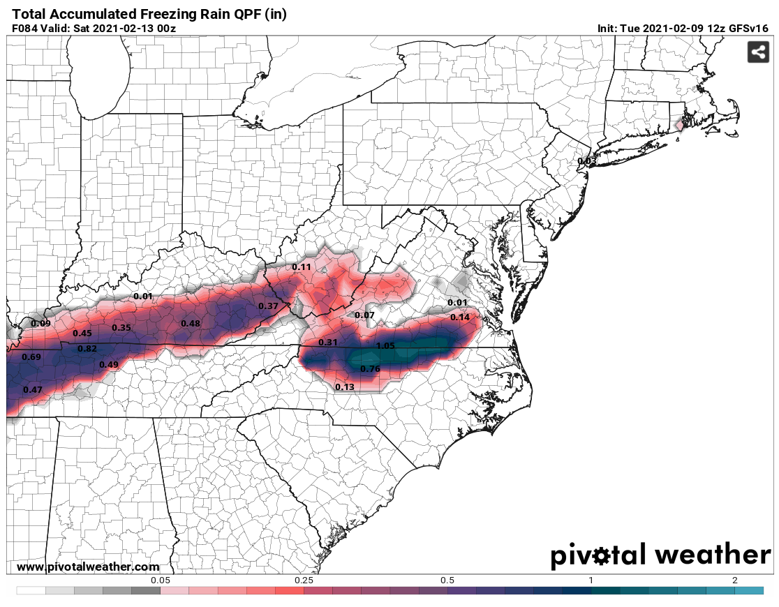
Amazing snow map! Would be fantastic if verified!
-
Winter 2020-2021 whining thread
WeatherWeenie87 replied to BullCityWx's topic in Southeastern States
I don't know why this is a surprise to everyone. The SE is warming year over year and dew points are rising also. We will have more and more mixing issues and the warm nose will increase in intensity. The fact the mountains has been blessed with this much snow and the SE hasn't torched as badly this year is a miracle. Always something to be thankful for. -
So many threads for these storms Guess that's a good problem to have!
-
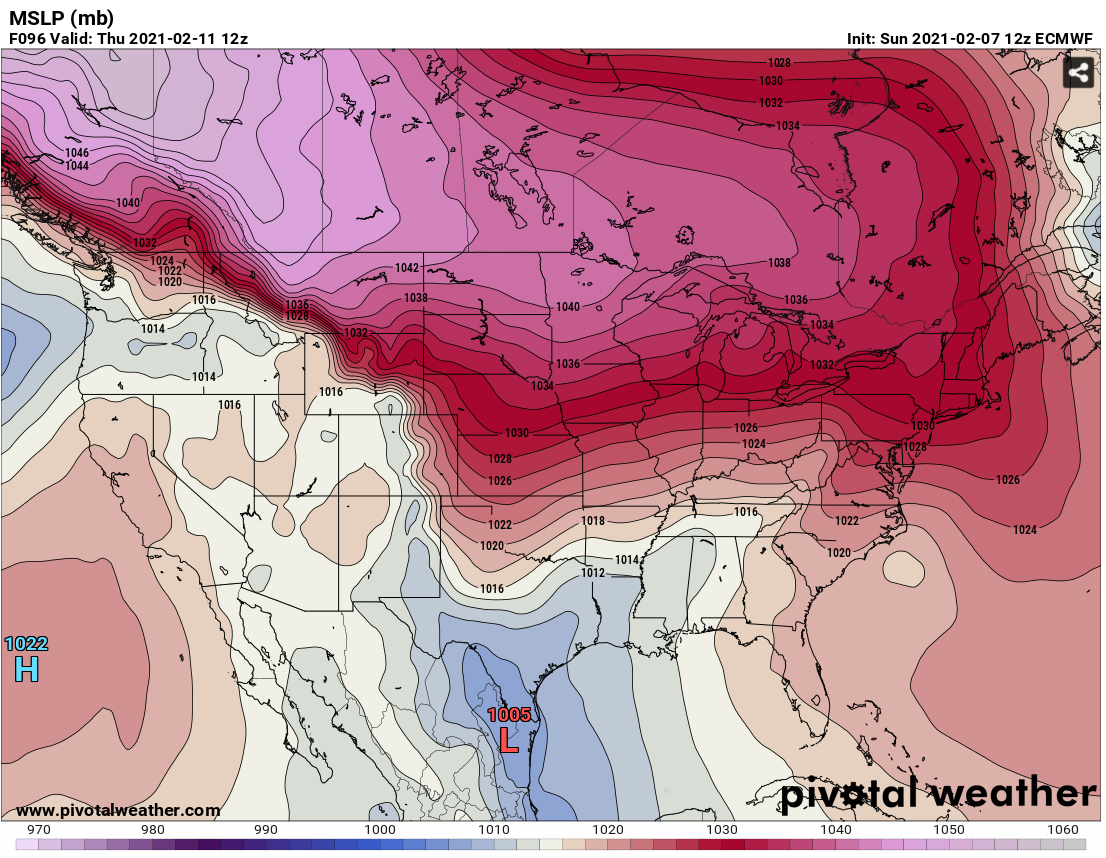
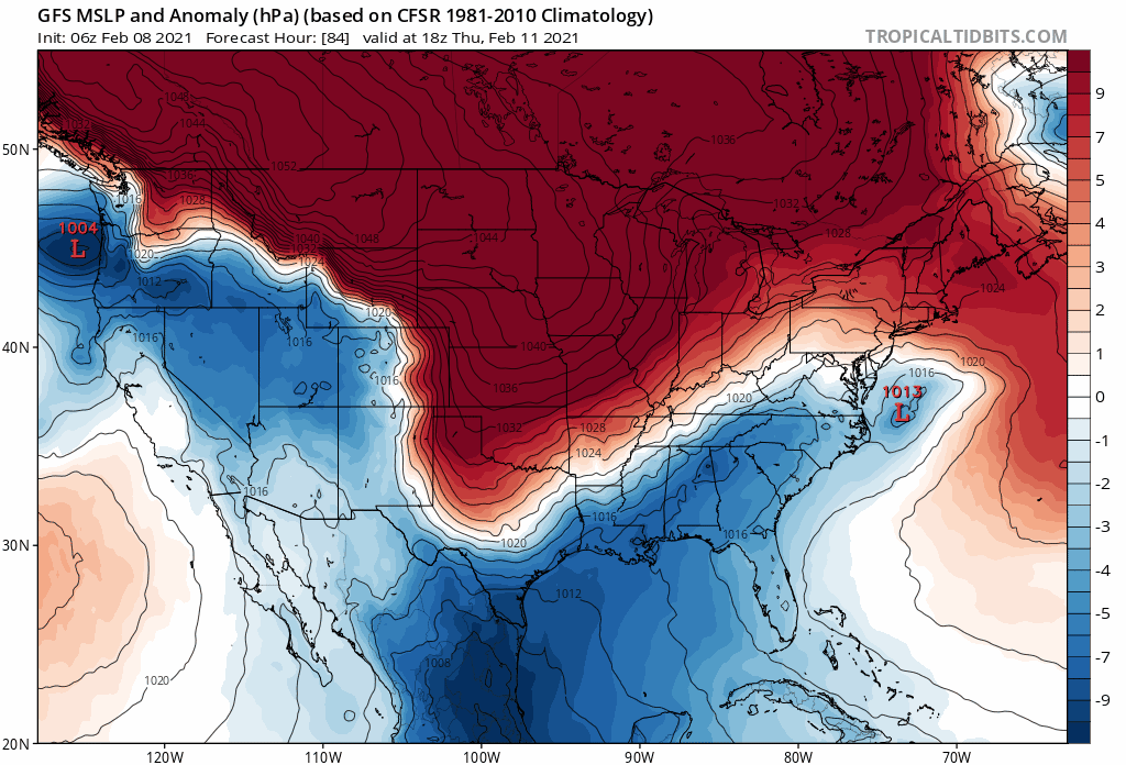
it's actually 1044 This time it looks like we will not have the marginal cold issues to deal with. I know lakes lows have screwed us over the last few years. This is true, but it's also about the gradients.
-
The ups and downs this season is worse than the ups and downs in Days of Our Lives. It sucks there is not as much data going into the models to produce accurate results. I hope the Triad folks get a snowy surprise this weekend!
-
The a branch breaker for sure! Better charge your phones!

-
Never seen so many Miller A rainstorms in 1 model run for AVL. I'm happy to just seen snow this winter. Always something to be thankful for.
-
Amazing trends! Classic CAD and Miller A!
-
Amazing Run for the GFS! So many opportunities!
-
Can't get a better look than this

-
It's not appropriate to judge what the exact p-type will be this far out. That is a clear CAD signature with a Miller A on the GFS. It's also depicted on the Euro.
-
I'm amazed nobody is talking about the system for next week! Banana 1050+ High!
-
If I recall, the winter storm we had last night was not picked up by models until 4-5 days in advance. Less planes = Less accurate results. https://www.ecmwf.int/en/newsletter/163/editorial/ecmwf-and-covid-19
-
2020/2021 Fall/Winter Mountain thread
WeatherWeenie87 replied to Met1985's topic in Southeastern States
It's really been remarkable. It's been awhile since I seen storms training like this. -
The Asheville Heat Dome never fails!
-
Heavy Snow in Asheville!
-
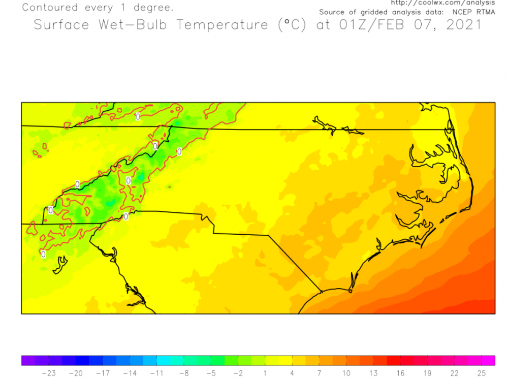
Looks like this may be a severe event for the OBX. Things are trending stormy....
-
NAM has been verifying rather warm lately....
-
It's a Miller B setup.
-
The NAM features a cold front coming from the gulf LOL Think this may be a outlier.
-
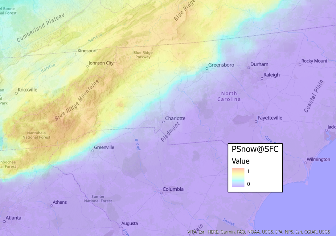
Here are the locations expected to receive snowfall... 0=0% 1=100%

-
HRRR wants to turn this from a Gulf Low into a Colorado low. Epic model battle ensuing.
-
Nice shift south! I knew the 12z suite were outliers.