.jpg.949052775cf13715749e9bd3740a4bd3.jpg)
Bigbald
-
Posts
174 -
Joined
-
Last visited
Content Type
Profiles
Blogs
Forums
American Weather
Media Demo
Store
Gallery
Posts posted by Bigbald
-
-
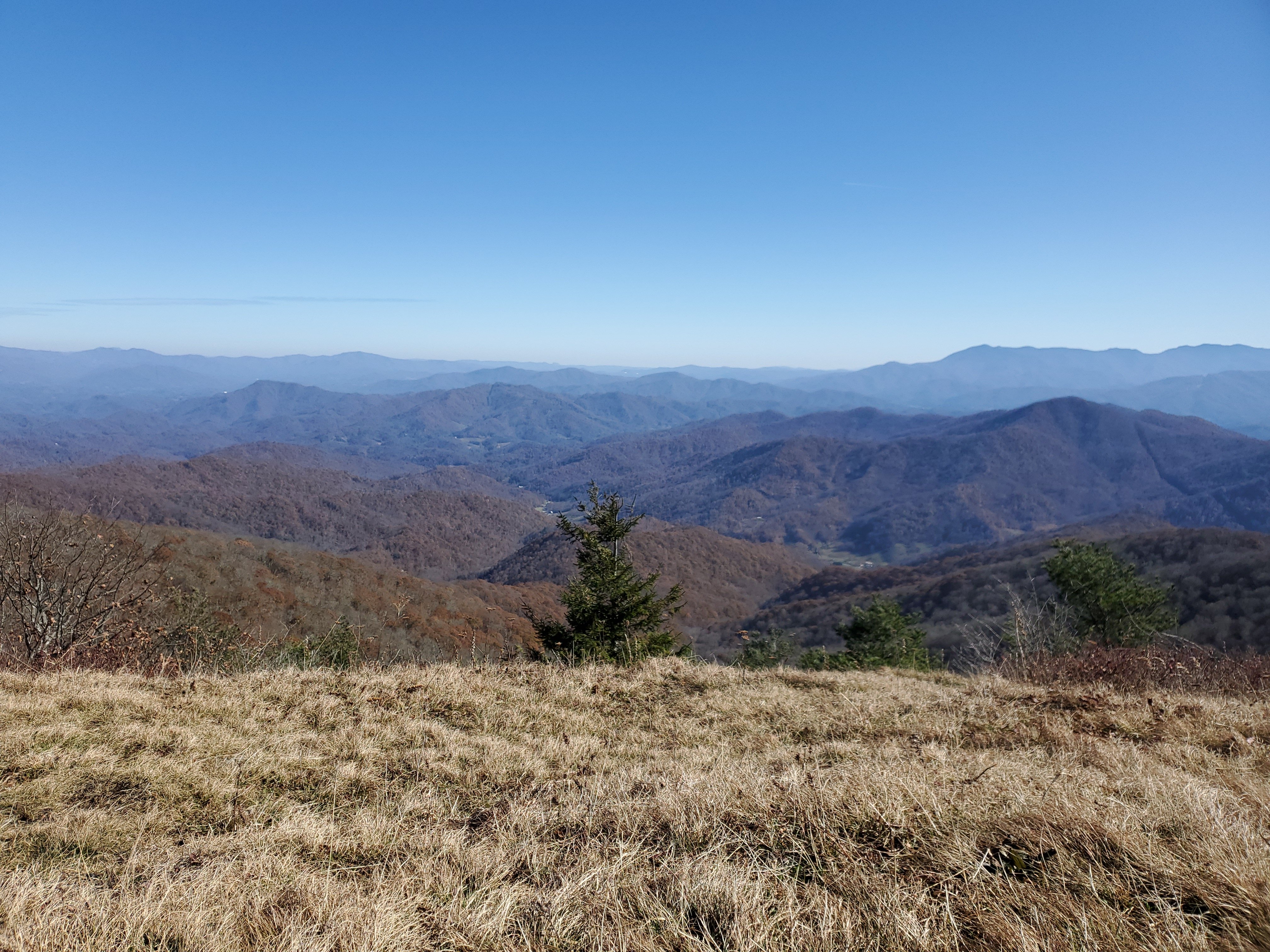
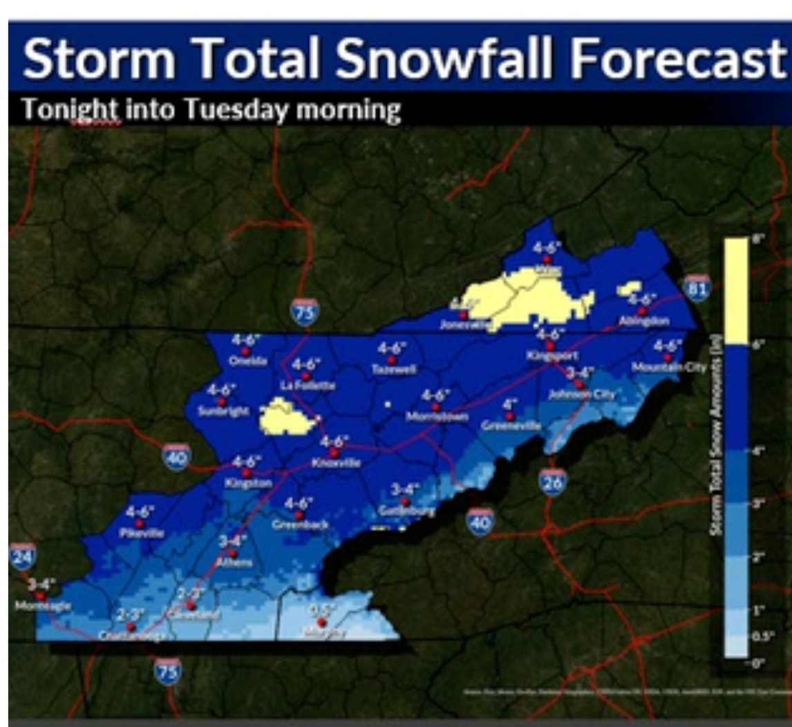
Seems like Wise, VA ought to be a good place to better understand long term winter patterns, a place purportedly averaging 50 plus inches of snow and isn't dependent on one or 2 storm tracks to make or break snow totals. When a place averages 8 inches a year it can be fickle, but when you avg 50 inches and your ending up in 20s or less it tends to stick out.
-
 1
1
-
 2
2
-
-
2 hours ago, Met1985 said:
Yeah big time snows over here in WNC. One of the best upslope events in a long time.
I loosely watched radar returns at both SS and Beech, it looked like Beech had more and better returns. I haven't heard anyone gawking at SS aftermath. I watched it unfold at the base of Sugar, man it was magical 48 hrs. Skied Friday until the bitter cold got the best of me.
-
3
-
-
I wonder who won the battle of the flow snow between Snowshoe and Beech/Sugar Mtn? Models were spitting out ridiculous numbers at SS in the run up but I'd be shocked if they were higher than what Beech ended up. I've heard reports from 16 inches upwards of more than two feet, But with all that wind who knows.
-
3
-
-
35 minutes ago, StantonParkHoya said:
This has been incredible at Banner Elk. Non stop powder 19 degrees.
It is, I am in banner right now. Pouring powder.
-
4
-
-
There is a thin line of a flizzard that is causing havoc on the roads, I am guessing the front pushing through and squeezing out the last remaining moisture. It is nearly parrellel to I 81.
-
2
-
-
Pretty crazy contrast
-
4
-
-
8 minutes ago, John1122 said:
Looked like it was about to clear out here and then radar suddenly filled all the way back to Fentress County. Possibly the lee side low causing it.
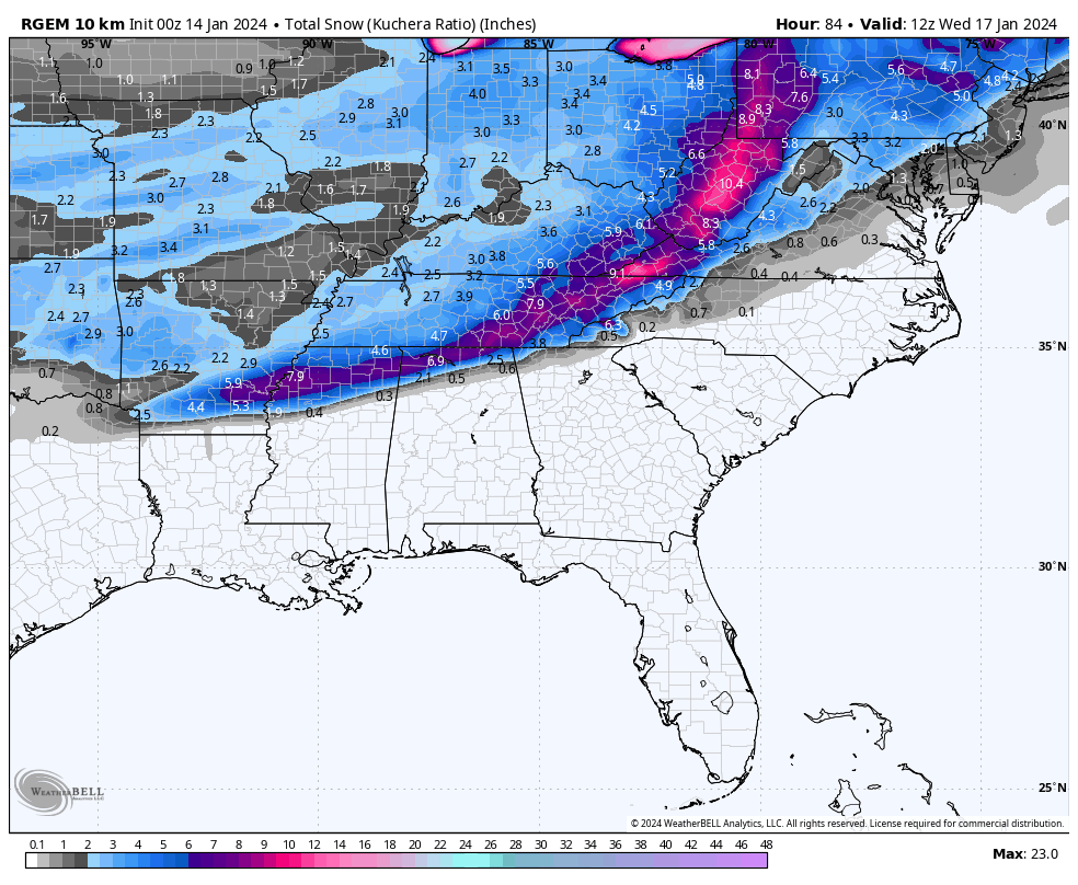
Hard for me to wrap my brain around 10 more hours of light snow like rgem/hrrr show with the lee side for swva upper east TN. Has any meso model not shown it?
-
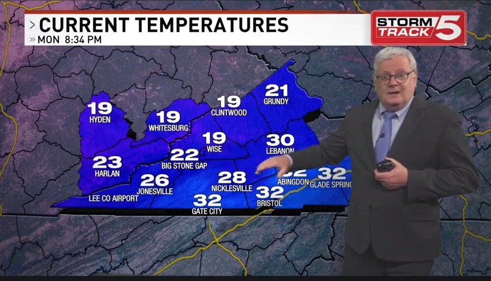
Not sure if WCYB decided to quit forecasting over the winter warning criteria or what. They've been sitting on 3-6 inches for upper East TN for awhile now. Like another poster stated, not sure it really matters.
-
I believe RGEM upped totals.

-
3
-
-
6 minutes ago, PowellVolz said:
Actually that might not be good for them. That could be, likely bright banding. When snow is in the process of melting on the way down it expands, gets bigger. When it gets bigger it shows up on radar as extremely heavy precipitation. I’ve been under those before and it could be light rain switching back and forth to fat mush flakes.
.Interesting, did not know that.
-
1
-
-
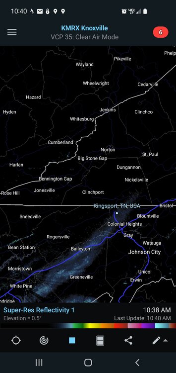
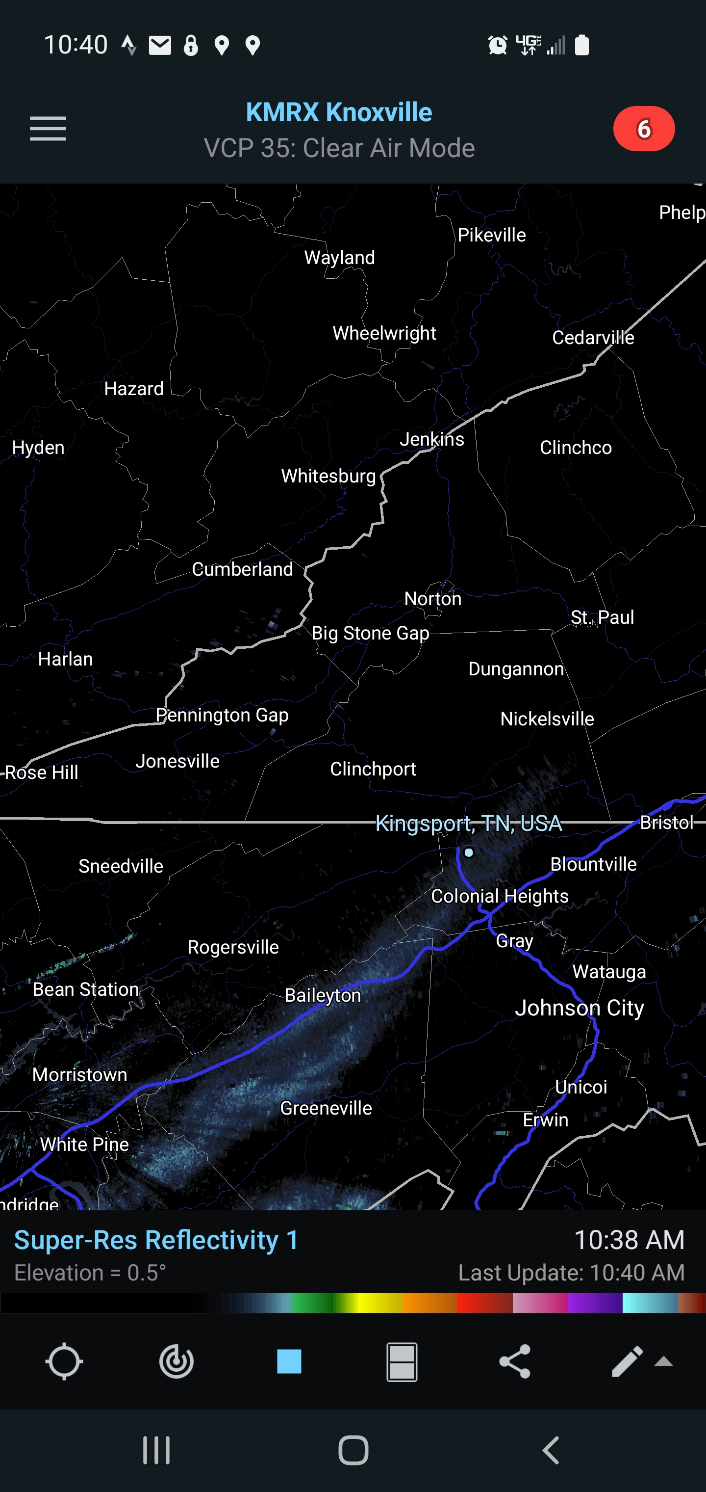
It's like that blob of yellows and orange on radar scope is just sitting on morristown. Impressive!
-
1
-
-
10 minutes ago, *Flash* said:
So, I know the event is still ongoing...and I need to get caught up on about 15 pages of comments. In terms of modeling W's and L's, how are we breaking down performance? Certainly, NOT a win for the Euro...
This is kind of trivial but I am curious to understand one thing from the vets on here.
For those of us in the east we were really interested in the low placement off NC. The track is projecting a near perfect northwest turn, almost slightly inland, but we don't appear to be getting the northwest flow wrap around (?) at the tailend of the storm that the gfs and cmc showed with this track. For those with the experience, Is the absence of the backend flow due to the result of popping the lee side low?
-
1
-
-
Gatlinburg really getting it good on radar
-
2
-
-
MRX starting to bump totals up on the map

-
4
-
-
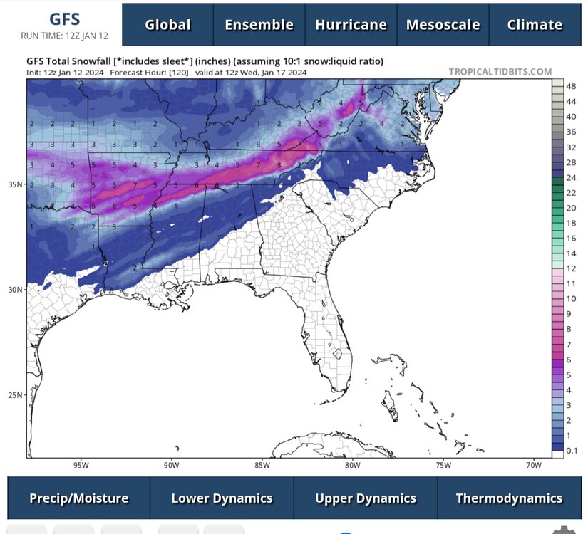
12z gfs says let's do this again. Would be incredibly high snow ratio.
-
6
-
-
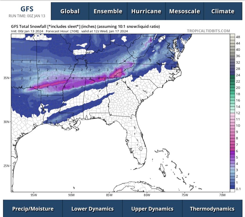
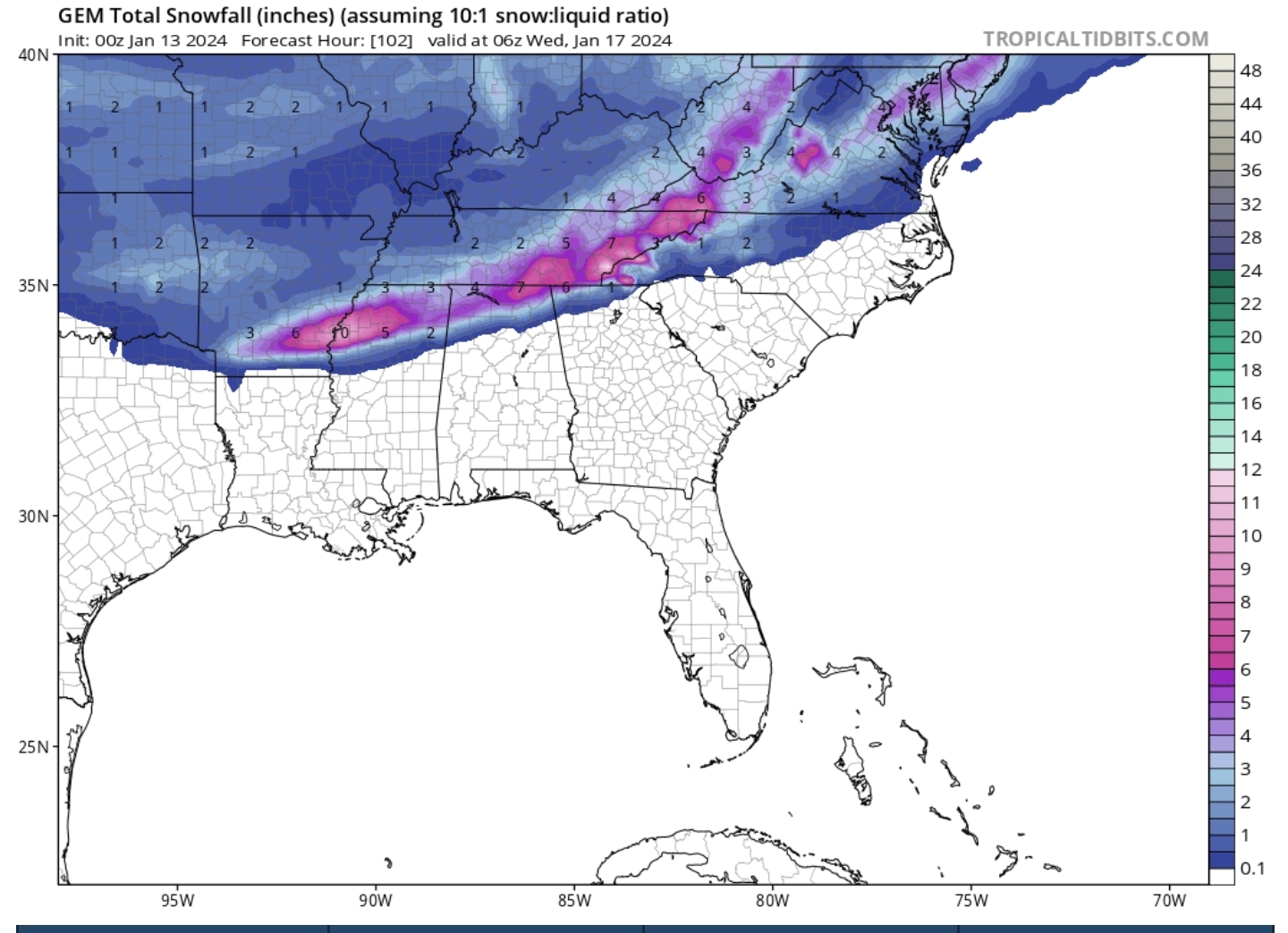
10 minutes ago, Silas Lang said:
0z RGEM pretty much the same as the 18z, but gives a little bit more to areas favored last run.
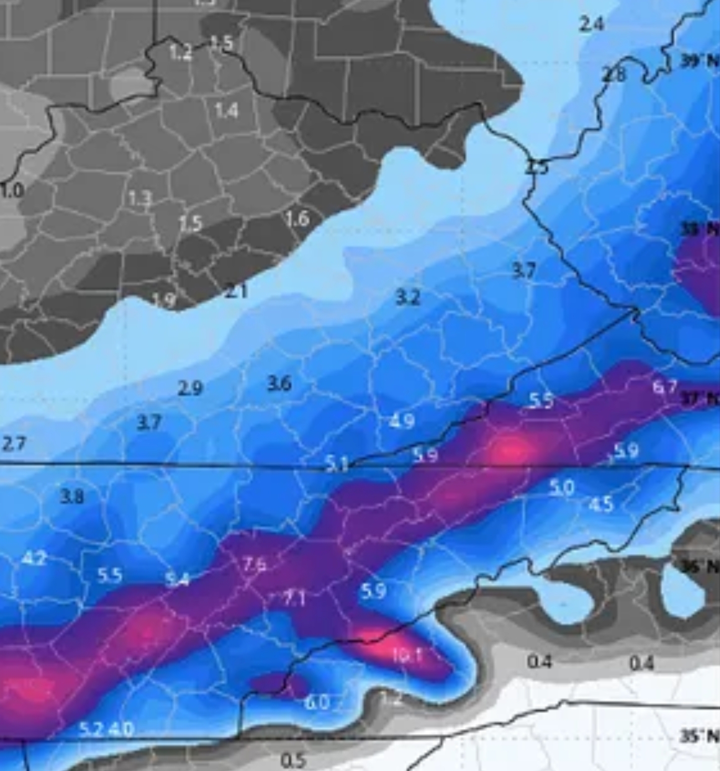
For SWVA folks, Look at the agreement on the NAM and RGEM for the communities of Duffield/Jasper/Big Stone Gap.
-
3
-
-
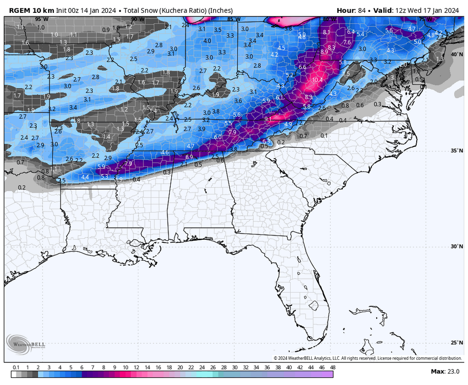
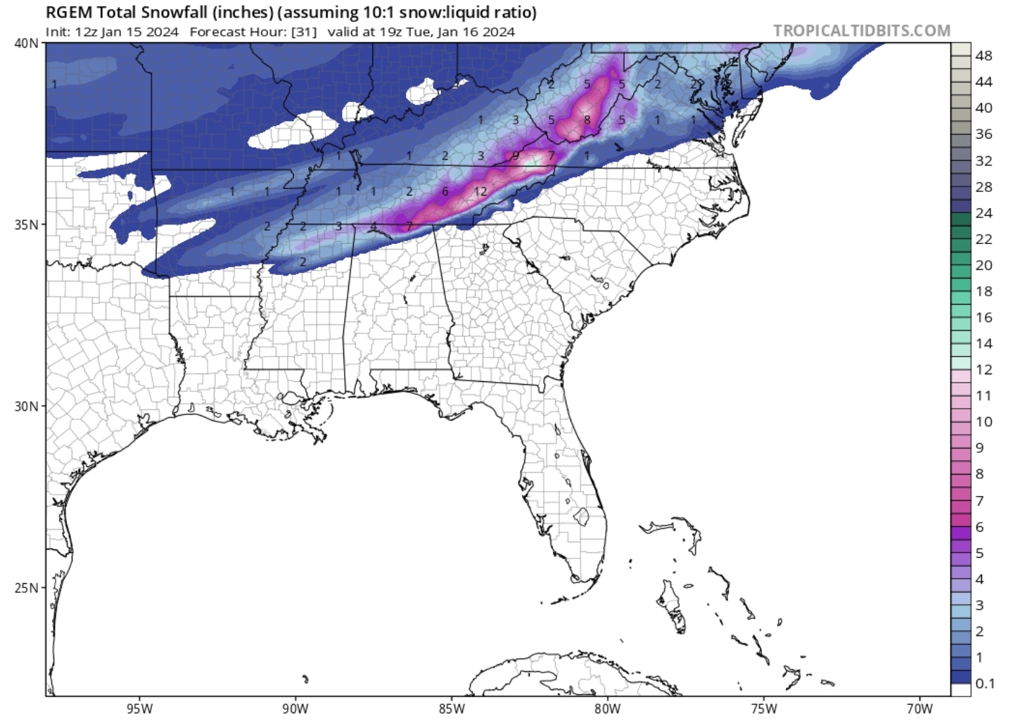
Looked like NAM pretty much painted all southwest va with 8-13 inches kuchura, high knob lolli pop.
-
2
-
 1
1
-
-
This little corridor has been showing up a big winner across multiple model runs here and there, and of course on the RGEM over and over again. I hate to even bring it up because I am in it.

-
5
-
-
14 minutes ago, Holston_River_Rambler said:
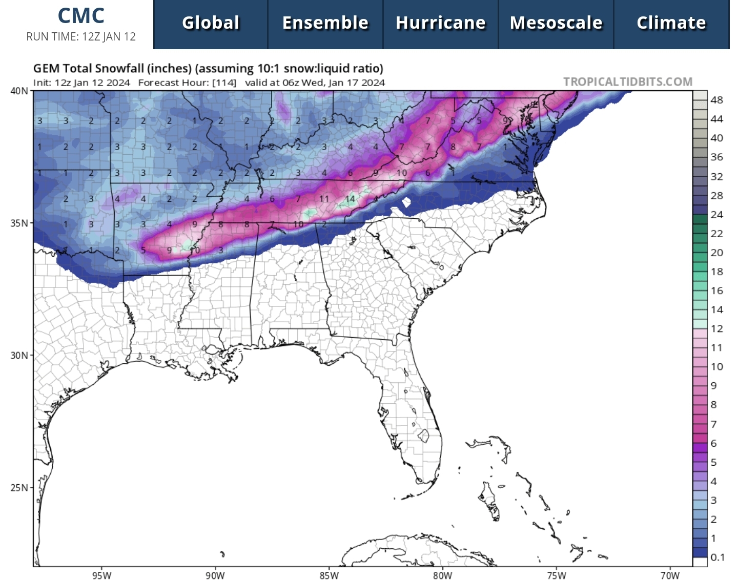
Close to a big dog again on the 12z GFS for the late week system
14 minutes ago, Holston_River_Rambler said:Close to a big dog again on the 12z GFS for the late week system
Yeah thats nice, wow
-
1
-
-
1 minute ago, TellicoWx said:
With this system being a little flatter, it may leave the gulf more open for #2 (or the wave may turn into a #2 lol)
Have been consumed with watching the first wave but seems like 12z suites are baby stepping the low more northwesterly up the east coast. Would love to see some bonus backend high ratio snow for east tn
-
2
-
-
12z cmc looking very interesting with the turn NW at the end, that's close to a big dog run
-
4
-
-
RGEM rock solid run over run. Would be east TN best case scenerio.
-
3
-
-
11 minutes ago, Stovepipe said:


-
1
-
-
15 minutes ago, PowellVolz said:
I think it’s a combination of all mods with some tweaks.
Regardless, that’s one of the best runs I’ve ever seen for Tennessee
.As George Constanta might say, there is shrinkage


March/ Spring mid-long range
in Tennessee Valley
Posted
Have to imagine this has been one the warmest March starts on record, are we averging plus 7-10 on temps for March thus far?