
letitsnow
-
Posts
18 -
Joined
-
Last visited
Content Type
Profiles
Blogs
Forums
American Weather
Media Demo
Store
Gallery
Everything posted by letitsnow
-
The “I bring the mojo” Jan 30-Feb 1 potential winter storm
letitsnow replied to lilj4425's topic in Southeastern States
And the observation thread, joshm's obs thread did not keep the mojo going for many of us. -
When all the mojo goes to juju right after somebody creates an observation thread, they should be banned forever from creating any more.
-
On the other hand, you should never create another one. Phenomenal mojo turned to shitty juju right after the obs thread was created, with the wrong title no less.
-
January 30th- Feb 1st ULL and coastal storm obs
letitsnow replied to JoshM's topic in Southeastern States
Congrats to those getting powder, enjoy! Nothing but a flizzard and bust imby, bad juju. -
January 30th- Feb 1st ULL and coastal storm obs
letitsnow replied to JoshM's topic in Southeastern States
Full blow blizzard flizzard here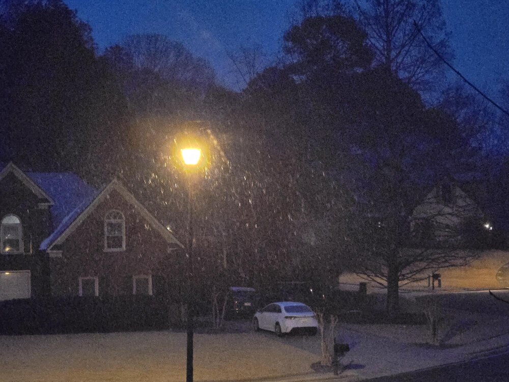
-
The “I bring the mojo” Jan 30-Feb 1 potential winter storm
letitsnow replied to lilj4425's topic in Southeastern States
And if it gets to that point the observation thread too!! -
The “I bring the mojo” Jan 30-Feb 1 potential winter storm
letitsnow replied to lilj4425's topic in Southeastern States
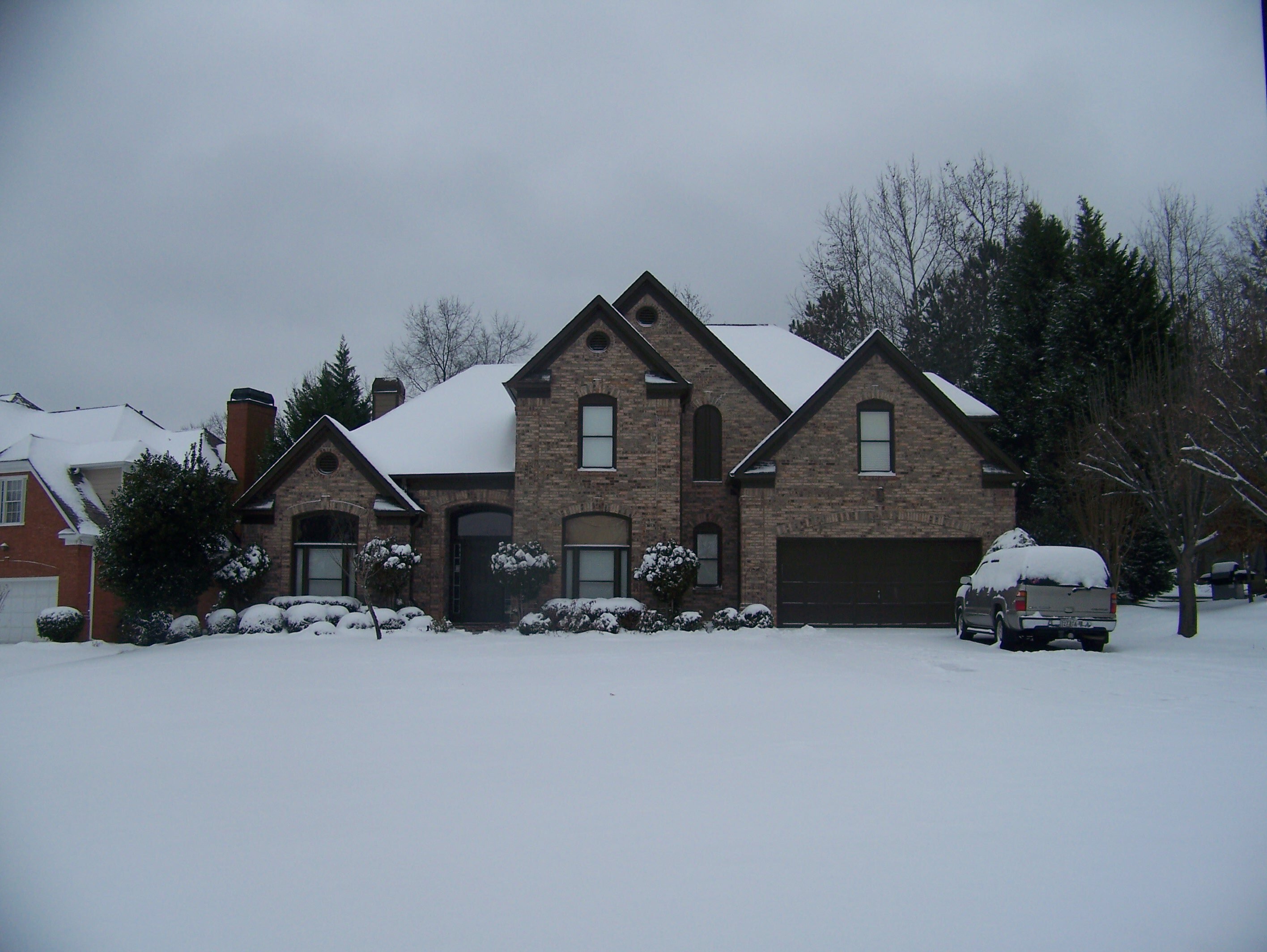
This particular shot was taken on February 12, 2014 on Glenwood Avenue in Raleigh, just up the street from the Angus Bar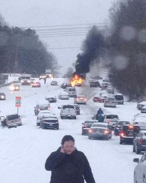
-
January 30th- Feb 1st ULL and coastal storm obs
letitsnow replied to JoshM's topic in Southeastern States
Bad juju, should've been called "keep the mojo going" -
The “I bring the mojo” Jan 30-Feb 1 potential winter storm
letitsnow replied to lilj4425's topic in Southeastern States
Putting down pre-emergent on top of snow when the soil temps are nowhere close to 55 degrees is just wasting money. -
You know things are way out of control when the NWS has to put this into their AFD (FFC) Source - National Weather Service Storm Threat Late Next Week? (Spoiler: Unlikely For Now) You may have heard about or seen posts on social media regarding a snow or winter weather threat in Georgia late next week or next weekend. Well, at this time, that threat appears to be quite low. The two primary ensemble models (ECMWF ENS and GEFS), which combine for over 70 members, are showing very strong agreement on the much cooler than normal airmass over the region. They`re also in pretty strong agreement on the region being in a dry and precipitation free airmass, with only a small sample (less than 10%) having some moisture moving through. So for now, we will continue to watch how things progress, but keep any winter weather out of the official forecast.
-
Southern Crippler - Get well soon Jimbo Storm Obs
letitsnow replied to BooneWX's topic in Southeastern States
Moderate sleet and freezing rain currently with the "last batch" coming through, sitting at 30 degrees. Here, as in most parts of NE Metro and further N in GA, we did have light freezing rain accruals earlier, you can almost see the ice growth on the trees and other objects, still hoping for the best at this point. This has been a strange and crazy storm, none of the models got it right, they each had their little parts but in the grand scheme of things it just shows the weather will do whatever it wants, and never underestimate the CAD. Safety for all and a huge thank you to all first responders and utility workers! -
Southern Crippler - Get well soon Jimbo Storm Obs
letitsnow replied to BooneWX's topic in Southeastern States
Sawnee down here (my co-op) brought in a lot of extra's too; hopefully they won't need them when this last batch comes through. As many have said, CAD was much stronger, there was no sleet down here on any of the models until the very last minute, and that was the HRRR but only about an hour or two before it happened. That CAD saved a whole lot of us, so far, now it might actually hurt us. Huge credit to the power companies for being prepared, now we need to hope and pray they don't need those workers with the last batch coming through. -
Southern Crippler - Get well soon Jimbo Storm Obs
letitsnow replied to BooneWX's topic in Southeastern States
Sleet (which wasn't on any of the models for this area) saved us and probably a lot of Metro Atl early this morning, now the question is will the squall line turn into freezing rain later today NE of Atl. Hopefully rates will be such there won't be much accretion. Suwanee, GA 30024 -
2021-2022 Fall/Winter Mountains Thread
letitsnow replied to BlueRidgeFolklore's topic in Southeastern States
Not in the Mtn's but wouldn't mind it at all. Refuse to post anything in a thread called izzy or anything twc named. A pic of our token 2" or so yesterday which was absolutely beautiful
-
2022, Dogs win the Championship actually beating Alabama and GA (and the rest of the SE) could get a nice snow storm.. Miracles can happen..
-
Try living in Pittsburgh in the so called spring they have..
-
Cartopper sleet/snow under a band
.thumb.jpg.1d55d9a6f81fdaca3322ae34bc15efca.jpg)


.jpg.7c0d993c89bcc00df542b6c9ff5ef76a.jpg)