Snowcane21
-
Posts
91 -
Joined
-
Last visited
Content Type
Profiles
Blogs
Forums
American Weather
Media Demo
Store
Gallery
Everything posted by Snowcane21
-
Here’s your Sleet according to the NAM
-
That map includes Ice
-
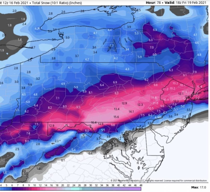
NAM looking good.

-
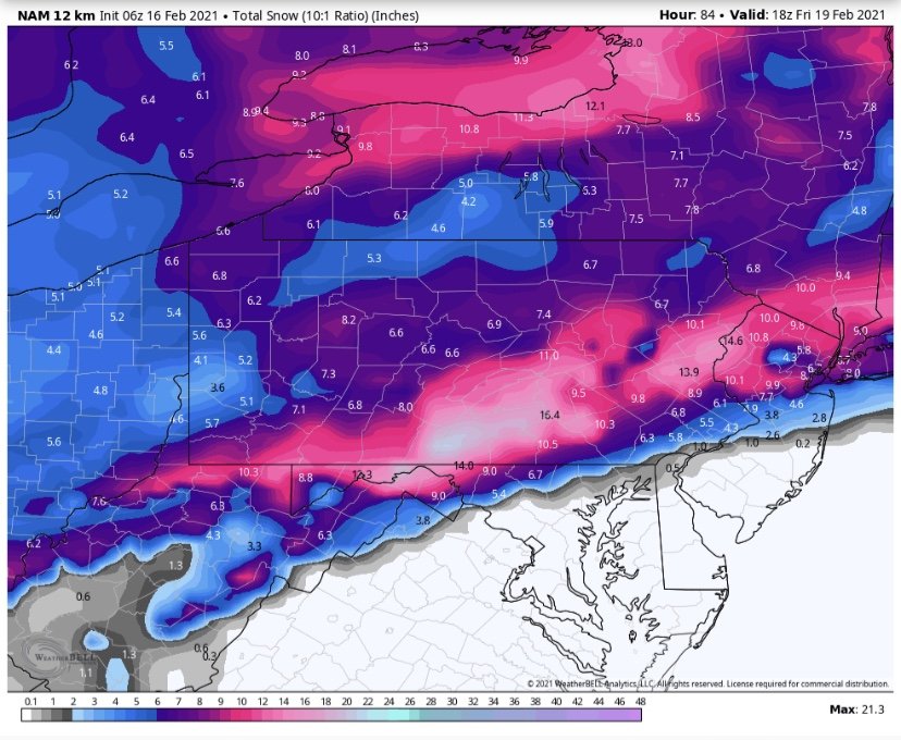
We must be looking at something different. All the 0z runs so far have been colder. All still depict a general 4-8” snowfall over most of the region. In fact the 0z Nam was its coldest run yet...
-
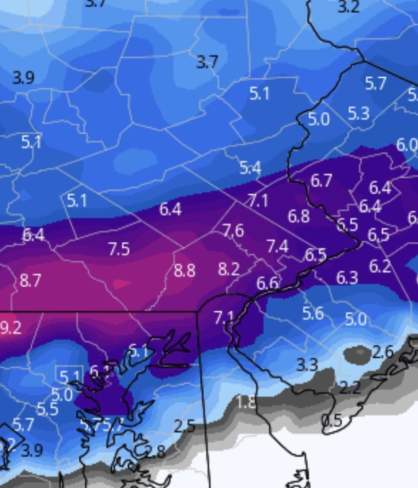
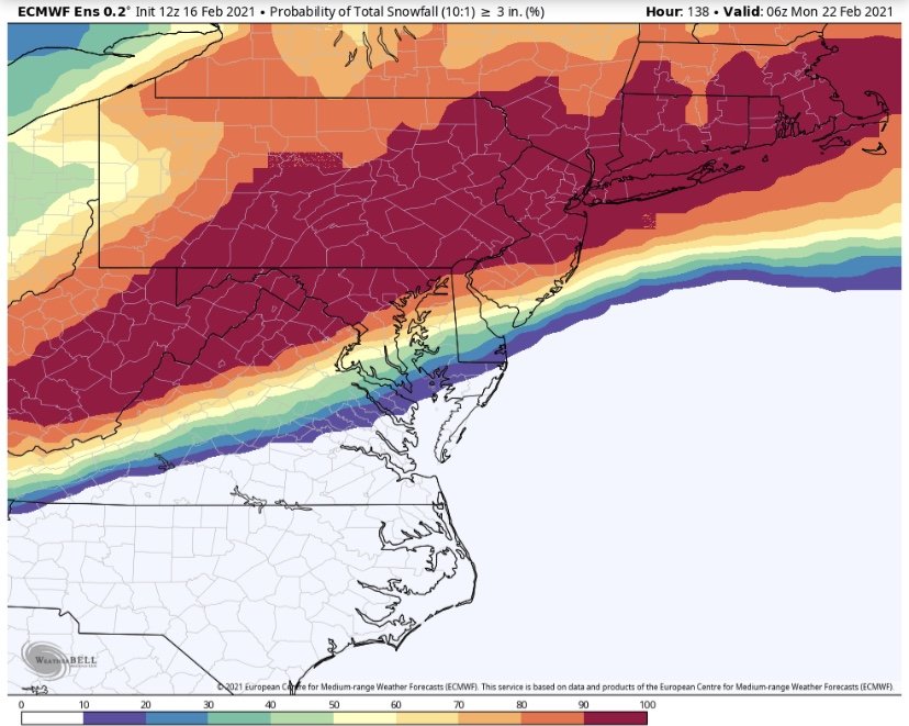
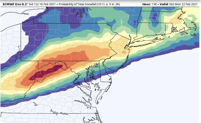
Probabilities looking very nice.....
-
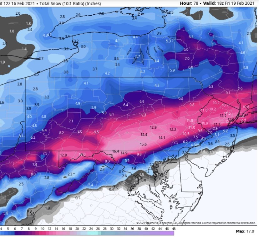
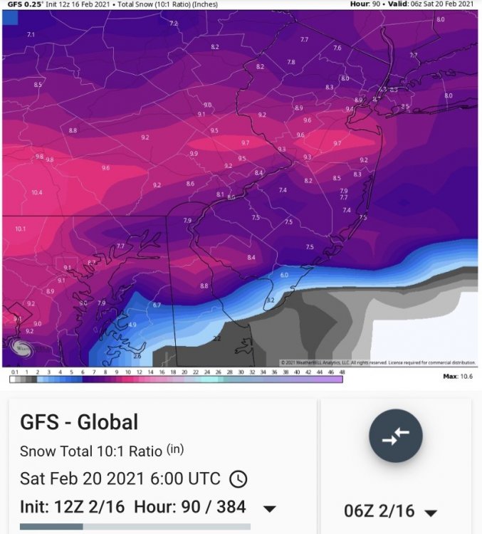
Gfs is a beautiful snowstorm for everyone I95 and northwest. South jersey flips to sleet for a period.
-
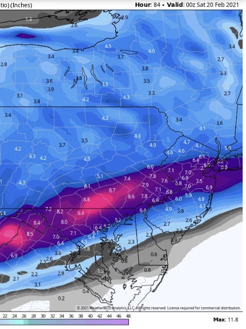
Rgem.... depicts several waves of snow. Still snowing lightly Friday afternoon. Much colder run. Philly never breaks 29 degrees ... aloft warms for a bit and sleet is introduced to southern sections but this model continues to trend colder so the sleet line may continue to be pushed
-
Definite tick South.
-
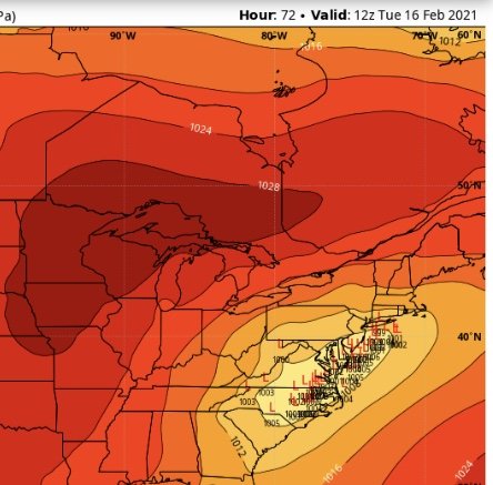
Each run continues to shift south. We have the reverse we’ve had all winter. Finally a strong high pushing NAM continues to adjust.
-
I dont hug any model. But it’s prudent to use the models based on their skill and ability. I don’t take the weather personally. If a storm comes in warmer I don’t get upset. There’s always another one to look forward to.
-
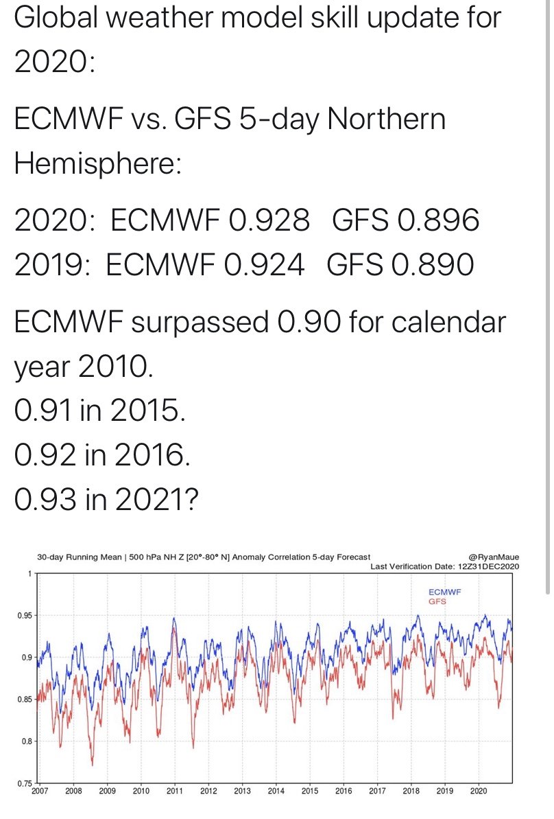
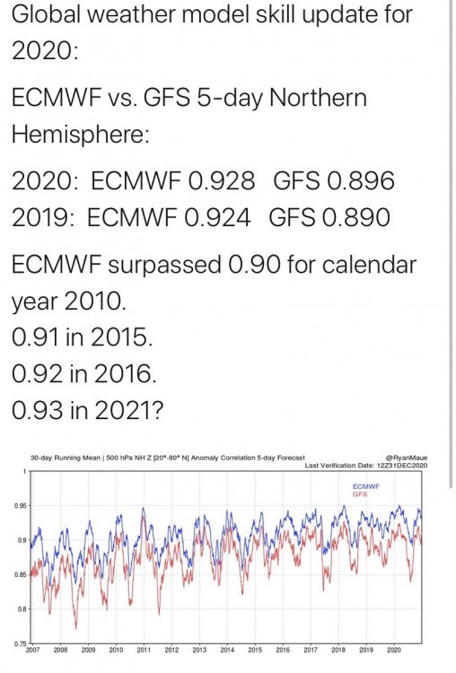
As we showed you yesterday it is the best performing model we have. As we said yesterday it’s not perfect. Hence why we use skill scores to grade models. Not one model run.
-
Big red flag on the 18z. In one run it took Philly from 37 to 58 degrees .... the fine details of where the surface low tracks. Do we keep the NNE wind or do we veer SE.
-
Caveat to that is they opted for Winter Storm Warnings Instead of Ice Storm Warnings for the February 2014 Ice Storm. We all know how that turned out.
-
Different Criteria to trigger a warning for Ice is baffling. Unlike snow where the more prepared an area is I.e. plows. Etc. can impact each region much differently. Ice is ice. Accretion of .25” on trees and power lines creates the same issues in any county. Ice is much more of a great equalizer. It essentially cripples everyone
-
the HRR, NAM, WRF suite are showing the bulk of the precipitation done by 7am Tuesday with the low level cold holding til then .. the global models a bit slower with the precipitation and warm the low levels much faster ... the prior suite is usually better at picking up this type of scenario close in.. we shall see.
-
Yep. NAM shows a serious ice storm for Allentown. Not a surprise. Still a precarious situation for N and W zones....
-
That’s not a skill score graph.
-
-
If you look at the skill score the Euro is still leading the pac by far. It’s not even close
-
That is not a good look for N and W zones.
-
-
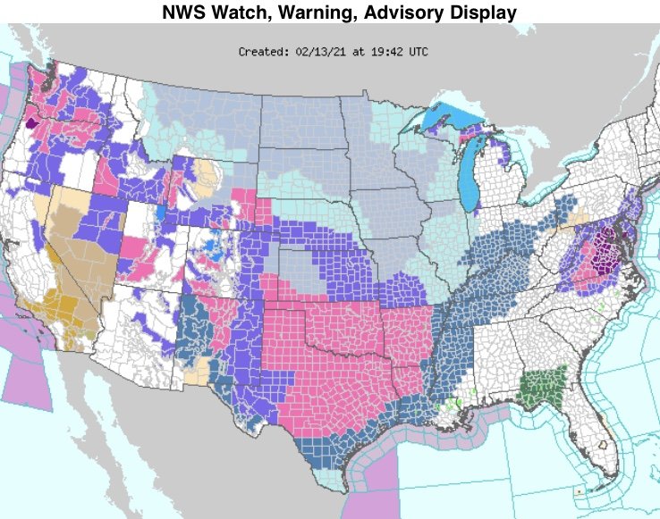
Simply incredible to see ... a very rare event unfolding across the nation... the entire state of Oklahoma is under a winter storm warning and watches are down to the beaches of south Texas. This storm will be remembered for a very long time ... hopefully we escape a devastating ice storm.
-
The NAM is 33 and rain. The models aren’t really all that far apart here.
-
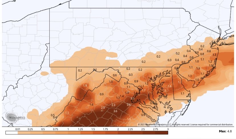
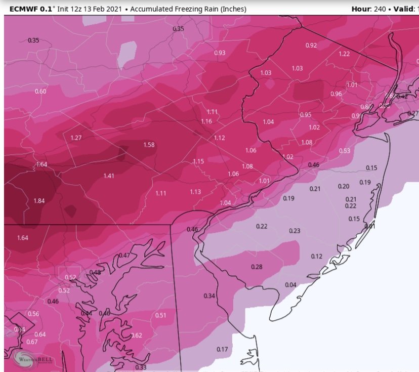
Total Ice accretion through Friday Morning on the Euro. This signal has been glaring for many days now ... someone is going to get wacked with one heck of an icing event.
-
It’s far from alone. Alot of guidance has .75-1” qpf with temps of 32-33 degrees. It’s still 3 days out and much can change but the general consensus is someone’s going to get a lot of ice.