.jpg.7212c88cd7a6ee918250d4a9d2a8d183.jpg)

CHItoMKE916
-
Posts
355 -
Joined
-
Last visited
Content Type
Profiles
Blogs
Forums
American Weather
Media Demo
Store
Gallery
Everything posted by CHItoMKE916
-
Any prefrontal cells that pop ahead of the front that aren't undercut and are in the better parameter space. Yikes.
-
What does it take these days to get a Moderate risk? Doesn't make sense given the watch probabilities?
-
Safe to say morning clouds/debris will not be an issue. Time to build instability and a strong cap.
-
Maybe a dumb question but why does the SPC Mesoanalysis show CAPE in Illinois? I doubt we've accumulated 1000 J/kg under clouds all day.
-
Feels like another sleeper lower MI tornado day
-
Given the nuance in forecasting severe weather, I find it funny how the current enhanced eastern extent just barely extends into the Metro lol
-
The Great Lakes are the place to be when everything else goes to shit. At least we have fresh water.
-
They did. ILL!
-
Was driving around tons of flooded streets in Lincoln Park and Avondale earlier. Going to be a literal icerink out there tomorrow. If only someone could have cleared all of the crap from the sewer drains to prevent it...
-
Idk about using global models at short range, but interesting dual maxima of snow on GEFS in NW IL and NE IL. Who knows what happens.
-
MET from Central IL posted this. Would think this would extend north and east too? https://www.facebook.com/share/17Ay3SJdeN/
-
Morning storms looking fairly robust too. Saw some peeks of sun outside too
-
Does Chicago get more snow from this WAA snow than the actual storm? That's the big question lmao
-
soon to be all of us

-
I've sensed cautious optimism from you lately. I still think it's strange given the moving pieces we haven't really seen any large swings in guidance. I guess modeling isn't that terrible then
-
I was just hoping for more thunderstorms, but looks like between snow and thunderstorms, we've landed in the middle so we'll get neither lol
-
Never been so confused catching up on a thread. Models haven't really changed all too much (kinda wild given the many pieces of energy)? Are we rooting for a miss north? Are we vague posting?
-
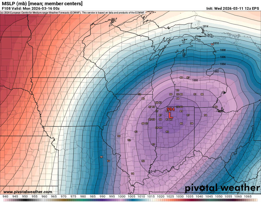
Glancing at the EPS mean qpf and I'm gonna need some see some ensemble members... Lol
-
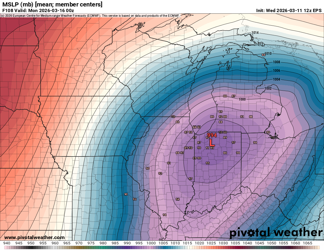
EPS big shift South?
-
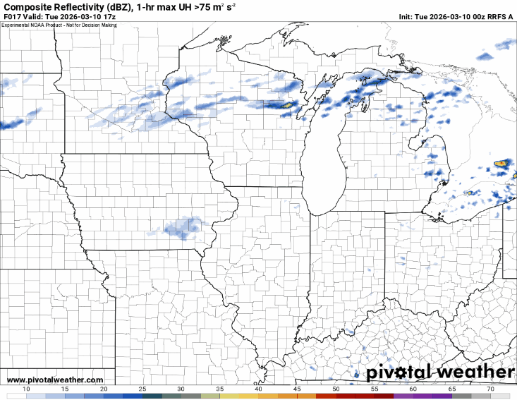
The 0z RRFS was actually fairly accurate after all. Single tornadic storm south then elevated cluster of hailers behind it (ducks)
-
Very cool satellite right now. Lake breeze continuing to move south, but also erosion of the cloud deck moving north. If anyone wants a great resource, I use Victor Gensini's site to have many resources available at once https://atlas.niu.edu/mapwall/
-
Idk if I buy the more northward trend of the front in IL to continue anymore then it has already, but the more north it trends, the higher the population threatened by a potential strong tornado (no guarantee obviously!)
-
Those north of the front may still not want to not park their cars outside with the higher risk for large hail with elevated storms.
-
Tuesday looks yikes on CAMS so far. If a storm latches onto the WF...thread worthy?
-
Tuesday might be interesting around here. Will higher dews make it north is the question though.